





->WP iampiyushnegi |
No edit summary |
||
| Line 23: | Line 23: | ||
}} | }} | ||
| image_alt = photomontage | | image_alt = photomontage | ||
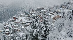
| image_caption = Clockwise from top:<br />Kumarsain | | image_caption = Clockwise from top:<br />View of Kumarsain town from a nearby village, St. Mary's Church at Kotgarh village, View of Pir Panjal mountain range from Kumarsain, Koteshwar Mahadev Temple at Mandholi village, A meadow on the way to Derthu Mata Temple, Tani Jubbar Lake | ||
| pushpin_map = India Himachal Pradesh#India | | pushpin_map = India Himachal Pradesh#India | ||
| pushpin_label_position = right | | pushpin_label_position = right | ||
| Line 32: | Line 32: | ||
| subdivision_name = {{flag|India}} | | subdivision_name = {{flag|India}} | ||
| subdivision_type1 = [[States and territories of India|State]] | | subdivision_type1 = [[States and territories of India|State]] | ||
| subdivision_name1 = [[Himachal Pradesh]] | | subdivision_name1 = {{flagicon image|Himachal Pradesh Flag, India.png}} [[Himachal Pradesh]] | ||
| subdivision_type2 = [[List of districts of India|District]] | | subdivision_type2 = [[List of districts of India|District]] | ||
| subdivision_name2 = [[Shimla district|Shimla]] | | subdivision_name2 = [[Shimla district|Shimla]] | ||
| Line 46: | Line 46: | ||
| area_total_km2 = | | area_total_km2 = | ||
| elevation_footnotes = | | elevation_footnotes = | ||
| elevation_m = | | elevation_m = 1675 | ||
| population_total = 5461 | | population_total = 5461 | ||
| population_as_of = 2011 | | population_as_of = 2011 | ||
| population_rank = | | population_rank = | ||
| population_density_km2 = 2711 | | population_density_km2 = 2711 | ||
| population_demonym = | | population_demonym = | ||
| Line 65: | Line 65: | ||
| footnotes = | | footnotes = | ||
}} | }} | ||
'''Kumarsain''' ({{IPAc-en|lang|pron|k|u|m|æ|r|s|æ|ɪ|n}}; {{IPA-hi|kʊmaɾsain|lang|Kumarsain Pronunciation.wav}}), also known as '''Kumharsain''', is a town in [[Shimla District]] in the [[States and territories of India|Indian state]] of [[Himachal Pradesh]]. Formerly it was | '''Kumarsain''' ({{IPAc-en|lang|pron|k|u|m|æ|r|s|æ|ɪ|n}}; {{IPA-hi|kʊmaɾsain|lang|Kumarsain Pronunciation.wav}}), also known as '''Kumharsain''', is a town in [[Shimla District]] in the [[States and territories of India|Indian state]] of [[Himachal Pradesh]]. Formerly under the [[British Raj]], it was the capital of [[princely state]] of Kumharsain, which was one of the several states of the [[Punjab States Agency]].<ref>{{cite web|url=http://www.panjabdigilib.org/webuser/searches/displayPage.jsp?ID=3006&page=1&CategoryID=1&Searched=W3GX&sbtsro=0|title=John Hutchison and JP Vogel, ''History of Punjab Hill states''; Lahore 1933}}</ref> It is about 80 km from [[Shimla]] and famous for [[apple]] and [[cherry]] [[orchard]]s. | ||
Kumarsain was founded in the [[11th century]] A.D. as '''''Kumharsain''' State''. It was occupied by [[Nepal]] from 1803 to 1816, and by [[Presidencies and provinces of British India|British India]] from 1839 to 1840.<ref>{{Cite web|url=https://www.rulers.org/indstat2.html|title=Indian states before 1947 K-W|website=www.rulers.org|access-date=2019-08-25}}</ref> | Kumarsain was founded in the [[11th century]] A.D. as the capital of '''''Kumharsain''' State''. It was occupied by [[Nepal]] from 1803 to 1816, and by [[Presidencies and provinces of British India|British India]] from 1839 to 1840.<ref>{{Cite web|url=https://www.rulers.org/indstat2.html|title=Indian states before 1947 K-W|website=www.rulers.org|access-date=2019-08-25}}</ref> | ||
Kumarsain lies 1 km beside [[National Highway 5 (India)|National Highway 5]] from Bharara village, which is 20 km from [[Narkanda]] towards [[Rampur Bushahr]]. Kumarsain has many educational institutes like Government ITI ([[Industrial training institute|Industrial Training Institute]]) and [[Government degree colleges in India|Government Degree College]]. Many other departments and schools are rapidly increasing the population and developing growth of Kumarsain. | Kumarsain lies 1 km beside [[National Highway 5 (India)|National Highway 5]] from Bharara village, which is 20 km from [[Narkanda]] towards [[Rampur Bushahr]]. Kumarsain has many educational institutes like Government ITI ([[Industrial training institute|Industrial Training Institute]]) and [[Government degree colleges in India|Government Degree College]]. Many other departments and schools are rapidly increasing the population and developing growth of Kumarsain. | ||
Kumarsain is also famous for | Kumarsain is also famous for Char Saala Mela ([[fair]]), which is celebrated after every 4 years and is the most crowded and awaited fair in the area. | ||
Kumarsain has an history of around 1000 years and is one of the oldest settlements that are still being inhabited in [[Himachal Pradesh]]. It is also one of the most literate towns in [[Himachal Pradesh]]. | Kumarsain has an history of around 1000 years and is one of the oldest settlements that are still being inhabited in [[Himachal Pradesh]]. It is also one of the most literate towns in [[Himachal Pradesh]]. | ||
| Line 77: | Line 77: | ||
== Geography == | == Geography == | ||
Kumarsain is located at | Kumarsain is located at | ||
{{coord|31.318145|N|77.446189|E|}} and has an average elevation of 1, | {{coord|31.318145|N|77.446189|E|}} and has an average elevation of 1,675 metres (5,495 ft). It is situated above the [[Satluj]] river in the North-West [[Himalayas]], about 80 km from [[Shimla]] towards interior ranges. Kumarsain has an ideal climate and temperature throughout year. Kumarsain town has many villages within its boundary namely Mateyog, Damali, Lathi, Bharara, Bai and Dethal. | ||
[[File:Panaromic view after sunset as sewn from Kumarsain.jpg|thumb|240px|Scenic view after sunset as seen from Kumarsain]] | [[File:Panaromic view after sunset as sewn from Kumarsain.jpg|thumb|240px|Scenic view after sunset as seen from Kumarsain]] | ||
| Line 88: | Line 88: | ||
== Government == | == Government == | ||
Kumarsain was a Constituency of [[Himachal Pradesh Legislative Assembly]] and had a separate election seat until 2008 [[Delimitation Commission of India|delimitation]], when it was merged with [[Theog (Himachal Pradesh Assembly constituency)|Theog constituency]]. Veteran Congress Minister [[Vidya Stokes]] was elected 2 times as [[Member of Legislative Assembly (India)|MLA]] in 2003 <ref>{{cite news| url=http://eci.nic.in/eci_main/statisticalreports/SE_Feb_2003/StatReport2003_HP.pdf |title=Himachal Pradesh legislative assembly election, 2003 |accessdate=25 October 2013}}</ref> and 2007 <ref>{{cite news| url=http://www.shimlatimes.in/2012/11/results-of-hp-state-assembly-elections_6.html |title=Himachal Pradesh legislative assembly election, 2007 |accessdate=25 October 2013}}</ref> from [[Kumarsain (Vidhan Sabha constituency)|Kumarsain Assembly Constituency]]. Kumarsain is a [[Tehsil|tehsil]]<ref>{{cite web|url=https://hpshimla.nic.in/tehsil/|title=Tehsils in Shimla District}}</ref> as well as a [[Subdivision (country subdivision)|sub-division]] and comes under Narkanda [[Community development blocks in India|Block]].<ref>{{cite web|url=http://hpshimla.nic.in/subdivision-blocks|title=Subdivisions & Blocks in Shimla District}}</ref> Former [[Chief secretary (India)|Chief Secretary]] and Current State Election Commissioner of Himachal Pradesh (Anil Kumar Khachi, [[Indian Administrative Services|IAS]] ([[Retirement|Retd.]]))<ref>{{cite news|url=https://indianexpress.com/article/cities/shimla/thakur-replaces-chief-secy-cong-protests-outsiders-elevation-7440813/lite/|title=Khachi Replaced from Chief Secretary Post}}</ref> also hails from Kumarsain.<ref>{{cite news|url=http://www.millenniumpost.in/amp/nation/khachi-is-new-chief-secy-in-himachal-pradesh-393711|title=Anil Khachi from Kumarsain, appointed as new Chief Secretary of Himachal Pradesh}}</ref> | Kumarsain was a Constituency of [[Himachal Pradesh Legislative Assembly]] and had a separate election seat until 2008 [[Delimitation Commission of India|delimitation]], when it was merged with [[Theog (Himachal Pradesh Assembly constituency)|Theog Assembly constituency]]. Veteran Congress Minister [[Vidya Stokes]] was elected 2 times as [[Member of Legislative Assembly (India)|MLA]] in 2003 <ref>{{cite news| url=http://eci.nic.in/eci_main/statisticalreports/SE_Feb_2003/StatReport2003_HP.pdf |title=Himachal Pradesh legislative assembly election, 2003 |accessdate=25 October 2013}}</ref> and 2007 <ref>{{cite news| url=http://www.shimlatimes.in/2012/11/results-of-hp-state-assembly-elections_6.html |title=Himachal Pradesh legislative assembly election, 2007 |accessdate=25 October 2013}}</ref> from [[Kumarsain (Vidhan Sabha constituency)|Kumarsain Assembly Constituency]]. Kumarsain is a [[Tehsil|tehsil]]<ref>{{cite web|url=https://hpshimla.nic.in/tehsil/|title=Tehsils in Shimla District}}</ref> as well as a [[Subdivision (country subdivision)|sub-division]] and comes under Narkanda [[Community development blocks in India|Block]].<ref>{{cite web|url=http://hpshimla.nic.in/subdivision-blocks|title=Subdivisions & Blocks in Shimla District}}</ref> Former [[Chief secretary (India)|Chief Secretary]] and Current State Election Commissioner of Himachal Pradesh (Anil Kumar Khachi, [[Indian Administrative Services|IAS]] ([[Retirement|Retd.]]))<ref>{{cite news|url=https://indianexpress.com/article/cities/shimla/thakur-replaces-chief-secy-cong-protests-outsiders-elevation-7440813/lite/|title=Khachi Replaced from Chief Secretary Post}}</ref> also hails from Kumarsain.<ref>{{cite news|url=http://www.millenniumpost.in/amp/nation/khachi-is-new-chief-secy-in-himachal-pradesh-393711|title=Anil Khachi from Kumarsain, appointed as new Chief Secretary of Himachal Pradesh}}</ref> | ||
'''Government Departments in Kumarsain:''' | '''Government Departments in Kumarsain:''' | ||
1. Himachal Pradesh Public Works Department (B & R Division and Sub Division). | 1. Himachal Pradesh Public Works Department (B & R Division and Sub Division) (Mechanical Sub Division). | ||
2. Himachal Pradesh State Electricity Board Limited (Division and Sub Division). | 2. Himachal Pradesh State Electricity Board Limited (Division and Sub Division). | ||
3. | 3. Jal Shakti Department (Sub Division). | ||
4. Women and Child Development Department (Child Development Project Officer). | 4. Women and Child Development Department (Child Development Project Officer). | ||
| Line 114: | Line 114: | ||
11. Block Development Office (Block Development Officer Narkanda) | 11. Block Development Office (Block Development Officer Narkanda) | ||
12. Forest Department (Divisional Forest Officer Kotgarh and Forest | 12. Forest Department (Divisional Forest Officer Kotgarh and Range Forest Officer Kumarsain) | ||
13. Himachal Pradesh Education Department (Block Education Officer) | 13. Himachal Pradesh Education Department (Block Education Officer) | ||
| Line 126: | Line 126: | ||
== History == | == History == | ||
Kirat Singh, also known as Kirti Singh (later Rana Kirat Chand), who was an office holder and Jagirdar at the court of Raja Narayan Pal of [[Gaya, India|Gaya]] in [[Bihar]], founded Kumharsain State in the [[11th century]] AD. He along with his two brothers (Kartar Singh and Prithvi Singh) was driven away from [[Gaya, India|Gaya]], by the fear of [[Mahmud of Ghazni|Mahmud | Kirat Singh, also known as Kirti Singh (later Rana Kirat Chand), who was an office holder and Jagirdar at the court of Raja Narayan Pal of [[Gaya, India|Gaya]] in [[Bihar]], founded Kumharsain State in the [[11th century]] AD. He along with his two brothers (Kartar Singh and Prithvi Singh) was driven away from [[Gaya, India|Gaya]], by the fear of [[Mahmud of Ghazni|Mahmud Ghaznavi]] and settled around Kumharsain. They conquered the country from a local chief named Bhambu Rai of Delath.<ref>{{cite book|url=https://books.google.com/books?id=QgZFhkVINvkC&q=karangla&pg=PA48|title=Wooden Temples of Himachal Pradesh|isbn=9788173870941|last1=Singh|first1=Mian Goverdhan|year=1999}}</ref> Later on Kirat Singh gave a tract called Karangla to his brother Kartar Singh. Descendants of Kartar Singh founded the states of Khaneti and [[Kotkhai]]. The younger brother, Prithvi Singh, established his independent state at Delath. Since the [[15th century]], Kumharsain was a feudatory of [[Bashahr|Bushahr State]], but was declared independent after the expulsion of the [[Gurkhas]] in 1815, by a ''sanad'' dated February 1816, but at the same time lost its own tributary states of Bharauli, Balsan and Madhan. The Rana maintains a military force of 45 infantry and 1 gun (as of 1892).<ref>{{Cite web|url=http://www.indianrajputs.com/view/kumharsain|title=Kumharsain (Princely State)}}</ref> Kumharsain State was ranked 6th in [[Order of precedence]] in the [[Hill States of India|Shimla Hill States]] and 11th amongst the [[Punjab Hill States]].<ref>{{cite book|url=https://books.google.com/books?id=ayYbAvECXQwC&q=Kumharsain&pg=PA225|title=The Princely and Noble Families of the Former Indian Empire: Himachal Pradesh|isbn=9788173871634|last1=Brentnall|first1=Mark|year=2004}}</ref><ref>{{cite book|url=https://books.google.com/books?id=QpWloqN5LTAC&q=order+of+precedence+in+shimla+hill+states&pg=PA53|title=The Emergence of Himachal Pradesh: A Survey of Constitutional Developments|isbn=9788173870354|last1=Verma|first1=V.|year=1995}}</ref> | ||
[[File:Kumarsain State Symbol.jpg|thumb|250px|Kumarsain State Symbol]] | [[File:Kumarsain State Symbol.jpg|thumb|250px|Kumarsain State Symbol]] | ||
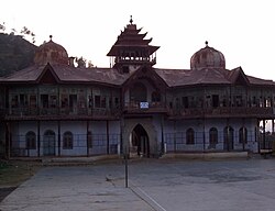
The Great Congress Leader | The Great Congress Leader [[Jai Bihari Lal Khachi]] (former [[Public works|Public Works]] Minister of [[Himachal Pradesh]]) was from this town and a government school in Kumarsain is also named after him, as a token of honor and appreciation for the work he had done for the state. Khachi was elected 5 times as [[Member of Legislative Assembly (India)|MLA]] from [[Kumarsain (Vidhan Sabha constituency)|Kumarsain assembly seat]] in 1972, 1982, 1985, 1993 and 1998 assembly elections.<ref>{{cite news |title=Sitting and previous MLAs from Kumarsain Assembly Constituency |url=http://elections.traceall.in/vidhan-sabha-assembly-election-results/Kumarsain-in-Himachal-Pradesh |work=Elections.in |access-date= November 2, 2017 }}</ref> He died of a massive heart attack in 2002, at that time he was the sitting MLA of Kumarsain Constituency. Kumarsain's famous '''Hira Mahal''' (named after the 56th Rana of Kumharsain, "''Hira Singh''"), which was pride of Kumarsain and served as the home to the Ranas of this princely state, was burnt because of an accidental fire that took place in the mahal on 25 December 2007. | ||
[[File:Hira Mahal Kumarsain.jpg|thumb|250px|Hira Mahal in 2005]] | [[File:Hira Mahal Kumarsain.jpg|thumb|250px|Hira Mahal in 2005]] | ||
| Line 639: | Line 639: | ||
146 Rahu | 146 Rahu | ||
147 | 147 Raog | ||
148 Rewali | 148 Rewali | ||
| Line 693: | Line 693: | ||
173 Urshu | 173 Urshu | ||
174 | 174 Virgarh | ||
==References== | ==References== | ||
| Line 701: | Line 701: | ||
*[http://rulers.org/indstat2.html Rulers.org: Kumharsain] | *[http://rulers.org/indstat2.html Rulers.org: Kumharsain] | ||
* [https://maps.google.co.in/maps?q=map+Kumarsain&ie=UTF-8&hq=&hnear=0x390585bba826eceb:0x798d4a66798efe44,Kumarsain,+Himachal+Pradesh&gl=in&ei=IUaaUNmjIZHb4QTo84CoDQ&ved=0CCEQ8gEwAA Kumarsain on Google Maps] | * [https://maps.google.co.in/maps?q=map+Kumarsain&ie=UTF-8&hq=&hnear=0x390585bba826eceb:0x798d4a66798efe44,Kumarsain,+Himachal+Pradesh&gl=in&ei=IUaaUNmjIZHb4QTo84CoDQ&ved=0CCEQ8gEwAA Kumarsain on Google Maps] | ||
* | * Article by: [https://www.instagram.com/iampiyushnegi Piyush Negi] | ||
Revision as of 11:48, 29 June 2022
Kumarsain
कुमारसैन | |
|---|---|
Town | |
      Clockwise from top: View of Kumarsain town from a nearby village, St. Mary's Church at Kotgarh village, View of Pir Panjal mountain range from Kumarsain, Koteshwar Mahadev Temple at Mandholi village, A meadow on the way to Derthu Mata Temple, Tani Jubbar Lake | |
  Kumarsain Location in Himachal Pradesh, India  Kumarsain Kumarsain (India) | |
| Coordinates: 31°19′05″N 77°26′46″E / 31.318145°N 77.446189°E | |
| Country |  India India |
| State | File:Himachal Pradesh Flag, India.png Himachal Pradesh |
| District | Shimla |
| Elevation | 1,675 m (5,495 ft) |
| Population (2011) | |
| • Total | 5,461 |
| • Density | 2,711/km2 (7,020/sq mi) |
| Languages | |
| • Official | Hindi |
| Time zone | UTC+5:30 (IST) |
| PIN | 172029 |
| Vehicle registration | HP-95 |

Kumarsain (English: /kumærsæɪn/; Hindi: [kʊmaɾsain] ( listen)), also known as Kumharsain, is a town in Shimla District in the Indian state of Himachal Pradesh. Formerly under the British Raj, it was the capital of princely state of Kumharsain, which was one of the several states of the Punjab States Agency.[1] It is about 80 km from Shimla and famous for apple and cherry orchards.
Kumarsain was founded in the 11th century A.D. as the capital of Kumharsain State. It was occupied by Nepal from 1803 to 1816, and by British India from 1839 to 1840.[2]
Kumarsain lies 1 km beside National Highway 5 from Bharara village, which is 20 km from Narkanda towards Rampur Bushahr. Kumarsain has many educational institutes like Government ITI (Industrial Training Institute) and Government Degree College. Many other departments and schools are rapidly increasing the population and developing growth of Kumarsain.
Kumarsain is also famous for Char Saala Mela (fair), which is celebrated after every 4 years and is the most crowded and awaited fair in the area.
Kumarsain has an history of around 1000 years and is one of the oldest settlements that are still being inhabited in Himachal Pradesh. It is also one of the most literate towns in Himachal Pradesh.
Geography
Kumarsain is located at 31°19′05″N 77°26′46″E / 31.318145°N 77.446189°E and has an average elevation of 1,675 metres (5,495 ft). It is situated above the Satluj river in the North-West Himalayas, about 80 km from Shimla towards interior ranges. Kumarsain has an ideal climate and temperature throughout year. Kumarsain town has many villages within its boundary namely Mateyog, Damali, Lathi, Bharara, Bai and Dethal.


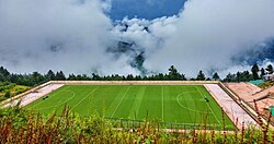
Tourist attractions around Kumarsain include Narkanda, Kotgarh-Thanedhar, Hatu Peak, Tani Jubbar Lake, Derthu Mata Temple and Shilaroo Hockey Stadium.


Government
Kumarsain was a Constituency of Himachal Pradesh Legislative Assembly and had a separate election seat until 2008 delimitation, when it was merged with Theog Assembly constituency. Veteran Congress Minister Vidya Stokes was elected 2 times as MLA in 2003 [3] and 2007 [4] from Kumarsain Assembly Constituency. Kumarsain is a tehsil[5] as well as a sub-division and comes under Narkanda Block.[6] Former Chief Secretary and Current State Election Commissioner of Himachal Pradesh (Anil Kumar Khachi, IAS (Retd.))[7] also hails from Kumarsain.[8]
Government Departments in Kumarsain:
1. Himachal Pradesh Public Works Department (B & R Division and Sub Division) (Mechanical Sub Division).
2. Himachal Pradesh State Electricity Board Limited (Division and Sub Division).
3. Jal Shakti Department (Sub Division).
4. Women and Child Development Department (Child Development Project Officer).
5. Himachal Pradesh Fire Services (Fire Post).
6. Tehsil Office (Tehsildar and Naib Tehsildar).
7. Sub Divisional Magistrate/Sub Divisional Officer Office.
8. Himachal Pradesh Department of Labour and Employment (Sub Office - Employmemt Exchange).
9. Police Station (Station House Officer/SHO)
10. Civil Hospital (Block Medical Officer)
11. Block Development Office (Block Development Officer Narkanda)
12. Forest Department (Divisional Forest Officer Kotgarh and Range Forest Officer Kumarsain)
13. Himachal Pradesh Education Department (Block Education Officer)
14. Sub-Treasury Office (Sub-Treasury Officer)
15. Tehsil Welfare Office (Tehsil Welfare Officer)
Demographics
As of 2011 India census,[9] Kumarsain had a population of 5,461. Males constitute 52% of the population and females 48%. Kumarsain has an average literacy rate of 97.8%, much higher than the national average of 74.04% male literacy is 97%, and female literacy is 89%. In Kumarsain 11% of the population is under 6 years of age.
History
Kirat Singh, also known as Kirti Singh (later Rana Kirat Chand), who was an office holder and Jagirdar at the court of Raja Narayan Pal of Gaya in Bihar, founded Kumharsain State in the 11th century AD. He along with his two brothers (Kartar Singh and Prithvi Singh) was driven away from Gaya, by the fear of Mahmud Ghaznavi and settled around Kumharsain. They conquered the country from a local chief named Bhambu Rai of Delath.[10] Later on Kirat Singh gave a tract called Karangla to his brother Kartar Singh. Descendants of Kartar Singh founded the states of Khaneti and Kotkhai. The younger brother, Prithvi Singh, established his independent state at Delath. Since the 15th century, Kumharsain was a feudatory of Bushahr State, but was declared independent after the expulsion of the Gurkhas in 1815, by a sanad dated February 1816, but at the same time lost its own tributary states of Bharauli, Balsan and Madhan. The Rana maintains a military force of 45 infantry and 1 gun (as of 1892).[11] Kumharsain State was ranked 6th in Order of precedence in the Shimla Hill States and 11th amongst the Punjab Hill States.[12][13]

The Great Congress Leader Jai Bihari Lal Khachi (former Public Works Minister of Himachal Pradesh) was from this town and a government school in Kumarsain is also named after him, as a token of honor and appreciation for the work he had done for the state. Khachi was elected 5 times as MLA from Kumarsain assembly seat in 1972, 1982, 1985, 1993 and 1998 assembly elections.[14] He died of a massive heart attack in 2002, at that time he was the sitting MLA of Kumarsain Constituency. Kumarsain's famous Hira Mahal (named after the 56th Rana of Kumharsain, "Hira Singh"), which was pride of Kumarsain and served as the home to the Ranas of this princely state, was burnt because of an accidental fire that took place in the mahal on 25 December 2007.

Also the first American apple tree grown in India was at Kotgarh village (a village in Kumharsain tehsil), which was planted by Satyanand Stokes (an American settled in India) in 1916.
Transportation
Kumarsain has a bus station from where you can take routine local route buses or long route buses of HRTC to Shimla, Chandigarh, Delhi, Kullu, Ambala, Haridwar and many other places.


Alternatively you can hire a taxi, as 24 hours taxi service is also available in Kumarsain.
Rulers

Rulers used the title of "Rana" (also styled as Rana Saheb).[16]
| Reign | Rana |
|---|---|
| 1021 - 1058 | Kirat Chand (1st Rana) |
| ???? - ???? | Ugarn Chand (2nd Rana) |
| ???? - ???? | Sansar Chand (3rd Rana) |
| ???? - ???? | Pratap Singh (4th Rana) |
| ???? - ???? | Nadev Singh (5th Rana) |
| ???? - ???? | Nahar Singh (6th Rana) |
| ???? - ???? | Jaidev Singh (7th Rana) |
| ???? - ???? | Jorawar Singh (8th Rana) |
| ???? - ???? | Dalbhajon Singh (9th Rana) |
| ???? - ???? | Randhir Singh (10th Rana) |
| ???? - ???? | Vishan Pal Singh (11th Rana) |
| ???? - ???? | Madhan Singh (12th Rana) |
| ???? - ???? | Jai Singh (13th Rana) |
| ???? - ???? | Narayan Singh (14th Rana) |
| ???? - ???? | Shamsher Singh (15th Rana) |
| ???? - ???? | Kahan Singh (16th Rana) |
| ???? - ???? | Chattar Singh (17th Rana) |
| ???? - ???? | Guja Singh (18th Rana) |
| ???? - ???? | Ganpat Singh (19th Rana) |
| ???? - ???? | Narbhay Singh (20th Rana) |
| ???? - ???? | Satdhari Singh (21st Rana) |
| ???? - ???? | Tegh Singh (22nd Rana) |
| ???? - ???? | Vikram Singh (23rd Rana) |
| ???? - ???? | Swat Singh (24th Rana) |
| ???? - ???? | Devi Singh (25th Rana) |
| ???? - ???? | Jaimal Singh (26th Rana) |
| ???? - ???? | Jagdish Singh (27th Rana) |
| ???? - ???? | Gildhar Singh (28th Rana) |
| ???? - ???? | Surat Singh (29th Rana) |
| ???? - ???? | Jowar Singh (30th Rana) |
| ???? - ???? | Tapdhari Singh (31st Rana) |
| ???? - ???? | Karam Singh (32nd Rana) |
| ???? - ???? | Jati Singh (33rd Rana) |
| ???? - ???? | Dharam Singh (34th Rana) |
| ???? - ???? | Jalim Singh (35th Rana) |
| ???? - ???? | Kewal Singh (36th Rana) |
| ???? - ???? | Dalip Singh (37th Rana) |
| ???? - ???? | Dalel Singh (38th Rana) |
| ???? - ???? | Tilak Singh (39th Rana) |
| ???? - ???? | Prithvi Singh (40th Rana) |
| ???? - ???? | Golal Singh (41st Rana) |
| ???? - ???? | Kishan Singh (42nd Rana) |
| ???? - ???? | Roop Singh (43rd Rana) |
| ???? - ???? | Ratan Singh (44th Rana) |
| ???? - ???? | Shiv Singh (45th Rana) |
| ???? - ???? | Fateh Singh (46th Rana) |
| ???? - ???? | Shakth Singh (47th Rana) |
| ???? - ???? | Chattar Singh (48th Rana) |
| ???? - 1725 | Ajmir Singh (49th Rana) |
| 1725 - 1755 | Anup Singh (50th Rana) |
| 1755 - 1789 | Daleep Singh (51st Rana) |
| 1789 - 1803 | Govardhan Singh (52nd Rana) |
| 1803 - 1816 | Occupied by Nepal |
| 1816 - 1839 | Kehar Singh (53rd Rana) |
| 1839 - 1840 | Occupied by British India |
| 1840 - 1858 | Pritam Singh (54th Rana) |
| 1858 - 1874 | Bhawani Singh (55th Rana) |
| 1874 - 1914 | Hira Singh (56th Rana) |
| 1914 - 1945 | Vidyadhar Singh (57th Rana) |
| 1945 - 1996 | Sumeshawar Singh (58th Rana) acceded title became honorary |
| 1996 - Present | Surendra Singh (59th Rana) |
Villages and Towns in Kumharsain Tehsil
Towns
1. Kumarsain
2. Narkanda
Villages
1 Ahar
2 Arot
3 Aur
4 Bagain
5 Bagthal
6 Bahli
7 Bai
8 Bakhlain
9 Balinda
10 Banahar
11 Banot
12 Baragaon
13 Barara
14 Bargal
15 Barogi
16 Barori
17 Bhanoli
18 Batara
19 Batari
20 Baza
21 Bhalari
22 Bhanana
23 Bharari
24 Bharasa
25 Bhareri
26 Bhargaon
27 Bhuna
28 Bhuth
29 Bhutti
30 Chajol
31 Chamseri
32 Chalan
33 Chamor
34 Chamyala
35 Charonta
36 Chekul
37 Chohan
38 Chopala
39 Churath
40 D.P.F. Nag kelo Saroga
41 D.P.F. Nagkelo
42 Dagrot
43 Dakolu
44 Dakoon
45 Dalan
46 Damaur
47 Daro
48 Dawala
49 Deeb
50 Deoridhar
51 Dethal
52 Devali Dhar
53 Dhala
54 Dhali
55 Dhanal
56 Dharuri
57 Dheongli
58 Dogri
59 Doja
60 Ganeog
61 Gharal
62 Ghareawat
63 Ghughvi
64 Ghumana
65 Gheti
66 Gonthla
67 Halyana
68 Hathiya
69 Jadoon
70 Jal
71 Jalti
72 Jangal Ahar
73 Jangal Dawala
74 Jangal Hatu
75 Jangal Havan
76 Jangal Jogsha
77 Jangal Madhawan
78 Jangal Marni
79 Jangal Nun-II
80 Janjeli
81 Jar
82 Jarol
83 Jhamol
84 Jhunjan
85 Jubroo
86 Kacheri
87 Kalmu
88 Kanahr
89 Kanda-1
90 Kanda-2
91 Kandyali
92 Kangal
93 Karaltoo
94 Katheen
95 Kaunthru
96 Kehri
97 Kepu
98 Khaner
99 Khaneti
100 Khatkar
101 Khekhar
102 Kholwi
103 Khuhan
104 Kingal
105 Kirti
106 Kopri
107 Kot
108 Kotgarh
109 Koti
110 Kotla
111 Kowahra
112 Kufri
113 Kui
114 Lathi
115 Lauga
116 Luan
117 Madhawani
118 Madhuban
119 Mahawari
120 Maholi
121 Majrog
122 Malendi
123 Manan-1
124 Manan-2
125 Mandholi
126 Mangsu
127 Manu
128 Melan
129 Mogra
130 Mohan
131 Nog Kanchi
132 Nagali
133 Nagraon
134 Nahal
135 Nahana
136 Nanjha
137 Naula
138 Nehri
139 Nun
140 Pamlai
141 Parashan
142 Pauchi
143 Pharal
144 Pharnal
145 Phirnu
146 Rahu
147 Raog
148 Rewali
149 Ropa
150 Sainj Paranu
151 Sakundi Chimla
152 Sapela
153 Sarahan
154 Saroga
155 Ser Dhar
156 Shalota
157 Shamthla
158 Shanand
159 Shathla
160 Shawat
161 Shehdari
162 Shela
163 Shelag
164 Shiwan
165 Talha
166 Tepri
167 Teshan
168 Thah
169 Thanedhar
170 Thanu
171 Thinu
172 Tramli
173 Urshu
174 Virgarh
References
- ↑ "John Hutchison and JP Vogel, History of Punjab Hill states; Lahore 1933".
- ↑ "Indian states before 1947 K-W". www.rulers.org. Retrieved 25 August 2019.
- ↑ "Himachal Pradesh legislative assembly election, 2003" (PDF). Retrieved 25 October 2013.
- ↑ "Himachal Pradesh legislative assembly election, 2007". Retrieved 25 October 2013.
- ↑ "Tehsils in Shimla District".
- ↑ "Subdivisions & Blocks in Shimla District".
- ↑ "Khachi Replaced from Chief Secretary Post".
- ↑ "Anil Khachi from Kumarsain, appointed as new Chief Secretary of Himachal Pradesh".
- ↑ "Census of India 2011: Data from the 2011 Census, including cities, villages and towns (Provisional)". Census Commission of India. Archived from the original on 16 June 2004. Retrieved 1 November 2008.
- ↑ Singh, Mian Goverdhan (1999). Wooden Temples of Himachal Pradesh. ISBN 9788173870941.
- ↑ "Kumharsain (Princely State)".
- ↑ Brentnall, Mark (2004). The Princely and Noble Families of the Former Indian Empire: Himachal Pradesh. ISBN 9788173871634.
- ↑ Verma, V. (1995). The Emergence of Himachal Pradesh: A Survey of Constitutional Developments. ISBN 9788173870354.
- ↑ "Sitting and previous MLAs from Kumarsain Assembly Constituency". Elections.in. Retrieved 2 November 2017.
- ↑ "British Library (Online Gallery)".
- ↑ "Indian Princely States K-Z". www.worldstatesmen.org. Retrieved 25 August 2019.