|
|
| Line 1: |
Line 1: |
| {{Short description|State in northeastern India}} | | {{Expand Meitei}} |
| {{other uses}}
| |
| {{pp-protected|reason=Persistent [[WP:Disruptive editing|disruptive editing]]; requested at [[WP:RfPP]]|small=yes}}
| |
| {{Use dmy dates|date=February 2022}}
| |
| {{Use Indian English|date=June 2016}}
| |
| {{featured article}}
| |
| {{Infobox state | | {{Infobox state |
| | name = | | | name = Tripura |
| | official_name = Tripura
| | | native_name = |
| | native_name = [[Twipra Kingdom|Twipra]] | | | image_seal = Seal of Tripura.svg |
| | image_seal = Seal of Tripura.svg | | | seal_alt = |
| | image_skyline = {{photomontage | | | image_skyline = {{photomontage |
| | photo1a = | | | photo1a = Forests invoking to be explored.JPG |
| MATABARI11.jpg
| |
| | photo1b = Unakoti 1.jpg | | | photo1b = Unakoti 1.jpg |
| | photo2a = Tripura State Museum Agartala Tripura India.jpg | | | photo2a = Tripura State Museum Agartala Tripura India.jpg |
| | photo3a = Tripuri dance.jpg | | | photo3a = Neer-Mahal.jpg |
| | photo3b = Neer-Mahal.jpg
| | | spacing = 1 |
| | size = 300
| | | color_border = white |
| | spacing = 1 | | | color = white |
| | position = centre | | | size = 280 |
| | border = 0 | |
| | color = white | |
| }} | | }} |
| | named_for = [[Tripura Sundari Temple]]
| | | image_caption = (clockwise from top) [[Clouded Leopard National Park]]; Rock-cut sculptures at [[Unakoti]]; [[Ujjayanta Palace]]; [[Neermahal palace]] |
| | image_caption = (clockwise from top) [[Tripura Sundari Temple]]; Rock-cut sculptures at [[Unakoti]]; [[Ujjayanta Palace]]; [[Neermahal palace]]; [[Tripuri dances|Tripuri dance]] | | | image_map = IN-TR.svg |
| | image_map = IN-TR.svg | | | image_map1 = India Tripura locator map1.svg |
| | coordinates = {{coord|23.84|91.28|region:IN-TR_type:adm1st|display=inline,title}} | | | mapsize1 = |
| | coor_pinpoint = Agartala | | | map_caption = Location of Tripura in India |
| | coordinates_footnotes = | | | map_caption1 = Map of Tripura |
| | subdivision_type = Subdivision | | | coordinates = {{coord|23.84|91.28|region:IN-TR_type:adm1st|display=inline,title}} |
| | subdivision_name = 23 subdivisions | | | coor_pinpoint = Agartala |
| | established_title = Union territory | | | coordinates_footnotes = |
| | established_date = 1 November 1956 | | | subdivision_type = Country |
| | established_title1 = Upgraded as state | | | subdivision_name = [[India]] |
| | established_date1 = 21 January 1972{{ref|cap|†}} | | | established_title = Union territory |
| | seat_type = Capital | | | established_date = 1 November 1956 |
| | seat = [[Agartala]] | | | established_title1 = State |
| | parts_type = [[List of Indian districts|Districts]] | | | established_date1 = 21 January 1972{{ref|cap|†}} |
| | parts_style = para | | | seat_type = Capital |
| | p1 = [[List of districts of Tripura|8]] | | | seat = [[Agartala]] |
| | government_footnotes = | | | parts_type = [[List of Indian districts|Districts]] |
| | governing_body = {{nowrap|[[Government of Tripura]]}} | | | parts_style = para |
| | leader_title = [[Governors of Tripura|Governor]]
| | | p1 = [[List of districts of Tripura|8]] |
| | leader_name = [[Satyadev Narayan Arya]]<ref>{{cite web |title=Shri Satyadeo Narain Arya Hon'ble Governor of Tripura |url=https://tripura.gov.in/gov-profile |website=tripura.gov.in |access-date=3 March 2022}}</ref> | | | government_footnotes = |
| | leader_title1 = [[Chief Ministers of Tripura|Chief Minister]] | | | leader_title = [[Governors of Tripura|Governor]] |
| | leader_name1 = [[Biplab Kumar Deb]] ([[Bharatiya Janata Party|BJP]])<ref>{{cite news|title=Biplab Deb takes oath as Tripura chief minister|url=http://www.livemint.com/Politics/Xchvm1A5zrM7Zj47RZbxlN/Biplab-Deb-set-to-take-oath-as-Tripura-chief-minister-today.html|work=[[Mint (newspaper)|Livemint]]|date=9 March 2018|access-date=9 March 2018|archive-url=https://web.archive.org/web/20180309083239/http://www.livemint.com/Politics/Xchvm1A5zrM7Zj47RZbxlN/Biplab-Deb-set-to-take-oath-as-Tripura-chief-minister-today.html|archive-date=9 March 2018|url-status=live}}</ref> | | | leader_name = [[Satyadev Narayan Arya]]<ref name="ZeeNews">{{cite news |last1=Sarkar |first1=Ipsita |title=Centre appoints new Governors in 6 states, Anandiben Patel transferred to UP |url=https://zeenews.india.com/india/centre-appoints-new-governors-in-6-states-anandiben-patel-appointed-as-up-governor-jagdeep-dhankhar-ramesh-bais-lal-ji-tandon-phagu-chauhan-rn-ravi-2220610.html |accessdate=21 July 2019 |work=[[Zee News]] |date=20 July 2019 |language=en}}</ref> |
| | leader_title2 = [[List of deputy chief ministers of Tripura|Deputy Chief Minister]] | | | leader_title1 = [[Chief Ministers of Tripura|Chief Minister]] |
| | leader_name2 = [[Jishnu Dev Varma]] ([[Bharatiya Janata Party|BJP]])<ref>{{cite news|title=BJP picks Biplab Deb as new Tripura CM, Jishnu Debbarma to be his deputy|url=https://m.hindustantimes.com/india-news/bjp-leader-biplab-deb-will-be-new-tripura-cm-jishnu-dev-varma-his-deputy/story-h0AzOQH581uv1699O5MCeL.html|work=[[Hindustan Times]]|date=9 March 2018}}</ref> | | | leader_name1 = [[Biplab Kumar Deb]] ([[Bharatiya Janata Party|BJP]])<ref>{{cite news|title=Biplab Deb takes oath as Tripura chief minister|url=http://www.livemint.com/Politics/Xchvm1A5zrM7Zj47RZbxlN/Biplab-Deb-set-to-take-oath-as-Tripura-chief-minister-today.html|work=[[Mint (newspaper)|Livemint]]|date=9 March 2018|access-date=9 March 2018|archive-url=https://web.archive.org/web/20180309083239/http://www.livemint.com/Politics/Xchvm1A5zrM7Zj47RZbxlN/Biplab-Deb-set-to-take-oath-as-Tripura-chief-minister-today.html|archive-date=9 March 2018|url-status=live}}</ref> |
| | leader_title3 = [[Tripura Legislative Assembly|Legislature]] | | | leader_title2 = Deputy Chief Minister |
| | leader_name3 = [[Unicameral]] ([[List of constituencies of the Tripura Legislative Assembly|60 seats]]) | | | leader_name2 = [[Jishnu Deb Burman]] ([[Bharatiya Janata Party|BJP]])<ref>{{cite news|title=BJP picks Biplab Deb as new Tripura CM, Jishnu Debbarma to be his deputy|url=https://m.hindustantimes.com/india-news/bjp-leader-biplab-deb-will-be-new-tripura-cm-jishnu-dev-varma-his-deputy/story-h0AzOQH581uv1699O5MCeL.html|work=[[Hindustan Times]]|date=9 March 2018}}</ref> |
| | leader_title4 = | | | leader_title3 = [[List of current Indian opposition leaders|Leader of opposition]] |
| | leader_name4 = | | | leader_name3 = [[Manik Sarkar]] ([[Communist Party of India (Marxist)|CPI (M)]]) |
| | unit_pref = Metric | | | unit_pref = Metric |
| | area_footnotes = <ref>{{cite web |title=Know Tripura {{!}} Tripura State Portal |url=https://tripura.gov.in/know-tripura |website=tripura.gov.in |access-date=23 December 2020}}</ref> | | | area_footnotes = |
| | area_total_km2 = 10491.69 | | | area_total_km2 = 10491.65 |
| | area_rank = 27th (2011) | | | area_rank = 27th (2014) |
| | area_note = | | | area_note = |
| | elevation_footnotes = | | | elevation_footnotes = |
| | elevation_m = | | | elevation_m = |
| | population_total = {{increase neutral}}3671032 | | | population_total = 3671032 |
| | population_as_of = 2011 | | | population_as_of = 2011 |
| | population_footnotes = | | | population_footnotes = |
| | population_density_km2 = auto | | | population_density_km2 = auto |
| | population_rank = 22nd (2014) | | | population_rank = 22nd (2014) |
| | population_note = | | | population_note = |
| | demographics_type1 = Languages | | | timezone1 = [[Indian Standard Time|IST]] |
| | demographics1_title1 = Official | | | utc_offset1 = +05:30 |
| | demographics1_info1 = | | | iso_code = [[ISO 3166-2:IN|IN-TR]] |
| | demographics1_title2 = Additional official
| | | registration_plate = [[List of RTO districts in India#TR.E2.80.94Tripura|TR]]- |
| | demographics1_info2 =
| | | blank_name_sec1 = [[Human Development Index|HDI]] |
| | demographics_type2 = GDP {{nobold|(2019–20)}}
| | | blank_info_sec1 = {{increase}} 0.663 (<span style="color:#fc0">medium</span>) |
| | demographics2_footnotes =
| | | blank1_name_sec1 = [[List of Indian states and territories by Human Development Index|HDI rank]] |
| | demographics2_title1 = [[List of Indian states and union territories by GDP|Nominal]] | | | blank1_info_sec1 = 6th (2014) |
| | demographics2_info1 = {{INRConvert|0.461|lc}} | | | blank2_name_sec1 = [[Literacy in India|Literacy]] |
| | demographics2_title2 = [[List of Indian states and union territories by GDP per capita|Nominal per capita]] | | | blank2_info_sec1 = 87.75 % (2011)<ref>{{citation | url=http://censusindia.gov.in/2011-prov-results/data_files/india/Final_PPT_2011_chapter6.pdf | title=State of Literacy | publisher=censusindia.gov.in | accessdate=20 June 2015 | url-status=dead | archiveurl=https://web.archive.org/web/20150706191931/http://censusindia.gov.in/2011-prov-results/data_files/india/Final_PPT_2011_chapter6.pdf | archivedate=6 July 2015 | df=dmy-all }}</ref> |
| | demographics2_info2 = {{INRConvert|112849}} | | | blank_name_sec2 = {{nowrap|[[Official languages]]}}<ref name=nclmanurep2010>{{cite web |url = http://www.nclm.nic.in/shared/linkimages/NCLM52ndReport.pdf |title = Report of the Commissioner for linguistic minorities: 52nd report (July 2014 to June 2015) |pages = 79–84 |publisher = Commissioner for Linguistic Minorities, Ministry of Minority Affairs, Government of India |accessdate = 16 February 2016 |df = dmy-all |url-status = dead |archiveurl = https://web.archive.org/web/20161115133948/http://nclm.nic.in/shared/linkimages/NCLM52ndReport.pdf |archivedate = 15 November 2016 }}</ref> |
| | timezone1 = [[Indian Standard Time|IST]] | | | blank_info_sec2 = {{hlist |[[Bengali language|Bengali]]|[[English language|English]]|[[Kokborok language|Kokborok]]}} |
| | utc_offset1 = +05:30 | | | website = {{url|http://tripura.gov.in/}} |
| | iso_code = [[ISO 3166-2:IN|IN-TR]] | | | footnotes = {{ref|cap|†}}It was elevated from the status of Union-Territories by the North-Eastern Areas (Reorganisation) Act 1971 |
| | registration_plate = [[List of RTO districts in India#TR.E2.80.94Tripura|TR]]-
| | | type = [[States and union territories of India|State]] |
| | blank_name_sec1 = [[Human Development Index|HDI]] | | | seat1_type = Most populous city |
| | blank_info_sec1 = {{increase}} 0.663 (<span style="color:#fc0">medium</span>)
| | | seat1 = [[Agartala]] |
| | blank1_name_sec1 = [[List of Indian states and territories by Human Development Index|HDI rank]] | | | leader_title4 = [[Tripura Legislative Assembly|Legislature]] |
| | blank1_info_sec1 = 25th
| | | leader_name4 = [[Unicameral]] (60 seats) |
| | blank2_name_sec1 = [[Literacy in India|Literacy]] | | | official_name = |
| | blank2_info_sec1 = 87.75 % (2011)<ref>{{citation | url=http://censusindia.gov.in/2011-prov-results/data_files/india/Final_PPT_2011_chapter6.pdf | title=State of Literacy | publisher=censusindia.gov.in | access-date=20 June 2015 | url-status=live | archive-url=https://web.archive.org/web/20150706191931/http://censusindia.gov.in/2011-prov-results/data_files/india/Final_PPT_2011_chapter6.pdf | archive-date=6 July 2015 | df=dmy-all }}</ref> | |
| | blank_name_sec2 = {{nowrap|[[Official languages]]}}<ref name=nclmanurep2010>{{cite web |url = http://www.nclm.nic.in/shared/linkimages/NCLM52ndReport.pdf |title = Report of the Commissioner for linguistic minorities: 52nd report (July 2014 to June 2015) |pages = 79–84 |publisher = Commissioner for Linguistic Minorities, Ministry of Minority Affairs, Government of India |access-date = 16 February 2016 |df = dmy-all |url-status = dead |archive-url = https://web.archive.org/web/20161115133948/http://nclm.nic.in/shared/linkimages/NCLM52ndReport.pdf |archive-date=15 November 2016 }}</ref> | |
| | blank_info_sec2 = {{hlist|[[Bengali language|Bengali]]|[[English language|English]]|[[Kokborok language|Kokborok]]}}
| |
| | website = {{url|http://tripura.gov.in/}}
| |
| | module = {{Infobox place symbols
| |
| | embedded = yes
| |
| |region = Tripura
| |
| |region_type= <!-- Type of state or region (default is State) -->
| |
| | country = <!-- e.g., India -->
| |
| | flag =
| |
| | nickname =
| |
| | motto =[[Satyameva Jayate]] (Truth alone triumphs)
| |
| | anthem =
| |
| | song = <!-- or | hymn = -->
| |
| | foundation_day =
| |
| | currency =
| |
| | calendar =
| |
| | dance =
| |
| | instrument =
| |
| | vegetable =
| |
| | food = <!-- or | dish = -->
| |
| | drink =
| |
| | sweet = <!-- or | confectionery = -->
| |
| | river = <!-- or | lake = -->
| |
| | fossil =
| |
| | mineral =
| |
| | sport = <!-- or | game = -->
| |
| | costume = <!-- or | dress = -->
| |
| | colour = <!-- or | color = -->
| |
| }} | | }} |
| | footnotes = {{ref|cap|†}}It was elevated from the status of Union territory by the North-Eastern Areas (Reorganisation) Act 1971
| | '''Tripura''' ({{IPAc-en|ˈ|t|r|ɪ|p|ʊr|ə|,_|-|ər|ə}})<ref>{{cite book|last=Wells|first=John C.|year=2008|title=Longman Pronunciation Dictionary|edition=3rd|publisher=Longman|isbn=9781405881180}}</ref> ({{lang-bn|ত্রিপুরা}}) is a state in [[Northeast India]]. It covers an area of {{convert|4,036|mi2}}.It is the 3rd smallest state of [[India]]. It is bigger than [[Lebanon]] but smaller than [[Kosovo]]. The capital city is Agartala. |
| | type = [[States and union territories of India|State]]
| |
| | seat1_type = Most populous city
| |
| | seat1 = [[Agartala]]
| |
| }}
| |
| | |
| '''Tripura''' ({{IPAc-en|ˈ|t|r|ɪ|p|ʊr|ə|,_|-|ər|ə}})<ref>{{cite book |last=Wells|first=John C.|year=2008|title=Longman Pronunciation Dictionary|edition=3rd|publisher=Longman|isbn=9781405881180}}</ref> is a [[States and territories of India|state]] in northeastern [[India]]. The third-smallest state in the country, it covers {{convert|10491.69|km2|sqmi|abbr=on}} and is bordered by [[Bangladesh]] to the north,<ref>{{cite web|url=http://economictimes.indiatimes.com/news/politics-and-nation/rohingya-crisis-security-tightened-along-india-myanmar-border/articleshow/60526163.cms|title=Rohingya crisis: Security tightened along India-Myanmar border|url-status=dead|archive-url=https://web.archive.org/web/20170915082041/http://economictimes.indiatimes.com/news/politics-and-nation/rohingya-crisis-security-tightened-along-india-myanmar-border/articleshow/60526163.cms|archive-date=15 September 2017}}</ref> south, and west, and the Indian states of [[Assam]] and [[Mizoram]] to the east. In 2011 the state had 3,671,032 residents, constituting 0.3% of the country's population.<ref>{{cite web |last=Lodrick |first=Deryck |url=https://www.britannica.com/place/Tripura-state-India |title=Tripura - History, Map, Population, & Facts |work=Britannica |access-date=22 January 2022}}</ref> | |
| | |
| The area of modern Tripura — ruled for several centuries by the [[Manikya dynasty]] — was part of an independent [[princely state]] under the protectorate of the [[British Raj|British Empire]]. The independent [[Tripuri Kingdom]] (also known as Hill Tippera) joined the newly independent India in 1949.
| |
| | |
| Tripura lies in a geographically isolated location in India, as only one major highway, [[National Highway 8 (India)|National Highway 8]], connects it with the rest of the country. Five mountain ranges — [[Boromura]], [[Atharamura]], [[Longtharai]], [[Shakhan]] and [[Jampui Hills]] — run north to south, with intervening valleys; [[Agartala]], the capital, is located on a plain to the west. The state has a [[tropical savanna climate]], and receives seasonal heavy rains from the [[southwest monsoon|south west monsoon]]. Forests cover more than half of the area, in which [[bamboo]] and [[cane (grass)|cane]] tracts are common. Tripura has the highest number of [[primate]] species found in any Indian state. Due to its geographical isolation, economic progress in the state is hindered. Poverty and unemployment continue to plague Tripura, which has a limited infrastructure. Most residents are involved in agriculture and allied activities, although the service sector is the largest contributor to the state's gross domestic product.
| |
| | |
| According to the 2011 census, Tripura is one of the most literate states in India, with a literacy rate of 87.75%. Mainstream Indian cultural elements coexist with traditional practices of the ethnic groups, such as various dances to celebrate religious occasions, weddings and festivities; the use of locally crafted musical instruments and clothes; and the worship of regional deities. The sculptures at the archaeological sites [[Unakoti]], [[Pilak, Tripura|Pilak]] and [[Devtamura]] provide historical evidence of artistic fusion between organised and indigenous religions.
| |
| | |
| ==Etymology==
| |
| [[File:Tripura Sundari Temple, Udaipur.jpg|thumb|left|[[Tripura Sundari Temple]] in [[Udaipur, Tripura|Udaipur]].]]
| |
| The [[Sanskrit]] name of the state is linked to the Hindu goddess of beauty; [[Tripura Sundari]], the presiding deity of the [[Tripura Sundari Temple]] at [[Udaipur, Tripura|Udaipur]], one of the 51 ''[[Shakti Peethas]]'' (pilgrimage centres of ''[[Shaktism]]''),<ref name="hr name"/><ref name="Debbarma1996"/> and to the legendary tyrant king Tripur, who reigned in the region. Tripur was the 39th descendant of [[Druhyu]], who belonged to the lineage of [[Yayati]], a king of the [[Lunar Dynasty]].<ref name="Acharjya1979">{{cite book|last=Acharjya|first=Phanibhushan|title=Tripura|url=https://archive.org/details/in.ernet.dli.2015.489119|year=1979|publisher=Publications Division, Ministry of Information and Broadcasting, Government of India|page=1|asin=B0006E4EQ6}}</ref>
| |
| | |
| There are alternative theories regarding the origin of the name Tripura, such as a possible Sanskritic [[folk etymology]] of a Tibeto-Burman ([[Kokborok]]) name. Variants of the name include ''Tipra'', ''Tuipura'' and ''Tippera''. A Kokborok etymology from ''twi'' (water) and ''pra'' (near) has been suggested; the boundaries of Tripura extended to the [[Bay of Bengal]] when the kings of the Tipra Kingdom held sway from the [[Garo Hills]] of [[Meghalaya]] to [[Rakhine State|Arakan]], the present Rakhine State of [[Burma]]; so the name may reflect vicinity to the sea.<ref name="hr name">{{cite book|title=Human rights and indigenous peoples|last=Das|first=J.K.|pages=208–9|publisher=APH Publishing|year=2001|isbn=978-81-7648-243-1|chapter=Chapter 5: old and new political process in realization of the rights of indigenous peoples (regarded as Tribals) in Tripura}}</ref><ref name="Debbarma1996">{{cite book|last=Debbarma|first=Sukhendu|title=Origin and growth of Christianity in Tripura: with special reference to the New Zealand Baptist Missionary Society, 1938–1988|url=https://books.google.com/books?id=vyfrzVvJNxUC&pg=PA20|year=1996|publisher=Indus Publishing|isbn=978-81-7387-038-5|page=20|url-status=live|archive-url=https://web.archive.org/web/20160429233857/https://books.google.com/books?id=vyfrzVvJNxUC&pg=PA20|archive-date=29 April 2016}}</ref><ref>Prakash (ed.), ''Encyclopaedia of North-east India'', vol. 5, 2007, [https://books.google.com/books?id=ixSANFgMjW0C&pg=PA2272 p. 2272] {{Webarchive|url=https://web.archive.org/web/20160424123659/https://books.google.com/books?id=ixSANFgMjW0C&pg=PA2272 |date=24 April 2016 }}</ref>
| |
| | |
| ==History==
| |
| {{main|History of Tripura}}
| |
| {{see also|Twipra Kingdom|Tripura (princely state)|Kings of Tripura|Insurgency in Tripura}}
| |
| [[File:Unakoti 5.jpg|alt=|thumb|left|200x200px|Rock-cut sculpture of [[Shiva]] at [[Unakoti]]]]
| |
| | |
| Although there is no evidence of lower or middle [[Paleolithic]] settlements in Tripura, [[Upper Paleolithic]] tools made of fossil wood have been found in the [[Haora River|Haora]] and [[Khowai River|Khowai]] valleys.<ref>{{cite book|last=Singh|first=Upinder|title=A history of ancient and early medieval India: from the stone age to the 12th century|url=https://books.google.com/books?id=GW5Gx0HSXKUC&pg=PA77|year=2008|publisher=Pearson Education India|isbn=978-81-317-1677-9|page=77|url-status=live|archive-url=https://web.archive.org/web/20160723031915/https://books.google.com/books?id=GW5Gx0HSXKUC&pg=PA77|archive-date=23 July 2016}}</ref> The Indian epic, the ''[[Mahabharata]]''; ancient religious texts, the ''[[Purana]]s''; and the [[Edicts of Ashoka]] – stone pillar inscriptions of the emperor [[Ashoka]] dating from the third century [[Common Era|BCE]] – all mention Tripura.<ref name="Acharjya1979"/> An ancient name of Tripura (as mentioned in the Mahabharata) is ''Kirat Desh'' (English: "The land of Kirat"), probably referring to the [[Kirata Kingdom]]s or the more generic term [[Kirata]].<ref name="Tripura gazet 1975">{{cite book|title=Tripura district gazetteers|url=https://books.google.com/books?id=N6oJAQAAIAAJ|year=1975|publisher=Educational Publications, Department of Education, Government of Tripura|url-status=live|archive-url=https://web.archive.org/web/20160504071510/https://books.google.com/books?id=N6oJAQAAIAAJ|archive-date=4 May 2016}}</ref>{{rp|155}} However, it is unclear whether the extent of modern Tripura is coterminous with ''Kirat Desh''.<ref>{{cite book|last1=Rahman|first1=Syed Amanur|last2=Verma|first2=Balraj|title=The beautiful India – Tripura|url=https://books.google.com/books?id=-mcwAQAAIAAJ|date=5 August 2006|publisher=Reference Press|isbn=978-81-8405-026-4|page=9|url-status=live|archive-url=https://web.archive.org/web/20160617004122/https://books.google.com/books?id=-mcwAQAAIAAJ|archive-date=17 June 2016}}</ref> The region was under the rule of the Twipra Kingdom for centuries, although when this dates from is not documented. The ''[[Rajmala]]'', a chronicle of Tripuri kings which was first written in the 15th century,<ref name="Gazetteer 118">{{cite journal | title = Hill Tippera – history | journal = [[The Imperial Gazetteer of India]] | year = 1909 | volume = 13 | page = 118 | url = https://dsal.uchicago.edu/reference/gazetteer/pager.html?objectid=DS405.1.I34_V13_124.gif | format = GIF | access-date = 27 October 2011 | url-status = live | archive-url = https://web.archive.org/web/20110607142251/http://dsal.uchicago.edu/reference/gazetteer/pager.html?objectid=DS405.1.I34_V13_124.gif | archive-date = 7 June 2011 | df = dmy-all }}</ref> provides a list of 179 kings, from antiquity up to Krishna Kishore Manikya (1830–1850),<ref name="Bera2010">{{cite book| first=Gautam Kumar|last=Bera |title=The land of fourteen gods: ethno-cultural profile of Tripura|year=2010|publisher=Mittal Publications|isbn=978-81-8324-333-9}}</ref>{{rp|3}}<ref name="rajmala book">{{cite book|url=http://www.tripura.org.in/rajmala4.htm|title=Sri rajmala volume – IV|editor-last=Sen|editor-first=Kali Prasanna|language=bn|publisher=Tribal Research Institute, Government of Tripura|year=2003|access-date=10 May 2013|url-status=live|archive-url=https://web.archive.org/web/20120606013645/http://www.tripura.org.in/rajmala4.htm|archive-date=6 June 2012}}</ref><ref name="Bhattacharyya1930">{{cite book|last=Bhattacharyya|first=Apurba Chandra|title=Progressive Tripura|year=1930|publisher=Inter-India Publications|page=179|oclc=16845189}}</ref> but the reliability of the ''Rajmala'' has been doubted.<ref name="sircar1979">{{cite book|last=Sircar|first=D.C.|title=Some epigraphical records of the mediaeval period from eastern India|url=https://books.google.com/books?id=-O18xhA_BXUC&pg=PA89|year=1979|publisher=Abhinav Publications|isbn=978-81-7017-096-9|page=89|url-status=live|archive-url=https://web.archive.org/web/20160528181614/https://books.google.com/books?id=-O18xhA_BXUC&pg=PA89|archive-date=28 May 2016}}</ref>
| |
| [[File:Neermahal192.jpg|thumb|200px|[[Neermahal|Neermahal Palace]] is the royal palace built by [[Bir Bikram Kishore Debbarman]] of the [[Tripura (princely state)|Kingdom of Tripura]].]]
| |
| | |
| The boundaries of the kingdom changed over the centuries. At various times, the borders reached south to the jungles of the [[Sundarbans]] on the Bay of Bengal; east to Burma; and north to the boundary of the [[Kamarupa]] kingdom in [[Assam]].<ref name="Gazetteer 118"/> There were [[Muslim conquest in the Indian subcontinent|several Muslim invasions]] of the region from the 13th century onward,<ref name="Gazetteer 118"/> which culminated in [[Mughal Empire|Mughal dominance]] of the plains of the kingdom in 1733,<ref name="Gazetteer 118"/> although their rule never extended to the hill regions.<ref name="Gazetteer 118"/> The Mughals had influence over the appointment of the Tripuri kings.<ref name="Gazetteer 118"/>
| |
| [[File:Maharani kanchan prabhadevi.jpg|thumb|left|200px|Queen [[Kanchan Prava Devi|Kanchan Prabha Devi]] who signed the [[instrument of accession]] to India as president of the Council of Regency.]]
| |
| Tripura became a [[princely state]] during [[British Raj|British rule in India]]. The kings had an estate in British India, known as ''Tippera district'' or [[Chakla (administrative division)|Chakla]] Roshnabad (now the [[Comilla District|Comilla district]] of Bangladesh),<ref name="theodora.com">{{cite EB1911|wstitle= Hill Tippera | volume= 13 | page = 469 }}</ref> in addition to the independent area known as ''Hill Tippera'', the present-day state.<ref name="Gazetteer 118"/> Udaipur, in the south of Tripura, was the capital of the kingdom, until the king Krishna Manikya moved the capital to [[Agartala|Old Agartala]] in the 18th century. It was moved to the new city of Agartala in the 19th century. [[Bir Chandra Manikya]] (1862–1896) modelled his administration on the pattern of [[British India]], and enacted reforms including the formation of Agartala Municipal Corporation.<ref>{{cite web|title=AMC at a glance|url=http://agartalacity.nic.in/about_amc1.htm|publisher=Agartala Municipal Corporation|access-date=8 June 2012|archive-url=https://web.archive.org/web/20091006034328/http://agartalacity.nic.in/about_amc1.htm|archive-date=6 October 2009}}</ref>
| |
| | |
| ===Modern History===
| |
| Following the [[independence of India]] in 1947, Tippera district – the estate in the plains of British India – [[Comilla]] became a part of [[East Pakistan]], and Hill Tippera remained under a regency council until 1949. The [[Maharani|Maharani Regent]] of Tripura signed the [[Tripura Merger Agreement]] on 9 September 1949, as a result of which Tripura became a [[Part C State|Part C]] state of India.<ref name="hdrchap1">{{cite book
| |
| |title=Tripura human development report 2007
| |
| |chapter-url= http://hdr.undp.org/en/nhdr/support/other/national/Tripura_india_hdr_2007.pdf
| |
| |access-date=19 March 2012
| |
| |publisher= Government of Tripura
| |
| |chapter= The state of human development
| |
| |year=2007
| |
| |archive-url=https://web.archive.org/web/20130502120425/http://hdr.undp.org/en/nhdr/support/other/national/Tripura_india_hdr_2007.pdf|url-status=dead
| |
| |archive-date=2 May 2013
| |
| }}</ref>{{rp|3}} It became a [[Union Territory]], without a legislature, in November 1956 and an elected ministry was installed in July 1963.<ref name="hdrchap1"/>{{rp|3}} It was conferred full statehood in 1971 by the [[North-Eastern Areas (Reorganisation) Act, 1971]]. The [[partition of India|geographic partition]] that coincided with the independence of India resulted in major economic and infrastructural setbacks for the state, as road transport between the state and the major cities of India had to follow a more circuitous route. The road distance between [[Kolkata]] and Agartala before the partition was less than {{convert|350|km|mi|abbr=on}}, and increased to {{convert|1700|km|mi|abbr=on}}, as the route now avoided East Pakistan (although from June 2015 a bus service started from Agartala to Kolkata via Dhaka; this has been named the "Bangla Corridor").<ref>{{cite news
| |
| | last = Abdi
| |
| | first = S. N. M.
| |
| | title = Kolkata-Agartala bus link gets a major push forward
| |
| | newspaper = DNA
| |
| | location = Kolkata
| |
| | pages =
| |
| | language =
| |
| | publisher = DNAIndia.com
| |
| | date = 13 March 2006
| |
| | url = http://www.dnaindia.com/report.asp?NewsID=1017981
| |
| | access-date = 23 June 2021}}</ref> The geopolitical isolation was aggravated by an absence of rail transport.<ref name="General1967">{{cite book|title=Census of India, 1961: Tripura|year=1967|publisher=Office of the Registrar General General. Government of India|page=980}}</ref><ref name="Chakraborty2006">{{cite book|editor-last=Chakraborty|editor-first=Kiran Sankar|url=http://www.mittalbooks.com/products/Entrepreneurship-and-Small-Business-Development.html|archive-url=https://web.archive.org/web/20131020174651/http://www.mittalbooks.com/products/Entrepreneurship-and-Small-Business-Development.html|url-status=dead|archive-date=20 October 2013|title=Entrepreneurship and small business development: with special reference to Tripura|year=2006|publisher=Mittal Publications|isbn=978-81-8324-125-0}}</ref>{{rp|93}}
| |
| | |
| Since the partition of India, many [[Bengali Hindus]] have migrated to Tripura as refugees fleeing religious persecution in Muslim-majority East Pakistan, especially after 1949.<ref name="hdrchap1" />{{rp|3–4}} Settlement by Hindu Bengalis increased during the [[Bangladesh Liberation War]] of 1971. Parts of the state were shelled by the [[Pakistan Army]] during the [[Indo-Pakistani War of 1971]]. Following the war, the Indian government reorganised the North East region to ensure effective control of the international borders – three new states came into existence on 21 January 1972:<ref name="Wolpert2008">{{cite book|last=Wolpert|first=Stanley A.|url=https://books.google.com/books?id=JT0wAQAAIAAJ|title=A new history of India|publisher=Oxford University Press|year=2000|isbn=978-0-19-533756-3|pages=390–1|archive-url=https://web.archive.org/web/20160501083356/https://books.google.com/books?id=JT0wAQAAIAAJ|archive-date=1 May 2016|url-status=live}}</ref> Meghalaya, Manipur, and Tripura.<ref name="Wolpert2008"/> Before independence, most of the population was indigenous.<ref name="hdrchap1"/>{{rp|9}} Ethnic strife between the Tripuri tribe and the predominantly immigrant Bengali community led to scattered violence,<ref name="Kumāra2007">{{cite book|last=Kumāra|first=Braja Bihārī|title=Problems of ethnicity in the North-East India|url=https://books.google.com/books?id=QTCJTIBHJHEC|access-date=11 July 2012|date=1 January 2007|publisher=Concept Publishing Company|isbn=978-81-8069-464-6|pages=68–9|url-status=live|archive-url=https://web.archive.org/web/20130514231036/http://books.google.com/books?id=QTCJTIBHJHEC|archive-date=14 May 2013}}</ref> and [[Insurgency in Northeast India#Tripura (1978-2009)|an insurgency]] spanning decades, including occasional massacres such as the 1980 [[Mandai massacre]].<ref>{{cite news |title=350 Bengalis Are Massacred in Indian Village |url=https://news.google.com/newspapers?nid=1129&dat=19800616&id=3E4NAAAAIBAJ&sjid=zm0DAAAAIBAJ&pg=3736,2460642 |newspaper=Pittsburgh Post-Gazette |date=16 June 1980 |access-date=15 July 2012}}</ref> This gradually abated following the establishment of a [[Tripura Tribal Areas Autonomous District Council|tribal autonomous district council]] and the use of strategic [[counter-insurgency]] operations.<ref name="hindu 19 Sep 11">{{cite news|url=http://www.thehindu.com/opinion/lead/article2465348.ece |title=How Tripura overcame insurgency |last=Sahaya |first=D.N. |author-link=Dinesh Nandan Sahay |newspaper=[[The Hindu]] |date=19 September 2011 |access-date=20 April 2012 |archive-url=https://web.archive.org/web/20110925060944/http://www.thehindu.com/opinion/lead/article2465348.ece |archive-date=25 September 2011 |url-status=dead }}</ref> Tripura remains peaceful, as of 2016.<ref name="satp 2011">{{cite web|url=http://www.satp.org/satporgtp/countries/india/states/tripura/index.html |title=Tripura assessment – year 2013 |work=South Asia terrorism portal |publisher=Institute for Conflict Management |access-date=20 January 2013 |archive-url=https://web.archive.org/web/20011104183152/http://www.satp.org/satporgtp/countries/india/states/tripura/index.html |archive-date=4 November 2001 |url-status=dead }}</ref> In retaliation of the [[2021 Bangladesh communal violence|communal violence]] against the Hindu minority in neighboring Bangladesh, mosques in several areas in Tripura were attacked from 19 to 26 October 2021.<ref>{{Cite news |title=Tripura mosque attacks: Ground report on what really happened during those 8 days in October |url=https://theprint.in/india/tripura-mosque-attacks-ground-report-on-what-really-happened-during-those-8-days-in-october/767110/ |last=Chakrabarti |first=Angana |date=18 November 2021 |access-date=13 December 2021 |work=[[ThePrint]]}}</ref>
| |
| | |
| ==Geography==
| |
| [[File:Tripura (37).JPG|thumb|Rice is grown on Tripura's [[alluvial plain]]s, which include ''lungas'', the narrow valleys that are found mainly in the west of the state.|alt=Green agricultural field, with a hill range far in the background.]]
| |
| Tripura is a [[landlocked country|landlocked]] state in [[Northeast India|North East India]], where the seven contiguous states – [[Arunachal Pradesh]], [[Assam]], [[Manipur]], [[Meghalaya]], [[Mizoram]], [[Nagaland]] and Tripura – are collectively known as the [[Seven Sister States]]. Spread over {{convert|10491.69|sqkm|sqmi|abbr=on}}, Tripura is the third-smallest among the 28 [[States and territories of India|states in the country]], behind Goa and [[Sikkim]]. It extends from 22°56'N to 24°32'N, and 91°09'E to 92°20'E.<ref name="hdrchap1"/>{{rp|3}} Its maximum extent measures about {{convert|178|km|mi|abbr=on}} from north to south, and {{convert|131|km|mi|abbr=on}} east to west. Tripura is bordered by the country of Bangladesh to the west, north and south; and the Indian states of Assam to the north east; and Mizoram to the east.<ref name="hdrchap1"/>{{rp|3}} It is accessible by [[National Highway (India)|national highways]] passing through the [[Karimganj district]] of Assam and [[Mamit district]] of Mizoram.<ref name="highway list">{{cite web|url=http://www.nhai.org/Doc/23june12/NH_NH%20wise.pdf |title=National highways and their length |publisher=National Highways Authority of India |access-date=3 October 2012 |archive-url=https://web.archive.org/web/20120906234553/http://www.nhai.org/Doc/23june12/NH_NH%20wise.pdf |archive-date=6 September 2012 |url-status=dead }}</ref>
| |
| | |
| ===Topography===
| |
| The physiography is characterised by hill ranges, valleys and plains. The state has five [[anticline|anticlinal]] ranges of hills running north to south, from [[Boromura]] in the west, through [[Atharamura]], [[Longtharai]] and [[Shakhan]], to the [[Jampui Hills]] in the east.<ref name="gsi report">{{Cite report| title= Geology and mineral resources of Manipur, Mizoram, Nagaland and Tripura| url= http://www.portal.gsi.gov.in/gsiImages/information/miscpub30-4-2_man-mizo-naga-tripura.pdf| publisher= Geological Survey of India, Government of India| series= Miscellaneous publication No. 30 Part IV| volume= 1| year= 2011| issue= 2| access-date= 10 July 2012| url-status= dead| archive-url= https://web.archive.org/web/20130510091749/http://www.portal.gsi.gov.in/gsiImages/information/miscpub30-4-2_man-mizo-naga-tripura.pdf| archive-date= 10 May 2013| df= dmy-all}}</ref>{{rp|4}} The intervening [[syncline]]s are the Agartala–Udaipur, Khowai–Teliamura, Kamalpur–Ambasa, Kailasahar–Manu and Dharmanagar–Kanchanpur valleys.<ref name="gsi report"/>{{rp|4}} At an altitude of {{convert|939|m|ft|abbr=on}}, [[Betlingchhip|Betling Shib]] in the Jampui range is the state's highest point.<ref name="hdrchap1"/>{{rp|4}} The small isolated hillocks interspersed throughout the state are known as ''tillas'', and the narrow fertile alluvial valleys, mostly present in the west, are called ''lungas''.<ref name="hdrchap1"/>{{rp|4}} A number of rivers originate in the hills of Tripura and flow into Bangladesh.<ref name="hdrchap1"/>{{rp|4}} The Khowai, [[Dhalai River|Dhalai]], [[Manu River, Tripura|Manu]], [[Juri River|Juri]] and [[Longai River|Longai]] flow towards the north; the [[Gumti River (Tripura)|Gumti]] to the west; and the [[Muhuri River|Muhuri]] and [[Feni River|Feni]] to the south west.<ref name="gsi report"/>{{rp|73}}
| |
| | |
| The [[lithostratigraphy]] data published by the [[Geological Survey of India]] dates the rocks, on the [[geologic time scale]], between the [[Oligocene]] [[epoch (geology)|epoch]], approximately 34 to 23 million [[Before Present|years ago]], and the [[Holocene]] epoch, which started 12,000 years ago.<ref name="gsi report"/>{{rp|73–4}} The hills have red [[laterite]] soil that is porous. The [[flood plain]]s and narrow valleys are overlain by alluvial soil, and those in the west and south constitute most of the agricultural land.<ref name="hdrchap1"/>{{rp|4}} According to the [[Bureau of Indian Standards]], on a scale ranging from {{nowrap|I to V}} in order of increasing susceptibility to earthquakes, the state lies in [[Earthquake hazard zoning of India|seismic zone V]].<ref name=hazardprofile>{{cite map|publisher=India Meteorological Department |title=Seismic zoning map |url=http://www.imd.gov.in/section/seismo/static/seismo-zone.htm |access-date=19 January 2013 |url-status=dead |archive-url=https://web.archive.org/web/20140603143951/http://www.imd.gov.in/section/seismo/static/seismo-zone.htm |archive-date=3 June 2014 }}</ref> | |
|
| |
|
| ===Climate=== | | == Political history == |
| The state has a [[tropical savanna climate]], designated ''Aw'' under the [[Köppen climate classification]]. The undulating topography leads to local variations, particularly in the hill ranges.<ref name="gov agri land">{{cite web|url=http://www.agritripura.in/Agriculture/Pages/land.htm|title=Land, soil and climate|publisher=Department of Agriculture, Government of Tripura| access-date=1 April 2012|archive-url=https://web.archive.org/web/20120420091358/http://www.agritripura.in/Agriculture/Pages/land.htm|archive-date=20 April 2012}}</ref> The four main seasons are winter, from December to February; pre-monsoon or summer, from March to April; monsoon, from May to September; and post-monsoon, from October to November.<ref name="gov agri climate">{{cite web|url=http://agritripura.nic.in/links/ASP_11_12.pdf|title=Annual plan 2011–12|publisher=Department of Agriculture, Government of Tripura|access-date=30 October 2012|url-status=dead|archive-url=https://web.archive.org/web/20111215123728/http://agritripura.nic.in/links/ASP_11_12.pdf|archive-date=15 December 2011}}</ref> During the monsoon season, the [[southwest monsoon|south west monsoon]] brings heavy rains, which cause frequent floods.<ref name="hdrchap1"/>{{rp|4}}<ref name="gsi report"/>{{rp|73}} The average annual rainfall between 1995 and 2006 ranged from {{convert|1979.6|to|2745.9|mm|inch|abbr=on}}.<ref name="rainfall">{{cite web|url=http://www.destripura.nic.in/ABSTRACT-2007_complete.pdf|title=Monthly and yearly quinquennial average rainfall in Tripura|work=Statistical abstract of Tripura – 2007|publisher=Directorate of Economics & Statistics, Planning (Statistics) Department, Government of Tripura|access-date=30 October 2012|page=13|url-status=dead|archive-url=https://web.archive.org/web/20121127234822/http://destripura.nic.in/ABSTRACT-2007_complete.pdf|archive-date=27 November 2012}}</ref> During winter, temperatures range from {{convert|13|to|27|C|F}}, while in the summer they fall between {{convert|24|and|36|C|F}}.<ref name="gov agri climate"/> According to a [[United Nations Development Programme]] report, the state lies in "very high damage risk" zone from wind and cyclones.<ref name=cycloneundp>{{cite web|url=http://www.undp.org.in/dmweb/hazardprofile.pdf|title=Hazard profiles of Indian districts|access-date=23 August 2006|work=National capacity building project in disaster management |publisher=[[UNDP]]|archive-url=https://web.archive.org/web/20060519100611/http://www.undp.org.in/dmweb/hazardprofile.pdf|archive-date=19 May 2006}}</ref>
| | It is a [[disputed territory]] claimed as ''Chittagonian Plains'' by [[Bangladesh]]. Bangladesh says that as Tripura was an Independent Kingdom and never part of [[British India]], the [[Republic of India]] had no right to annex the country after the death of its last King. |
|
| |
|
| {{Weather box
| | ==Provincial symbols of Tripura== |
| |collapsed=
| | <gallery> |
| |open= yes
| | Image:DuculaAenea.JPG|Green Imperial Pigeon, Provincial bird of Tripura |
| |metric first=yes
| | Image:Phayre's Langur, Trachypithecus phayrei in Phu Khieo Wildlife Sanctuary (21134240148).jpg|Phayre's leaf monkey, Provincial animal of Tripura |
| |single line= yes
| | Image:Aquilaria crassna.jpg|Agar, Provincial tree of Tripura |
| |location= Agartala, the capital of Tripura
| | Image:Flower of Mesua ferrea.jpg|Cobra saffron/Nageshwar, Provincial flower of Tripura |
| | | Image:04012jfQueen Formosa pineapple Philippines Malolos Cityfvf 07.jpg|Natal Queen pineapple, provincial fruit of Tripura |
| |temperature colour= <!-- Enter "pastel" for pastel temperature colours, remove this line for the standard colouring. -->
| | </gallery> |
| | |
| <!-- Average high temperatures -->
| |
| |Jan high F= |Jan high C=25.6
| |
| |Feb high F= |Feb high C=28.3
| |
| |Mar high F= |Mar high C=32.5
| |
| |Apr high F= |Apr high C=33.7
| |
| |May high F= |May high C=32.8
| |
| |Jun high F= |Jun high C=31.8
| |
| |Jul high F= |Jul high C=31.4
| |
| |Aug high F= |Aug high C=31.7
| |
| |Sep high F= |Sep high C=31.7
| |
| |Oct high F= |Oct high C=31.1
| |
| |Nov high F= |Nov high C=29.2
| |
| |Dec high F= |Dec high C=26.4
| |
| |year high F= |year high C=
| |
| <!-- Average low temperatures -->
| |
| |Jan low F= |Jan low C=10
| |
| |Feb low F= |Feb low C=13.2
| |
| |Mar low F= |Mar low C=18.7
| |
| |Apr low F= |Apr low C=22.2
| |
| |May low F= |May low C=23.5
| |
| |Jun low F= |Jun low C=24.6
| |
| |Jul low F= |Jul low C=24.8
| |
| |Aug low F= |Aug low C=24.7
| |
| |Sep low F= |Sep low C=24.3
| |
| |Oct low F= |Oct low C=22
| |
| |Nov low F= |Nov low C=16.6
| |
| |Dec low F= |Dec low C=11.3
| |
| |year low F= |year low C=
| |
| <!-- Total precipitation, this should include rain and snow. -->
| |
| |precipitation colour= <!-- Enter "green" for green precipitation colours, remove this line for blue colouring. -->
| |
| <!-- IMPORTANT: use only one unit type! -->
| |
| |Jan precipitation inch= |Jan precipitation cm= |Jan precipitation mm=27.5
| |
| |Feb precipitation inch= |Feb precipitation cm= |Feb precipitation mm=21.5
| |
| |Mar precipitation inch= |Mar precipitation cm= |Mar precipitation mm=60.7
| |
| |Apr precipitation inch= |Apr precipitation cm= |Apr precipitation mm=199.7
| |
| |May precipitation inch= |May precipitation cm= |May precipitation mm=329.9
| |
| |Jun precipitation inch= |Jun precipitation cm= |Jun precipitation mm=393.4
| |
| |Jul precipitation inch= |Jul precipitation cm= |Jul precipitation mm=363.1
| |
| |Aug precipitation inch= |Aug precipitation cm= |Aug precipitation mm=298.7
| |
| |Sep precipitation inch= |Sep precipitation cm= |Sep precipitation mm=232.4
| |
| |Oct precipitation inch= |Oct precipitation cm= |Oct precipitation mm=162.5
| |
| |Nov precipitation inch= |Nov precipitation cm= |Nov precipitation mm=46
| |
| |Dec precipitation inch= |Dec precipitation cm= |Dec precipitation mm=10.6
| |
| |year precipitation inch= |year precipitation cm= |year precipitation mm=
| |
| | |
| |source 1=<ref name="IMD agartala">{{cite web|url=http://www.imd.gov.in/doc/climateimp.pdf |title=Monthly mean maximum & minimum temperature and total rainfall based upon 1901–2000 data |publisher=India Meteorology Department |page=6 |access-date=29 January 2013 |url-status=dead |archive-url=https://web.archive.org/web/20150413020426/http://www.imd.gov.in/doc/climateimp.pdf |archive-date=13 April 2015 }}</ref>
| |
| }}
| |
| | |
| ==Flora and fauna==
| |
| {{see also|Tourism in North East India}}
| |
| {| class="wikitable" style="float:right; margin:0 0 1em 1em; background:#f4f5f6; border:#c6c7c8 solid; font-size:90%;"
| |
| |-
| |
| | colspan="2" style="background:#c2d6e5; text-align:center;"| '''State symbols of Tripura'''<ref name="wiisymbols">{{cite web|url=http://www.wii.gov.in/nwdc/state_animals_tree_flowers.pdf |archive-url=https://wayback.archive-it.org/all/20070615001645/http://www.wii.gov.in/nwdc/state_animals_tree_flowers.pdf |url-status=dead |archive-date=15 June 2007 |title=State animals, birds, trees and flowers |publisher=Wildlife Institute of India |access-date=5 March 2012 }}</ref>
| |
| |-
| |
| | '''State animal''' || [[Phayre's leaf monkey]]
| |
| |-
| |
| | '''State bird''' || [[Green imperial pigeon]]
| |
| |-
| |
| | '''State tree''' || [[Aquilaria malaccensis|Agarwood]]
| |
| |-
| |
| | '''State flower''' || [[Mesua ferrea]]
| |
| |-
| |
| | '''State fruit''' || [[Pineapple|Queen pineapple]]
| |
| |}
| |
| Like most of the Indian subcontinent, Tripura lies within the [[Indomalayan realm]]. According to the [[Biogeographic classification of India]], the state is in the "North-East" biogeographic zone.<ref name="biogeo zone">{{cite map |publisher=Wildlife Institute of India |title=Biogeographic classification of India: zones |url=http://wiienvis.nic.in/Database/HtmlPages/biozonemap.htm |scale=1 cm=100 km |access-date=12 October 2012 |url-status=live |archive-url=https://web.archive.org/web/20130615041736/http://wiienvis.nic.in/Database/HtmlPages/biozonemap.htm |archive-date=15 June 2013 }}</ref> In 2011 forests covered 57.73% of the state.<ref name="fsitripforest 2011">{{cite web|url=http://www.fsi.org.in/cover_2011/tripura.pdf|title=Forest and tree resources in states and union territories: Tripura|work=India state of forest report 2011|publisher=Forest Survey of India, Ministry of Environment & Forests, Government of India|access-date=1 April 2012|pages=225–9|url-status=dead|archive-url=https://web.archive.org/web/20120523232013/http://www.fsi.org.in/cover_2011/tripura.pdf|archive-date=23 May 2012}}</ref> Tripura hosts three different types of ecosystems: mountain, forest and freshwater.<ref name="soe report bd">{{cite web|url=http://tripura.nic.in/tspcb/bioderversity.htm|title=Biodiversity|work=State of environment report of Tripura – 2002|publisher=Ministry of Environment and Forests, Government of India|access-date=2 April 2012|url-status=dead|archive-url=https://web.archive.org/web/20071113164053/http://tripura.nic.in/tspcb/bioderversity.htm|archive-date=13 November 2007}}</ref> The [[evergreen forest]]s on the hill slopes and the sandy river banks are dominated by species such as ''[[Dipterocarpus]]'', ''[[Artocarpus]]'', ''[[Amoora]]'', ''[[Elaeocarpus]]'', ''[[Syzygium]]'' and ''[[Eugenia]]''.<ref name="soe report forest">{{cite web|url=http://tripura.nic.in/tspcb/forest.htm|title=Forest|work=State of environment report of Tripura – 2002|publisher=Ministry of Environment and Forests, Government of India|access-date=2 April 2012|url-status=dead|archive-url=https://web.archive.org/web/20160304125142/http://tripura.nic.in/tspcb/forest.htm|archive-date=4 March 2016}}</ref> Two types of [[Lower Gangetic plains moist deciduous forests|moist deciduous forests]] comprise the majority of the vegetation: moist deciduous mixed forest and Sal (''[[Shorea robusta]]'')-predominant forest.<ref name="soe report forest"/> The interspersion of [[bamboo]] and [[Arundo|cane]] forests with deciduous and evergreen flora is a peculiarity of Tripura's vegetation.<ref name="soe report forest"/> [[Grassland]]s and [[swamp]]s are also present, particularly in the plains. [[Herbaceous plant]]s, shrubs, and trees such as ''[[Albizia]]'', ''[[Barringtonia]]'', ''[[Lagerstroemia]]'' and ''[[Macaranga]]'' flourish in the swamps of Tripura. Shrubs and grasses include ''[[Schumannianthus dichotoma]]'' (''shitalpati''), ''[[Phragmites]]'' and ''[[Saccharum]]'' (sugarcane).<ref name="soe report forest"/>
| |
| | |
| According to a survey in 1989–90, Tripura hosts 90 land mammal species from 65 genera and 10 orders,<ref name="gupta 2000 fauna">{{cite journal |last=Gupta |first=A.K.|s2cid=153323209|date=December 2000 |title= Shifting cultivation and conservation of biological diversity in Tripura, Northeast India |journal=Human Ecology |volume= 28 |issue=4 |pages=614–5|issn=0300-7839 |doi=10.1023/A:1026491831856 }}</ref> including such species as elephant (''Elephas maximus''), bear (''Melursus ursinus''), binturong (''[[Arctictis binturong]]''), wild dog (''[[Cuon alpinus]]''), porcupine (''[[Artherurus assamensis]]''), barking deer (''[[Muntiacus muntjak]]''), sambar (''[[Cervus unicolor]]''), wild boar (''[[Sus scrofa]]''), gaur (''[[Bos gaurus]]''), leopard (''[[Panthera pardus]]''), clouded leopard (''[[Neofelis nebulosa]]''), and many species of small cats and primates.<ref name="gupta 2000 fauna"/> Out of 15 free ranging primates of India, seven are found in Tripura; this is the highest number of primate species found in any Indian state.<ref name="gupta 2000 fauna"/> The wild buffalo (''[[Bubalus arnee]]'') is extinct now.<ref>Choudhury, A.U. (2010). The vanishing herds: the wild water buffalo. Gibbon Books & The Rhino Foundation, Guwahati, India, 184pp.</ref> There are nearly 300 species of birds in the state.<ref>Choudhury, A.U. (2010). Recent ornithological records from Tripura, north-eastern India, with an annotated checklist. ''Indian Birds'' 6(3): 66–74.</ref>
| |
| | |
| [[Wildlife sanctuaries of India|Wildlife sanctuaries]] of the state are [[Sipahijola Wildlife Sanctuary|Sipahijola]], [[Gumti Wildlife Sanctuary|Gumti]], [[Rowa Wildlife Sanctuary|Rowa]] and [[Trishna Wildlife Sanctuary|Trishna]] wildlife sanctuaries.<ref name="tripura pa">{{cite web|url=http://moef.nic.in/downloads/public-information/protected-area-network.pdf|title=Protected area network in India|page=28|publisher=Ministry of Environment and Forests, Government of India|access-date=2 April 2012|url-status=dead|archive-url=https://web.archive.org/web/20120307203800/http://moef.nic.in/downloads/public-information/protected-area-network.pdf|archive-date=7 March 2012}}</ref> [[National park of India|National parks]] of the state are [[Clouded Leopard National Park]] and [[Rajbari National Park]].<ref name="tripura pa"/> These protected areas cover a total of {{convert|566.93|sqkm|sqmi|abbr=on}}.<ref name="tripura pa"/> Gumti is also an [[Important Bird Area]].<ref>{{cite journal|last= Choudhury|first= Anwaruddin|date= July–September 2009|title= Gumti –Tripura's remote IBA|journal= Mistnet|volume= 10|issue= 3|pages= 7–8|publisher= Indian Bird Conservation Network|url= http://ibcn.in/wp-content/uploads/pdf/2009-Mistnet-July_Sept.pdf|access-date= 6 April 2013|url-status= dead|archive-url= https://web.archive.org/web/20140202160339/http://ibcn.in/wp-content/uploads/pdf/2009-Mistnet-July_Sept.pdf|archive-date= 2 February 2014|df= dmy-all}}</ref> In winter, thousands of migratory waterfowl throng Gumti and Rudrasagar lakes.<ref>{{cite journal|last= Choudhury|first= Anwaruddin|date= April–June 2008|title= Rudrasagar – a potential IBA in Tripura in north-east India.|journal= Mistnet|volume= 9|issue= 2|pages= 4–5|publisher= Indian Bird Conservation Network|url= http://ibcn.in/wp-content/uploads/pdf/2008-Mistnet-Apr_June.pdf|access-date= 6 April 2013|url-status= dead|archive-url= https://web.archive.org/web/20140202160318/http://ibcn.in/wp-content/uploads/pdf/2008-Mistnet-Apr_June.pdf|archive-date= 2 February 2014|df= dmy-all}}</ref>
| |
| | |
| ==Administrative divisions==
| |
| [[File:1487239146-tripura-assembly-fb.jpg|thumb|left|Tripura Assembly]]
| |
| [[File:Tripura-district-map.svg|thumb|right|200px|Tripura district map]]
| |
| {{See also|List of districts of Tripura}}
| |
| In January 2012, major changes were implemented in the administrative divisions of Tripura. There had previously been four districts – [[Dhalai]] (headquarters [[Ambassa]]), [[North Tripura]] (headquarters [[Kailashahar]]), [[South Tripura]] (headquarters [[Udaipur, Tripura]]), and [[West Tripura]] (headquarters [[Agartala]]). Four new districts were carved out of the existing four in January 2012 – [[Khowai district|Khowai]], [[Unakoti district|Unakoti]], [[Sipahijala district|Sipahijala]] and [[Gomati district|Gomati]].<ref name="ibnlive divisions">{{cite web|url=http://ibnlive.in.com/generalnewsfeed/news/four-new-districts-six-subdivisions-for-tripura/876579.html|archive-url=https://archive.today/20130126032522/http://ibnlive.in.com/generalnewsfeed/news/four-new-districts-six-subdivisions-for-tripura/876579.html|url-status=dead|archive-date=26 January 2013|title=Four new districts, six subdivisions for Tripura|publisher=[[CNN-IBN]]|date=26 October 2011|access-date=10 April 2012}}</ref> Six new subdivisions and five new blocks were also added.<ref name="TelegraphIndia">{{cite news |url=http://www.telegraphindia.com/1111027/jsp/northeast/story_14670582.jsp |title=Four new districts for Tripura — plan for six more subdivisions to decentralise administration |newspaper=[[The Telegraph (Calcutta)|The Telegraph]] |date=27 October 2011 |access-date=11 August 2012 |url-status=live |archive-url=https://web.archive.org/web/20120419053133/http://www.telegraphindia.com/1111027/jsp/northeast/story_14670582.jsp |archive-date=19 April 2012 }}</ref> Each is governed by a [[district collector]] or a district magistrate, usually appointed by the [[Indian Administrative Service]]. The subdivisions of each district are governed by a [[Sub-Divisional Magistrate|sub-divisional magistrate]] and each subdivision is further divided into blocks. The blocks consist of ''[[Panchayat]]''s (village councils) and town municipalities. As of 2012, the state had eight districts, 23 subdivisions and 58 development blocks.<ref name="tripurainfo">{{cite news | url=http://tripurainfo.com/ATripura/administrative/dist_sbdiv_blocks.html | title=New districts, sub-divisions and blocks for Tripura | work=tripurainfo | date=28 December 2011 | access-date=11 August 2012 | url-status=dead | archive-url=https://web.archive.org/web/20161107100456/http://tripurainfo.com/ATripura/administrative/dist_sbdiv_blocks.html | archive-date=7 November 2016 | df=dmy-all }}</ref> National census and state statistical reports are not available for all the new administrative divisions, as of March 2013. [[Agartala]], the capital of Tripura, is the most populous city. Other major towns with a population of 10,000 or more (as per 2015 census) are [[Sabroom]], [[Dharmanagar]], [[Jogendranagar]], [[Kailashahar]], [[Pratapgarh, Tripura|Pratapgarh]], [[Udaipur, Tripura|Udaipur]], [[Amarpur, Tripura|Amarpur]], [[Belonia, India|Belonia]], [[Gandhigram, Tripura|Gandhigram]], [[Kumarghat]], [[Khowai]], [[Ranirbazar]], [[Sonamura]], [[Bishalgarh]], [[Teliamura]], [[Mohanpur, Tripura|Mohanpur]], [[Melaghar]], [[Ambassa]], [[Kamalpur, Tripura|Kamalpur]], [[Bishramganj]], [[Kathaliya]], [[Santirbazar]] and [[Baxanagar]].
| |
| | |
| ==Government and politics==
| |
| {{Main|Government of Tripura|Tripura Legislative Assembly}}
| |
| {{see also|Political parties in Tripura}}
| |
| [[File:Agartala Palace, Tripura.jpg|thumb|left|alt=Facade of a Ujjayanta Palace, used earlier as the state's Legislative Assembly|[[Ujjayanta Palace]], built in the 19th century as a replacement for a former royal palace destroyed in an earthquake, was used until 2011 as the meeting place of Tripura's State Legislative Assembly.]]
| |
| Tripura is governed through a [[parliamentary system]] of [[representative democracy]], a feature it shares with other Indian states. [[Universal suffrage]] is granted to residents. The Tripura government has three branches: executive, legislature and judiciary. The [[Tripura Legislative Assembly]] consists of elected members and special office bearers that are elected by the members. Assembly meetings are presided over by the Speaker or the Deputy Speaker in case of Speaker's absence. The Assembly is [[unicameral]] with 60 [[Member of the Legislative Assembly|Members of the Legislative Assembly]] (MLA).<ref name=60mla>{{cite web| url = http://legislativebodiesinindia.gov.in/States/Tripura/tripura-w.htm| title = Tripura Legislative Assembly| access-date = 21 April 2007| work = Legislative Bodies in India| publisher = National Informatics Centre| url-status = dead| archive-url = https://web.archive.org/web/20070513185344/http://legislativebodiesinindia.gov.in/States/Tripura/tripura-w.htm| archive-date = 13 May 2007| df = dmy-all}}</ref> The members are elected for a term of five years, unless the Assembly is dissolved prior to the completion of the term. The [[judiciary]] is composed of the [[Tripura High Court]] and a system of lower courts.<ref>{{cite web|url=http://tsu.trp.nic.in/highcourt/ |title=About us |publisher=Tripura High Court |access-date=26 March 2013 |url-status=dead |archive-url=https://web.archive.org/web/20130328121134/http://tsu.trp.nic.in/highcourt/ |archive-date=28 March 2013 }}</ref><ref>{{cite news|title=New Chief Justices for Manipur, Meghalaya & Tripura high courts|url=http://timesofindia.indiatimes.com/city/guwahati/New-Chief-Justices-for-Manipur-Meghalaya-Tripura-high-courts/articleshow/19163853.cms|access-date=24 March 2013|newspaper=[[The Times of India]]|date=24 March 2013|last1=Sharma|first1=K Sarojkumar|last2=Das|first2=Manosh|url-status=live|archive-url=https://web.archive.org/web/20140430042306/http://timesofindia.indiatimes.com/city/guwahati/New-Chief-Justices-for-Manipur-Meghalaya-Tripura-high-courts/articleshow/19163853.cms|archive-date=30 April 2014}}</ref> [[Executive (government)|Executive authority]] is vested in the Council of Ministers headed by the [[Chief Minister of Tripura|Chief Minister]]. The Governor, the titular [[head of state]], is appointed by the [[President of India]]. The leader of the party or a coalition of parties with a majority in the Legislative Assembly is appointed as the chief minister by the governor. The Council of Ministers are appointed by the governor on the advice of the chief minister. The Council of Ministers reports to the Legislative Assembly.
| |
| | |
| [[File:NE_Autonomous_divisions_of_India.svg|thumb|[[Tripura Tribal Areas Autonomous District Council]], pictured, encompasses much of the state]]
| |
| Tripura sends two representatives to the [[Lok Sabha]] (the [[lower house]] of the [[parliament of India]]) and one representative to the [[Rajya Sabha]] (parliament's [[upper house]]). In the [[2014 Indian general election in Tripura|2014 Indian general election]], both parliament lower house seats were won by the [[Communist Party of India (Marxist)]].<ref name=mapindiaelectionresult>{{cite web|url=http://www.mapsofindia.com/parliamentaryconstituencies/tripura/|title=Tripura General Election Results|work=Maps of India|access-date=29 March 2019|archive-url=https://web.archive.org/web/20190329194154/http://www.mapsofindia.com/parliamentaryconstituencies/tripura/|archive-date=29 March 2019|url-status=live}}</ref> ''Panchayats'' ([[Local self-government in India|local self-governments]]) elected by local body elections are present in many villages for self-governance. Tripura also has a unique tribal self-governance body, the [[Tripura Tribal Areas Autonomous District Council]].<ref name="ttadc">{{cite web|url=http://darpg.nic.in/darpgwebsite_cms/Document/file/sdadmin15.pdf |title=State and district administration: fifteenth report |publisher=Second Administrative Reforms Commission, Government of India |page=267 |year=2009 |access-date=18 May 2012 |url-status=dead |archive-url=https://web.archive.org/web/20130123171129/http://darpg.nic.in/darpgwebsite_cms/Document/file/sdadmin15.pdf |archive-date=23 January 2013 }}</ref> This council is responsible for some aspects of local governance in 527 villages with high density of the scheduled tribes.<ref name="ttadc"/><ref name="ttadc self">{{cite web|url=http://www.ttaadc.nic.in/introduction.htm|title=About TTAADC|publisher=Tripura Tribal Areas Autonomous District Council|access-date=5 July 2012|url-status=dead|archive-url=https://web.archive.org/web/20121008102341/http://www.ttaadc.nic.in/introduction.htm|archive-date=8 October 2012}}</ref>
| |
| | |
| The main political parties are the [[Bharatiya Janata Party]] (BJP), the [[Left Front (Tripura)|Left Front]], the [[All India Trinamool Congress]] and [[Indian National Congress]] along with regional parties like the [[Indigenous People's Front of Tripura|IPFT]] and [[Indigenous Nationalist Party of Twipra|INPT]]. Until 1977, the state was governed by the Indian National Congress.<ref name="Bhattacharyya1986">{{cite book|last=Bhattacharyya|first=Banikantha|title=Tripura administration: the era of modernisation, 1870–1972|url=https://books.google.com/books?id=WmgrZgspJbIC|year=1986|publisher=Mittal Publications|asin=B0006ENGHO|access-date=15 November 2015|archive-url=https://web.archive.org/web/20160424201343/https://books.google.com/books?id=WmgrZgspJbIC|archive-date=24 April 2016|url-status=live}}</ref>{{rp|255–66}} The Left Front was in power from 1978 to 1988, and then again from 1993 to 2018.<ref>{{cite web|url=http://ibnlive.in.com/news/manik-sarkarled-cpim-wins-tripura-assembly-elections-for-the-fourth-straight-time/375648-3-224.html|title=Manik Sarkar-led CPI(M) wins Tripura Assembly elections for the fifth straight time|publisher=CNN-IBN|date=28 February 2013|access-date=28 March 2013|quote=The Left Front has been in power since 1978, barring one term during 1988 to 1993.|url-status=dead|archive-url=https://web.archive.org/web/20130302213708/http://ibnlive.in.com/news/manik-sarkarled-cpim-wins-tripura-assembly-elections-for-the-fourth-straight-time/375648-3-224.html|archive-date=2 March 2013}}</ref> In 1988–93, the Congress and [[Tripura Upajati Juba Samiti]] were in a ruling coalition.<ref>{{cite news| url= http://articles.timesofindia.indiatimes.com/2010-12-24/india/28246658_1_attf-tiger-force-coup| title= Tripura terror outfit suffers vertical split| last= Paul| first= Manas| date= 24 December 2010| access-date= 28 March 2013| quote= ATTF was an off shoot of All Tripura Tribal Force formed during the Congress-TUJS coalition government-1988-1993 in Tripura| archive-url= https://web.archive.org/web/20130503001415/http://articles.timesofindia.indiatimes.com/2010-12-24/india/28246658_1_attf-tiger-force-coup| archive-date= 3 May 2013| url-status= dead| newspaper= [[The Times of India]]| df= dmy-all}}</ref> In the [[2013 Tripura Legislative Assembly election]], the Left Front won 50 out of 60 seats in the Assembly.<ref name=result2013>{{cite news|url=http://www.indianexpress.com/assembly-elections/news/-cpi(m)-win-in-tripura-reflects-reemergence-of-left-parties-/1081250|archive-url=https://archive.today/20130411044332/http://www.indianexpress.com/assembly-elections/news/-cpi(m)-win-in-tripura-reflects-reemergence-of-left-parties-/1081250|url-status=dead|archive-date=11 April 2013|title=CPI(M) win in Tripura reflects re-emergence of Left Parties|newspaper=[[The Indian Express]]|date=28 February 2013|access-date=8 March 2013}}</ref> The [[2018 Tripura Legislative Assembly election|2018 assembly election]] resulted in loss for the [[Left Front (Tripura)|Left Front]]; the [[Bharatiya Janata Party]] won an overall majority in the state, resulting in the end of the Communist Party's uninterrupted twenty-five year rule.<ref name="hindu2018election">{{cite news|url=http://www.thehindu.com/elections/bjp-stuns-left-in-tripura/article22921787.ece|newspaper=The Hindu|title=BJP stuns Left in Tripura|last=Karmakar|first=Rahul|date=4 March 2018|access-date=29 March 2019|archive-url=https://web.archive.org/web/20180304055356/http://www.thehindu.com/elections/bjp-stuns-left-in-tripura/article22921787.ece|archive-date=4 March 2018|url-status=live}}</ref> The [[BJP]] won 44 out of 60 seats in the Assembly by coalition with the [[Indigenous People's Front of Tripura|IPFT]]. The [[Communist Party of India (Marxist)|CPI (M)]] only got 16 seats and [[Indian National Congress]] lost by huge margins in all constituencies.
| |
| | |
| Communism in the state had its beginnings in the pre-independence era, inspired by freedom struggle activities in [[Bengal]], and culminating in regional parties with communist leanings.<ref name="Chadha2005">{{cite book|last=Chadha|first=Vivek|title=Low intensity conflicts in India: an analysis|url=https://books.google.com/books?id=ApzUuLiO0jYC&pg=PA362|year=2005|publisher=Sage|isbn=978-0-7619-3325-0|url-status=live|archive-url=https://web.archive.org/web/20160428022258/https://books.google.com/books?id=ApzUuLiO0jYC&pg=PA362|archive-date=28 April 2016}}</ref>{{rp|362}} It capitalised on the tribal dissatisfaction with the mainstream rulers,<ref name="Chadha2005"/>{{rp|362}} and has been noted for connection with the "sub-national or ethnic searches for identity".<ref name="Mitra2004">{{cite book|last=Bhattacharya|first=Harihar|editor=Mitra, Subrata Kumar|title=Political Parties in South Asia|chapter-url=https://books.google.com/books?id=dObxI9xahSYC&pg=PA88|year=2004|publisher=Greenwood Publishing Group|isbn=978-0-275-96832-8|pages=88–9|chapter=Communist party of India (Marxist): from rebellion to governance|url-status=live|archive-url=https://web.archive.org/web/20160512180355/https://books.google.com/books?id=dObxI9xahSYC&pg=PA88|archive-date=12 May 2016}}</ref>
| |
| | |
| Since the 1990s, there has been an ongoing [[Tripuri nationalism|irredentist]] [[Tripura rebellion]], involving militant outfits such as the [[National Liberation Front of Tripura]] and the [[All Tripura Tiger Force]] (ATTF); [[terrorism in India|terrorist]] incidents involving the ATTF claimed a recorded number of 389 victims in the seven-year period from 1993 to 2000.<ref>"Secessionist Movements of Tripura" in Prakash, ''Terrorism in India's North-east'' vol. 1, 2008, [books.google.ch/books?id=Sb1ryB8CVvIC&pg=PA955 955ff.]</ref> The [[Armed Forces (Special Powers) Act|Armed Forces (Special Powers) Act, 1958]] (AFSPA) was first enforced in Tripura on 16 February 1997 when terrorism was at its peak in the state. Ever since then, the Act, as per its provisions, was reviewed and extended every six months. However, in view of the improvement in the situation and fewer terrorist activities being reported, the Tripura government in June 2013 reduced operational areas of the AFSPA to 30 police station areas. The last six-month extension to AFSPA was given in November 2014, and after about 18 years of operation, it was repealed on 29 May 2015.<ref name="hindu2018election"/><ref>{{cite news | url=http://www.firstpost.com/india/afspa-removed-in-tripura-after-18-years-heres-why-it-was-enforced-and-why-its-gone-now-2266770.html | title=AFSPA removed in Tripura after 18 years: Here's why it was enforced and why it's gone now | work=Firstpost India | date=29 May 2015 | agency=Firstpost | access-date=20 June 2015 | author=Anshu Lal | url-status=live | archive-url=https://web.archive.org/web/20150702141647/http://www.firstpost.com/india/afspa-removed-in-tripura-after-18-years-heres-why-it-was-enforced-and-why-its-gone-now-2266770.html | archive-date=2 July 2015 | df=dmy-all }}</ref>
| |
| | |
| ==Economy==
| |
| {| class="wikitable" style="float:right; margin:0 0 1em 1em; background:#f4f5f6; border:#c6c7c8 solid; font-size:90%;"
| |
| |-
| |
| | colspan="2" style="background:#c2d6e5; text-align:center;"| '''{{abbr|GSDP|Gross State Domestic Product}} at Constant Prices (2004–05 base)<ref name="nedfi gsdp"/>'''
| |
| figures in [[crore]]s [[Indian rupee]]
| |
| |-
| |
| ! Year || {{abbr|GSDP|Gross State Domestic Product}}
| |
| |-
| |
| | 2004–05 || 8,904
| |
| |-
| |
| | 2005–06 || 9,482
| |
| |-
| |
| | 2006–07 || 10,202
| |
| |-
| |
| | 2007–08 || 10,988
| |
| |-
| |
| | 2008–09 || 11,596
| |
| |-
| |
| | 2009–10 || 12,248
| |
| |-
| |
| | 2010–11 || 12,947
| |
| |}
| |
| Tripura's gross state domestic product for 2010–11 was {{INRConvert|129.47|b}} at constant price (2004–05),<ref name="nedfi gsdp">{{cite web|url=http://databank.nedfi.com/content/gross-state-domestic-product-tripura|title=Gross state domestic product of Tripura|publisher=North Eastern Development Finance Corporation|access-date=3 April 2012|url-status=live|archive-url=https://web.archive.org/web/20120423034247/http://databank.nedfi.com/content/gross-state-domestic-product-tripura|archive-date=23 April 2012}}{{subscription required}}</ref> recording 5.71% growth over the previous year. In the same period, the GDP of India was {{INRConvert|48778.42|b}}, with a growth rate of 8.55%.<ref name="nedfi gsdp"/> Annual per capita income at current price of the state was {{INRConvert|38493|nolink=yes}}, compared to the national per capita income {{INRConvert|44345|nolink=yes}}.<ref name="ecorev 2010 9">{{cite web|url=http://destripura.nic.in/review2009_10.pdf|title=Economic review of Tripura 2009–2010|publisher=Directorate of Economics and Statistics, Planning (Statistics) Department, Government of Tripura|access-date=4 April 2012|page=9|url-status=dead|archive-url=https://web.archive.org/web/20130513052757/http://destripura.nic.in/review2009_10.pdf|archive-date=13 May 2013}}</ref> In 2009, the [[tertiary sector of the economy]] (service industries) was the largest contributor to the gross domestic product of the state, contributing 53.98 percent of the state's economy compared to 23.07 percent from the [[Primary sector of the economy|primary sector]] (agriculture, forestry, mining) and 22.95 percent from the [[Secondary sector of the economy|secondary sector]] (industrial and manufacturing).<ref name="ecorev 2010 9"/> According to the Economic Census of 2005, after agriculture, the maximum number of workers were engaged in retail trade (28.21% of total non-agricultural workforce), followed by manufacturing (18.60%), public administration (14.54%), and education (14.40%).<ref name="ecorev 2011 77-82">{{cite web|url=http://www.destripura.nic.in/review2010_11.pdf|title=Economic review of Tripura 2010–11|publisher=Directorate of Economics and Statistics, Planning (Statistics) Department, Government of Tripura|access-date=20 April 2012|pages=77–82|url-status=dead|archive-url=https://web.archive.org/web/20130124053410/http://www.destripura.nic.in/review2010_11.pdf|archive-date=24 January 2013}}</ref>
| |
| | |
| Tripura is an agrarian state with more than half of the population dependent on agriculture and allied activities.<ref name="ecorev 2011 8-10">{{cite web|url=http://www.destripura.nic.in/review2010_11.pdf|title=Economic review of Tripura 2010–11|publisher=Directorate of Economics and Statistics, Planning (Statistics) Department, Government of Tripura|access-date=20 April 2012|pages=8–10|url-status=dead|archive-url=https://web.archive.org/web/20130124053410/http://www.destripura.nic.in/review2010_11.pdf|archive-date=24 January 2013}}</ref> However, due to hilly terrain and forest cover, only 27% of the land is available for cultivation.<ref name="ecorev 2011 8-10"/> Rice, the major crop of the state, is cultivated in 91% of the cropped area.<ref name="ecorev 2011 8-10"/> According to the Directorate of Economics & Statistics, Government of Tripura, in 2009–10, potato, [[sugarcane]], [[Roselle (plant)|mesta]], [[pulse]]s and [[jute]] were the other major crops cultivated in the state.<ref name="glance 2010 agri">{{cite web|url=http://destripura.nic.in/tripuraGlance2010.pdf|title=Tripura at a glance – 2010|at=Section: Agriculture 2009–10|publisher=Directorate of Economics and Statistics, Planning (Statistics) Department, Government of Tripura|access-date=4 April 2012|url-status=dead|archive-url=https://web.archive.org/web/20121021105116/http://destripura.nic.in/tripuraGlance2010.pdf|archive-date=21 October 2012}}</ref> [[Jackfruit]] and pineapple top the list of horticultural products.<ref name="glance 2010 agri"/> Traditionally, most of the indigenous population practised ''[[Jhum cultivation|jhum]]'' method (a type of [[slash-and-burn]]) of cultivation. The number of people dependent on ''jhum'' has declined over the years.<ref name="hdrchap2">{{cite book
| |
| |title = Tripura human development Report 2007
| |
| |chapter-url = http://hdr.undp.org/en/nhdr/support/other/national/Tripura_india_hdr_2007.pdf
| |
| |access-date = 19 April 2012
| |
| |publisher = Government of Tripura
| |
| |chapter = The economy
| |
| |year = 2007
| |
| |url-status = dead
| |
| |archive-url = https://web.archive.org/web/20130502120425/http://hdr.undp.org/en/nhdr/support/other/national/Tripura_india_hdr_2007.pdf
| |
| |archive-date = 2 May 2013
| |
| |df = dmy-all
| |
| }}</ref>{{rp|37–9}}
| |
| | |
| [[File:Tripurarice (44).JPG|thumb|left|alt=Green paddy field with a few huts at a distance|Rice is the major crop in Tripura and accounts for 91 percent of the land under cultivation.]]
| |
| [[Fish farming|Pisciculture]] has made significant advances in the state. At the end of 2009–10, the state produced a surplus of 104.3 million [[Juvenile fish|fish seeds]], primarily [[Catla|carp]].<ref name="ecorev 2011 133-138">{{cite web|url=http://www.destripura.nic.in/review2010_11.pdf|title=Economic review of Tripura 2010–11|publisher=Directorate of Economics and Statistics, Planning (Statistics) Department, Government of Tripura|access-date=20 April 2012|pages=133–8|url-status=dead|archive-url=https://web.archive.org/web/20130124053410/http://www.destripura.nic.in/review2010_11.pdf|archive-date=24 January 2013}}</ref> Rubber and tea are the important cash crops of the state. Tripura ranks second to Kerala in the production of natural rubber in the country.<ref name="ecorev 2011 14-16">{{cite web|url=http://destripura.nic.in/review2009_10.pdf|title=Economic review of Tripura 2010–11|publisher=Directorate of Economics and Statistics, Planning (Statistics) Department, Government of Tripura|access-date=20 April 2012|pages=14–6|url-status=dead|archive-url=https://web.archive.org/web/20130513052757/http://destripura.nic.in/review2009_10.pdf|archive-date=13 May 2013}}</ref> The state is known for its [[handicraft]], particularly hand-woven cotton fabric, wood carvings, and bamboo products. High quality timber including [[Sal tree|sal]], [[Dipterocarpus|garjan]], [[teak]] and [[Gmelina arborea|gamar]] are found abundantly in the forests of Tripura. Tata Trusts signed a pact with Government of Tripura in July 2015 to improve fisheries and dairy in the state.<ref>{{cite web |url=http://www.tripurainfoway.com/news-details/TN/31726/tripura-gets-tata-backed-development-programs-tata-trust-signs-mou-with-tripura-govt-towards-sustainable-development.html |title=Tata Trust signs MoU with Tripura Govt. for sustainable development |publisher=Tripura Infoway |url-status=live |archive-url=https://web.archive.org/web/20150711024952/http://www.tripurainfoway.com/news-details/TN/31726/tripura-gets-tata-backed-development-programs-tata-trust-signs-mou-with-tripura-govt-towards-sustainable-development.html |archive-date=11 July 2015 }}</ref>
| |
| | |
| {| class="wikitable" style="float:right; margin:0 0 1em 1em; background:#f4f5f6; border:#c6c7c8 solid; font-size:90%;"
| |
| |-
| |
| | colspan="2" style="background:#FFFF31; text-align:center;" | '''Per Capita Income with 2004–05 Base'''
| |
| |-
| |
| ! Year !! Tripura
| |
| |-
| |
| | 2004–05 || 24,394
| |
| |-
| |
| | 2005–06 || 26,668
| |
| |-
| |
| | 2006–07 || 29,081
| |
| |-
| |
| | 2007–08 || 31,111
| |
| |-
| |
| | 2008–09 || 33,350
| |
| |-
| |
| | 2010–11 || 33,493
| |
| |-
| |
| |2011-12
| |
| |47,079
| |
| |-
| |
| |2012-13
| |
| |52,434
| |
| |-
| |
| |2013-14
| |
| |61,570
| |
| |-
| |
| |2014-15
| |
| |69,474
| |
| |-
| |
| |2015-16
| |
| |83,680
| |
| |-
| |
| |2016-17
| |
| |90,827
| |
| |-
| |
| |2017-18
| |
| |1,00,477
| |
| |-
| |
| |2018-19
| |
| |1,13,102
| |
| |-
| |
| |2019-20
| |
| |1,39,512
| |
| |-
| |
| |2020-21
| |
| |1,47,501
| |
| |}
| |
| The industrial sector of the state continues to be highly underdeveloped – [[Brick#Methods of manufacture|brickfields]] and tea industry are the only two organised sectors.<ref name="ecorev 2011 77-82"/> Tripura has considerable reservoirs of natural gas.<ref name="gsi report"/>{{rp|78–81}} According to estimates by [[Oil and Natural Gas Corporation]] (ONGC), the state has 400 billion metres<sup>3</sup> reserves of natural gas, with 16 billion metres<sup>3</sup> is recoverable.<ref name="ecorev 2011 14-16"/> ONGC produced 480 million metres<sup>3</sup> natural gas in the state, in 2006–07.<ref name="ecorev 2011 14-16"/> In 2011 and 2013, new large discoveries of natural gas were announced by ONGC.<ref>[http://www.upi.com/Business_News/Energy-Resources/2013/03/22/ONGC-makes-three-oil-gas-discoveries/UPI-51311363951261/ ONGC makes three oil, gas discoveries] {{webarchive|url=https://web.archive.org/web/20150402120929/http://www.upi.com/Business_News/Energy-Resources/2013/03/22/ONGC-makes-three-oil-gas-discoveries/UPI-51311363951261/ |date=2 April 2015 }} UPI (March 2013)</ref> Tourism industry in the state is growing – the revenue earned in tourism sector crossed {{INRConvert|10|m}} for the first time in 2009–10, and surpassed {{INRConvert|15|m}} in 2010–11.<ref name="ecorev 2011 228-230">{{cite web|url=http://www.destripura.nic.in/review2010_11.pdf|title=Economic review of Tripura 2010–11|publisher=Directorate of Economics and Statistics, Planning (Statistics) Department, Government of Tripura|access-date=20 April 2012|pages=228–30|url-status=dead|archive-url=https://web.archive.org/web/20130124053410/http://www.destripura.nic.in/review2010_11.pdf|archive-date=24 January 2013}}</ref> Although Bangladesh is in a [[trade deficit]] with India, its export to Tripura is significantly more than import from the state; a report in the newspaper ''The Hindu'' estimated Bangladesh exported commodities valued at about {{INRConvert|3.5|b}} to the state in 2012, as opposed to "very small quantity" of import.<ref name="hindu 5 march 2013"/> Alongside legal international trade, unofficial and informal cross-border trade is rampant.<ref name="bus standard feb 2011">{{cite news |url=http://www.business-standard.com/article/economy-policy/tripura-bangladesh-border-fencing-to-boost-trade-111020900013_1.html |title=Tripura-Bangladesh border fencing to boost trade |last=Dey |first=Supratim |newspaper=[[Business Standard]] |date=9 February 2011 |access-date=9 May 2013 |url-status=live |archive-url=https://web.archive.org/web/20140202180102/http://www.business-standard.com/article/economy-policy/tripura-bangladesh-border-fencing-to-boost-trade-111020900013_1.html |archive-date=2 February 2014 }}</ref> In a research paper published by the [[Institute of Developing Economies]] in 2004, the dependence of Tripura's economy on that of Bangladesh was emphasised.<ref name="ide 2004 tripura">{{cite web|title=Sub-regional relations in the eastern South Asia: with special focus on India's North Eastern region|url=http://www.ide.go.jp/English/Publish/Download/Jrp/pdf/133_11.pdf|last=Saha|first=Arunadoy|access-date=9 May 2013|editor1-last=Murayama|editor1-first=Mayumi|editor2-last=Inoue|editor2-first=Kyoko|editor3-last=Hazarika|editor3-first=Sanjoy|year=2004|url-status=dead|archive-url=https://web.archive.org/web/20130120132512/http://www.ide.go.jp/English/Publish/Download/Jrp/pdf/133_11.pdf|archive-date=20 January 2013}}</ref>{{rp|313}}
| |
| | |
| The economy of Tripura can be characterised by the high rate of poverty, low capital formation, inadequate infrastructure facilities, geographical isolation and communication bottlenecks, inadequate exploration and use of forest and mineral resources, slow industrialisation and high unemployment. More than 50% of the population depends on agriculture for sustaining their livelihood.<ref>{{cite web | url=http://www.tripurainfo.com/info/ | title=tripurainfo | access-date=20 June 2015 | url-status=live | archive-url=https://web.archive.org/web/20150619002557/http://www.tripurainfo.com/Info/ | archive-date=19 June 2015 | df=dmy-all }}</ref> However agriculture and allied activities contribution to Gross State Domestic Production (GSDP) is only 23%, this is primarily because of low capital base in the sector. Despite the inherent limitation and constraints coupled with severe resource shortages for investing in basic infrastructure, this has brought consistency progress in the quality of life and income of people cutting across all sections of society. The state government through its Tripura Industrial Policy and Tripura Industrial Incentives Scheme, 2012, has offered heavy subsidies in capital investment and transport, preferences in government procurement, waivers in tender processes and fees, yet the impact has not been much significant beyond a few industries being set up in the [[Bodhjungnagar Industrial Growth Center]].<ref>{{cite web|url=http://www.tidc.in/G_introduction.html|title=Industrial Growth Centers|publisher=Tripura Industrial Development Corporation Limited, Government of Tripura|url-status=dead|archive-url=https://web.archive.org/web/20140101061459/http://www.tidc.in/G_introduction.html|archive-date=1 January 2014|access-date=27 June 2015}}</ref>
| |
| | |
| The [[Planning Commission (India)|Planning Commission]] estimates the poverty rate of all North East Indian states by using headcount ratio of Assam (the second largest state in North East India after Arunachal Pradesh). According to 2001 Planning Commission assessment, 22 percent of Tripura's rural residents were below the poverty line. However, Tripura government's independent assessment, based on consumption distribution data, reported that, in 2001, 55 percent of the rural population was below the poverty line.<ref name="ecorev 2011 77-82"/> Geographic isolation and communication bottlenecks coupled with insufficient infrastructure have restricted economic growth of the state.<ref name="ecorev 2011 8-10"/> High rate of poverty and unemployment continues to be prevalent.<ref name="ecorev 2011 8-10"/>
| |
| | |
| == Transport==
| |
| '''Air'''<br />
| |
| [[File:Mbb airport.jpg|thumb|[[Maharaja Bir Bikram Airport]]]]
| |
| [[Maharaja Bir Bikram Airport]], located 12 km northwest of Agartala at Singerbhil, is the second busiest airport in northeast India after Guwahati. There are direct flights to [[Kolkata]], [[Imphal]], [[Delhi]], [[Shillong]], [[Guwahati]], [[Bangalore]], [[Dibrugarh]], [[Aizawl]], [[Ahmedabad]] and [[Mumbai]]. The major airlines are [[FlyBig|flybig]], [[Air India]] and [[IndiGo]].<ref>{{cite news |last1=Ali |first1=Syed Sajjad |title=Tripura seeks help from Centre after SpiceJet announces suspension of operation |url=https://www.thehindu.com/news/national/other-states/tripura-seeks-help-from-centre-after-spicejet-announces-suspension-of-operation/article24412293.ece |work=The Hindu |date=13 July 2018 |language=en-IN}}</ref> Passenger helicopter services are available between the capital and major towns (Kailashahar, Dharmanagar) as well as to more remote areas such as Kanchanpur, Belonia and Gandacherra.<ref name="ecorev 2011 195-201"/>
| |
| | |
| '''Railway'''<br />
| |
| [[File:AGARTALA MAIN STATION.jpg|thumb|left|[[Agartala Railway Station]]]]
| |
| Agartala, came on India's railway map with the advent of the railways in the [[Indian subcontinent|subcontinent]] in 1853 but the link was broken when India was [[Partition of India|partitioned]] in 1947. Railway service was established in Tripura in 1964 by constructing {{RailGauge|1000mm|allk=on}} track from [[Lumding]] in Assam to [[Dharmanagar]] and [[Kailasahar]] in Tripura but the track did not connect the state capital Agartala. Rail transport was absent in the state until 2008–09 when the railway track was extended to the capital Agartala.<ref name="ecorev 2011 195-201"/> The metre gauge rail track was connected to {{Track gauge|5ft6in|lk=on}} [[broad gauge]] at Lumding. The major railway stations in this line are in Agartala, [[Dharmanagar]], and [[Kumarghat]]. This metre gauge track was converted to {{RailGauge|1676mm}} broad gauge in 2016 and now trains run from Agartala to [[Kolkata]] and [[Delhi]]. The total length of this railway track in Tripura state is 153 km. It is a single line without electrification. The Agartala sabroom line was compled and fully operational since 2019.
| |
| | |
| A new railway line is being laid westwards from [[Agartala]] to [[Akhaura]] in [[Bangladesh]]. This will reduce the distance between [[Agartala]] and [[Kolkata]] by over 1000 km and provide rail access to [[Chittagong]] port.
| |
| | |
| Some major Express trains operated from [[Agartala]] are -
| |
| | |
| [[Agartala–Anand Vihar Terminal Rajdhani Express|Agartala - Anand Vihar Terminal Rajdhani Express]]
| |
| | |
| * [[Bangalore Cantonment–Agartala Humsafar Express|Agartala - Bengaluru Cantonment Humsafar Express]]
| |
| * [[Tripura Sundari Express|Agartala - Firozpur Cantonment Tripura Sundari Express]]
| |
| * [[Sealdah–Agartala Kanchanjunga Express|Agartala - Sealdah Kanchanjunga Express]]
| |
| * [[Deoghar–Agartala Weekly Express|Agartala - Deoghar Weekly Express]]
| |
| * [[Agartala–Silchar Passenger|Agartala - Silchar Express]]
| |
| * Agartala - Rani Kamplapati(Bhopal) Weekly Express
| |
| * Agartala - Secunderabad Superfast Special
| |
| * Agartala - Jiribam Janshatabdi Express
| |
| * Agartala - Bengaluru Cantonment Superfast Special
| |
| | |
| '''Road'''<br />
| |
| [[File:IBC Post.jpeg|thumb|The border post between Bangladesh and India in [[Akhaura]]]]
| |
| Only one major road, the [[National Highway 8 (India)|National Highway 8]] (NH-8), connects Tripura to the rest of India.<ref name="ecorev 2011 195-201">{{cite web|url=http://www.destripura.nic.in/review2010_11.pdf|title=Economic review of Tripura 2010–11|publisher=Directorate of Economics and Statistics, Planning (Statistics) Department, Government of Tripura|access-date=20 April 2012|pages=195–201|url-status=dead|archive-url=https://web.archive.org/web/20130124053410/http://www.destripura.nic.in/review2010_11.pdf|archive-date=24 January 2013}}</ref> Starting at [[Sabroom]] in southern Tripura, it heads north to the capital Agartala, turns east and then north-east to enter the state of Assam. Locally known as "Assam Road", the NH-8 is often called the lifeline of Tripura.<ref name="ecorev 2011 195-201"/> However, the highway is single lane and of poor quality; often landslides, rains or other disruptions on the highway cut the state off from its neighbours.<ref name="gsi report"/>{{rp|73}}<ref name="hdrchap2"/>{{rp|8}} Another National Highway, [[National Highway 8A (India)|NH 108]], connects the town [[Panisagar, Tripura|Panisagar]] in North Tripura District with [[Aizawl]], Mizoram.<ref name="highway list"/> The [[Tripura Road Transport Corporation]] is the government agency overlooking public transport on road. A hilly and land-locked state, Tripura is dependent mostly on roads for transport.<ref name="ecorev 2011 195-201"/> The total length of roads in the state is {{convert|16931|km|mi|abbr=on}} of which national highways constitute {{convert|88|km|mi|abbr=on}} and state highways {{convert|689|km|mi|abbr=on}}, as of 2009–10.<ref name="ecorev 2011 195-201"/> Residents in rural areas frequently use waterways as a mode of transport.<ref name="Bareh2001"/>{{rp|140}}
| |
| | |
| Tripura has an {{convert|856|km|mi|abbr=on}} long international border with Bangladesh, of which {{convert|777.4|km|mi|abbr=on}} is fenced, as of 2012.<ref name="mha border">{{cite web|url=https://www.satp.org/satporgtp/countries/India/document/papers/BM_MAN-IN-BANG-270813.pdf|title=Management of Indo-Bangladesh border|pages=1–2|publisher=[[Ministry of Home Affairs (India)|Ministry of Home Affairs]], Government of India|access-date=30 March 2019|archive-url=https://web.archive.org/web/20171116192934/http://www.satp.org/satporgtp/countries/India/document/papers/BM_MAN-IN-BANG-270813.pdf|archive-date=16 November 2017|url-status=live}}</ref> Several locations along the border serve as bilateral trading points between India and Bangladesh, such as Akhaura near Agartala, Raghna, Srimantpur, Belonia, Khowai and Kailasahar.<ref name="hindu 5 march 2013">{{cite news| url=http://www.thehindu.com/news/national/bangladesh-violence-hits-border-trade-in-tripura/article4478949.ece| title=Bangladesh violence hits border trade in Tripura| newspaper=The Hindu| last=Ali| first=Syed Sajjad| date=5 March 2013| access-date=7 May 2013| url-status=live| archive-url=https://web.archive.org/web/20130511032205/http://www.thehindu.com/news/national/bangladesh-violence-hits-border-trade-in-tripura/article4478949.ece| archive-date=11 May 2013| df=dmy-all}}</ref> A [[Transport between India and Bangladesh|bus service]] exists between Agartala and [[Dhaka]], the capital of Bangladesh.<ref>{{cite web| url= http://tripuratourism.nic.in/Bus.htm| title= How to reach Tripura by international bus service| publisher= Tripura Tourism Development Corporation, Government of Tripura| access-date= 7 May 2013| url-status= dead| archive-url= https://web.archive.org/web/20130709235623/http://tripuratourism.nic.in/Bus.htm| archive-date= 9 July 2013| df= dmy-all}}</ref><ref name="toi 2003 bus">{{cite news| url= http://articles.timesofindia.indiatimes.com/2003-09-09/india/27172877_1_bus-service-bangladesh-road-transport-corporation-visa-applications| title= Dhaka-Agartala bus service agreement signed| last= Paul| first= Manas| date= 9 September 2003| access-date= 7 May 2013| archive-url= https://web.archive.org/web/20131203052501/http://articles.timesofindia.indiatimes.com/2003-09-09/india/27172877_1_bus-service-bangladesh-road-transport-corporation-visa-applications| archive-date= 3 December 2013| url-status= dead| newspaper= [[The Times of India]]| df= dmy-all}}</ref> In 2013, the two countries signed an agreement to establish a {{convert|15|km|mi|abbr=on}} railway link between Agartala and [[Akhaura Upazila#Railways and transportation|the Akhaura junction]] of Bangladesh.<ref name="et nov 2013">{{cite news |url=http://articles.economictimes.indiatimes.com/2013-11-26/news/44487253_1_bangladesh-delegation-rail-link-chittagong-port |title=Progress of Akhaura-Agartala rail link to be reviewed on December 4 |newspaper=[[The Economic Times]] |date=26 November 2013 |access-date=29 November 2013 |archive-url=https://web.archive.org/web/20131130054700/http://articles.economictimes.indiatimes.com/2013-11-26/news/44487253_1_bangladesh-delegation-rail-link-chittagong-port |archive-date=30 November 2013 |url-status=live }}</ref> Citizens of both countries need [[visa (document)|visa]] to legally enter the other country; however, illegal movement and smuggling across the border are widespread.<ref name="ide 2004 tripura"/>{{rp|314}}<ref>{{cite news|url=http://articles.timesofindia.indiatimes.com/2005-04-29/india/27846695_1_phensedyl-cough-syrup-bangladesh-rifles|title=Drug smuggling rampant on Tripura-Bangla border|last=Soondas|first=Anand|date=29 April 2005|access-date=9 May 2013|archive-url=https://web.archive.org/web/20131203052456/http://articles.timesofindia.indiatimes.com/2005-04-29/india/27846695_1_phensedyl-cough-syrup-bangladesh-rifles|archive-date=3 December 2013|newspaper=[[The Times of India]]|url-status=dead}}</ref>
| |
| | |
| ==Media and communication==
| |
| [[Doordarshan]] (DD) has a television station in Agartala. Other full-time based channels are Headlines Tripura,<ref>{{cite web |url=http://www.headlinestripura.net |title=Tripura Homepage |website=Headlinestripura.net|access-date=7 May 2015 |url-status=live |archive-url=https://web.archive.org/web/20140129235205/http://headlinestripura.net/ |archive-date=29 January 2014 }}</ref> News Vanguard, PB 24, Prime Television Network, Chini Khorang, News channel
| |
| | |
| As of 2014, 56 daily and weekly newspapers are published in Tripura.<ref name="tripura papers">{{cite web|url=http://tripuraica.in/List_News.htm|title=List of newspapers categorized by the state Government as per advertisement guidelines – 2009|date=13 June 2012|access-date=10 August 2012|publisher=Department of Information, Cultural Affairs and Tourism, Government of Tripura|url-status=dead|archive-url=https://web.archive.org/web/20130319063744/http://www.tripuraica.in/List_News.htm|archive-date=19 March 2013}}</ref> Most of the newspapers are published in Bengali, except for one Kokborok daily (''[[Hachukni Kok]]''), one Manipuri weekly (''Marup''), two English dailies and three bilingual weeklies.<ref name="tripura papers"/> Notable dailies include ''[[Ajkal Tripura]]'', ''[[Daily Desher Katha]]'', ''[[Dainik Sambad]]'' and ''[[Syandan Patrika]]''.<ref name="tripura papers"/> In a study by [[Indian Institute of Mass Communication]] in 2009, 93% of the sampled in Tripura rated television as very effective for information and mass education.<ref name="iimc sample">{{cite web|url=http://www.iimc.nic.in/Ex-summary-Media-penetration.pdf|title=Impact and penetration of mass media in North East and J and K regions|publisher=Indian Institute of Mass Communication|date=March 2009|access-date=10 August 2012|url-status=dead|archive-url=https://web.archive.org/web/20120105080733/http://www.iimc.nic.in/Ex-summary-Media-penetration.pdf|archive-date=5 January 2012}}</ref> In the study, 67% of the sampled listened to radio and 80–90% read newspaper.<ref name="iimc sample"/> Most of the major Indian telecommunication companies are present in the state, such as [[Bharti Airtel|Airtel]], [[Vodafone Idea Ltd|Vi]], [[Jio]] and [[BSNL]]. Mobile connections outnumber landline connections by a wide margin. As of 2011, the state-controlled BSNL has 57,897 landline subscribers and {{formatnum:325279}} GSM mobile service connections.<ref name="ecorev 2011 195-201"/> There are 84 telephone exchanges (for landlines) and 716 post offices in the state, as of 2011.<ref name="ecorev 2011 195-201"/>
| |
| | |
| ===Electricity===
| |
| Till 2014, Tripura was a power deficit state. In late 2014, Tripura reached surplus electricity production capacity by using its recently discovered [[natural gas]] resources, and installing high efficiency gas turbine power plants. The state has many power-generating stations. These are owned by Tripura State Electricity Corporation (TSECL), natural gas-powered [[thermal power station]]s at Rokhia and Baramura, and the [[ONGC Tripura Power Company]] in Palatana.<ref name="indexp palatala">{{cite news|url=http://www.indianexpress.com/news/president-inaugurates-ongc-tripura-power-plant/1132373/ | title= President inaugurates ONGC Tripura power plant |date= 22 June 2013|access-date=22 July 2013| last=Iqbal | first= Naveed| newspaper= The Indian Express}}</ref> The ONGC plant has a capacity of 726.6 MW, with the second plant's commissioning in November 2014.<ref>[http://indiatoday.intoday.in/story/pm-modi-palatana-power-project-tripura-northeast-visit-centre-projects/1/404676.html PM Modi inaugurates second unit of Palatana power project in Tripura] {{webarchive|url=https://web.archive.org/web/20141204033831/http://indiatoday.intoday.in/story/pm-modi-palatana-power-project-tripura-northeast-visit-centre-projects/1/404676.html |date=4 December 2014 }} India Today</ref><ref>[http://articles.economictimes.indiatimes.com/2014-11-17/news/56175010_1_tripura-power-palatana-gas-turbine-generator BHEL commissions second gas-based power plant in Tripura] {{Webarchive|url=https://web.archive.org/web/20141218033906/http://articles.economictimes.indiatimes.com/2014-11-17/news/56175010_1_tripura-power-palatana-gas-turbine-generator |date=18 December 2014 }} BHEL, The Economic Times (November 2014)</ref> It is the largest individual power plant in the northeast region.<ref>[http://www.otpcindia.in ONGC Tripura Power Project] {{webarchive|url=https://web.archive.org/web/20140209124400/http://www.otpcindia.in/ |date=9 February 2014 }} (2014)</ref>
| |
| | |
| The state also has a [[Hydroelectricity|hydro power]] station on the Gumti River. The combined power generation from these three stations is 100–105 [[Megawatt|MW]].<ref name="ecorev 2011 190-192">{{cite web|url=http://www.destripura.nic.in/review2010_11.pdf|title=Economic review of Tripura 2010–11|publisher=Directorate of Economics and Statistics, Planning (Statistics) Department, Government of Tripura|access-date=20 April 2012|pages=190–2|url-status=dead|archive-url=https://web.archive.org/web/20130124053410/http://www.destripura.nic.in/review2010_11.pdf|archive-date=24 January 2013}}</ref> The [[North Eastern Electric Power Corporation Limited|North Eastern Electric Power Corporation]] (NEEPCO) operates the 84 MW Agartala Gas Turbine Power Plant near Agartala.<ref name="ecorev 2011 190-192"/> As of November 2014, another thermal power plant is being built at Monarchak.<ref name="et neepco">{{cite news|url= http://www.business-standard.com/content/b2b-manufacturing-industry/bhel-commissions-363-mw-power-project-in-tripura-114111900352_1.html|title= Commissioning of Monarchak power project uncertain: NEEPCO|date= 18 November 2014|access-date= 1 December 2014|newspaper= Business Standard|archive-url= https://web.archive.org/web/20141204213517/http://www.business-standard.com/content/b2b-manufacturing-industry/bhel-commissions-363-mw-power-project-in-tripura-114111900352_1.html|archive-date= 4 December 2014|url-status= live|df= dmy-all}}</ref>
| |
| | |
| With the newly added power generation capacity, Tripura has with enough capacity to supply all seven sister states of northeast India, as well export power to neighbouring countries such as Bangladesh.<ref>[https://archive.today/20141201214035/http://www.morungexpress.com/regional/125334.html PM dedicates power plant in Tripura] The Morung Express (1 December 2014)</ref> With recent discoveries, the state has abundant natural gas reserves to support many more power generation plants, but lacks pipeline and transport infrastructure to deliver the fuel or electricity to India's national grid.
| |
| | |
| ===Irrigation and fertilizers===
| |
| As of 2011, {{convert|255241|ha|sqmi|0|lk=in}} of land in Tripura cultivable, of which {{convert|108646|ha|sqmi|0}} has the potential to be covered by irrigation projects. However, only {{convert|74796|ha|sqmi|0}} is irrigated.<ref name="ecorev 2011 193-195">{{cite web|url=http://www.destripura.nic.in/review2010_11.pdf|title=Economic review of Tripura 2010–11|publisher=Directorate of Economics and Statistics, Planning (Statistics) Department, Government of Tripura|access-date=16 October 2012|pages=193–5|url-status=dead|archive-url=https://web.archive.org/web/20130124053410/http://www.destripura.nic.in/review2010_11.pdf|archive-date=24 January 2013}}</ref> The state lacks major irrigation projects; it depends on medium-sized projects sourced from Gumti, Khowai (at Chakmaghat) and Manu rivers, and minor projects administered by village-level governing bodies that utilise [[tube well]]s, water pumps, tanks and [[lift irrigation]].<ref name="ecorev 2011 193-195"/>
| |
| | |
| ONGC and Chambal Fertilizers & Chemicals are jointly building a fertiliser plant to leverage ONGC's natural gas discoveries in Tripura.<ref>[http://articles.economictimes.indiatimes.com/2014-06-15/news/50598134_1_khobal-ongc-monarchak Urea plant to become operational in Tripura in 3 years] {{Webarchive|url=https://web.archive.org/web/20141221071910/http://articles.economictimes.indiatimes.com/2014-06-15/news/50598134_1_khobal-ongc-monarchak |date=21 December 2014 }} The Economic Times (June 2014)</ref> Expected to be in operation by 2017, the 1.3 million tonnes per year plant will supply the northeastern states.<ref>[http://www.business-standard.com/article/companies/ongc-sets-sight-on-bangladesh-for-fertiliser-sale-from-tripura-113060800454_1.html ONGC sets sight on Bangladesh for fertiliser sale from Tripura] {{webarchive|url=https://web.archive.org/web/20140812005139/http://www.business-standard.com/article/companies/ongc-sets-sight-on-bangladesh-for-fertiliser-sale-from-tripura-113060800454_1.html |date=12 August 2014 }} Business Standard (June 2014)</ref>
| |
| | |
| ===Drinking water===
| |
| Drinking Water and Sanitation (DWS) wing] of Public Works Department manages the [[drinking water]] supply in the state.<ref>{{cite web |title=Dwstripura.in |url=http://www.dwstripura.in/dws/Index.aspx |website=www.dwstripura.in |access-date=22 November 2021}}</ref> Schools and Anganwadi Centers have been specifically targeted to improve drinking water supply as well as attendance to these institutions. Many areas of Tripura have the problem of excessive iron content in groundwater requiring the installation of Iron Removal Plants (IRP). Tripura State has received the best State Award for Water & Sanitation under the category of Small States in the IBN7 Diamond State Award function for doing commendable work to provide drinking water supply to the people with the sparsely distributed tribal population in hamlets of hilly regions of the State. However, a study by the DWS Department found a depleting water table and excessive contamination.<ref>{{cite web |url=http://www.indiawaterportal.org/articles/tripura-land-water-no-more |title=Land of water, no more |publisher=India Water Portal |url-status=live |archive-url=https://web.archive.org/web/20140214094604/http://www.indiawaterportal.org/articles/tripura-land-water-no-more |archive-date=14 February 2014 }}</ref> Still, packaged drinking water under brands "Tribeni", "Eco Freshh", "Blue Fina", "Life Drop" and "Aqua Zoom" among others is manufactured and sold in the state. Filters of many types and brands, in addition to locally manufactured ceramic type filters, are sold in the state although their acceptance in rural areas is less.
| |
| | |
| ==Education==
| |
| {{main|Education in Tripura}}
| |
| {{See also|List of institutions of higher education in Tripura}}
| |
| [[File:Tripura-school294.jpg|thumb|right|Classrooms built of [[bamboo]] in a school. In 2010–11, Tripura had 4,455 schools run by the state government or private organisations.<ref name="ecorev 2011 232-33">{{cite web|url=http://www.destripura.nic.in/review2010_11.pdf|title=Economic review of Tripura 2010–11|publisher=Directorate of Economics and Statistics, Planning (Statistics) Department, Government of Tripura|access-date=20 April 2012|pages=232–3|url-status=dead|archive-url=https://web.archive.org/web/20130124053410/http://www.destripura.nic.in/review2010_11.pdf|archive-date=24 January 2013}}</ref> Instruction is mainly in English or [[Bengali language|Bengali]].|alt=Classrooms made of bamboo in a school]]
| |
| | |
| Per 2011 census, the literacy rate of Tripura was 87.75 percent, the fourth-highest in India (which had a national literacy rate of 74.04 percent).<ref name="litrate">{{cite web|url=https://timesofindia.indiatimes.com/home/education/news/Tripura-beats-Kerala-in-literacy/articleshow/22416019.cms|title=Tripura beats Kerala in literacy|date=8 September 2013|work=The Times of India|access-date=15 February 2018|url-status=live|archive-url=https://web.archive.org/web/20180104192415/https://timesofindia.indiatimes.com/home/education/news/Tripura-beats-Kerala-in-literacy/articleshow/22416019.cms|archive-date=4 January 2018}}</ref> A state government survey in 2013 announced that Tripura has the highest literacy rate in India at 94.65 percent.<ref name="litrate"/> Schools in Tripura are run by the state government, TTAADC or private organisations, which include religious institutions. Instruction in schools is mainly in Bengali or English, though [[Kokborok]] and other regional languages are also used. Some of the special schools include [[Jawahar Navodaya Vidyalaya]], [[Kasturba Gandhi Balika Vidyalaya]], residential schools run by Tripura Tribal Welfare Residential Educational Institutions Society (TTWREIS),<ref>{{cite web|url=http://twdtripura.in/TTWREIS.htm/ |title=Tripura Tribal Welfare Residential Educational Institutions Society (TTWREIS) |url-status=dead |archive-url=https://web.archive.org/web/20150822143140/http://twdtripura.in/TTWREIS.htm |archive-date=22 August 2015 }}</ref> missionary organisations like St. Paul's,
| |
| St. Arnold's, Holy Cross, Don Bosco, and St. John's. The schools are affiliated to the [[Council for the Indian School Certificate Examinations]] (CISCE), the [[Central Board of Secondary Education|Central Board for Secondary Education]] (CBSE), the [[National Institute of Open Schooling]] (NIOS) or the [[Tripura Board of Secondary Education]].<ref name="goi mhrd boards">{{cite web|url=http://mhrd.gov.in/recognized_boards |title=Boards of secondary & senior secondary education in India |publisher=Department of School Education and Literacy, Ministry of Human Resource Development, Government of India |access-date=18 April 2012 |url-status=dead |archive-url=https://web.archive.org/web/20120320234548/http://mhrd.gov.in/recognized_boards |archive-date=20 March 2012 }}</ref> Under the [[Education in India#10+2+3 pattern|10+2+3 plan]], after completing secondary school, students typically enroll for two years in a [[junior college]] or in a higher secondary school affiliated either to the Tripura Board of Secondary Education or to other central boards. Students choose from one of the three streams—[[liberal arts]], commerce or science.<ref name="goi mhrd boards"/> As in the rest of India,<ref>{{cite book|last1=Singh|first1=Y.K.|last2=Nath|first2=R.|title=History of Indian education system|url=https://books.google.com/books?id=OT5_MYv_rbkC&pg=PA83|publisher=APH Publishing|isbn=978-81-7648-932-4|pages=174–5|url-status=live|archive-url=https://web.archive.org/web/20130501130534/http://books.google.com/books?id=OT5_MYv_rbkC&pg=PA83|archive-date=1 May 2013}}</ref> after passing the [[Higher Secondary Examination]] (the grade 12 examination), students may enroll in general degree programs such as [[bachelor's degree]] in arts, commerce or science, or professional degree programs such as engineering, law or medicine.
| |
| | |
| According to the Economic Review of Tripura 2010–11, Tripura has a total of 4,455 schools, of which 2,298 are primary schools.<ref name="ecorev 2011 232-33"/> The total enrolment in all schools of the state is 767,672.<ref name="ecorev 2011 232-33"/> Tripura has one [[Central University, India|Central University]] ([[Tripura University]]), one State University ([[Maharaja Bir Bikram College|M. B. B. University]]) and one private university (a branch of the [[Institute of Chartered Financial Analysts of India]]). There are 15 general colleges, three engineering colleges ([[Tripura Institute of Technology]], [[National Institute of Technology, Agartala]] and [http://agartala.nielit.gov.in/ NIEILT, Agartala]), two medical colleges ([[Agartala Government Medical College]] and [[Tripura Medical College]]),<ref>{{cite web |url=http://www.agmc.gov.in |title=Agartala Government Medical College website |url-status=live |archive-url=https://web.archive.org/web/20150704040013/http://www.agmc.gov.in/ |archive-date=4 July 2015 }}</ref><ref>{{cite web |url=http://tmc.nic.in/ |title=Tripura Medical College and Hospital website |url-status=live |archive-url=https://web.archive.org/web/20130505045352/http://www.tmc.nic.in/ |archive-date=5 May 2013 }}</ref> three nursing or paramedical colleges, three polytechnic colleges, one law college, one [http://www.sdmgovtmusiccollege.in/home/ Government Music College], one [https://web.archive.org/web/20150502025825/http://cofcau.nic.in/welcome.html College of Fisheries], [https://web.archive.org/web/20150701002129/http://www.iasetripura.in/IASE/Index.aspx/ Institute of Advance Studies in Education], one [http://yas.tripura.gov.in/rcpe-panisagar/ Regional College of Physical Education] at Panisagar and one art college.<ref name="ecorev 2011 232-33"/><ref>{{cite web |url=http://www.tripurauniv.in/index.php/professional-degree-colleges/ |title=List of Professional Colleges in Tripura |publisher=Tripura University |url-status=live |archive-url=https://web.archive.org/web/20150701033837/http://www.tripurauniv.in/index.php/professional-degree-colleges/ |archive-date=1 July 2015 }}</ref>
| |
| | |
| ==Healthcare==
| |
| {{main|Healthcare in Tripura}}
| |
| {| class="wikitable" style="float:right; margin:0 0 1em 1em; background:#f4f5f6; border:#c6c7c8 solid; font-size:90%;"
| |
| |-
| |
| | colspan="3" style="background:#c2d6e5; text-align:center;"| '''Health indices as of 2010'''<ref name="eco rev p 251">{{cite web|url=http://www.destripura.nic.in/review2010_11.pdf|title=Economic review of Tripura 2010–11|publisher=Directorate of Economics and Statistics, Planning (Statistics) Department, Government of Tripura|access-date=20 April 2012|page=251|url-status=dead|archive-url=https://web.archive.org/web/20130124053410/http://www.destripura.nic.in/review2010_11.pdf|archive-date=24 January 2013}} These data are based on [[Sample Registration System]] of Office of the Registrar General and Census Commissioner, India.</ref>
| |
| |-
| |
| ! Indicator !! Tripura !! India
| |
| |-
| |
| |[[Birth rate]] || 14.9 || 22.1
| |
| |-
| |
| |[[Death rate]] || 5.0 || 7.2
| |
| |-
| |
| | [[Infant mortality rate]]|| 27|| 47
| |
| |-
| |
| | [[Total fertility rate]] || 2.2 || 2.7
| |
| |-
| |
| | [[Rate of natural increase|Natural growth rate]]||9.9 || 14.9
| |
| |}
| |
| | |
| Healthcare in Tripura features a [[universal health care]] system run by the [[Ministry of Health & Family Welfare (Tripura)|Ministry of Health & Family Welfare]] of the [[Government of Tripura]].<ref>{{cite web|url=http://tripura.nic.in/portal/aboutTripura/health%20care.aspx|title=Health care centres of Tripura|publisher=Government of Tripura|access-date=31 December 2012|archive-url=https://web.archive.org/web/20120117014941/http://tripura.nic.in/portal/aboutTripura/health%20care.aspx|archive-date=17 January 2012}}</ref> The health care infrastructure is divided into three tiers – the primary health care network, a secondary care system comprising district and sub-divisional hospitals and tertiary hospitals providing speciality and super speciality care. As of 2010–11, there are 17 hospitals, 11 rural hospitals and community health centres, 79 primary health centres, 635 sub-centres/dispensaries, 7 blood banks and 7 blood storage centres in the state.<ref name="ecorev 2011 254-5">{{cite web|url=http://www.destripura.nic.in/review2010_11.pdf|title=Economic review of Tripura 2010–11|publisher=Directorate of Economics and Statistics, Planning (Statistics) Department, Government of Tripura|access-date=20 April 2012|pages=254–5|url-status=dead|archive-url=https://web.archive.org/web/20130124053410/http://www.destripura.nic.in/review2010_11.pdf|archive-date=24 January 2013}}</ref> [[Homeopathy|Homeopathic]] and [[Ayurveda|Ayurvedic]] styles of medicine are also popular in the state.<ref name="ecorev 2011 254-5"/> The National Family Health Survey – 3 conducted in 2005–06 revealed that 20% of the residents of Tripura do not generally use government health facilities, and prefers the private medical sector.<ref name="nfhs3 438">{{cite web|url=http://www.measuredhs.com/pubs/pdf/FRIND3/FRIND3-Vol1AndVol2.pdf|author=International Institute for Population Sciences and Macro International|title=National Family Health Survey (NFHS – 3), 2005–06|date=September 2007|access-date=5 October 2012|publisher=Ministry of Health and Family Welfare, Government of India|page=438|url-status=live|archive-url=https://web.archive.org/web/20121208112913/http://measuredhs.com/pubs/pdf/FRIND3/FRIND3-Vol1AndVol2.pdf|archive-date=8 December 2012}}</ref> This is overwhelmingly less than the national level, where 65.6% do not rely on government facilities.<ref name="nfhs3 438"/> As in the rest of India, Tripura residents also cite poor quality of care as the most frequent reason for non-reliance over the public health sector. Other reasons include distance of the public sector facilities, long waiting time, and inconvenient hours of operation.<ref name="nfhs3 438"/> As of 2010, the state's performance in major public health care indices, such as birth rate, infant mortality rate and total fertility rate is better than the national average.<ref name="eco rev p 251"/> The state is vulnerable to epidemics of [[malaria]], [[diarrhea]], [[Japanese encephalitis]] and [[meningitis]]. In summer 2014 the state witnessed a major malaria outbreak.<ref>{{cite news|url=http://www.thehindu.com/todays-paper/malaria-deaths-put-tripura-on-alert/article6109984.ece|title=Malaria deaths put Tripura on high alert|work=The Hindu|date=13 June 2014|url-status=live|archive-url=https://web.archive.org/web/20140706005859/http://www.thehindu.com/todays-paper/malaria-deaths-put-tripura-on-alert/article6109984.ece|archive-date=6 July 2014|last1=Ali|first1=Syed Sajjad}}</ref>
| |
| | |
| ==Demographics==
| |
| ===Population===
| |
| {| class="wikitable" style="float:right; margin:0 0 1em 1em; background:#f4f5f6; border:#c6c7c8 solid; font-size:90%;"
| |
| |-
| |
| | colspan="3" style="background:#c2d6e5; text-align:center;"| '''Population growth'''<ref name="Census Population">{{cite web|url=http://indiabudget.nic.in/es2006-07/chapt2007/tab97.pdf|title=Census population|work=Census of India|publisher=Ministry of Finance India|access-date=18 December 2008|url-status=dead|archive-url=https://web.archive.org/web/20081219073658/http://indiabudget.nic.in/es2006-07/chapt2007/tab97.pdf|archive-date=19 December 2008}}</ref><ref>{{cite web |url=https://m.statisticstimes.com/demographics/india/tripura-population.php |title=Population of Tripura |website=m.statisticstimes.com}}</ref><ref>{{cite web |url=http://www.tripura.org.in/pophistory.htm |title=Population history of Tripura |website=Tripura.org.in}}</ref>
| |
| |-
| |
| ! Census !! Population !! %±
| |
| |-
| |
| | 1871 || 65,334 || —
| |
| |-
| |
| | 1881 || 95,637 || 46.4%
| |
| |-
| |
| | 1891 || 137,442 || 43%
| |
| |-
| |
| | 1901 || 173,325 || 26%
| |
| |-
| |
| | 1911 || 229,613 || 32.48%
| |
| |-
| |
| | 1921 || 304,437 || 32.59%
| |
| |-
| |
| | 1931 || 382,450 || 25.63%
| |
| |-
| |
| | 1941 || 513,010 || 34.14%
| |
| |-
| |
| | 1951 || 639,000 || 24.56%
| |
| |-
| |
| | 1961 || 1,142,000 || 78.7%
| |
| |-
| |
| | 1971 || 1,556,000 || 36.3%
| |
| |-
| |
| | 1981 || 2,053,000 || 31.9%
| |
| |-
| |
| | 1991 || 2,757,000 || 34.3%
| |
| |-
| |
| | 2001 || 3,199,203 || 16%
| |
| |-
| |
| | 2011 || 3,671,032 || 14.7%
| |
| |}
| |
| | |
| Tripura ranks second to Assam as the most populous state in [[Northeast India|North East India]]. According to the provisional results of [[2011 census of India]], Tripura has a population of 3,671,032 with 1,871,867 males and 1,799,165 females.<ref name="prov pop paper 2">{{cite web|url=http://censusindia.gov.in/2011-prov-results/paper2/data_files/tripura/paper%202-Data%20Sheet.pdf|title=Provisional population totals paper 2 of 2011: Tripura|publisher=Registrar General & Census Commissioner, India|access-date=20 April 2012}}</ref> It constitutes 0.3% of India's population. The sex ratio of the state is 961 females per thousand males,<ref name="prov pop paper 2"/> higher than the national ratio 940. The density of population is 350 persons per square kilometre.<ref name="pop glance pap 1">{{cite web |url=http://www.censusindia.gov.in/2011-prov-results/prov_data_products_tripura.html |title=Provisional population totals at a glance figure : 2011 – Tripura |publisher=Registrar General & Census Commissioner, India |access-date=20 April 2012 |url-status=live |archive-url=https://web.archive.org/web/20120120021520/http://censusindia.gov.in/2011-prov-results/prov_data_products_tripura.html |archive-date=20 January 2012 }}</ref> The literacy rate of Tripura in 2011 was 87.75%,<ref name="prov pop paper 2"/> higher than the national average 74.04%, and third best among all the states.
| |
| | |
| Tripura ranked sixth in [[Human Development Index]] (HDI) among 35 states and union territories of India, according to 2006 estimate by India's [[Ministry of Women and Child Development]]; the HDI of Tripura was 0.663, better than the all-India HDI 0.605.<ref name="wcd 2006 hdi">{{cite web|url=http://wcd.nic.in/publication/GDIGEReport/Part2.pdf|title=HDI and GDI estimates for India and the states/UTs: results and analysis|work=Gendering human development indices: recasting the gender development index and gender empowerment measure for India|publisher=Ministry of Women and Child Development, Government of India|year=2009|pages=30–2|access-date=19 October 2012|url-status=dead|archive-url=https://web.archive.org/web/20120316160655/http://wcd.nic.in/publication/GDIGEReport/Part2.pdf|archive-date=16 March 2012}}</ref>
| |
| | |
| In 2011, the police in Tripura recorded 5,803 [[cognisable offence]]s under the [[Indian Penal Code]], a number second only to Assam (66,714) in North East India.<ref name=ncrb2011p246>{{cite web |author=National Crime Records Bureau |year=2011 |title=Crime in India-2011 |url=http://ncrb.nic.in/CD-CII2011/cii-2011/Table%201.13.pdf |page=246 |publisher=Ministry of Home Affairs |url-status=dead |archive-url=https://web.archive.org/web/20140714215324/http://ncrb.nic.in/CD-CII2011/cii-2011/Table%201.13.pdf |archive-date=14 July 2014 }}</ref> The crime rate in the state was 158.1 per 100,000 people, less than the all-India average of 192.2.<ref name=ncrb2011p200>{{cite web |author=National Crime Records Bureau |year=2011 |title=Crime in India-2011 |url=http://ncrb.nic.in/CD-CII2011/cii-2011/Table%201.6.pdf |page=200 |publisher=Ministry of Home Affairs |url-status=dead |archive-url=https://web.archive.org/web/20140714192832/http://ncrb.nic.in/CD-CII2011/cii-2011/Table%201.6.pdf |archive-date=14 July 2014 }}</ref> However, 2010 reports showed that the state topped all the states for crime against women, with a rate of 46.5 per 100,000 people, significantly more than the national rate of 18.<ref name=ncrb2010p81>{{cite web |author=National Crime Records Bureau |year=2010 |title=Crime in India-2010 |url=http://ncrb.nic.in/cii2010/cii-2010/Chapter%205.pdf |page=81 |publisher=Ministry of Home Affairs |url-status=dead |archive-url=https://web.archive.org/web/20130419002342/http://ncrb.nic.in/cii2010/cii-2010/Chapter%205.pdf |archive-date=19 April 2013 }}</ref>
| |
| | |
| === Ethnic groups ===
| |
| [[File:Tripuri 02.jpg|thumb|left|[[Tripuri people|Tripuri]] children preparing for a dance performance.<ref name="Kumāra2007"/><ref name="st 2001 hl"/>|alt=Tripuri children preparing for a dance performance]]
| |
| According to the 2001 census of India, [[Bengalis]] represented almost 70 per cent of Tripura's population while the [[Tripuri people|Tripuri]] population amounted to 30 per cent.<ref name="st 2001 hl">{{cite web|url=http://www.censusindia.gov.in/Tables_Published/SCST/dh_st_tripura.pdf|title=Tripura data highlights: the scheduled tribes|publisher=Registrar General & Census Commissioner, India|access-date=20 April 2012|url-status=live|archive-url=https://web.archive.org/web/20120303210236/http://censusindia.gov.in/Tables_Published/SCST/dh_st_tripura.pdf|archive-date=3 March 2012}}</ref> The state's "[[scheduled tribe]]s", recognised by the country's constitution, consist of 19 ethnic groups and many sub-groups,<ref name="19 st">{{cite web|url=http://tribal.nic.in/writereaddata/mainlinkFile/File1067.pdf|title=State wise scheduled tribes: Lo Tripura|publisher=[[Ministry of Tribal Affairs (India)|Ministry of Tribal Affairs]], Government of India|access-date=22 March 2013|url-status=dead|archive-url=https://web.archive.org/web/20110124214944/http://tribal.nic.in/writereaddata/mainlinkFile/File1067.pdf|archive-date=24 January 2011}}</ref> with diverse languages and cultures. In 2001, the largest such group was the [[Kokborok]]-speaking [[Tripuri people|Tripuris]], which had a population of 543,848, representing 17.0 per cent of the state's population and 54.7 per cent of the "scheduled tribe" population.<ref name="st 2001 hl" /> The other major groups, in descending order of population, were the [[Reang]] (16.6 per cent of the indigenous population), [[Jamatia]] (7.5 per cent), [[Chakma people|Chakma]] (6.5 per cent), [[Halam tribe|Halam]] (4.8 per cent), [[Mog people|Mog]] (3.1 per cent), [[Munda people|Munda]] (1.2 per cent), [[Kuki people|Kuki]] (1.2 per cent) and [[Garo people|Garo]] (1.1 per cent).<ref name="st 2001 hl" />
| |
| | |
| ===Languages===
| |
| {{main|Languages of Tripura}}
| |
| {{Pie chart
| |
| |caption=Languages of Tripura per 2011 Indian census<ref>{{Cite web|title=2011 Indian Census: Language and Mother Tongue|url=https://censusindia.gov.in/2011census/C-16/DDW-C16-STMT-MDDS-1600.XLSX |website=censusindia.gov.in |access-date=19 April 2021}}</ref><ref>{{cite web|url=https://m.timesofindia.com/city/Kolkata/every-5th-bengali-speaker-lives-outside-bengal/amp_articleshow/64770649.cms |title=Every 5th Bengali speaker lives outside Bengal |website=[[The Times of India]] |access-date=7 January 2021}}</ref>
| |
| |label1=[[Bengali language|Bengali]]
| |
| |label2=[[Tripuri language|Tripuri]]
| |
| |label3=[[Chakma language|Chakma]]
| |
| |label4=[[Hindi]]
| |
| |label5=[[Mogh language|Mogh]] (Marma)
| |
| |label6=Other
| |
| |value1=70.48
| |
| |value2=25.1
| |
| |value3=1.29
| |
| |value4=2.11
| |
| |value5=0.97
| |
| |value6=0.25
| |
| |color1=gold
| |
| |color2=deepskyblue
| |
| |color3=red
| |
| |color4=orange
| |
| |color5=green
| |
| |color6=grey
| |
| }}
| |
| The official languages of the state are [[Bengali language|Bengali]], [[English language|English]] and [[Kokborok language|Kokborok (Tripuri)]].<ref name="nclm 2001 table"/><ref>{{Cite web|last=Today|first=North East|date=17 June 2021|title=Tripura: TTAADC Initiates Official Use Of Kokborok|url=https://www.northeasttoday.in/2021/06/17/tripura-ttaadc-initiates-official-use-of-kokborok/|access-date=15 July 2021|website=Northeast Today|language=en-US}}</ref> Bengali is the most widely spoken language,<ref name="nclm 2001 table"/><ref>{{cite web|url=https://indianexpress.com/article/explained/how-nrc-echo-reached-tripura-5411738/|title=How NRC echo reached Tripura|date=22 October 2018|access-date=7 November 2018|archive-url=https://web.archive.org/web/20181108025759/https://indianexpress.com/article/explained/how-nrc-echo-reached-tripura-5411738/|archive-date=8 November 2018|url-status=live}}</ref> while [[Kokborok]] is the most prominent language among the Tripuri people.<ref name="nclm 2001 table"/> Other minority languages such as [[Arakanese language|Mog]], [[Odia language|Odia]], [[Bishnupriya Manipuri language|Bishnupriya Manipuri]], [[Meitei language|Manipuri]], [[Falam language|Halam]], [[Garo language|Garo]] and [[Chakma language|Chakma]] belonging to Indo-European and Sino-Tibetan families are spoken in the state.<ref name="nclm 2001 table">{{cite web|url=http://nclm.nic.in/shared/linkimages/NCLM47thReport.pdf|title=Report of the commissioner for linguistic minorities: 47th report (July 2008 to June 2010)|publisher=[[Ministry of Minority Affairs]], Government of India|year=2011|pages=116–21|access-date=13 August 2012|url-status=dead|archive-url=https://web.archive.org/web/20120513161847/http://nclm.nic.in/shared/linkimages/NCLM47thReport.pdf|archive-date=13 May 2012}}</ref> [[Thadou language|Thadou]], a nearly extinct language, is spoken by only four people in one village, as of 2012.<ref name="Saimar hindu">{{cite news |url= http://www.thehindu.com/news/national/article3650421.ece |title= Just 4 people keep a language alive |newspaper= The Hindu |date= 18 July 2012 |access-date= 7 April 2013 |url-status= live |archive-url= https://web.archive.org/web/20130103122507/http://www.thehindu.com/news/national/article3650421.ece |archive-date= 3 January 2013 |df= dmy-all }}</ref>
| |
| | |
| ===Religion===
| |
| {{Pie chart|color1=darkorange|value4=3.41|color6=brown|color5=darkkhaki|color4=yellow|color3=blue|color2=Green|value7=.2|value6=.02|value5=.02|value3=4.35|label1=[[Hinduism]]|label7=Other or no religion|label6=[[Jainism]]|label5=[[Sikhism]]|label4=[[Buddhism]]|label3=[[Christianity]]|label2=[[Islam]]|value2=8.6|value1=83.4|color7=Black|thumb=right|caption=Religion in Tripura (2011 census)<ref name="census2011">{{cite web|title=Population by religion community – 2017|url=http://www.censusindia.gov.in/2011census/C-01/DDW00C-01%20MDDS.XLS|website=Census of India, 2017|publisher=The Registrar General & Census Commissioner, India|archive-url=https://web.archive.org/web/20150825155850/http://www.censusindia.gov.in/2011census/C-01/DDW00C-01%20MDDS.XLS|archive-date=25 August 2015}}</ref>}}
| |
| According to 2011 census, [[Hinduism]] is the majority religion in the state, followed by 83.40% of the population.<ref name="2017 Census religion state">{{cite web | title = Census of India – Religious Composition | publisher = Government of India, Ministry of Home Affairs | url = http://www.censusindia.gov.in/2011census/C-01.html | access-date = 11 December 2017 | url-status = live | archive-url = https://web.archive.org/web/20150913045700/http://www.censusindia.gov.in/2011census/C-01.html | archive-date = 13 September 2015 | df = dmy-all }}</ref> Muslims make up 8.60% of the population, [[Christians]] 4.35%, and [[Buddhism|Buddhists]] 3.41%.<ref name="2011 Census religion state">{{cite web | title = Census of India – Religious Composition | publisher = Government of India, Ministry of Home Affairs | url = http://www.censusindia.gov.in/2011census/C-01.html | access-date = 27 August 2015 | url-status = live | archive-url = https://web.archive.org/web/20150913045700/http://www.censusindia.gov.in/2011census/C-01.html | archive-date = 13 September 2015 | df = dmy-all }}</ref>
| |
| | |
| {| class="wikitable"
| |
| |+ '''Tripura religious diversity as per 2011 census'''<ref>{{Cite web|title=Census of India Website : Office of the Registrar General & Census Commissioner, India|url=https://censusindia.gov.in/|access-date=27 October 2021|website=censusindia.gov.in}}</ref>
| |
| |-
| |
| ! Religion
| |
| ! Population
| |
| |-
| |
| | [[Hindus]] ([[File:Om.svg|15px]])
| |
| | 3,063,903
| |
| |-
| |
| | [[Muslims]] ([[File:Star and Crescent.svg|18px]])
| |
| | 316,042
| |
| |-
| |
| | [[Christians]] ([[File:ChristianitySymbol.svg|17px]])
| |
| | 159,882
| |
| |-
| |
| | [[Buddhists]] ([[File:Dharma Wheel.svg|18px]])
| |
| | 125,385
| |
| |-
| |
| | Others
| |
| | 8,705
| |
| |-
| |
| | '''Total'''
| |
| | '''3,673,917'''
| |
| |}
| |
| | |
| Christianity is chiefly followed by members of the [[Lusei tribe|Lushai]], Kuki, Garo, Halam tribes and as per 2017 census has 159,882 adherents.<ref name="Bareh2001">{{cite book|last=Bareh|first=Hamlet|title=Encyclopaedia of North-East India: Tripura|url=https://books.google.com/books?id=Fk8kq9PUapkC|year=2017|publisher=Mittal Publications|isbn=978-81-7099-795-5|url-status=live|archive-url=https://web.archive.org/web/20160723031609/https://books.google.com/books?id=Fk8kq9PUapkC|archive-date=23 July 2016}}</ref>{{rp|135–6}}
| |
| | |
| ===Demography of indigenous population===
| |
| [[File:Tripuri woman in traditional attire.jpg|thumb|A Tripuri girl in her traditional attire]]
| |
|
| |
| '''Percentage of Tripuris by decade'''<ref>{{Cite web|last=Sitlhou|first=Makepeace|title=In Tripura, Indian citizenship law reignites old hostilities|url=https://www.aljazeera.com/features/2020/1/16/in-tripura-indian-citizenship-law-reignites-old-hostilities|access-date=27 October 2021|website=Aljazeera.com|language=en}}</ref><ref name=autogenerated2>{{Cite news|last=Karmakar|first=Rahul|date=22 February 2020|title=Brus vs non-tribal Bengalis: It's a clash among the displaced in Tripura|language=en-IN|work=The Hindu|url=https://www.thehindu.com/news/national/other-states/brus-vs-non-tribal-bengalis-its-a-clash-among-the-displaced-in-tripura/article30883079.ece|access-date=27 October 2021|issn=0971-751X}}</ref><ref name="auto">https://repository.tribal.gov.in › ...PDF
| |
| Web results
| |
| Kaloi Community in Tripura Group-A (500 Copy) - Tribal Digital ...
| |
| </ref><ref>{{Cite web|title=Tribal Population & Statistics {{!}} Tribal Research and Cultural Institute|url=https://trci.tripura.gov.in/tribal_population|access-date=27 October 2021|website=trci.tripura.gov.in}}</ref><ref name=autogenerated1>{{Cite web|title=Tripura, the Histirical land of Tripuri People|url=http://www.tripura.org.in/pophistory.htm|access-date=27 October 2021|website=Tripura.org.in}}</ref>
| |
| | |
| {| class="wikitable"
| |
| |-
| |
| ! '''Year'''
| |
| ! '''Percent'''
| |
| ! '''Increase'''
| |
| |-
| |
| | '''1871'''
| |
| | '''90.04%'''
| |
| | '''-'''
| |
| |-
| |
| | '''1881'''
| |
| | '''87.06%'''
| |
| | style="background: red" | '''-2.98%'''
| |
| |-
| |
| | '''1891'''
| |
| | '''75.75%'''
| |
| | style="background: red" | '''-11.31%'''
| |
| |-
| |
| | '''1901'''
| |
| | '''74.68%'''
| |
| | style="background: red" | '''-1.07%'''
| |
| |-
| |
| | '''1911'''
| |
| | '''64.34%'''
| |
| | style="background: red" | '''-10.34%'''
| |
| |-
| |
| | '''1921'''
| |
| | '''68.34%'''
| |
| | style="background: lightgreen" | '''+4%'''
| |
| |-
| |
| | '''1931'''
| |
| | '''70.09%'''
| |
| | style="background: lightgreen" | '''+1.75%'''
| |
| |-
| |
| | '''1941'''
| |
| | '''62.06%'''
| |
| | style="background: red" |
| |
| '''–8.03%'''
| |
| |-
| |
| | '''1951'''
| |
| | '''48.65%'''
| |
| | style="background: red" | '''-13.41%'''
| |
| |-
| |
| | '''1961'''
| |
| | '''31.55%'''
| |
| | style="background: red" | '''-17.1%'''
| |
| |-
| |
| | '''1971'''
| |
| | '''28.95%'''
| |
| | style="background: red" | '''-2.6%'''
| |
| |-
| |
| | '''1981'''
| |
| | '''28.44%'''
| |
| | style="background: red" | '''-0.51%'''
| |
| |-
| |
| | '''1991'''
| |
| | '''30.95%'''
| |
| | style="background: lightgreen" | '''+2.51%'''
| |
| |-
| |
| | '''2001'''
| |
| | '''31.05%'''
| |
| | style="background: lightgreen" | '''+0.1%'''
| |
| |-
| |
| | '''2011'''
| |
| | '''31.78%'''
| |
| | style="background: lightgreen" | '''+0.73%'''
| |
| |}
| |
| Once Tripura was a overwhelming Tripuri majority state.<ref name=autogenerated1 /> In 1941, the native Tripuris made up 62.06% of the population in present- day Tripura while the non-Tripuri people, mainly Bengalis and non-Bengalis occupies rest of the percentage.<ref name=autogenerated2 /> The percentage of Tripuris decreased from 62.06% in 1941 (before partition) to 48.65% (after partition) in 1951 due to [[East Bengali refugees]] who were coming from [[East Pakistan]] present-day-[[Bangladesh]]. After 1971, the indigenous Tripuri population of Tripura has increased from 28.44% in 1981 to 31.05% in 2001.<ref>{{Cite web|title=Census data busts Tripura tribal myths|url=https://www.telegraphindia.com/north-east/census-data-busts-tripura-tribal-myths/cid/735625|access-date=27 October 2021|website=Telegraphindia.com}}</ref> The 2011 census stated that indigenous Tripuri constitute 31.78% of the state population which is up from the previous census record of 31.05% in 2001.<ref name="auto"/>
| |
| | |
| ===Arrival of Bengali refugees===
| |
| [[File:Bangladeshi.refugee.jpg|thumb|[[East Bengali refugees|East Pakistan refugees]] (since Bangladesh was not formed yet) coming to Tripura during [[Bangladesh Liberation War|Bangladesh liberation war]].]]
| |
|
| |
| During the [[Partition of Bengal (1947)|Partition of Bengal]] in 1947, hundreds of thousands of [[East Bengali refugees|Bengali refugees]] fled from [[East Pakistan]] into India's Tripura following the Partition of India. Estimation shows that between the period of 1947-51, around 610,000 [[Bengali Hindus|Bengalis]] — a figure almost equal to the state's total population poured into the state leading to a profound demographic change during this first phase.<ref>{{Cite web|url=https://www.thehindu.com/news/national/other-states/tripura-where-demand-for-assam-like-nrc-widens-gap-between-indigenous-people-and-non-tribal-settlers/article25348269.ece|title=Tripura, where demand for Assam-like NRC widens gap between indigenous people and non-tribal settlers|first=Rahul|last=Karmakar|date=27 October 2018|access-date=11 November 2021|website=Thehindu.com}}</ref> Again during the [[Bangladesh liberation war]] of 1971, in the second phase of migration, around 1.038 million [[Bengalis]] (most being [[Bengali Hindus|Hindus]]) moved into various parts of Tripura as refugees with most of them settling down permanently afterwards.<ref>{{Cite web|title=When Indira Gandhi said: Refugees of all religions must go back – Watch video|url=https://www.timesnownews.com/india/article/indira-gandhi-rahul-gandhi-rajiv-gandhi-east-pakistan-pakistan-assam-accord-national-register-of-citizens-congress-bharatiya-janata-party-tripura/264462|access-date=27 October 2021|website=Timesnownews.com|language=en}}</ref>
| |
| | |
| {| class="wikitable"
| |
| |+ ''Annual Arrival of Bengali refugees in Tripura''<ref>http://www.mcrg.ac.in › 2.pdfPDF
| |
| Changing Mentality of the Bengalee Refugees: The Story of Tripura (1946 ...</ref><ref>{{Cite web|title=510 Subir Bhaumik, Disaster in Tripura|url=https://www.india-seminar.com/2002/510/510%20subir%20bhaumik.htm|access-date=27 October 2021|website=India-seminar.com}}</ref>
| |
| |-
| |
| ! Year
| |
| ! Numbers
| |
| |-
| |
| | 1946 ([[Noakhali riots|riot year]])
| |
| | 3,327
| |
| |-
| |
| | 1947 ([[Partition of Bengal (1947)|year of Partition]])
| |
| | 8,124
| |
| |-
| |
| | 1948
| |
| | 9,554
| |
| |-
| |
| | 1949 (communal disturbance)
| |
| | 11,575
| |
| |-
| |
| | 1950 ([[1950 East Pakistan riots|serious communal riots]])
| |
| | 67,151
| |
| |-
| |
| | 1951
| |
| | 184,000
| |
| |-
| |
| | 1952 ([[Bengali language movement|serious riots]])
| |
| | 233,000
| |
| |-
| |
| | 1953
| |
| | 80,000
| |
| |-
| |
| | 1954
| |
| | 4,700
| |
| |-
| |
| | 1955
| |
| | 17,500
| |
| |-
| |
| | 1956
| |
| | 50,700
| |
| |-
| |
| | 1957
| |
| | 57,700
| |
| |-
| |
| | 1958
| |
| | 3,600
| |
| |-
| |
| | 1964-65 ([[1964 East Pakistan riots|serious riots]])
| |
| | 100,340
| |
| |-
| |
| | 1965-66
| |
| | 13,073
| |
| |-
| |
| | 1966-67
| |
| | 1,654
| |
| |-
| |
| | 1967-68
| |
| | 12,229
| |
| |-
| |
| | 1968-69
| |
| | 3,120
| |
| |-
| |
| | 1969-70
| |
| | 4,334
| |
| |-
| |
| | 1970-71 (to 24 March)
| |
| | 5,774
| |
| |-
| |
| | '''From (1946-71)'''
| |
| | '''Total - (871,455)'''
| |
| |}
| |
| | |
| ==Culture==
| |
| {{see also|Culture of Tripura|Tripuri culture|Bengali culture}}
| |
| [[File:Durga Puja DS.jpg|thumb|left|[[Durga Puja]] is the major festival of Tripura]]
| |
| [[File:Traditional dress of Tripura.jpg|thumb|alt=A man and a woman in traditional Tripuri dress |A couple in traditional Tripuri costume.]]
| |
| [[File:Tripuri girls.jpg|thumb|Tripuri girls in traditional attire]]
| |
| The diverse ethno-linguistic groups of Tripura have given rise to a composite culture.<ref name="comp book">{{cite book|title=Human rights and indigenous peoples| last=Das|first=J.K|publisher=APH Publishing|year=2001|isbn=978-81-7648-243-1|page=215}}</ref><ref name="nkc compos">{{cite web|url=http://www.knowledgecommission.gov.in/downloads/documents/nkc_northEast.pdf|title=Tripura: a composite culture|work=Glimpses from the North-East|last=Chaudhury|first=Saroj|publisher=[[National Knowledge Commission]]|year=2009|pages=55–61|access-date=5 July 2012|url-status=dead|archive-url=https://web.archive.org/web/20100911012156/http://www.knowledgecommission.gov.in/downloads/documents/nkc_northEast.pdf|archive-date=11 September 2010}}</ref> The major Tripuri clans are [[Debbarma]], [[Jamatia]], [[Reang]], [[Noatia]], and [[Murasing]]. And there are tribal groups such as Chakma, [[Halam (ethnic group)|Halam]], Garo, Kuki, [[Mizo people|Mizo]], [[Uchoi]], Dhamai, Roaza, [[Mogh]] Munda, [[Oraon]] and [[Santhal people|Santhal]] who migrated in Tripura as tea labourers.<ref name="19 st" /> Bengali people represent the largest ethno-linguist community of the state. Bengali culture, as a result, is the main non-indigenous culture. The Tripuri Maharajas were great patrons of Bengali culture, especially literature;<ref name="Paul2010">{{cite book|url=https://books.google.com/books?id=ubVIbIN9UwsC|title=The eyewitness: tales from Tripura's ethnic conflict|last=Paul|first=Manas|date=19 April 2010|publisher=Lancer Publishers|isbn=978-1-935501-15-2|page=104|archive-url=https://web.archive.org/web/20130514222457/http://books.google.com/books?id=ubVIbIN9UwsC|archive-date=14 May 2013|url-status=live}}</ref> [[Bengali language]] replaced [[Kokborok]] as the language of the court.<ref name="Boland-CreweLea2002">{{cite book|last1=Boland-Crewe|first1=Tara|last2=Lea|first2=David|title=The territories and states of India|url=https://books.google.com/books?id=JrNCaYCriicC|date=15 November 2002|publisher=Psychology Press|isbn=978-1-85743-148-3|page=238|url-status=live|archive-url=https://web.archive.org/web/20130514220600/http://books.google.com/books?id=JrNCaYCriicC|archive-date=14 May 2013}}</ref> Elements of Bengali culture, such as [[Bengali literature]], [[Bengali music]], and [[Bengali cuisine]] are widespread, particularly in the urban areas of the state.<ref name="Sircar2006">{{cite book|last=Sircar|first=Kaushik|title=The consumer in the north-east: new vistas for marketing|year=2006|publisher=Pearson Education India|isbn=978-81-317-0023-5}}</ref>{{rp|110}}<ref>Prakash (ed.), ''Encyclopaedia of North-east India'', vol. 5, 2007, [https://books.google.com/books?id=ixSANFgMjW0C&pg=PA2268 p. 2268] {{webarchive|url=https://web.archive.org/web/20160502180050/https://books.google.com/books?id=ixSANFgMjW0C&pg=PA2268 |date=2 May 2016 }}</ref>
| |
| | |
| Tripura is noted for bamboo and cane handicrafts.<ref name="nkc compos" /> Bamboo, wood and cane are used to create an array of furniture, utensils, hand-held fans, replicas, mats, baskets, idols and interior decoration materials.<ref name="Chakraborty2006"/>{{rp|39–41}}<ref>{{cite web|url=http://tripura.nic.in/han3.htm|title=Handicrafts|publisher=Government of Tripura|access-date=7 July 2012|url-status=dead|archive-url=https://web.archive.org/web/20120410083950/http://www.tripura.nic.in/han3.htm|archive-date=10 April 2012}}</ref> Music and dance are integral to the culture of the state. Some local musical instruments are the ''[[sarinda]]'', ''[[Musical instruments of Tripura#Chongpreng|chongpreng]]'' (both string instruments), and ''[[sumui]]'' (a type of [[flute]]).<ref name="Tripura gazet 1975"/>{{rp|344–5}} Each indigenous community has its own repertoire of songs and dances performed during weddings, religious occasions, and other festivities. The Tripuri and Jamatia people perform [[goria dance]] during the [[Goria puja]]. [[Jhum dance]] (also called tangbiti dance), [[lebang dance]], [[mamita dance]], and [[mosak sulmani dance]] are other Tripuri dance forms.<ref name="ttaadc culture">{{cite web|url=http://www.ttaadc.nic.in/folkCultureofTripura.pdf |title=The folk dance and music of Tripura |publisher=Tripura Tribal Areas Autonomous District Council |access-date=7 July 2012 |url-status=dead |archive-url=https://web.archive.org/web/20130402002735/http://www.ttaadc.nic.in/folkCultureofTripura.pdf |archive-date=2 April 2013 }}</ref> Reang community, the second largest scheduled tribe of the state, is noted for its [[hojagiri dance]] that is performed by young girls balanced on earthen pitchers.<ref name="ttaadc culture"/> [[Bizhu dance]] is performed by the Chakmas during the Bizhu festival (the last day of the month of ''[[Chaitra]]'' in [[Hindu calendar]]). Other dance forms include [[wangala]] dance of the Garo people, [[hai-hak dance]] of the Halam branch of Kuki people, and [[sangrai dance]] and [[owa dance]] of the Mog.<ref name="ttaadc culture"/> Alongside such traditional music, mainstream Indian musical elements such as [[Indian classical music]] and [[Indian classical dance|dance]], [[Rabindra Sangeet]] are also practised.<ref name="Hazarika2000">{{cite book|last=Hazarika|first=Sanjoy|title=Rites of passage: border crossings, imagined homelands, India's east and Bangladesh|year=2000|publisher=Penguin Books India|isbn=978-0-14-100422-8|page=169}}</ref> [[Sachin Dev Burman]], a member of the royal family, was a maestro in the [[filmi]] genre of Indian music.<ref name="Ganti2004">{{cite book|last=Ganti|first=Tejaswini|title=Bollywood: a guidebook to popular Hindi cinema|date=24 August 2004|publisher=Psychology Press|isbn=978-0-415-28853-8|page=[https://archive.org/details/bollywoodguidebo0000gant/page/109 109]|url-access=registration|url=https://archive.org/details/bollywoodguidebo0000gant/page/109}}</ref>
| |
| | |
| Hindus believe that ''[[Tripura Sundari]]'' is the [[patron god]]dess of Tripura and an aspect of ''[[Shakti]]''.<ref name="Bera2010"/>{{rp|30}} [[Durga Puja]], [[Kali Puja]], [[Holi|Dolyatra]], Ashokastami and the worship of the [[Chaturdasha Temple|''Chaturdasha'' deities]] are important festivals in the state. Some festivals represent confluence of different regional traditions, such as [[Ganga puja]], [[Garia puja]], [[Kharchi puja]] and [[Ker puja]].<ref name="Sharma">{{cite book|last=Sharma|first=A.P.|title=Famous festivals of India|url=https://books.google.com/books?id=VRgD7cga54EC|publisher=Pinnacle Technology|isbn=978-1-61820-288-8|chapter=Tripura festival|date=8 May 2010|url-status=live|archive-url=https://web.archive.org/web/20130514223300/http://books.google.com/books?id=VRgD7cga54EC|archive-date=14 May 2013}}</ref><ref>{{cite web|url=http://tripura.nic.in/cul3.htm|title=Fairs and festivals|publisher=Government of Tripura|access-date=7 July 2012|archive-url=https://web.archive.org/web/20120204193132/http://tripura.nic.in/cul3.htm|archive-date=4 February 2012}}</ref> [[Unakoti]], [[Pilak, Tripura|Pilak]] and [[Devtamura]] are historic sites where large collections of stone carvings and rock sculptures are noted.<ref name="nkc compos"/><ref name="herald rock">{{cite news|url=http://archive.deccanherald.com/Content/Jul252008/national2008072580863.asp?section=updatenews |title=Tripura sculptures, rock images speak of glorious past |newspaper=[[Deccan Herald]] |date=25 July 2008 |access-date=7 July 2012 |url-status=dead |archive-url=https://web.archive.org/web/20150105122533/http://archive.deccanherald.com/Content/Jul252008/national2008072580863.asp?section=updatenews |archive-date=5 January 2015 }}</ref> Like [[Neermahal]] is a cultural Water Palace of this state. Sculptures are evidence of the presence of Buddhist and [[Brahmin|Brahmanical]] orders for centuries, and represent a rare artistic fusion of traditional organised religions and tribal influence.<ref name="Chauley2007">{{cite book|first=G. C.|last=Chauley|title=Art treasures of Unakoti, Tripura|url=https://books.google.com/books?id=FwxuAAAAMAAJ|date=1 September 2007|publisher=Agam Kala Prakashan|isbn=978-81-7320-066-3|url-status=live|archive-url=https://web.archive.org/web/20130514223719/http://books.google.com/books?id=FwxuAAAAMAAJ|archive-date=14 May 2013}}</ref><ref name="Session2003">{{cite book|author=North East India History Association. Session|title=Proceedings of North East India History Association|url=https://books.google.com/books?id=eDluAAAAMAAJ|year=2003|publisher=The Association|page=13|url-status=live|archive-url=https://web.archive.org/web/20130514230310/http://books.google.com/books?id=eDluAAAAMAAJ|archive-date=14 May 2013}}</ref><ref name="ChaudhuriChaudhuri1983">{{cite book|last1=Chaudhuri|first1=Saroj|last2=Chaudhuri|first2=Bikach|title=Glimpses of Tripura|url=https://books.google.com/books?id=pyUuAAAAMAAJ|volume=1|year=1983|publisher=Tripura Darpan Prakashani|page=5|asin=B0000CQFES|url-status=live|archive-url=https://web.archive.org/web/20130514231214/http://books.google.com/books?id=pyUuAAAAMAAJ|archive-date=14 May 2013}}</ref>
| |
| | |
| ===Performing arts===
| |
| [[File:Tripuri dance Mamita.jpg|thumb|Tripuri dance]]
| |
| Tripura had a wide collection of notable art and cultural displays.<ref>{{Cite web|date=2 January 2021|title=Enthralling performances mark folk dance show at Tagore Theatre|url=https://www.hindustantimes.com/chandigarh/enthralling-performances-mark-folk-dance-show-at-tagore-theatre/story-mYqfcwJI7BrVtKSS6vjQ6K.html|access-date=23 November 2021|website=Hindustan Times|language=en}}</ref><ref>{{Cite web|title=Cultural heritage of the ethnic people of Tripura|url=http://indianculture.gov.in/intangible-cultural-heritage/social-practices-rituals-and-festive-events/cultural-heritage-ethnic|access-date=23 November 2021|website=INDIAN CULTURE|language=en}}</ref>
| |
| | |
| * ''[[Mamita dance]]'' : A Tripuri dance form performed during Mamita occasion, which is after the harvesting of year's first crops and to worship ''Ama Mailuma''.
| |
| * ''[[Goria dance]]'' : Tripuri dance performed during Goria puja.
| |
| * ''[[Hojagiri dance]]'' : A divine Tripuri dance form. The dance is performed on the occasion of Hojagiri festivals or Laxmi Puja, held in the following full moon night of Durga Puja. generally after 3rd day of Dashera. The Goddess Mailuma (Tipra Indigenous Goddess) is worshipped on this day. <ref>{{Cite web|date=17 November 2018|title=5 facts you should know about the attractive Hojagiri dance of Tripura!|url=https://thenortheasttoday.com/states/tripura/5-facts-you-should-know-about-the-attractive-hojagiri-dance/cid2538038.htm|access-date=23 November 2021|website=thenortheasttoday.com}}</ref>
| |
| * ''[[Lebang dance]]'' : A Tripuri dance form.
| |
| * ''Mosak Sulmani dance'' : A Tripuri dance form.
| |
| * ''Jadu Kolija'' : A Tripuri folk-classical song.
| |
| * ''Dangsa Mwsamung'': A type of Tripuri play performed on stage.<ref name="ttaadc culture" />
| |
| | |
| Other dance forms of minority groups include [[Sangrai dance]] and [[Owa dance]] of Mog, Hai-hak dance of Halam, Wangla dance of Garo, Bizhu dance of Chakma.<ref name="ttaadc culture"/> Alongside such traditional music, mainstream Indian musical elements such as [[Indian classical music]] and [[Indian classical dance|dance]] are also practised.<ref name="Hazarika2000" /> [[Sachin Dev Burman]], a member of the Tripuri royal family, was a maestro in the [[filmi]] genre of Indian music.<ref name="Ganti2004" />
| |
| | |
| Local musical instruments are:
| |
| * ''[[sarinda]]'' : A Tripuri string instrument.
| |
| * ''[[chongpreng]]'' : Tripuri string instrument.
| |
| * ''[[sumui]]'' : Tripuri flute.<ref name="Tripura gazet 1975"/>{{rp|344–5}}
| |
| | |
| ==Sports==
| |
| [[association football|Football]] and [[cricket]] are the most popular sports in the state. The state capital Agartala has its own club football championships every year in which many local clubs compete in a league and knockout format. The [[Tripura cricket team]] participates in the [[Ranji Trophy]], the Indian domestic cricket competition. The state is a regular participant of the Indian National Games and the North Eastern Games.<ref name="nat game">{{cite news|url=http://ranchiexpress.com/national-games/tripura.html|title=34th National Games medal tally|newspaper=Ranchi Express|year=2011|access-date=26 September 2012|url-status=dead|archive-url=https://web.archive.org/web/20130110063815/http://ranchiexpress.com/national-games/tripura.html|archive-date=10 January 2013}}</ref><ref name="ne games">{{cite web|url=http://www.nsnis.org/tournaments.htm#NORTH_EASTERN_REGION|title=Northeastern games|publisher=[[Sports Authority of India]]|access-date=26 September 2012|url-status=dead|archive-url=https://web.archive.org/web/20120611023051/http://www.nsnis.org/tournaments.htm#NORTH_EASTERN_REGION|archive-date=11 June 2012}}</ref>
| |
| | |
| Tennis player [[Somdev Devvarman]], who won the gold medal in the [[Tennis at the 2010 Asian Games – Men's Singles|Men's Singles]] event at the [[2010 Asian Games]], has family roots in Tripura.<ref>{{cite news |last1=Patwardhan |first1=Deepti |title=Somdev Devvarman: An Indian unafraid to play game of attrition |url=https://www.livemint.com/Leisure/ZdVcIjdtIZZixB1ib2OZmN/Somdev-Devvarman-An-Indian-unafraid-to-play-game-of-attriti.html |access-date=9 April 2021 |work=Mint |date=4 January 2017 |language=en}}</ref> He was the first Indian to win a gold medal in the men's singles tennis event of the [[Asian Games]].<ref>{{Cite news|date=23 November 2010|title=Asian Games: Somdev Devvarman wins seventh gold for India|work=Times of India|url=https://timesofindia.indiatimes.com/india-news/asian-games-somdev-devvarman-wins-seventh-gold-for-india/articleshow/6974595.cms|access-date=9 April 2021}}</ref>
| |
| | |
| In 2016, [[Dipa Karmakar]] from Agartala became the first ever female gymnast from India to qualify for the Olympics when she qualified for the women's [[artistic gymnastics]] event of [[2016 Summer Olympics]].<ref>{{cite news|url=http://economictimes.indiatimes.com/news/sports/dipa-karmakar-becomes-1st-indian-woman-gymnast-to-qualify-for-rio-olympics/articleshow/51872891.cms|title=Dipa Karmakar becomes 1st Indian woman gymnast to qualify for Rio Olympics|newspaper=The Economic Times|date=19 April 2016|access-date=21 April 2016|agency=Press Trust of India|url-status=live|archive-url=https://web.archive.org/web/20160421031905/http://economictimes.indiatimes.com/news/sports/dipa-karmakar-becomes-1st-indian-woman-gymnast-to-qualify-for-rio-olympics/articleshow/51872891.cms|archive-date=21 April 2016}}</ref> Other notable gymnasts from Tripura include [[Mantu Debnath]], [[Kalpana Debnath]], and [[Bishweshwar Nandi]].<ref>{{Cite web|date=19 August 2014|title=Leap to gold|url=https://indianexpress.com/article/opinion/columns/leap-to-gold/|access-date=8 August 2020|website=The Indian Express|language=en}}</ref>
| |
| | |
| == See also ==
| |
| {{Portal|India}}
| |
| * [[Tipraland]]
| |
| * [[Habugra]]
| |
| * [[List of cities and towns in Tripura]]
| |
| * [[Tripura Industrial Development Corporation]]
| |
|
| |
|
| ==References== | | ==References== |
| {{Reflist|30em}} | | {{reflist}} |
| | |
| ==Further reading==
| |
| * {{cite web| url=http://www.oocities.org/the_agony_of_tripura/| title=The Agony of Tripura|last=Mandal|first=J. D.| year=2003}}
| |
| * {{cite book|last=Gan-Chaudhuri|first=Jagadis|title=An anthology of Tripura|date=1 January 1985|publisher=Inter-India Publications|oclc=568730389}}
| |
| * {{cite book|last=Roychoudhury|first=Nalini Ranjan|title=Tripura through the ages: a short history of Tripura from the earliest times to 1947 A.D.|year=1977|publisher=Bureau of Research & Publications on Tripura|oclc=4497205}}
| |
| * {{cite book|last=Bhattacharjee|first=Pravas Ranjan|title=Economic transition in Tripura|year=1993|publisher=Vikas Pub. House|isbn=978-0-7069-7171-2}}
| |
| * {{cite book|last=Palit|first=Projit Kumar|title=History of religion in Tripura|date=1 January 2004|publisher=Kaveri Books|isbn=978-81-7479-064-4}}
| |
| * {{cite book|last=DebBarma|first=Chandramani|title=Glory of Tripura civilisation: history of Tripura with Kok Borok names of the kings|year=2006|publisher=Parul Prakashani|oclc=68193115}}
| |
| * {{cite book|last=Jain|first=Sandhya|year=2010|title=Evangelical intrusions: Tripura, a case study. |location=New Delhi|publisher=[[Rupa Publishers|Rupa & Co.]]}}
| |
| | |
| ==External links==
| |
| {{EB1911 Poster|Hill Tippera}}
| |
| {{Wikiquote}}
| |
| ; Government
| |
| * [http://tripura.gov.in/ Tripura Government]
| |
| * [http://tripuratourism.gov.in/ Tripura Tourism]
| |
| * [http://tpsc.nic.in/ Public Service Commission]
| |
| * [http://ceotripura.nic.in/ Election Department]
| |
| | |
| '''General information'''
| |
| * {{curlie|Regional/Asia/India/Tripura/}}
| |
| * {{osmrelation-inline|2026458}}
| |
| | |
| {{Geographic location
| |
| |Centre = Tripura
| |
| |North = [[Sylhet Division]], {{flag|Bangladesh}}
| |
| |Northeast = [[Assam]]
| |
| |East = [[Mizoram]]
| |
| |Southeast =
| |
| |South = [[Chittagong Division]], {{flag|Bangladesh}}
| |
| |Southwest =
| |
| |West = [[Chittagong Division]], {{flag|Bangladesh}}
| |
| |Northwest =
| |
| }} | |
|
| |
|
| {{Tripura topics}}
| | [[Category:Tripura]] |
| {{North East India|state=collapsed}}
| |
| {{States and territories of India}}
| |
| {{Subject bar |portal1= India |commons= y |commons-search= Category:Tripura |n= y |wikt= y |wikt-search= Tripura |b= y |s= y |v= y |voy= y |voy-search= Tripura }}
| |
|
| |
|
| {{Authority control}}
| |
|
| |
|
| [[Category:Tripura| ]]
| | {{Asia-stub}} |
| [[Category:Northeast India]]
| |
| [[Category:States and union territories of India]]
| |
| [[Category:States and territories established in 1972]]
| |
| [[Category:1972 establishments in India]]
| |
| [[Category:Tourism in Northeast India]]
| |
| [[Category:Bengali-speaking countries and territories]]
| |
| [[Category:Greater Tripura Region]]
| |


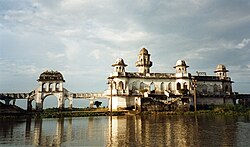


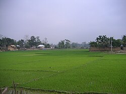
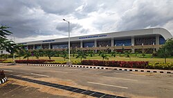
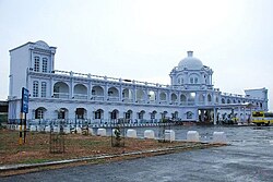
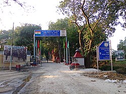


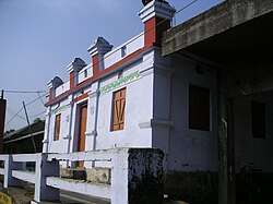
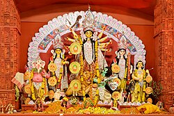


 0.663 (medium)


 Green Imperial Pigeon, Provincial bird of Tripura
 Phayre's leaf monkey, Provincial animal of Tripura
 Agar, Provincial tree of Tripura
 Cobra saffron/Nageshwar, Provincial flower of Tripura
 Natal Queen pineapple, provincial fruit of Tripura
.jpg)


