Rangeet River: Difference between revisions
imported>Kautilya3 (Reverted 1 edit by 43.230.64.27 (talk): Unexplained deletion of caption) |
No edit summary |
||
| (2 intermediate revisions by 2 users not shown) | |||
| Line 1: | Line 1: | ||
{{short description|River in India}} | {{short description|River in India}} | ||
{{Use dmy dates|date=August 2019}} | {{Use dmy dates|date=August 2019}}RANgEet | ||
{{Infobox river | {{Infobox river | ||
| name = Rangeet River | | name = Rangeet River | ||
| Line 64: | Line 64: | ||
==References== | ==References== | ||
{{Reflist}} | {{Reflist}} | ||
{{Hydrography of Sikkim}} | {{Hydrography of Sikkim}} | ||
| Line 72: | Line 71: | ||
[[Category:Rivers of Sikkim]] | [[Category:Rivers of Sikkim]] | ||
[[Category:Rivers of India]] | [[Category:Rivers of India]] | ||
[[Category:Tributaries of the Teesta River]] | |||
{{Sikkim-geo-stub}} | {{Sikkim-geo-stub}} | ||
{{India-river-stub}} | {{India-river-stub}} | ||
Latest revision as of 21:22, 14 January 2023
RANgEet
| Rangeet River | |
|---|---|
| Location | |
| Country | India |
| State | Sikkim |
| Physical characteristics | |
| Source | Himalayas |
| • location | Himalayas, Sikkim, India |
| • coordinates | 27°21′50″N 88°23′26″E / 27.3639°N 88.3905°E |
| Mouth | Teesta River |
• location | South Sikkim district, Sikkim, India |
• coordinates | 27°04′46″N 88°25′59″E / 27.07952°N 88.4331°E |
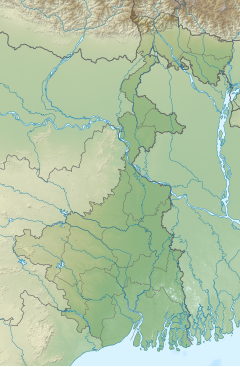
The Rangeet or Rangit is a tributary of the Teesta river, which is the largest river in the Indian state of Sikkim.[1] The Rangeet river originates in the Himalayan mountains in West Sikkim district. The river also forms the boundary between Sikkim and Darjeeling district. A perennial river, it is fed by the melting snow of the Himalayas in early summer and the monsoon rains in June–September. It is popular among rafting enthusiasts owing to its turbulent waters. The river flows past the towns of Jorethang, Pelling and Legship. During its final few kilometres, it joins the Teesta River at a confluence[2] known as Tribeni,[3] which is a popular picnic spot. The Rangeet river has an NHPC hydropower plant with a capacity of 60 megawatts (80,000 hp) capacity in Sikkim.[4]
ReferencesEdit
- ↑ "Rivers". sikkim.nic.in.
- ↑ "Welcome to the Official Web Portal of Sikkim Tourism :: Sikkim at a Glance - Natures Bounty - Rivers". sikkimtourism.gov.in.
- ↑ win7. "Triveni - River Teesta and Rangeet Confluence". darjeeling-tourism.com.
- ↑ "Archived copy". Archived from the original on 14 January 2011. Retrieved 2 January 2011.
{{cite web}}: CS1 maint: archived copy as title (link), Rangit Hydel Project.
Coordinates: 27°10′25″N 88°18′15″E / 27.1736°N 88.3043°E


