

Ajay Kumar (talk | contribs) Created a new article |
No edit summary |
||
| Line 1: | Line 1: | ||
{{Infobox settlement | {{Infobox settlement | ||
| name | | name = Upper Assam division | ||
| native_name | | official_name = Ahom Kingdom (Ak) | ||
| other_name | | native_name = Ujanidesh | ||
| settlement_type | | other_name = | ||
| settlement_type = [[Divisions of India|Division]] | |||
<!-- images, nickname, motto --> | <!-- images, nickname, motto --> | ||
| image_skyline | | image_skyline = Jorhat Baruah Chariali.jpg | ||
| image_caption | | image_caption = Jorhat, the 3rd biggest city of Assam | ||
| image_flag | | image_flag = | ||
| image_shield | | image_shield = | ||
| motto | | motto = | ||
| nickname | | nickname = | ||
| etymology | | etymology = <!-- location --> | ||
<!-- location --> | | subdivision_type = Country | ||
| subdivision_type | | subdivision_name = [[India]] | ||
| subdivision_name | | subdivision_type1 = State | ||
| subdivision_type1 | | subdivision_name1 = [[Assam]] | ||
| subdivision_name1 | | subdivision_type2 = | ||
| subdivision_type2 | | subdivision_name2 = | ||
| subdivision_name2 | | subdivision_type3 = | ||
| subdivision_type3 | | subdivision_name3 = | ||
| subdivision_name3 | | subdivision_type4 = | ||
| subdivision_type4 | | subdivision_name4 = <!-- maps and coordinates --> | ||
| subdivision_name4 | | image_map = Divisions of Assam.svg | ||
<!-- maps and coordinates --> | | map_caption = The five divisions of Assam | ||
| image_map | | pushpin_map = | ||
| map_caption | | pushpin_relief = | ||
| pushpin_map | | pushpin_map_caption = | ||
| pushpin_relief | | coordinates = | ||
| pushpin_map_caption | | coordinates_footnotes = <!-- seat --> | ||
| coordinates | | seat = | ||
| seat_type = <!-- established --> | |||
| coordinates_footnotes | | established_title = | ||
<!-- seat --> | | established_date = <!-- area --> | ||
| seat | | area_footnotes = | ||
| seat_type | | area_total_km2 = | ||
<!-- established --> | | area_total_sq_mi = | ||
| established_title | | area_land_sq_mi = | ||
| established_date | | area_water_sq_mi = <!-- elevation --> | ||
<!-- area --> | | elevation_footnotes = | ||
| area_footnotes | | elevation_m = | ||
| area_total_km2 | | elevation_ft = <!-- population --> | ||
| area_total_sq_mi | | population_as_of = 2021 | ||
| area_land_sq_mi | | population_footnotes = | ||
| area_water_sq_mi | | population_total = 15.5 million | ||
<!-- elevation --> | | population_density_km2 = auto | ||
| elevation_footnotes | | population_density_sq_mi = | ||
| elevation_m | | population_demonym = <!-- time zone(s) --> | ||
| elevation_ft | | timezone1 = UTC +05:30 ([[Indian Standard Time|IST]]) | ||
<!-- population --> | | utc_offset1 = | ||
| population_as_of | | timezone1_DST = | ||
| population_footnotes | | utc_offset1_DST = <!-- postal codes, area code --> | ||
| population_total | | postal_code_type = | ||
| population_density_km2 | | postal_code = | ||
| population_density_sq_mi= | | area_code_type = | ||
| population_demonym | | area_code = | ||
<!-- time zone(s) --> | | geocode = | ||
| timezone1 | | iso_code = <!-- website, footnotes --> | ||
| utc_offset1 | | website = | ||
| timezone1_DST | | footnotes = | ||
| utc_offset1_DST | |||
<!-- postal codes, area code --> | |||
| postal_code_type | |||
| postal_code | |||
| area_code_type | |||
| area_code | |||
| geocode | |||
| iso_code | |||
<!-- website, footnotes --> | |||
| website | |||
| footnotes | |||
}} | }} | ||
'''Upper Assam''' is an [[Divisions of Assam|administrative division]] of the state of [[Assam]] comprising the undivided [[Lakhimpur district|Lakhimpur]] and [[Sivasagar district|Sivasagar]] (previously, | '''Upper Assam division''' or Ujanidesh is an [[Divisions of Assam|administrative division]] of the state of [[Assam]] comprising the undivided [[Lakhimpur district|Lakhimpur]] and [[Sivasagar district|Sivasagar]] (previously, Sivasagar) districts, of the upper reaches of the [[Brahmaputra Valley]]. The other divisions are: [[Lower Assam division|Lower Assam]], [[North Assam]] and [[Hills and Barak Valley]]. The division is under the jurisdiction of a Commissioner.[[Rang Ghar|³]] | ||
Dibrugarh, | Consisting of 7 districts initially, the Upper Assam division now contains 10 districts, that includes [[Sivasagar district|Sivasagar]], [[Jorhat district|Jorhat]], [[Dibrugarh district|Dibrugarh]], [[Dhemaji district|Dhemaji]], [[Golaghat district|Golaghat]], [[Charaideo district|Charaideo]], [[Lakhimpur district|Lakhimpur]], [[Majuli district|Majuli]], [[Biswanath district|Biswanath]], and [[Tinsukia district|Tinsukia]]. While Charaideo and Majuli are the newest districts that were raised to district status in 2016,<ref>{{cite news|url=http://www.eastern-today.com/entries/blog/preparations-afoot-for-inauguration-of-charaideo-district-at-sonari|title=Preparations afoot for inauguration of Charaideo district at Sonari, ''The Eastern Today''|work=ET Correspondent|date=10 February 2016|archive-date=18 July 2021|access-date=11 July 2017|archive-url=https://web.archive.org/web/20210718081936/http://www.eastern-today.com/entries/blog/preparations-afoot-for-inauguration-of-charaideo-district-at-sonari|url-status=dead}}</ref><ref>{{cite news | url=http://hindustantimes.com/indianews/assam-majuli-to-become-india-s-first-river-island-district/story-hzFoxSUxh3IpRpSeIqrhtM.html| title=Assam: Majuli becomes 1st river island district of India| work=[[Hindustan Times]] | date=27 June 2016| access-date=28 June 2016| location=[[Guwahati]]}}</ref> Golaghat and Tinsukia are the biggest districts in terms square kilometre area in the region, raised to the district status in the years of 1987 and 1989 respectively.<ref name="Statoids">{{cite web | url = http://www.statoids.com/yin.html | title = Districts of India | access-date = 2011-10-11 | last = Law | first = Gwillim | date = 2011-09-25 | work = Statoids}}</ref><ref>{{cite web |url =http://www.assaminfo.com/districts/|title=Various Districts in Assam}}</ref> | ||
Jorhat,{{ref|1|1}} Golaghat{{ref|2|2}} and Dibrugarh{{ref|3|3}} are also the oldest recognised and constantly inhabited urban centres (municipal areas) in the region based on the earliest years of formation of the civic bodies, constituted before the Indian independence of 1947.<ref>{{cite web|url=https://books.google.com/books?id=gZmusO1pWjUC|title=Quit India Movement In Assam|first=Anil Kumar|last=Sharma|date=1 January 2007|publisher=Mittal Publications|access-date=5 August 2016|via=Google Books}}</ref> Jorhat is the Second most developed city of Assam. On 26 January 2025 Honourable Chief Minister of Assam Sri Himanta Biswa Sarmah declared Dibrugarh as Second Capital of Assam and now it serves as the headquarter of upper Assam division. Other cities of upper Assam are Tinsukia, Sivasagar, Lakhimpur, Dhemaji etc. | |||
[[ | An extended list of Upper Assam region also includes the districts of [[Sonitpur district|Sonitpur]], [[Karbi Anglong district|Karbi Anglong]] [[Kamrup Metropolitan district]] & [[Nagaon district|Nagaon]]. The region is the most productive part of the state of Assam, which is rich in natural resources like coal, oil and natural gas as well as tea plantations. | ||
==History== | ==History== | ||
===Medieval=== | ===Medieval period=== | ||
====Chutia Kingdom==== | ====Chutia Kingdom==== | ||
The medieval [[Chutia Kingdom]] was on the bank of the river [[Brahmaputra]]. It was a powerful kingdom which had ruled in northeastern [[Assam]] and some areas of present-day [[Arunachal Pradesh]], with the capital at [[Sadiya]]. The kingdom controlled almost the entire region of present Assam districts of [[Lakhimpur district|Lakhimpur]], [[Dhemaji district|Dhemaji]], [[Tinsukia district|Tinsukia]] and [[Dibrugarh district|Dibrugarh]] as well as parts of [[Sonitpur district|Sonitpur]], [[Golaghat district|Golaghat]], [[Jorhat district|Jorhat]] and [[ | The medieval [[Chutia Kingdom]] was on the bank of the river [[Brahmaputra]]. It was a powerful kingdom which had ruled in northeastern [[Assam]] and some areas of present-day [[Arunachal Pradesh]], with the capital at [[Sadiya]]. The kingdom controlled almost the entire region of present Assam districts of [[Lakhimpur district|Lakhimpur]], [[Dhemaji district|Dhemaji]], [[Tinsukia district|Tinsukia]] and [[Dibrugarh district|Dibrugarh]] as well as parts of [[Sonitpur district|Sonitpur]], [[Golaghat district|Golaghat]], [[Jorhat district|Jorhat]] and [[Sivasagar district|Sivasagar]] districts. In Arunachal Pradesh, it covered the districts bordering Assam. | ||
====Ahom Kingdom==== | ====Ahom Kingdom==== | ||
The [[Ahom Kingdom]] was a kingdom in the [[Brahmaputra]] valley in Assam that maintained its sovereignty for nearly 600 years and successfully resisted [[Mughal Empire|Mughal]] expansion in [[North-East India]]. Established by [[Sukaphaa]], a [[Tai peoples|Tai]] prince from [[Mong Mao]], it began as a [[Mueang|Mong]] in the upper reaches of the [[Brahmaputra | The [[Ahom Kingdom]] was a kingdom in the [[Brahmaputra]] valley in Assam that maintained its sovereignty for nearly 600 years and successfully resisted [[Mughal Empire|Mughal]] expansion in [[North-East India]]. Established by [[Sukaphaa]], a [[Tai peoples|Tai]] prince from [[Mong Mao]], it began as a [[Mueang|Mong]] in the upper reaches of the [[Brahmaputra River]]. It expanded suddenly under [[Suhungmung]] in the 16th century after annexing the Chutia kingdom and parts of Kachari kingdom and therefore became multi-ethnic in character. The kingdom became weaker with the rise of the [[Moamoria rebellion]], and subsequently fell to a succession of [[Burmese invasion of Assam|Burmese invasions]]. With the defeat of the Burmese after the [[First Anglo-Burmese War]] and the [[Treaty of Yandabo]] in 1826, control of the kingdom passed into British ([[East India Company]]) hands. | ||
== Demographics == | == Demographics == | ||
The Upper Assam division | The Upper Assam division, comprising 28 percent of Assam's population at 15.56 million, predominantly adheres to Hinduism embraced by nearly 90 percent of its people, with Islam being the second most practiced religion. More than 90 percent of the people speak [[Assamese language|Assamese]]. | ||
The major communities of Upper assam are [[Ahom people|Ahom]], [[Chutiya people|Chutia]], Tea tribes, [[Mishing people|Mishing]], [[Sonowal Kacharis]], Moran, Matak, [[Deori people|Deori]], | The major communities of Upper assam are [[Ahom people|Ahom]], [[Chutiya people|Chutia]], [[Tea tribes]], [[Mishing people|Mishing]], [[Sonowal Kacharis]], Moran, Matak, [[Deori people|Deori]], [[Thengal-Kachari|Thengal Kacharis]] and indigenous Assamese Muslim communities like Gorias Morias, Gorkhas, Bihari, tribel naga, sumi, Nokte, and others living here from thousands of years | ||
== Gallery == | == Gallery == | ||
| Line 100: | Line 88: | ||
City_Skyline_-_Golaghat.png|{{center|Golaghat <br><small>''Skyline of Golaghat Central (west)''</small>}} | City_Skyline_-_Golaghat.png|{{center|Golaghat <br><small>''Skyline of Golaghat Central (west)''</small>}} | ||
GNB_Road_and_Ranghr_Complex.jpg|{{center|Tinsukia <br><small>''Evening view of G. N. B. Road, Tinsukia''</small>}} | GNB_Road_and_Ranghr_Complex.jpg|{{center|Tinsukia <br><small>''Evening view of G. N. B. Road, Tinsukia''</small>}} | ||
</gallery> | </gallery>[[File:Jorhat Night View.png | thumb | right | alt=Jorhat, the 2nd biggest city of Assam | Jorhat, the 2nd biggest city of Assam]] | ||
== Notes == | == Notes == | ||
{{refbegin}} | {{refbegin}} | ||
*{{note|1|1}} Formation of Dibrugarh municipal region, 1873.<ref>{{cite web|url=http://dibrugarhmunicipality.org.in/|title=Dibrugarh Municipal Board}}</ref> | *{{note|1|1}} Formation of Dibrugarh municipal region, 1873.<ref>{{cite web|url=http://dibrugarhmunicipality.org.in/|title=Dibrugarh Municipal Board|access-date=2017-07-11|archive-date=2016-06-11|archive-url=https://web.archive.org/web/20160611150105/http://dibrugarhmunicipality.org.in/|url-status=dead}} | ||
</ref> | |||
*{{note|2|2}} Formation of Golaghat municipal region, 1920.<ref>{{cite news|url=http://www.telegraphindia.com/1150119/jsp/northeast/story_9079.jsp#.V0OXAZMrIcg|archive-url=https://web.archive.org/web/20150630120603/http://www.telegraphindia.com/1150119/jsp/northeast/story_9079.jsp#.V0OXAZMrIcg|url-status=dead|archive-date=June 30, 2015|title=AGP lists civic poll candidates (Golaghat Municipal Board)|access-date=5 August 2016}}</ref> | *{{note|2|2}} Formation of Golaghat municipal region, 1920.<ref>{{cite news|url=http://www.telegraphindia.com/1150119/jsp/northeast/story_9079.jsp#.V0OXAZMrIcg|archive-url=https://web.archive.org/web/20150630120603/http://www.telegraphindia.com/1150119/jsp/northeast/story_9079.jsp#.V0OXAZMrIcg|url-status=dead|archive-date=June 30, 2015|title=AGP lists civic poll candidates (Golaghat Municipal Board)|access-date=5 August 2016}}</ref> | ||
*{{note|3|3}} Formation of Jorhat municipal region, 1909.<ref>{{cite web|url=http://www.jorhatmunicipalboard.org/jorhat_municipal_board.php|title=Jorhat Municipal Board(JBM), Jorhat, Assam|access-date=2016-08-05|archive-url=https://web.archive.org/web/20160327181336/http://jorhatmunicipalboard.org/jorhat_municipal_board.php|archive-date=2016-03-27|url-status= | *{{note|3|3}} Formation of Jorhat municipal region, 1909.<ref>{{cite web|url=http://www.jorhatmunicipalboard.org/jorhat_municipal_board.php|title=Jorhat Municipal Board(JBM), Jorhat, Assam|access-date=2016-08-05|archive-url=https://web.archive.org/web/20160327181336/http://jorhatmunicipalboard.org/jorhat_municipal_board.php|archive-date=2016-03-27|url-status=usurped}}</ref> | ||
{{refend}} | {{refend}} | ||
| Line 113: | Line 102: | ||
==References== | ==References== | ||
* {{citation |last=Nag |first=Sajal |chapter=Devour thy Neighbour: Foreign Invasions and the Decline of States in Eighteenth Century North East India |editor=Tejimala Gurung |title=The Falling Polities: Crisis and Decline of States in North-East India in the Eighteenth Century |publisher=DVS Publishers |year=2018 |isbn=9789385839122 |chapter-url=https://www.academia.edu/38831733/Burmese_invasion |via=academia.edu}} | |||
* {{Cite journal| last = Phukan| first=J. N.| title = Relations of the Ahom kings of Assam with those of Mong Mao (in Yunnan, China) and of Mong Kwang (Mogaung in Myanmar) | journal= Proceedings of the Indian History Congress| volume=52 | year=1991| pages= 888–893| jstor=44142722|issn=2249-1937}} | |||
*{{cite book | *{{cite book | ||
| first = Leslie | | first = Leslie | ||
Latest revision as of 01:12, 19 March 2026
Upper Assam division
Ujanidesh | |
|---|---|
| Ahom Kingdom (Ak) | |
 Jorhat, the 3rd biggest city of Assam | |
 The five divisions of Assam | |
| Country | India |
| State | Assam |
| Population (2021) | |
| • Total | 15.5 million |
| Time zone | UTC +05:30 (IST) |
Upper Assam division or Ujanidesh is an administrative division of the state of Assam comprising the undivided Lakhimpur and Sivasagar (previously, Sivasagar) districts, of the upper reaches of the Brahmaputra Valley. The other divisions are: Lower Assam, North Assam and Hills and Barak Valley. The division is under the jurisdiction of a Commissioner.³
Consisting of 7 districts initially, the Upper Assam division now contains 10 districts, that includes Sivasagar, Jorhat, Dibrugarh, Dhemaji, Golaghat, Charaideo, Lakhimpur, Majuli, Biswanath, and Tinsukia. While Charaideo and Majuli are the newest districts that were raised to district status in 2016,[1][2] Golaghat and Tinsukia are the biggest districts in terms square kilometre area in the region, raised to the district status in the years of 1987 and 1989 respectively.[3][4]
Jorhat,1 Golaghat2 and Dibrugarh3 are also the oldest recognised and constantly inhabited urban centres (municipal areas) in the region based on the earliest years of formation of the civic bodies, constituted before the Indian independence of 1947.[5] Jorhat is the Second most developed city of Assam. On 26 January 2025 Honourable Chief Minister of Assam Sri Himanta Biswa Sarmah declared Dibrugarh as Second Capital of Assam and now it serves as the headquarter of upper Assam division. Other cities of upper Assam are Tinsukia, Sivasagar, Lakhimpur, Dhemaji etc.
An extended list of Upper Assam region also includes the districts of Sonitpur, Karbi Anglong Kamrup Metropolitan district & Nagaon. The region is the most productive part of the state of Assam, which is rich in natural resources like coal, oil and natural gas as well as tea plantations.
History[edit | edit source]
Medieval period[edit | edit source]
Chutia Kingdom[edit | edit source]
The medieval Chutia Kingdom was on the bank of the river Brahmaputra. It was a powerful kingdom which had ruled in northeastern Assam and some areas of present-day Arunachal Pradesh, with the capital at Sadiya. The kingdom controlled almost the entire region of present Assam districts of Lakhimpur, Dhemaji, Tinsukia and Dibrugarh as well as parts of Sonitpur, Golaghat, Jorhat and Sivasagar districts. In Arunachal Pradesh, it covered the districts bordering Assam.
Ahom Kingdom[edit | edit source]
The Ahom Kingdom was a kingdom in the Brahmaputra valley in Assam that maintained its sovereignty for nearly 600 years and successfully resisted Mughal expansion in North-East India. Established by Sukaphaa, a Tai prince from Mong Mao, it began as a Mong in the upper reaches of the Brahmaputra River. It expanded suddenly under Suhungmung in the 16th century after annexing the Chutia kingdom and parts of Kachari kingdom and therefore became multi-ethnic in character. The kingdom became weaker with the rise of the Moamoria rebellion, and subsequently fell to a succession of Burmese invasions. With the defeat of the Burmese after the First Anglo-Burmese War and the Treaty of Yandabo in 1826, control of the kingdom passed into British (East India Company) hands.
Demographics[edit | edit source]
The Upper Assam division, comprising 28 percent of Assam's population at 15.56 million, predominantly adheres to Hinduism embraced by nearly 90 percent of its people, with Islam being the second most practiced religion. More than 90 percent of the people speak Assamese. The major communities of Upper assam are Ahom, Chutia, Tea tribes, Mishing, Sonowal Kacharis, Moran, Matak, Deori, Thengal Kacharis and indigenous Assamese Muslim communities like Gorias Morias, Gorkhas, Bihari, tribel naga, sumi, Nokte, and others living here from thousands of years
Gallery[edit | edit source]
-
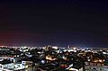 Dibrugarh
Night view of Dibrugarh -
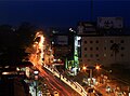 Jorhat
Evening view of Jorhat -
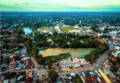 Golaghat
Skyline of Golaghat Central (west) -
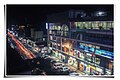 Tinsukia
Evening view of G. N. B. Road, Tinsukia


Notes[edit | edit source]
Notes[edit | edit source]
- ↑ "Preparations afoot for inauguration of Charaideo district at Sonari, The Eastern Today". ET Correspondent. 10 February 2016. Archived from the original on 18 July 2021. Retrieved 11 July 2017.
- ↑ "Assam: Majuli becomes 1st river island district of India". Hindustan Times. Guwahati. 27 June 2016. Retrieved 28 June 2016.
- ↑ Law, Gwillim (2011-09-25). "Districts of India". Statoids. Retrieved 2011-10-11.
- ↑ "Various Districts in Assam".
- ↑ Sharma, Anil Kumar (1 January 2007). "Quit India Movement In Assam". Mittal Publications. Retrieved 5 August 2016 – via Google Books.
- ↑ "Dibrugarh Municipal Board". Archived from the original on 2016-06-11. Retrieved 2017-07-11.
- ↑ "AGP lists civic poll candidates (Golaghat Municipal Board)". Archived from the original on June 30, 2015. Retrieved 5 August 2016.
- ↑ "Jorhat Municipal Board(JBM), Jorhat, Assam". Archived from the original on 2016-03-27. Retrieved 2016-08-05.
References[edit | edit source]
- Nag, Sajal (2018), "Devour thy Neighbour: Foreign Invasions and the Decline of States in Eighteenth Century North East India", in Tejimala Gurung (ed.), The Falling Polities: Crisis and Decline of States in North-East India in the Eighteenth Century, DVS Publishers, ISBN 9789385839122 – via academia.edu
- Phukan, J. N. (1991). "Relations of the Ahom kings of Assam with those of Mong Mao (in Yunnan, China) and of Mong Kwang (Mogaung in Myanmar)". Proceedings of the Indian History Congress. 52: 888–893. ISSN 2249-1937. JSTOR 44142722.
- Shakespear, Leslie (1914). History of Upper Assam, Upper Burmah and Northeast Frontier. Cambridge University Press.
- Gogoi, Padmeswar (1956). The political expansion of the Mao Shans.