Sausar
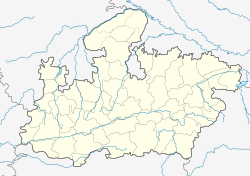
Sausar (Saunsar) is a town and a nagar palika in Chhindwara district in the Indian state of Madhya Pradesh. It is famous for its oranges. More than 90 per cent of farmers produce oranges. Cotton is grown in large quantities in the local area.
Sausar
Saunsar | |
|---|---|
city | |
| Coordinates: 21°39′N 78°47′E / 21.65°N 78.78°ECoordinates: 21°39′N 78°47′E / 21.65°N 78.78°E | |
| Country | |
| State | Madhya Pradesh |
| District | Chhindwara |
| Government | |
| • Type | Nagar palika |
| Elevation | 352 m (1,155 ft) |
| Population (2011)[1] | |
| • Total | 67,459 |
| Time zone | UTC+5:30 (IST) |
| Pin Code | 480106 |
| Vehicle registration | MP-28 |
IndustryEdit
Sausar tehsil is home to numerous industries after the arrival of Raymond textiles in Borgaon in the 1990s, since then the industrial area called AKVN Borgaon-khairitaigaon (Audyogik Kendra Vikas Nigam) (Industrial center development Corporation) has seen a number of small and large industries of which major are Jindal Gas pipe industries and a few alloy processing units, chemical units, plastic products units, paper box and much highlighted Food park within the Industrial area which comprises food processing units in which renowned names like Britannia(Sobisco), Sunder, Suruchi (safal foods) are operational along with other dozen small scale units. The area is a hotspot for manufacturers mainly due to its location as it lies just 10 km within MP state from Maharashtra and the highway is connected to every part of India as now it has been declared a National Highway 547. Maharashtra states winter Capital Nagpur lies at a distance of just 72 km and Bhopal lies at a distance of just 300 km and Chhindwara at 55 km.
As the industrial development plan proposed by Government of India, Sausar has been gifted with a multi product SEZ near the existing industrial area.
A textile park is also about to be set up between Sausar and Pandhurna, near Rajna village, where industries related to textile and clothing will enjoy special benefits, it may become one of the largest textile parks in the nation. Shree Gayatri Industries Established on 1998 and expended in 2013 Fully Automated Ginning & Pressing Unit, His Mainly Cotton Manufacturing Unit Distributed Material in all over India.
PlacesEdit
Jam Sawali Hanuman Mandir is one of the most famous and oldest temple in this area. In this Hanuman temple, the idol is in a resting posture which is very rare form. It is believed that no one can visit this Hindu temple until he or she is called by the Lord Hanuman. Lord Hanuman here called as Bal Bramhachari. There are two main entry gates one for women and another for men in this temple. Lord Rama stands in role of Peepal tree and the Lord Hanuman sleeps on legs respectively of Lord Rama with these worshiping. Lord Hanuman sleeps on a wealth of gold and diamonds.
EducationEdit
The city has government schools and two government colleges for science and art commerce. Raymond textiles mills had started their own CBSE pattern school for the children of their employees and the general public. Kailashpath Singhania High School similar to Bhansali Vidya Mandir Public School started by the Bhansali Engineering Polymers Ltd. in satnoor. Bhansali Vidya Mandir was first CBSE school in this area followed by Kailashpat Singhania which is located in Lodhikheda.
GeographyEdit
Sausar is located at 21°39′N 78°47′E / 21.65°N 78.78°E in central India.[2] It has an average elevation of 352 metres (1,154 feet). The Jam and Kanhan Rivers are the main rivers in Sausar. The town is situated between the two rivers.
DemographyEdit
At the 2001 census of India, Sausar had a population of 24,312.[3] Males constituted 52% of the population and females 48%. Sausar has an average literacy rate of 71% higher than the national average of 59.5 percent; male literacy is 77% and female literacy is 65%. In Sausar, 13% of the population is under 6 years of age.
ReferencesEdit
- ↑ "Census of India Search details". censusindia.gov.in. Retrieved 10 May 2015.
- ↑ Falling Rain Genomics, Inc - Sausar
- ↑ "Census of India 2001: Data from the 2001 Census, including cities, villages and towns (Provisional)". Census Commission of India. Archived from the original on 16 June 2004. Retrieved 1 November 2008.

