| Parbati River | |
|---|---|
| Location | |
| Country | India |
| States | Madhya Pradesh and Rajasthan |
| Physical characteristics | |
| Source | Pithapura Lake near Siddikganj |
| • location | Vindhya Ranges in Sehore District in Madhya Pradesh |
| • elevation | 610 m (2,000 ft) |
| Mouth | Chambal River |
• location | National Ghariyal Sanctuary near Palin village Sawai Madhopur District in Rajasthan |
| Length | 471 km (293 mi) |
Parbati River is a river in Madhya Pradesh And Rajasthan, India that flows into the Chambal River.[1] The river rises at a height of 610 m in the Vindhya range in Sehore district Madhya Pradesh And flows in Sehore District, Rajgarh District, Guna District of Madhya Pradesh and then enters in Rajasthan and flows from Baran District and Sawai Madhopur District of Rajasthan where it falls into Chambal River in Sawai Madhopur District and runs for 471 km.[citation needed] It is one of the Chambal River's three main tributaries, along with the Banas River and the Kali Sindh River.[2] Ramgarh crater is located on its eastern bank.[citation needed]
See also[edit | edit source]
References[edit | edit source]
- ↑ Pratiyogita Darpan, August, 2007; p. 268
- ↑ Ram Narayan Yadava (2003). Water resources system operation: proceedings of the International Conference on Water and Environment (WE-2003), December 15-18, 2003, Bhopal, India. Allied Publishers. pp. 545–546. ISBN 978-81-7764-548-4. Retrieved 1 May 2011.
External links[edit | edit source]
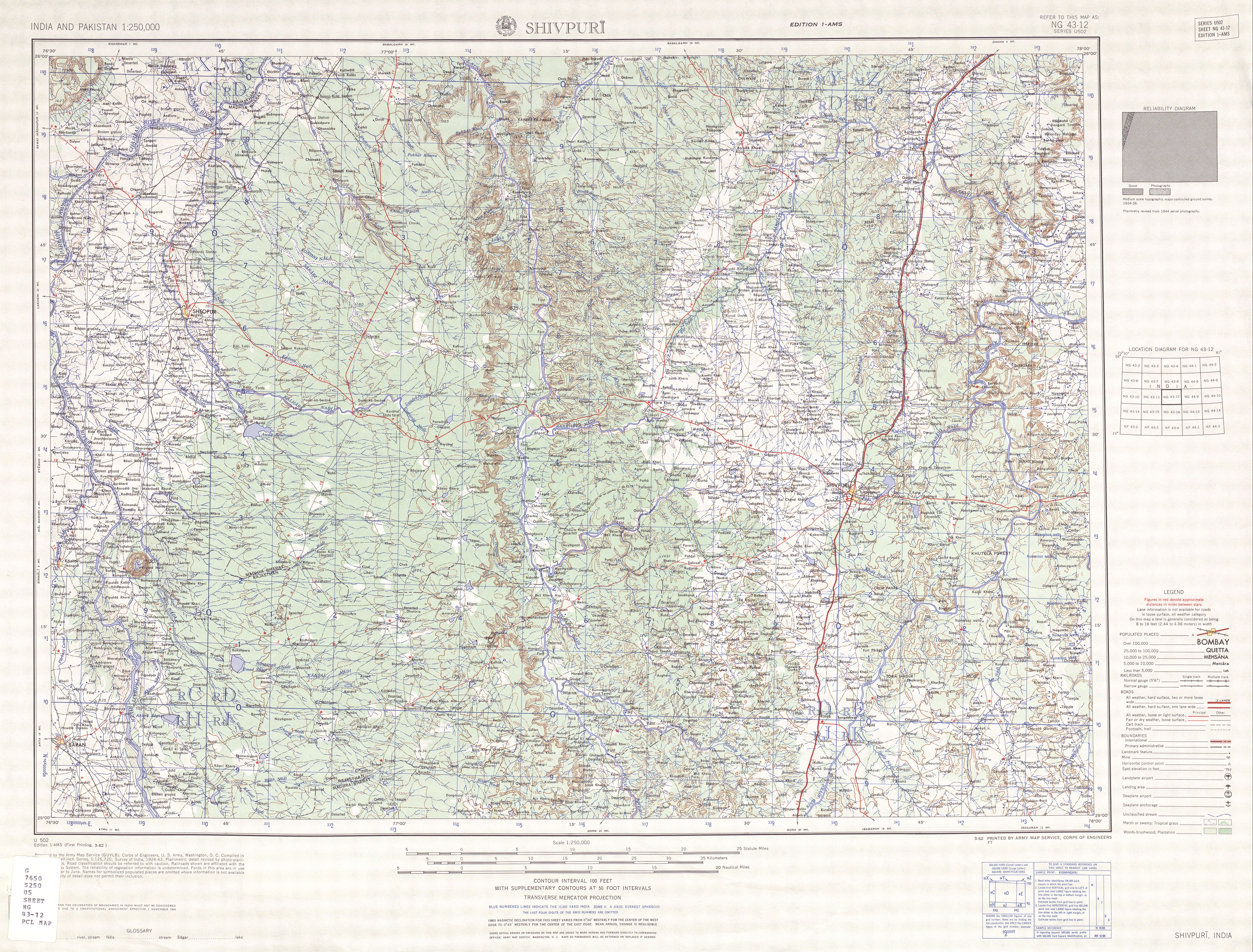
- Shrivpuri, topographic map showing the Parbati-Chambal confluence.
25°50′40″N 76°33′48″E / 25.84444°N 76.56333°E
This article related to a location in Madhya Pradesh is a stub. You can help Bharatpedia by expanding it. |