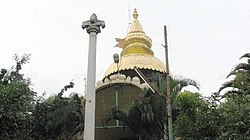
Mahalakshmi Layout
This article does not cite any sources. (June 2018) |
Mahalakshmi Layout is a suburb in north-west Bengaluru, India. It is near Rajajinagar, Basaveshwaranagar and Yeshwanthapura. Together with Nandini Layout, Kurubarahalli and Nagapura, it is one of the biggest residential areas in Bengaluru.
Mahalakshmi Layout | |
|---|---|
neighbourhood | |
 | |
| Nickname: Temple Layout | |
| Coordinates: 13°01′00″N 77°32′18″E / 13.01667°N 77.53833°ECoordinates: 13°01′00″N 77°32′18″E / 13.01667°N 77.53833°E | |
| Country | India |
| State | Karnataka |
| District | Bangalore Urban |
| Metro | Bangalore |
| Area | |
| • Total | 1.46756 km2 (0.56663 sq mi) |
| Languages | |
| • Official | Kannada |
| Time zone | UTC+5:30 (IST) |
| PIN | 560086 |
| Telephone code | 080 |
| Vehicle registration | KA 02 |
Educational institutionsEdit
Mahalakshmin layout has a considerable number of educational institutions, both at the primary/secondary education and higher education level.
The area consists of renowned colleges such as BGS World School, BGS PU COLLEGE, BGS Institute of Management Bengaluru, Basaveshwara Aided High school, Max Muller Public School and St. Paul's High school <
