

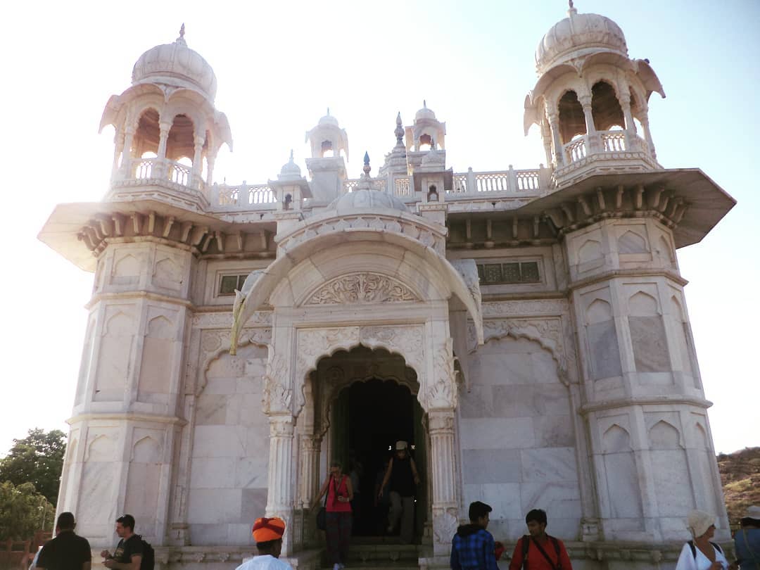


The Jaswant Thada is a cenotaph located in Jodhpur, in the Indian state of Rajasthan. It was built by Maharaja Sardar Singh of Jodhpur State in 1899 in memory of his father, Maharaja Jaswant Singh II,[1] and serves as the cremation ground for the royal Rajput family of Marwar.[2]
The cenotaph is built out of intricately carved sheets of Makrana marble. These sheets are extremely thin and polished so that they emit a warm glow when illuminated by the Sun.
The cenotaph's grounds feature carved gazebos, a tiered garden, and a small lake. There are three other cenotaphs in the grounds. The cenotaph of Maharaja Jaswant Singh displays portraits of the rulers and Maharajas of Jodhpur.[3]
Gallery[edit | edit source]


References[edit | edit source]
- ↑ Jain, Ajay (2013). Jodhpur, Rajasthan, India. Kunzum. p. 11.
- ↑ Sinha, Juhi (2007). Beyond the Dunes: Journeys in Rajasthan. Penguin. p. 72. ISBN 9780143063063.
- ↑ Subodh Kapoor (2002). The Indian Encyclopaedia: Indo-Pak War-Kamla Karri. p. 3755.
Jasvvant Thada, Close to the fort complex lies this white marble cenotaph, built in 1899, in commemoration of Maharaja Jaswant Singh II.Rare portraits of Jodhpur's rulers are also to be seen at Jaswant Thada.
26°18′14″N 73°01′31″E / 26.30389°N 73.02528°E
External links[edit | edit source]
This article about an Indian building or structure is a stub. You can help Bharatpedia by expanding it. |
This article related to a location in Rajasthan is a stub. You can help Bharatpedia by expanding it. |