.svg)
File:Madhya Pradesh districts location map big.svg

Size of this PNG preview of this SVG file: 220 × 155 pixels. Other resolutions: 320 × 225 pixels | 500 × 352 pixels | 1,041 × 732 pixels.
Original file (SVG file, nominally 1,041 × 732 pixels, file size: 313 KB)
Summary
| Description |
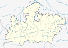
English: Locator map of Madhya Pradesh. Geographical limits of the map: * N: 27.15°N * S: 20.75°N * E: 83.1°E * W: 73.2°E Français : Carte de localisation du Madhya Pradesh, Inde. |
| Date | |
| Source | File:India Madhya Pradesh location map.svg |
| Author | Planemad, Nayvik, Yann (talk) |
| Other versions |
|

Licensing
This file is licensed under the Creative Commons Attribution-Share Alike 3.0 Unported license.
- You are free:
- to share – to copy, distribute and transmit the work
- to remix – to adapt the work
- Under the following conditions:
- attribution – You must give appropriate credit, provide a link to the license, and indicate if changes were made. You may do so in any reasonable manner, but not in any way that suggests the licensor endorses you or your use.
- share alike – If you remix, transform, or build upon the material, you must distribute your contributions under the same or compatible license as the original.
File history
Click on a date/time to view the file as it appeared at that time.
| Date/Time | Thumbnail | Dimensions | User | Comment | |
|---|---|---|---|---|---|
| current | 21:30, 21 April 2020 | | 1,041 × 732 (313 KB) | wikimediacommons>C1MM | Added rivers and new district |
File usage
More than 100 pages use this file. The following list shows the first 100 pages that use this file only. A full list is available.
- Adhartal railway station
- Amla Junction railway station
- Anuppur Junction railway station
- Ashoknagar railway station
- Asirgarh Road railway station
- Badnagar railway station
- Bagra Tawa railway station
- Balaghat
- Bamnia railway station
- Betul railway station
- Bhadbhada Ghat railway station
- Bhandarkund railway station
- Bina Junction railway station
- Bir railway station
- Birlanagar Junction railway station
- Budhni railway station
- Burhanpur railway station
- Chachaura Binaganj railway station
- Chhanera railway station
- Dabra railway station
- Damoh railway station
- Datia Airstrip
- Datia railway station
- Dewanganj railway station
- Dewas Junction railway station
- Dhar railway station
- Dr. Ambedkar Nagar railway station
- Fatehabad Chandrawatiganj Junction railway station
- Gadarwara railway station
- Ganj Basoda railway station
- Ghoradongri railway station
- Guna Junction railway station
- Gwalior Junction railway station
- Harda railway station
- Hoshangabad railway station
- Jaora railway station
- Junnardeo railway station
- Kareli railway station
- Katni Junction railway station
- Katni Murwara Junction railway station
- Katni South railway station
- Khachrod railway station
- Khaigaon railway station
- Khajuraho Airport
- Khandwa Airport
- Khandwa Junction railway station
- Khargapur railway station
- Khurai railway station
- Maharaja Chhatrasal Station Chhatarpur railway station
- Maihar railway station
- Makronia railway station
- Maksi Junction railway station
- Mandi Bamora railway station
- Mandideep railway station
- Mandsaur railway station
- Manglia Gaon railway station
- Mathela railway station
- Meghnagar railway station
- Misrod railway station
- Morena railway station
- Mukhtiara Balwada railway station
- Multai railway station
- Nagda Junction railway station
- Narsinghpur railway station
- Neemuch railway station
- Nepanagar railway station
- New Katni Junction railway station
- Pandhurna railway station
- Paporaji
- Patharia railway station
- Pingleshwar railway station
- Pipariya railway station
- Ranapur
- Ratlam Junction railway station
- Rau railway station
- Ravindra Natya Grah
- Rewa Terminal railway station
- Ruthiyai Junction railway station
- Saifee Nagar railway station
- Sanawad railway station
- Sanchi railway station
- Sant Hirdaram Nagar railway station
- Satna Airport
- Satna Junction railway station
- Saugor railway station
- Sehore railway station
- Shahdol railway station
- Shajapur railway station
- Shamgarh railway station
- Shivpuri railway station
- Shridham railway station
- Shujalpur railway station
- Sihora Road railway station
- Sohagpur railway station
- Surgaon Banjari railway station
- Talvadiya Junction railway station
- Thandla Road railway station
- Tihi railway station
- Tikamgarh railway station
- Ujjain Airstrip
View more links to this file.