.svg)

File:Leh 02.jpg
Size of this preview: 220 × 147 pixels. Other resolutions: 320 × 213 pixels | 500 × 333 pixels | 5,206 × 3,471 pixels.
Original file (5,206 × 3,471 pixels, file size: 6.14 MB, MIME type: image/jpeg)
Summary
| Description |
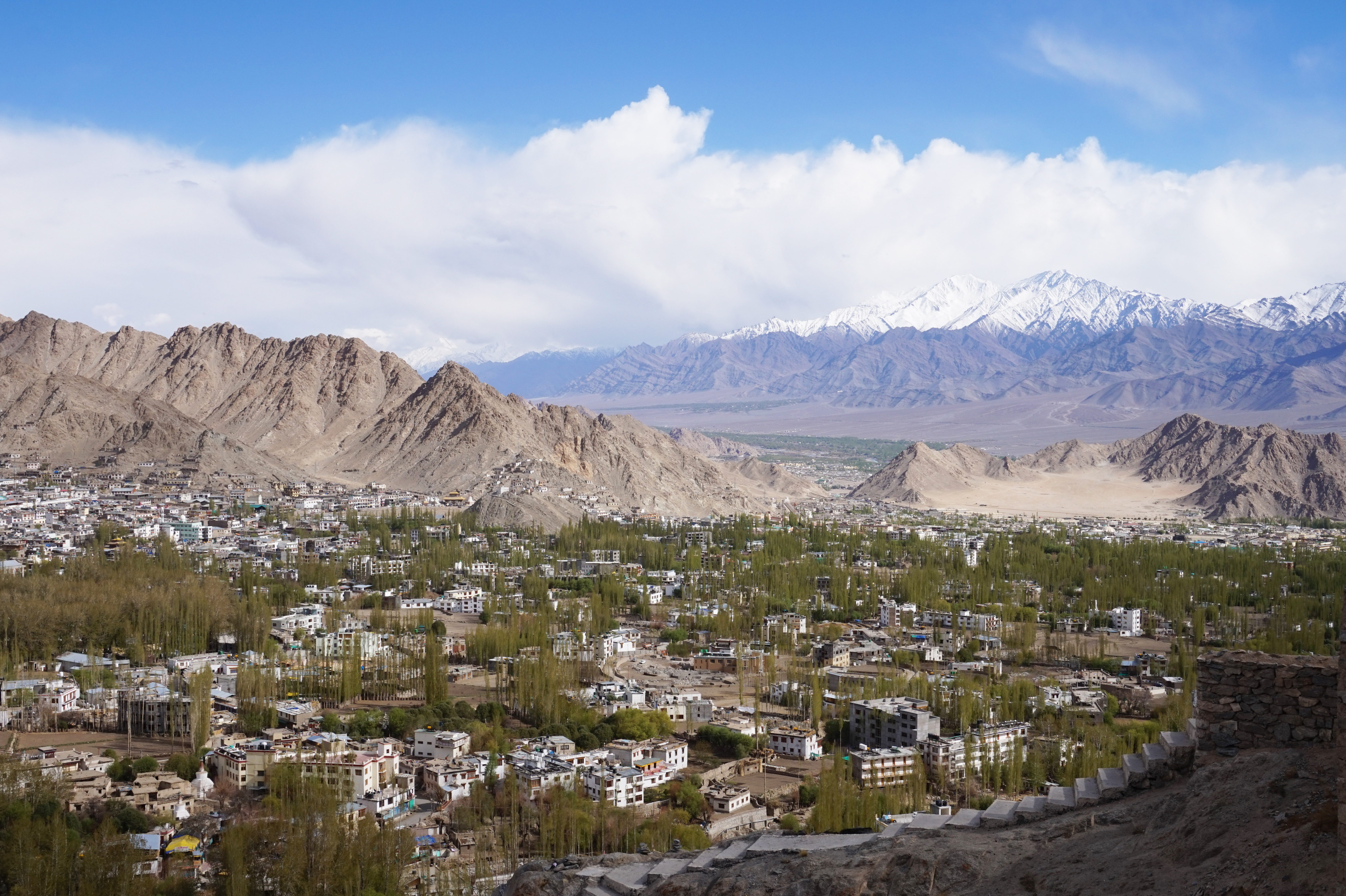
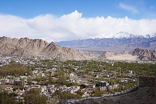
English: View of Leh from the Shanti Stupa, India
Français : Vue de Leh à partir du Shanti Stupa, Leh, Inde |
| Date | |
| Source | Own work |
| Author | Bernard Gagnon |
| Camera location | | View this and other nearby images on: OpenStreetMap |
|---|
Licensing
I, the copyright holder of this work, hereby publish it under the following licenses:

|
Permission is granted to copy, distribute and/or modify this document under the terms of the GNU Free Documentation License, Version 1.2 or any later version published by the Free Software Foundation; with no Invariant Sections, no Front-Cover Texts, and no Back-Cover Texts. A copy of the license is included in the section entitled GNU Free Documentation License. |
This file is licensed under the Creative Commons Attribution-Share Alike 4.0 International, 3.0 Unported, 2.5 Generic, 2.0 Generic and 1.0 Generic license.
- You are free:
- to share – to copy, distribute and transmit the work
- to remix – to adapt the work
- Under the following conditions:
- attribution – You must give appropriate credit, provide a link to the license, and indicate if changes were made. You may do so in any reasonable manner, but not in any way that suggests the licensor endorses you or your use.
- share alike – If you remix, transform, or build upon the material, you must distribute your contributions under the same or compatible license as the original.
You may select the license of your choice.
| Annotations | This image is annotated: View the annotations at Commons |
This image has been assessed using the Quality image guidelines and is considered a Quality image.
|
File history
Click on a date/time to view the file as it appeared at that time.
| Date/Time | Thumbnail | Dimensions | User | Comment | |
|---|---|---|---|---|---|
| current | 21:14, 17 November 2024 | | 5,206 × 3,471 (6.14 MB) | wikimediacommons>Bgag | sharper |
File usage
The following page uses this file: