.svg)
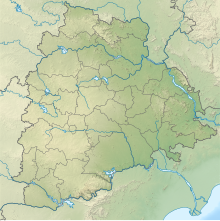
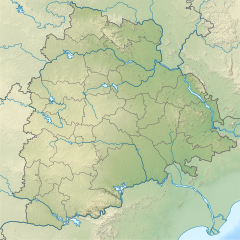
File:India Telangana relief map.svg

Size of this PNG preview of this SVG file: 220 × 220 pixels. Other resolutions: 240 × 240 pixels | 375 × 375 pixels | 851 × 852 pixels.
Original file (SVG file, nominally 851 × 852 pixels, file size: 1.46 MB)
Summary
| Description |
English: Telangana relief map. Boundaries based on Telangana location map. Elevation data from STRM1. |
| Date | |
| Source | Based on File:India Telangana location map.svg |
| Author | Own work based on User:Milenioscuro |
Licensing
This file is licensed under the Creative Commons Attribution-Share Alike 3.0 Unported license.
- You are free:
- to share – to copy, distribute and transmit the work
- to remix – to adapt the work
- Under the following conditions:
- attribution – You must give appropriate credit, provide a link to the license, and indicate if changes were made. You may do so in any reasonable manner, but not in any way that suggests the licensor endorses you or your use.
- share alike – If you remix, transform, or build upon the material, you must distribute your contributions under the same or compatible license as the original.
File history
Click on a date/time to view the file as it appeared at that time.
| Date/Time | Thumbnail | Dimensions | User | Comment | |
|---|---|---|---|---|---|
| current | 10:43, 7 June 2021 | | 851 × 852 (1.46 MB) | wikimediacommons>C1MM | Added better elevation colouring |
File usage
The following 46 pages use this file:
- Alampur Jogulamba Temple
- Alampur Navabrahma Temples
- Alampur Papanasi Temples
- Alwal Lake
- Ananthagiri Hills, Vikarabad district
- Bhadrakali Lake
- Bogatha Waterfall
- Doli Gutta
- Durgam Cheruvu
- Edulabad Lake
- Fox Sagar Lake
- Himayat Sagar
- Hussain Sagar
- Icchampally Project
- Janampet Barrage
- Jurala Project
- Kaddam Project
- Kapra Lake
- Kuntala Waterfall
- Laknavaram Lake
- Lower Jurala Hydro Electric Project
- Lower Manair Dam
- Mallela Theertham
- Mid Manair Dam
- Mir Alam Tank
- Nizam Sagar
- Osman Sagar
- Palamuru-Rangareddy Lift Irrigation Scheme
- Parvati Barrage
- Ramakrishnapuram Lake
- Ramanthapur Lake
- Ramappa Lake
- Rukn-ud-Daula lake
- Safilguda Lake
- Saraswati Barrage
- Saroornagar Lake
- Shamirpet Lake
- Shanigaram Reservoir
- Sri Komaram Bheem Project
- Sripada Yellampalli Project
- Sriram Sagar Project
- Taliperu Project
- Tummidihetti Barrage
- Upper Manair Dam
- Waddepally Lake
- Wyra Reservoir