.svg)
File:India Kerala relief map.png
Size of this preview: 220 × 320 pixels. Other resolutions: 165 × 240 pixels | 258 × 375 pixels | 828 × 1,205 pixels.
Original file (828 × 1,205 pixels, file size: 933 KB, MIME type: image/png)
Summary
| Description |
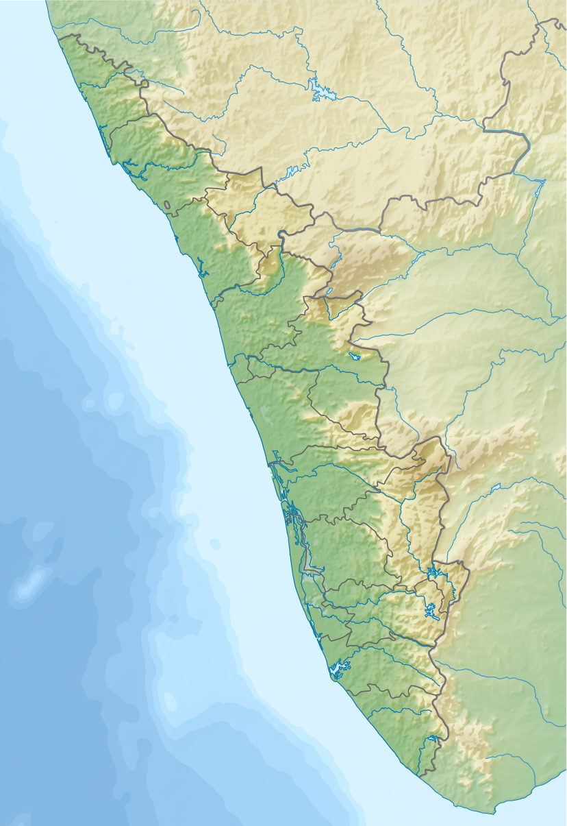
English: Relief map of Kerala, India. |
|||||||||
| Date | ||||||||||
| Source |
|
|||||||||
| Creator | ||||||||||
| Geotemporal data | ||||||||||
| Bounding box |
|
|||||||||
| Georeferencing | If inappropriate please set warp_status = skip to hide. | |||||||||
| Other versions |
|
|||||||||

Licensing
I, the copyright holder of this work, hereby publish it under the following license:
This file is licensed under the Creative Commons Attribution-Share Alike 4.0 International license.
- You are free:
- to share – to copy, distribute and transmit the work
- to remix – to adapt the work
- Under the following conditions:
- attribution – You must give appropriate credit, provide a link to the license, and indicate if changes were made. You may do so in any reasonable manner, but not in any way that suggests the licensor endorses you or your use.
- share alike – If you remix, transform, or build upon the material, you must distribute your contributions under the same or compatible license as the original.
File history
Click on a date/time to view the file as it appeared at that time.
| Date/Time | Thumbnail | Dimensions | User | Comment | |
|---|---|---|---|---|---|
| current | 18:24, 23 August 2017 | | 828 × 1,205 (933 KB) | wikimediacommons>Nzeemin | User created page with UploadWizard |
File usage
The following 83 pages use this file:
- Aenigmachanna gollum
- Allunkal Dam
- Anaimalai Hills
- Anamudi
- Anathode Dam
- Anginda peak
- Anjarakandi River
- Aruvikkuzhi Waterfalls
- Aruvikkuzhy Falls
- Ashtamudi Lake
- Asurankundu Dam
- Azhuthayar
- Banasura Hill
- Banasura Sagar Dam
- Bhoothathankettu
- Brahmagiri (Karnataka)
- Cardamom Hills
- Chembra Peak
- Cheruthoni Dam
- Chimmini Dam
- Devar Mala
- Edakkal Caves
- Edamalayar
- Elivai Mala
- Enamakkal Lake
- Ezhimala (hill, Kannur)
- Gayathripuzha River
- Idamalayar Dam
- Idukki Dam
- Kakkayam Dam
- Kakki Reservoir
- Kanjirapuzha Dam
- Karapuzha Dam
- Karimala Gopuram
- Kattaka Kayal
- Kavvayi Backwaters
- Kayamkulam Kayal
- Kodanad Abhayaranyam animal shelter and elephant training centre
- Kottamala
- Kulamavu Dam
- Malampuzha Dam
- Mananchira
- Mangalam Dam
- Mangalam River
- Maniyar Dam
- Mattupetty Dam
- Meenuliyan Para
- Meesapulimala
- Neyyar Dam
- Nilgiri Biosphere Reserve
- Paithalmala
- Parambikulam Dam
- Parambikulam Tiger Reserve
- Paravur Lake
- Peechi Dam
- Peppara Dam
- Peringalkuthu Dam
- Periyar National Park
- Perunthenaruvi Falls
- Peruvaripallam Dam
- Phantom Rock
- Ponmudi
- Ponmudi Dam
- Pookode Lake
- Poomala Dam
- Pothundi Dam
- Sasthamcotta Lake
- Siruvani Dam
- Soochipara Falls
- Thanneermukkom Bund
- Thattekad Bird Sanctuary
- Thenmala Dam
- Thrissur-Ponnani Kole Wetlands
- Thunakkadavu Dam
- Valanjanganam falls
- Vallabhankunnu
- Vavul Mala
- Vazhani Dam
- Veeranpuzha
- Vellayani Lake
- Vembanad
- Walayar Dam
- Zamorin