Dhaka District
Dhaka District | |
|---|---|
 Location of Dhaka District within Bangladesh | |
| Coordinates: Lua error in package.lua at line 80: module 'Module:ISO 3166/data/BD' not found. | |
| Country | |
| Division | Dhaka Division |
| Government | |
| • Deputy Commissioner | Md. Shahidul Islam |
| • District Council Chairman | Md. Mahbubur Rahman [1] |
| • Chief Executive Officer | Md. Mamunur Rashid |
| Area | |
| • Total | 1,463.6 km2 (565.1 sq mi) |
| Population (2011)[2] | |
| • Total | 12,043,977 |
| • Rank | 1 |
| • Density | 8,200/km2 (21,300/sq mi) |
| Demonym(s) | Dhakai, Dhakaiya |
| ISO 3166-2 | BD-13 |
| HDI (2019) | 0.711[3] high · 1st of 20 |
| Website | http://www.dhaka.gov.bd/ |
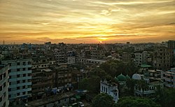
Dhaka District (Bengali: ঢাকা জেলা, Dhaka jela) is a district in central Bangladesh,[4] and is the densest district in the nation. It is a part of the Dhaka Division. Dhaka, the capital of Bangladesh, and rests on the eastern banks of the Buriganga River which flows from the Turag to the southern part of the district. While Dhaka (city corporation) occupies only about a fifth of the area of Dhaka district, it is the economic, political and cultural centre of the district and the country as a whole. Dhaka District consists with Dhaka, Keraniganj , Nababganj, Dohar, Savar and Dhamrai upazila. Dhaka District is an administrative entity, and like many other cities it does not cover the modern conurbation which is Greater Dhaka, which has spilled into neighbouring districts, nor does the conurbation cover the whole district, as there are rural areas within the district.
- ↑ zpdhaka.org
- ↑ "Population & Housing Census-2011" (PDF). Bangladesh Bureau of Statistics. p. 41. Archived from the original (PDF) on 8 December 2015. Retrieved 15 December 2015.
- ↑ "Sub-national HDI - Area Database - Global Data Lab". hdi.globaldatalab.org. Retrieved 18 March 2020.
- ↑ Molla, Md Tuhin (2012). "Dhaka District". In Islam, Sirajul; Jamal, Ahmed A. (eds.). Banglapedia: National Encyclopedia of Bangladesh (Second ed.). Asiatic Society of Bangladesh.


