


| Chaiturgarh fort | |
|---|---|
Lafagarh | |
| Part of Chhattisgarh Forts | |
| Korba district, Chhattisgarh | |
| File:Chaiturgarh temple, korba Chhattisgarh 68760.jpg | |
| Lua error in Module:Location_map at line 501: Unable to find the specified location map definition: "Module:Location map/data/India Chattisgarh" does not exist. | |
| Coordinates | 22°30′37″N 82°16′17″E / 22.5103°N 82.2714°E |
| Type | Hill fort / natural fortification |
| Height | 3,060 feet (930 m) |
| Site information | |
| Owner | Central Archeological Department of |
| Condition | Protected ruins |
| Site history | |
| Built | 10th century CE |
| Built by | Raja Prithvideva I |
| In use | Temple and tourism |

Chaiturgarh or Lafagarh is a fort about 51 kilometres (32 mi) from Katghora tehsil, Korba district, Chhattisgarh, India, on the Korba–Bilaspur road. It is an Archaeological Survey of India protected monument. Chaiturgarh is one of the 36 forts of Chhattisgarh. Chaithurgarh is situated around 70 kilometres (43 mi) from Korba and 21 kilometres (13 mi) from Pali town.
Location[edit | edit source]
Chaiturgarh (also known as Lafagarh) is situated at a height of 3,060 feet (930 m) on a hilltop. It is protected by strong natural walls and is considered as one of the strongest natural forts. Since it is protected by strong natural walls, only at some places walls have been built. The fort has three main entrances which are named as Menaka, Humkara, and Simhadwar.[1]


On the hilltop there is a plain area of about 5 square kilometres (1.9 sq mi) where there are five ponds. Three of these ponds have water all around the year. Many types of wild animals and birds are found here.
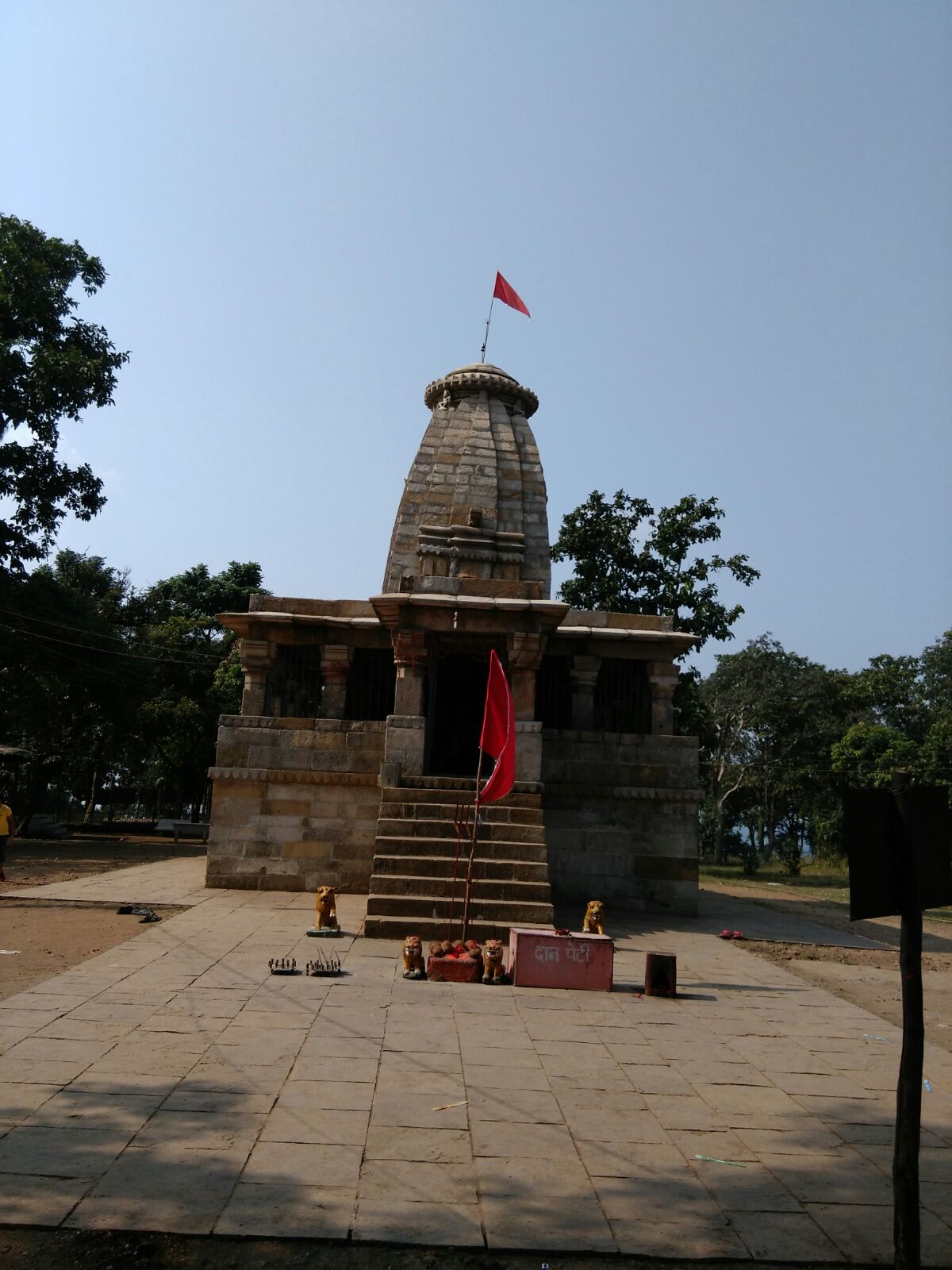
Architecture[edit | edit source]
The Mahishasur Mardini temple is situated here. The idol of Mahishasur Mardini having 12 hands is installed in the sanctum sanctorum. Shankar cave is situated 3 kilometres (1.9 mi) away from the temple. The cave which is like a tunnel, is 25 feet (7.6 m) long. One can go inside the cave only by creeping since it is very small in diameter.

History[edit | edit source]
- Archeologists consider it as one of the strongest natural forts.A Descriptive List of Inscriptions in the Central Province and Berar – dated in Kalchuri Era 933 (1181-82 CE) gives a long genealogical list of the Kalchuri kings. It mentions that there was a king in the family of the Haihaya who has eighteen sons. One of them was Kalinga whose son Kamala ruled over Tummana. Kamala was succeeded by Ratnaraja I and later by Prithvideva I. Mughal emperor Akbar captured the fort in 1571 and Mughals ruled until 1628 CE. Chaiturgarh was constructed by Raja Prithvideva I.[2][3]
References[edit | edit source]
- ↑ "Korba Chaiturgarh". Archived from the original on 10 January 2012. Retrieved 9 May 2012.
- ↑ "Kharod inscription of Ratnadeva III". Archived from the original on 30 April 2012. Retrieved 9 May 2012.
- ↑ Chauley, G. C. (2004). Monumental Heritage of Orissa. Book India Pub. Co. p. 114. ISBN 978-81-85638-19-5.
This article about an Indian building or structure is a stub. You can help Bharatpedia by expanding it. |
This military base or fortification article is a stub. You can help Bharatpedia by expanding it. |