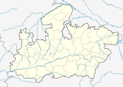
Amlai
Amlai is a census town in Anuppur district in the state of Madhya Pradesh, India.
Amlai | |
|---|---|
Census Town | |
| Coordinates: 23°11′42″N 81°32′27″E / 23.19500°N 81.54083°ECoordinates: 23°11′42″N 81°32′27″E / 23.19500°N 81.54083°E | |
| Country | |
| State | Madhya Pradesh |
| District | Shahdol |
| Population (2001) | |
| • Total | 30,292 |
| Languages | |
| • Official | Hindi |
| Time zone | UTC+5:30 (IST) |
DemographicsEdit
As of 2001[update] India census,[1] Amlai had a population of 30,292. Males constitute 53% of the population and females 47%. Amlai has an average literacy rate of 65%, higher than the national average of 59.5%; with 61% of the males and 39% of females literate. 15% of the population is under 6 years of age.
TransportEdit
Amlai Railway Station is situated just at 5 km from main town. And near the amlai station situated a coal siding as a company name was mahaveer benification pvt ltd since 2004 But no permission was granted any government institution for opened coal siding at that location
ReferencesEdit
- ↑ "Census of India 2001: Data from the 2001 Census, including cities, villages and towns (Provisional)". Census Commission of India. Archived from the original on 16 June 2004. Retrieved 1 November 2008.
(This information is given by Shubham Kushwaha) Amlai rellway station is the Six Platform The largest railway station from all around the railway stations is the same(If we talk about the size and platform)Natively the native resident of the Amlai Zone is no one hereThe name of this place was given by the Britishers
Template:Shahdol Division Here's the special thing here that Sanjay Nagar is a church where every wish will be fulfilled

