
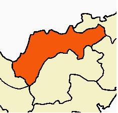
File:Vellore district.JPG
Size of this preview: 220 × 211 pixels. Other resolution: 235 × 225 pixels.
Original file (235 × 225 pixels, file size: 10 KB, MIME type: image/jpeg)
Summary
| DescriptionVellore district.JPG | |
| Date | |
| Source | Based on Wiki-Maps by Users SwiftRakesh, Jungpionier and Kavaiyan |
| Author | Ravichandar84 |
| Other versions |
 |
Licensing

|
Permission is granted to copy, distribute and/or modify this document under the terms of the GNU Free Documentation License, Version 1.2 or any later version published by the Free Software Foundation; with no Invariant Sections, no Front-Cover Texts, and no Back-Cover Texts. A copy of the license is included in the section entitled GNU Free Documentation License.http://www.gnu.org/copyleft/fdl.htmlGFDLGNU Free Documentation Licensetruetrue |

|
This map image could be re-created using vector graphics as a SVG file. This has several advantages; see Commons:Media for cleanup for more information. If a SVG form of this image is available, please upload it and afterwards replace this template with
{{vector version available|new image name}}.It is recommended to name the SVG file “Vellore district.svg”—then the template Vector version available (or Vva) does not need the new image name parameter. |


Captions
Add a one-line explanation of what this file represents
File history
Click on a date/time to view the file as it appeared at that time.
| Date/Time | Thumbnail | Dimensions | User | Comment | |
|---|---|---|---|---|---|
| current | 16:53, 8 August 2009 |  | 235 × 225 (10 KB) | (username removed) |
File usage
The following 82 pages use this file:
- Agaram Aru River
- Alangayam
- Alangayan block
- Ambur taluk
- Ammoor
- Anaicut
- Anaicut block
- Anvarthikanpettai
- Arakkonam block
- Arakkonam division
- Arcot, Tamil Nadu
- Arcot block
- Arcot taluk
- Arungundram
- Auxilium College
- Ayyampettai (Vellore district)
- Chenguttai
- Dakshina Patha Palayam
- Eriguthi
- Goddar River
- Government Thirumagal Mill's College
- Gudiyatham
- Gudiyattam block
- Gudiyattam taluk
- Guruvarajapet
- Jolarpet block
- Jolarpettai
- K. V. Kuppam block
- K Velur
- Kadambanallur
- Kalavai puthur
- Kallar River
- Kammavanpet
- Kandili block
- Kandipedu
- Kaniyambadi block
- Karivedu
- Katpadi block
- Katpadi taluk
- Kaundinya River
- Kaveripakkam
- Khaderpet
- Kodayanchi
- Krishnampalli
- Mahendravadi
- Malattar River
- Meenoor
- Melmoil
- Melpulam
- Melvisharam
- Naga Nathi River
- Nemili block
- Odugathur
- Ozhalai, Vellore
- Paiyampalli
- Paradarami
- Pennagar, Vellore
- Peranambattu block
- Periyapet
- Ramanayanikuppam
- Reddiyur
- Rendadi
- Sakkaramallur
- Seekarajapuram
- Sembedu
- Sholinghur block
- Thakkolam
- Timiri
- Timiri block
- Tirupattur taluk
- Uthayendram
- Valathoor
- Veerangkuppam
- Vellore Municipal Corporation
- Vellore block
- Vellore district
- Vellore division
- Vellore taluk
- Vettangulam
- Walajapet block
- Walajapet taluk
- Template:Vellore district
