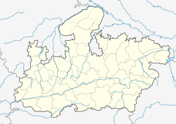
Sleemanabad
Sleemanabad | |
|---|---|
Village | |
| Coordinates: 23°06′N 80°07′E / 23.10°N 80.12°ECoordinates: 23°06′N 80°07′E / 23.10°N 80.12°E | |
| Country | |
| State | Madhya Pradesh |
| District | Katni |
| Named for | William Henry Sleeman |
| Elevation | 418 m (1,371 ft) |
| Population | |
| • Total | 40,000 |
| Languages | |
| • Official | Hindi |
| Time zone | UTC+5:30 (IST) |
| PIN | 483440 |
| Coastline | 0 kilometres (0 mi) |
| Nearest city | Katni |
| Lok Sabha constituency | Katni |
| Vidhan Sabha constituency | Bahoriband |
| Avg. summer temperature | 42 °C (108 °F) |
| Avg. winter temperature | 12 °C (54 °F) |
Sleemanabad is a village in Madhya Pradesh, India, approximately 62 km from Jabalpur and 32 km from Katni.
Etymology[edit]
Sleemanabad, literally "Sleeman's town", was named after William Henry Sleeman, a British soldier and administrator during the colonial period Sleeman was one of the key figures responsible for bringing an end to the Thuggee Cult..[1]
Copper deposits[edit]
Copper deposits are found in Sleemanabad. As per Geological Survey of India's DID Report (2011) on base metals, in this area the mineralisation is mostly along faults, fractures/ joints trending N10° - 20°W to S10° - 20°E. Baryte veins and limonitic patches are noticed in the brecciated quartzites. Geochemical sampling showed results for copper. [2]
References[edit]
- ↑ Dash, Mike Thug: the true story of India's murderous cult ISBN 1-86207-604-9, 2005
- ↑ [1]
