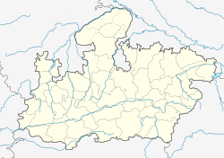
Gohad
Gohad
Gohud | |
|---|---|
city | |
| Coordinates: 26°26′N 78°26′E / 26.43°N 78.44°ECoordinates: 26°26′N 78°26′E / 26.43°N 78.44°E | |
| Country | |
| State | Madhya Pradesh |
| District | Bhind |
| Elevation | 159 m (522 ft) |
| Population (2001) | |
| • Total | 45,194 |
| Languages | |
| • Official | Hindi |
| Time zone | UTC+5:30 (IST) |
Gohad is a city and a municipality in Bhind district in the Indian state of Madhya Pradesh. A town of historical importance it is situated close to the city of Gwalior. The Gohad Fort is located here.
History[edit]
Gohad was founded by Jats of Bamraulia clan in 1505 AD. Gohad was ruled by Jat rulers. The first ruler of Gohat was Singhandev I and last ruler was Kirat Singh. The Bhim Singh Rana was a most popular ruler of Gohad. He ruled on Gwalior over 16 years from 1740 to 1756.[1]
Geography[edit]
Gohad has an average elevation of 159 metres (521 feet).
Demographics[edit]
As of 2001[update] India census,[2] Gohad had a population of 45,194. Males constitute 55% of the population and females 45%. Gohad has an average literacy rate of 57%, lower than the national average of 59.5%: male literacy is 68%, and female literacy is 44%. In Gohad, 17% of the population is under 6 years of age.
See also[edit]
References[edit]
- ↑ "Bheem Singh Rana Ki Chhatri Gwalior". www.localguidesconnect.com. 6 June 2020. Retrieved 27 June 2021.
- ↑ "Census of India 2001: Data from the 2001 Census, including cities, villages and towns (Provisional)". Census Commission of India. Archived from the original on 16 June 2004. Retrieved 1 November 2008.
