

imported>MalnadachBot m Fixed Lint errors in signatures. (Task 2) |
Alphadelta (talk | contribs) added initial page w/ refs |
||
| Line 1: | Line 1: | ||
{{short description|Wikimedia subject-area collaboration}} | {{short description|Wikimedia subject-area collaboration}} | ||
{{Wikipedia:WikiProject India/Navigation}} | {{Wikipedia:WikiProject India/Navigation}} | ||
{{WikiProject status| | {{WikiProject status|Defunct|type=geo|parent=India|date=November 2020}} | ||
:''The parent of this WikiProject are [[Wikipedia:WikiProject India|WikiProject India]] and [[Wikipedia:WikiProject Maps|WikiProject Maps]]'' | :''The parent of this WikiProject are [[Wikipedia:WikiProject India|WikiProject India]] and [[Wikipedia:WikiProject Maps|WikiProject Maps]]'' | ||
'''Aim''' – This project aims to draw hi-resolution, vector maps for India-related articles. It also aims to get hi-resolution raster (.png) topography images. mastan | '''Aim''' – This project aims to draw hi-resolution, vector maps for India-related articles. It also aims to get hi-resolution raster (.png) topography images. mastan | ||
| Line 13: | Line 13: | ||
|- | |- | ||
| | | | ||
* [[user:Nichalp|< | * [[user:Nichalp|<span style="color: #0082B8;">Nichalp</span>]] [[User Talk:Nichalp|<span style="color: #0082B8;">«Talk»</span>]] 06:04, 10 June 2006 (UTC) | ||
* [[User:Lostintherush|Lost]] 10:10, 10 June 2006 (UTC) I have no skills at this, only trying to learn | * [[User:Lostintherush|Lost]] 10:10, 10 June 2006 (UTC) I have no skills at this, only trying to learn | ||
* {{user|Deeptrivia}} 13:10, 10 June 2006 (UTC) | * {{user|Deeptrivia}} 13:10, 10 June 2006 (UTC) | ||
* <sup> [[User:PlaneMad|< | * <sup> [[User:PlaneMad|<span style="color: red;">Plane</span><span style="color: blue;">Mad</span>]]|[[User talk:Planemad|YakYak]]</sup> 13:29, 10 June 2006 (UTC) | ||
*[[User:Dwaipayanc|Dwaipayan]] ([[User_talk:Dwaipayanc|talk]]) 13:35, ow, 10 June 2006 (UTC) | *[[User:Dwaipayanc|Dwaipayan]] ([[User_talk:Dwaipayanc|talk]]) 13:35, ow, 10 June 2006 (UTC) | ||
*[[User:HarshaDevulapalli]]([[User_talk:HarshaDevulapalli|talk]]) | *[[User:HarshaDevulapalli]]([[User_talk:HarshaDevulapalli|talk]]) | ||
* [[User:Ganeshk|<span style="color:navy;">Ganeshk</span>]] <span style="color:navy;">([[User talk:Ganeshk|<span style="color:navy;">talk</span>]])</span> 15:32, 10 June 2006 (UTC) | * [[User:Ganeshk|<span style="color:navy;">Ganeshk</span>]] <span style="color:navy;">([[User talk:Ganeshk|<span style="color:navy;">talk</span>]])</span> 15:32, 10 June 2006 (UTC) | ||
*[[User:ImpuMozhi|Het666]] i m a geography lover , have read almost all countries' article | |||
*[[User:ImpuMozhi|ImpuMozhi]] 22:07, 11 June 2006 (UTC). I lack skilled, but I wanna learn. | *[[User:ImpuMozhi|ImpuMozhi]] 22:07, 11 June 2006 (UTC). I lack skilled, but I wanna learn. | ||
*--[[User:Whizkidravi|< | *--[[User:Whizkidravi|<span style="color: green;">ᵺe Æffist</span>]] 18:50, 30 July 2006 (UTC) | ||
*— [[User:Ambuj.Saxena|Ambuj Saxena]] ([[User talk:Ambuj.Saxena|talk]]) 14:44, 20 October 2006 (UTC) (I can help with most of the things) | *— [[User:Ambuj.Saxena|Ambuj Saxena]] ([[User talk:Ambuj.Saxena|talk]]) 14:44, 20 October 2006 (UTC) (I can help with most of the things) | ||
* {{user|Rama's Arrow}} | * {{user|Rama's Arrow}} | ||
| Line 29: | Line 30: | ||
* [[User:Mkeranat|Mkeranat]] ([[User talk:Mkeranat|talk]]) 08:26, 17 February 2008 (UTC) | * [[User:Mkeranat|Mkeranat]] ([[User talk:Mkeranat|talk]]) 08:26, 17 February 2008 (UTC) | ||
* [[User:gppande|gppande]] [[User:Gppande|gppande]] ([[User talk:Gppande|talk]]) 15:23, 20 February 2008 (UTC) I am good at using Inkscape, leave request on my talk page. | * [[User:gppande|gppande]] [[User:Gppande|gppande]] ([[User talk:Gppande|talk]]) 15:23, 20 February 2008 (UTC) I am good at using Inkscape, leave request on my talk page. | ||
* [[User:Amog|< | * [[User:Amog|<span style="color: #02b;">Amog</span>]] |<sup>[[User talk:Amog|T<span style="color: red;">a</span><span style="color: green;">l</span><span style="color: black;">k</span>]]</sup> 14:05, 24 May 2008 (UTC) | ||
* [[User:Faizhaider|Sayed Mohammad Faiz Haider Rizvi]] ([[User talk:Faizhaider|talk]]) 12:15, 9 February 2009 (UTC) | * [[User:Faizhaider|Sayed Mohammad Faiz Haider Rizvi]] ([[User talk:Faizhaider|talk]]) 12:15, 9 February 2009 (UTC) | ||
*[[User:Naveenpf|naveenpf]] ([[User talk:Naveenpf|talk]]) | *[[User:Naveenpf|naveenpf]] ([[User talk:Naveenpf|talk]]) | ||
* -- [[User:Karthikndr|♪Karthik♫]] [[User talk:Karthikndr|♪Nadar♫]] 06:19, 8 April 2012 (UTC) | * -- [[User:Karthikndr|♪Karthik♫]] [[User talk:Karthikndr|♪Nadar♫]] 06:19, 8 April 2012 (UTC) | ||
* [[User:Faizking321|Ahmad Faiz Mustafa]] [[User talk:Faizking321|talk]] FAMustafa 23:15, 3 September 2013 (UTC) | * [[User:Faizking321|Ahmad Faiz Mustafa]] [[User talk:Faizking321|talk]] FAMustafa 23:15, 3 September 2013 (UTC) | ||
* '''< | * '''<span style="color: black;">''Shivam''</span><span style="color: red;">'' Setu''</span>''' <small><span style="color: red;">''([[User:Shivamsetu|<span style="color: red;">U</span>]]-[[User talk:Shivamsetu|<span style="color: red;">T</span>]]-[[Special:Contributions/Shivamsetu|<span style="color: red;">C</span>]])''</span></small> 18:46, 22 December 2013 (UTC) | ||
*[[User:Bongan|<span style="color: red">Bo</span><span style="color: blue">ng</span><span style="color: green">an</span><sup style="color black">®</sup>]] [[User talk:Bongan|<span style="color: green">→TalkToMe←</span>]] 14:05, 12 August 2015 (UTC) | *[[User:Bongan|<span style="color: red">Bo</span><span style="color: blue">ng</span><span style="color: green">an</span><sup style="color black">®</sup>]] [[User talk:Bongan|<span style="color: green">→TalkToMe←</span>]] 14:05, 12 August 2015 (UTC) | ||
*[[User:Arnabsaha2212|Arnabsaha2212]] | *[[User:Arnabsaha2212|Arnabsaha2212]] | ||
*[[User:Tojoroy20]] | |||
* Add your name! | * Add your name! | ||
|} | |} | ||
Latest revision as of 22:08, 13 January 2025
{{Wikipedia:WikiProject India/Navigation}} Template:WikiProject status
- The parent of this WikiProject are WikiProject India and WikiProject Maps
Aim – This project aims to draw hi-resolution, vector maps for India-related articles. It also aims to get hi-resolution raster (.png) topography images. mastan
Scope – NPOV maps related to India (post-1947) and historical pre-Independence India (includes the South Asian nations of Pakistan, Bangladesh, Sri Lanka, Nepal and Bhutan). The secondary goal would be to get NPOV maps for Pakistan, PRC, Afghanistan and Bhutan since they border disputed territories of India.
Members[edit source]
| Members |
|---|
|
Inactive[edit source]
- Soumya-8974 (talk · contribs)
Types[edit source]
The project is divided into locator maps, general maps and city maps.
Locator[edit source]
Locator maps are used to show the location of a city, town, state or particular area within India. It is also used to show the location of a district, division or region in a map of a state
General maps[edit source]
Non-locator maps. Maps of this type incude rivers, ancient kingdoms, crop-related etc.
City maps[edit source]
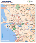
Maps of cities. See the featured image of Manila alongside for reference: rama nathapuram [1]
Topographical maps[edit source]
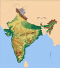
These maps depict the topography of a region. See User:Captain Blood/GMT Example for an example.
These maps show demographic information using colors.
-
 City maps
 -
 Topographical maps
 -
 Thematic maps


for more and updated information about indian census or maps
Using locator maps[edit source]
Locator maps for cities are automatically added when the Infobox Indian Jurisdiction is used and latitude and logitude parameters are provided. If a locator map needs to be added to a section in an article, then use Location map template. Find below some examples.
Usage[edit source]
{{Location map|India
 |label=label
 |position=left or right - position of the label relative to the mark, defaults to right
 |background=color - background color for the label, defaults to none
 |lat=latitude in degrees
 |long=longitude in degrees
 |mark=image file name - a red dot by default
 |caption=caption - caption below the map
 |float=left or right or none
 |width=width of the map
}}
Examples[edit source]
{{Location map|India|float=none|label=Mumbai|lat=18.96|long=72.82|position=left}}


{{Location map|India|float=left|width=100|label=Thiruvananthapuram|lat=8.5|long=76.9|caption=Thiruvananthapuram is the capital city of Kerala}}
{{Location map|India|float=right|label=Chennai|lat=13.09|long=80.27|background=white}}
cvvcc
{{location map+|India|float=none|width=270|caption=Metropolitan cities of India|places=
{{location map~|India|label=[[Mumbai]]|position=right|lat=18.96|long=72.82}}
{{location map~|India|label=[[Chennai]]|position=right|lat=13.09|long=80.27}}
{{location map~|India|label=[[Delhi]]|position=left|lat=28.35|long=77.13}}
{{location map~|India|label=[[Kolkata]]|position=left|lat=22.33|long=88.20}}
{{Location map~|India|label=[[Bangalore]]|position=left|lat=12.58|long=77.35}}
{{Location map~|India|label=[[Hyderabad]]|position=bottom|lat=17.20|long=78.80}}
}}
Graphic Conventions[edit source]
Colours[edit source]
Please use the following colours recommended by WikiProject Maps. {{Wikipedia:WikiProject Maps/Conventions/Locator maps (blank)}} {{Wikipedia:WikiProject Maps/Conventions/Areas maps}}
Border styles[edit source]
| Style | Used for | Comments |
|---|---|---|
| Thick line | Primary borders | Use a thick line for the primary (usually political) borders on a map. If the map primarily depicts a country, use a thick line for the country borders; if a state, the state borders. |
| Thin line | Secondary borders | Use a thin line (approximately 1/2 the thickness of the primary borders) for secondary boundaries. If a state map shows counties, use a thin line for county borders. |
| Italic font | Bodies of water | Use an italicized font for labelling bodies of water: oceans, lakes, rivers, etc. |
| All-caps font | Primary regions | Use a font in all-capital letters for labelling primary regions of interest: country names, state names, etc. |
| Mixed case font | Secondary regions | Use mixed case (capital followed by lowercase) for regions of secondary interest: provinces in a country map, counties in a state map, etc. |
Words-relate Conventions[edit source]
Typeface[edit source]
Use only Sans serif-type fonts in the maps.
| Scheme | Case | Font | Size | Tracking | Opacity | Example |
|---|---|---|---|---|---|---|
| Union territory | Normal | Bold | 30/24 | 0 | 35 | |
| National capital | UPPERCASE | Bold Italic | 24 | -25 | 100 | |
| Union territory capital | Normal | Italic | 24 | -25 | 100 | |
| State | UPPERCASE | Bold | 40/30 | 0 | 35 | |
| State capital | Normal | Regular | 24 | -25 | 100 | |
| Metro cities | UPPERCASE | Regular | 24 | -25 | 100 |
Cartographic conventions[edit source]
- Names of coastal cities are written in the sea
- Names of rivers and mountain ranges follow the path of the river/range
- Capital cities are usually marked with a star
Uploading[edit source]
Format[edit source]
All maps should be drawn SVG format. SVG is a vector format that allows upscaling without pixellation. It also allows users to download and modify the map to make derivatives. Please do not use the following raster formats: .png, .gif and .jpg for maps. For topographical maps, use .png.
Filenames[edit source]
TBD
Upload location[edit source]
- If the map contains no text, upload it to commons:
- If text is needed to be added to the map, please make two versions: One, a blank map without text, and the other with text. Upload the blank map to commons, and the one with English text here on en wiki.
Licensing[edit source]
Only images with a licence that allows commercial usage and allows derivatives to be made may be uploaded to wikipedia. The following licences qualify:
- PD (Public domain) – user releases all rights to the image
- GFDL – derivatives or commercial usage must be released only under the GFDL licence. User must be credited.
- CC-BY- (creative commons, attribution) – similar to GFDL, the user must be credited, but derivatives may be released under other licences.
- CC-BY-SA- (creative commons, attribution, share-alike) – same as CC-BY- but derivatives may be released only under the CC-BY-SA licence
You may use either one of the above. However to allow maximum compatibility across all wikimedia projects, it is suggested that we use either PD, or a dual licence GDFL + CC-BY-SA (v1.0, 2.0, 2.5, 3.0). (dual licence).
Summary[edit source]
Please add the following information to summary while uploading.
{{Information
|Description=
|Source=
|Date=
|Author=
|Permission=
|other_versions=
}}
Legend[edit source]
Use the following template:
| Template syntax | Produces |
|---|---|
| {{Legend|#0000FF|Area where live [[Blue wale]].}} | Area where live Blue whale.
|
Software and tips[edit source]
Two popular SVG drawing software available are Inkscape and Adobe Illustrator. Inkscape is free and available for many platforms.
- Draw images in the highest resolution possible.
- For text please use a generic font such as Serif, Sans-serif. Sans is more suited for maps. The wikimedia renderer rasterises all fonts using Arial, so use Arial regular to maintain appearance of the map.
- In inkscape make sure that you unflow the text
- Ensure that no embedded raster images are present
- Always add metadata. In Inkscape, metadata can be added in the Document Preferences.
Map resources[edit source]
- India Political map
- Survey of India maps
- 2001 Census state maps with districts
- Demis map server for physical maps
- India portal
- TN Maps online
Status / See Commons:Category:WikiProject India Maps[edit source]
All India Maps
- Base map of India with district boundaries, rivers and lakes
 Image:India map blank.svg / Image:India map en.svg
 - Locator maps for all States Image:India RegionName locator map.svg
- locator maps for all regions Image:India StateName locator map.svg
- Disputed areas map Image:India disputed areas map.svg
- Physical map Image:India physical map.svg
- Roadway map Image:India roadway map.svg
- Railway map (schematic) Image:India railway schematic map.svg
- Precipitation map Image:India annual rainfall map.svg
- Earthquake zone map Image:India earthquake zone map.svg
- Wind zone map Image:India wind zone map.svg
- Flood zone map Image:India flood zone map.svg
- Population density map Image:India population density map.svg
- Literacy rate map Image:India literacy rate map.svg
- Sex ratio map Image:India sex ratio map.svg
- Rivers and lakes map Image:India rivers and lakes map.svg
- Decadal population growth map Image:India decadal growth rate map en.svg
- Climatic zone map Image:India climatic zone map en.svg
- Average annual temperature map Image:India average annual temperature map en.svg
- Climatic disaster risk map Image:India climatic disaster risk map en.svg
- Southwest summer monsoon onset map Image:India southwest summer monsoon onset map en.svg
- Air connectivity map


State Locator Maps[edit source]
- Andhra Pradesh Image:Andhra Pradesh locator map.svg
- Arunachal Pradesh Image:Arunachal Pradesh locator map.svg
- Assam Image:Assam locator map.svg
- Bihar Image:Bihar locator map.svg
- Chhattisgarh Image:Chhattisgarh locator map.svg
- Goa Image:Goa locator map.svg
- Gujarat Image:Gujarat locator map.svg
- Haryana Image:Haryana locator map.svg
- Himachal Pradesh Image:Himachal Pradesh locator map.svg
- Jammu and Kashmir Image:Jammu and Kashmir locator map.svg
- Jharkhand Image:Jharkhand locator map.svg
- Karnataka Image:Karnataka locator map.svg
- Kerala Image:Kerala locator map.svg
- Madhya Pradesh Image:Madhya Pradesh districts location map big.svg
- Maharashtra Image:Maharashtra locator map.svg
- Manipur Image:Manipur locator map.svg
- Meghalaya Image:Meghalaya locator map.svg
- Mizoram Image:India Mizoram locator map.svg
- Nagaland Image:Nagaland locator map.svg
- Orissa Image:Orissa locator map.svg
- Punjab Image:Punjab locator map.svg
- Rajasthan Image:Rajasthan locator map.svg
- Sikkim Image:Sikkim locator map.svg
- Tamil Nadu Image:Tamil Nadu locator map.svg
- Tripura Image:India Tripura locator map.svg
- Uttar Pradesh Image:Uttar Pradesh locator map.svg
- Uttarakhand Image:Uttarakhand locator map.svg
- West Bengal Image:West Bengal locator map.svg


State political Maps[edit source]
- Andhra Pradesh
- Arunachal Pradesh
- Assam
- Bihar Image:BiharDistricts.png
- Chhattisgarh
- Goa Image:Goamap.png
- Gujarat
- Haryana
- Himachal Pradesh
- Jammu and Kashmir
- Jharkhand
- Karnataka
- Kerala
- Madhya Pradesh
- Maharashtra
- Manipur
- Meghalaya
- Mizoram
- Nagaland Image:Nagalandmap.png
- Orissa
- Punjab Image:Punjab district map.png
- Rajasthan
- Sikkim Image:Sikkimdistricts.png
- Tamil Nadu
- Tripura Image:Tripura map.png
- Uttar Pradesh
- Uttarakhand Image:UttarakhandDistricts.png
- West Bengal


City Maps[edit source]
- Map of New Delhi Image:New Delhi map.svg
- Base map of Delhi with city limits and water bodies Image:Location map India New Delhi.png
- Base map of Mumbai with city limits and water bodies Image:Mumbai area locator map.svg
- Base map of Kolkata with city limits and water bodies
- Base map of Chennai with city limits and water bodies Image:Chennai area locator map.svg
- Base map of Bangalore with city limits and water bodies Image:Bangalore street Map.png
- Base map of Pune with city limits and water bodies
- Base map of Ahmedabad with city limits and water bodies
- Base map of Kochi with city limits and water bodies File:Kochi India area locator map.svg
- Base map of Hyderabad (India) with city limits and water bodies File:Hyderabad Outer Ring Road and its radial roads.png
- Base map of Patna with city limits and water bodies File:Patna area locator map.svg
- Base map of Bhopal with city limits and water bodies File:Location map India Bhopal.svg
- Base map of Trichy with city limits and water bodies File:Tiruchirappalli city locator.png
- Base map of Lucknow with city limits and water bodies


District Maps[edit source]
- Nagpur district map (locator) File:Nagpur.png

Requests[edit source]
- Category:Wikipedia requested maps in India
- Request a map at User talk:Planemad, please provide a link to a source map.