

>Citation bot Alter: template type. Add: date, newspaper, title, authors 1-1. Changed bare reference to CS1/2. | Use this bot. Report bugs. | Suggested by BrownHairedGirl | Linked from User:BrownHairedGirl/Articles_with_bare_links | #UCB_webform_linked 1017/2198 |
general correct section per standard format and cleaned formatting |
||
| Line 1: | Line 1: | ||
{{Use dmy dates|date=November 2018}} | {{Use dmy dates|date=November 2018}} | ||
{{Use Indian English|date=November 2018}} | {{Use Indian English|date=November 2018}} | ||
<!-- See [[ | {{hatnote group| | ||
{{distinguish|Gondikota|Gadikota}} | |||
{{for|a person with the name ''Gandikota''|Gandikota V. Rao}} | |||
}} | |||
<!-- See [[Bharatpedia:WikiProject Indian cities]] for details -->{{Infobox settlement | |||
| name = Gandikota | | name = Gandikota | ||
| native_name = | | native_name = | ||
| Line 7: | Line 11: | ||
| other_name = | | other_name = | ||
| image_skyline = Indian Grand Canyon Sudhakar Bichali.jpg | | image_skyline = Indian Grand Canyon Sudhakar Bichali.jpg | ||
| caption = Gandikota | | caption = Gandikota [[Gorge]] | ||
| nickname = | | nickname = | ||
| settlement_type = Historical site, Archaeological Survey of India | | settlement_type = Historical site, Archaeological Survey of India | ||
| pushpin_map | | mapframe = yes | ||
| mapframe-zoom = 14 | |||
| pushpin_map = India Andhra Pradesh | |||
| pushpin_label_position = right | | pushpin_label_position = right | ||
| pushpin_map_alt = | | pushpin_map_alt = | ||
| pushpin_map_caption = Location in Andhra Pradesh, India | | pushpin_map_caption = Location in Andhra Pradesh, India | ||
| coordinates = {{coord|14 | | coordinates = {{coord|14|48|53|N|78|17|12|E|display=inline,title}} | ||
| subdivision_type = Country | | subdivision_type = Country | ||
| subdivision_name = {{flag|India}} | | subdivision_name = {{flag|India}} | ||
| Line 21: | Line 27: | ||
| established_title = Established | | established_title = Established | ||
| established_date = 12th Century A. D. | | established_date = 12th Century A. D. | ||
| founder = Kaka Raja, subordinate of [[Kalyani Chalukya]] dynasty (small sand fort)<br />[[Pemmasani Ramalinga | | founder = Kaka Raja, subordinate of [[Kalyani Chalukya]] dynasty (small sand fort)<br />[[Pemmasani Ramalinga Nayudu]], (101 towers huge rock fort) | ||
| named_for = | | named_for = | ||
| government_type = | | government_type = | ||
| Line 47: | Line 53: | ||
| area_code = 08560 | | area_code = 08560 | ||
| registration_plate = AP04 | | registration_plate = AP04 | ||
| website = {{URL|1=http://aptdc.gov.in/aptdc/getHotels?hotelPlace=GANDIKOTA|2= | | website = {{URL|1=http://aptdc.gov.in/aptdc/getHotels?hotelPlace=GANDIKOTA|2=aptdc.gov.in}} | ||
| footnotes = | | footnotes = | ||
| official_name = | | official_name = | ||
}} | }} | ||
'''Gandikota''' is a village and historical fort on the right bank of the [[Penna River|Penna river]], 15 km from [[Jammalamadugu]] in [[Kadapa]] district, [[Andhra Pradesh]], India. The fort was the | '''Gandikota''' is a village and historical fort on the right bank of the [[Penna River|Penna river]], 15 km from [[Jammalamadugu]] in [[Kadapa]] district, [[Andhra Pradesh]], India. The fort was the centre of power for various dynasties, such as the [[Kalyani Chalukya]]s, [[Pemmasani Nayaks|Pemmasani Nayakas]], and the [[Sultanate of Golconda|Golconda Sultanate]]. Initially, a sand fort was constructed by Kaka Raja, a vassal of the Kalyani Chalukya rulers. The village transformed into a major fortified settlement with the rise of the Pemmasani Nayakas. Later, various additions reflecting Islamic architectural styles were made during [[Mughal Empire|the period of Muslim rule]]. The fort is a centrally protected monument of [[Archaeological Survey of India|Archaeological Survey of India (ASI)]].<ref>{{Cite web |date=2022-04-04 |title=Lok Sabha Unstarred Question No. 5213 |url=https://tourism.gov.in/sites/default/files/2022-04/usq%205213%20for%2004042022.pdf |url-status=live |archive-url=https://web.archive.org/web/20220812100008/https://tourism.gov.in/sites/default/files/2022-04/usq%205213%20for%2004042022.pdf |archive-date=2022-08-12 |access-date=2024-04-22 |website=Ministry of Tourism}}</ref> | ||
== Etymology== | == Etymology== | ||
The fort of Gandikota acquired its name due to the 'gorge', formed between the Erramala range of hills, also known as Gandikota hills and the river Pennar that flows at its foot, reducing its width to a mere | The fort of Gandikota acquired its name due to the 'gorge', formed between the Erramala range of hills, also known as Gandikota hills and the river Penna (Pennar) that flows at its foot, reducing its width to a mere 100 m (look for the river image in the montage/main image). | ||
==Geology== | |||
Gandikota canyon consists of [[sedimentary rock]]s, namely 'Gandikota [[Quartzite]]' in the Chitravati Group part of Cuddapah [[Stratigraphic unit#Supergroup|Supergroup]]. | |||
The Chitravati Group consists of three formation | |||
rank units: the Pulivendla Quartzite; the Tadpatri | |||
Formation; and the Gandikota Quartzite.<ref>{{cite web| url=https://www.researchgate.net/publication/256442051_Palaeoproterozoic_sedimentation_in_the_Cuddapah_Basin_south_India_and_regional_tectonics_A_review|title=Palaeoproterozoic sedimentation in the Cuddapah Basin south India and regional tectonics A review|date=2012|access-date=11 February 2023}}</ref><ref>{{cite web|url=https://employee.gsi.gov.in/cs/groups/public/documents/document/b3zp/odk0/~edisp/dcport1gsigovi894618.pdf|title=Pictorial Atlas of Cuddapah Basin|publisher=Geological Survey of India|date=2020|access-date=11 February 2023|archive-date=22 December 2023|archive-url=https://web.archive.org/web/20231222192902/https://employee.gsi.gov.in/cs/groups/public/documents/document/b3zp/odk0/~edisp/dcport1gsigovi894618.pdf|url-status=dead}}</ref> | |||
==History== | ==History== | ||
===Early history=== | ===Early history=== | ||
Gandikota is a village on the right bank of the river Penna, 15 km from Jammalamudugu in Kadapa district, Andhra Pradesh, India. Gandikota area was first identified and made Sand fort in 1123 by Kakatiya Raja of nearby Bommanapalle village and a subordinate of Ahavamalla Someswara I, [[Kalyani Chalukya]] ruler. Gandikota came under the rule of [[Kakatiya]] dynasty from 1239 A.D to 1304 A.D and ruled by their various subordinates | Gandikota is a village on the right bank of the river Penna, 15 km from Jammalamudugu in Kadapa district, Andhra Pradesh, India. Gandikota area was first identified and made Sand fort in 1123 by Kakatiya Raja of nearby Bommanapalle village and a subordinate of Ahavamalla Someswara I, [[Kalyani Chalukya]] ruler. Gandikota came under the rule of [[Kakatiya]] dynasty from 1239 A.D to 1304 A.D and ruled by their various subordinates. | ||
The village transformed into major fort after the emergence of [[Pemmasani Nayaks|Pemmasani Nayakas]].<ref>{{cite web |first=Robert |last=Sewell |title=A Forgotten Empire (Vijayanagar): A contribution to the History of India |url=http://historion.net/r.sewell-vijayanagar-history-india |access-date=3 March 2007 |archive-url=https://web.archive.org/web/20051202102715/http://historion.net/r.sewell-vijayanagar-history-india/ |archive-date=2 December 2005 |url-status=dead }}</ref><ref>{{cite web |title=K. A. Nilakanta sastry: Further Sources of Vijayanagar History |year= 1946 |url=https://archive.org/details/FurtherSourcesOfVijayanagaraHistory}}</ref><ref>{{cite book |title=Vijayanagara |first=Burton |last=Stein |publisher=Cambridge University Press |year=1989 |page=92 |isbn=0-521-26693-9}}</ref><ref>{{cite book |title=Tidings of the king: a translation and ethnohistorical analysis of the Rayavachakamu by Phillip B. Wagoner |publisher=University of Hawaii Press |location=Honolulu |year=1993 |pages= 138–139 |isbn= 0-8248-1495-9 |url= https://www.questia.com/PM.qst?a=o&d=62773998}}</ref> | The village transformed into major fort after the emergence of [[Pemmasani Nayaks|Pemmasani Nayakas]].<ref>{{cite web |first=Robert |last=Sewell |title=A Forgotten Empire (Vijayanagar): A contribution to the History of India |url=http://historion.net/r.sewell-vijayanagar-history-india |access-date=3 March 2007 |archive-url=https://web.archive.org/web/20051202102715/http://historion.net/r.sewell-vijayanagar-history-india/ |archive-date=2 December 2005 |url-status=dead }}</ref><ref>{{cite web |title=K. A. Nilakanta sastry: Further Sources of Vijayanagar History |year= 1946 |url=https://archive.org/details/FurtherSourcesOfVijayanagaraHistory}}</ref><ref>{{cite book |title=Vijayanagara |first=Burton |last=Stein |publisher=Cambridge University Press |year=1989 |page=92 |isbn=0-521-26693-9}}</ref><ref>{{cite book |title=Tidings of the king: a translation and ethnohistorical analysis of the Rayavachakamu by Phillip B. Wagoner |publisher=University of Hawaii Press |location=Honolulu |year=1993 |pages= 138–139 |isbn= 0-8248-1495-9 |url= https://www.questia.com/PM.qst?a=o&d=62773998}}</ref> | ||
| Line 67: | Line 79: | ||
[[Vemana]] poet, native of [[Kadapa]] district and believed to have lived in Gandikota area for a short period. | [[Vemana]] poet, native of [[Kadapa]] district and believed to have lived in Gandikota area for a short period. | ||
[[Jean Baptiste Tavernier]] visited the fort during his travel to Golconda sultanate. | [[Jean Baptiste Tavernier]] visited the fort during his travel to Golconda sultanate.<ref>{{Cite web |title=Gandikota {{!}} District YSR (Kadapa) |url=https://kadapa.ap.gov.in/gandikota/ |url-status=live |archive-url=https://web.archive.org/web/20250403071815/https://kadapa.ap.gov.in/gandikota/ |archive-date=2025-04-03 |access-date=2025-05-22 |language=en-US}}</ref> | ||
{{ | |||
== Major structures == | == Major structures == | ||
| Line 77: | Line 85: | ||
Ranganatha_Swamy_Temple_Distant.jpg|Ranganatha Swamy Temple | Ranganatha_Swamy_Temple_Distant.jpg|Ranganatha Swamy Temple | ||
Gandikota_Fort_Entrance.jpg |Gandikota Fort Entrance | Gandikota_Fort_Entrance.jpg |Gandikota Fort Entrance | ||
Camping_Banks_Pennar_River.jpg| Camping on the banks of Pennar river | Camping_Banks_Pennar_River.jpg| Camping on the banks of Penna (Pennar) river | ||
File:Juma masjid.jpg|Juma masjid | |||
</gallery> | </gallery> | ||
In the fort are two ancient temples, dedicated to Madhava and Ranganatha. They are in ruins and the fort area is full of the debris of ages and many ancient structures in varying stages of decay. The large granary, with a vaulted roof, is now used as watchman's quarters. The Jamia Masjid has two adjacent minarets. A heritage festival is held every year in the fort area.<ref>{{cite news|title=Gandikota Heritage festival from October 26|url=http://www.thehindu.com/todays-paper/tp-national/tp-andhrapradesh/gandikota-heritage-festival-from-october-26/article3913182.ece|access-date=4 April 2014|newspaper=The Hindu|date=19 September 2012}}</ref> | In the fort are two ancient temples, dedicated to [[Madhavaraya Temple, Gandikota|Madhava]] and Ranganatha. They are in ruins and the fort area is full of the debris of ages and many ancient structures in varying stages of decay. The large granary, with a vaulted roof, is now used as watchman's quarters. The Jamia Masjid has two adjacent minarets. A heritage festival is held every year in the fort area.<ref>{{cite news|title=Gandikota Heritage festival from October 26|url=http://www.thehindu.com/todays-paper/tp-national/tp-andhrapradesh/gandikota-heritage-festival-from-october-26/article3913182.ece|access-date=4 April 2014|newspaper=The Hindu|date=19 September 2012}}</ref> | ||
The other structures in the fort, include another large granary (used for storing food and grains late back), a magazine, a graceful 'pigeon tower' with fretted windows and an extensive palace built by bricks with some plastered decorations and some wells. There is an old cannon lying in the fort. There is the 'Rayalacheruvu' with its perennial springs irrigating some lime and plantain gardens. It is said that this 'Cheruvu' was connected to a fountain in Jamia Masjid by pipes, traces of which can still be seen. | The other structures in the fort, include another large granary (used for storing food and grains late back), a magazine, a graceful 'pigeon tower' with fretted windows and an extensive palace built by bricks with some plastered decorations and some wells. There is an old cannon lying in the fort. There is the 'Rayalacheruvu' with its perennial springs irrigating some lime and plantain gardens. It is said that this 'Cheruvu' was connected to a fountain in Jamia Masjid by pipes, traces of which can still be seen.{{citation needed|date=May 2025}} | ||
There were other gardens and springs. There is an undated inscription on a boulder, near the 'Nagajhari' outside the fort, recording the gift of two gardens at the place to the temple. There was a garden called 'Parebagh' with a waterfall at the foot of the hills, on the bank of the Penneru. | There were other gardens and springs. There is an undated inscription on a boulder, near the 'Nagajhari' outside the fort, recording the gift of two gardens at the place to the temple. There was a garden called 'Parebagh' with a waterfall at the foot of the hills, on the bank of the Penneru. | ||
There are multiple camping areas outside the Fort and on the banks of the Pennar river. | There are multiple camping areas outside the Fort and on the banks of the Penna (Pennar) river. | ||
The other main attractions at the fort includes House of the Drum (drums were used to alert the army in case of invasion), Charminar, Jail (where in the prisoners were held captive) and Red Koneru (Also known as pond of Swords, The huge lake in front of the mosque, where the warriors used to dip their swords in this lake and the waters used to turn blood red after the war). | The other main attractions at the fort includes House of the Drum (drums were used to alert the army in case of invasion), Charminar, Jail (where in the prisoners were held captive) and Red Koneru (Also known as pond of Swords, The huge lake in front of the mosque, where the warriors used to dip their swords in this lake and the waters used to turn blood red after the war).{{citation needed|date=May 2025}} | ||
==Access and transportation == | ==Access and transportation == | ||
| Line 96: | Line 105: | ||
There are buses available from Jammalamadugu Old Bus Stand (Gandhi Statue Junction) to Gandikota. | There are buses available from Jammalamadugu Old Bus Stand (Gandhi Statue Junction) to Gandikota. | ||
Inside the fort there is no means of transportation except to walk by foot | Inside the fort there is no means of transportation except to walk by foot. There is a good downhill trek through the canyon that leads to the riverbed. There is a dam upstream (Gandikota Dam) and a dam downstream (Mylavaram Dam).{{citation needed|date=May 2025}} | ||
There is a Haritha hotel run by Andhra Pradesh Tourism department which has lodging facilities. However the facilities are limited during the weekdays as the visitors during weekdays are low.{{citation needed|date=May 2025}} | |||
==Tourism == | |||
Gandikota has been referred to as "the [[Grand Canyon]] of India."<ref name = "toi"/> | |||
The Andhra Pradesh government announced an investment of three crore rupees towards tourism development in Gandikota.<ref name = "toi">{{cite web |title=Andhra Pradesh is planning to upgrade tourism infrastructure at Gandikota village |url=https://timesofindia.indiatimes.com/travel/travel-news/andhra-pradesh-is-planning-to-upgrade-tourism-infrastructure-at-gandikota-village/articleshow/88232313.cms |website=The Times of India}}</ref> | |||
==References== | ==References== | ||
{{ | {{reflist}} | ||
==Further reading== | ==Further reading== | ||
| Line 112: | Line 122: | ||
==External links== | ==External links== | ||
{{Commons category|Gandikota}} | {{Commons category|Gandikota}} | ||
*[https://www.natureinfocus.in/guide GandiKota Travel Guide to Plan Your Trip by Nature inFocus/] | * [https://kadapa.ap.gov.in/tourist-place/gandikota/ Gandikota — YSR District Official Website] | ||
* [https://www.natureinfocus.in/guide GandiKota Travel Guide to Plan Your Trip by Nature inFocus/] | |||
* [https://dsal.uchicago.edu/reference/gazetteer/pager.html?objectid=DS405.1.I34_V12_133.gif Imperial Gazetteer of India: About Gandikota] | * [https://dsal.uchicago.edu/reference/gazetteer/pager.html?objectid=DS405.1.I34_V12_133.gif Imperial Gazetteer of India: About Gandikota] | ||
* [http://columbiauniversity.us/itc/mealac/pritchett/00glossarydata/places/gandikot/gandikot.html Water color paintings by Thomas Fraser and Sir Thomas Anburey-- in 1799 & 1802] | * [http://columbiauniversity.us/itc/mealac/pritchett/00glossarydata/places/gandikot/gandikot.html Water color paintings by Thomas Fraser and Sir Thomas Anburey-- in 1799 & 1802] | ||
Latest revision as of 00:48, 23 January 2026
Gandikota | |
|---|---|
Historical site, Archaeological Survey of India | |
 Gandikota Gorge | |
  Gandikota Location in Andhra Pradesh, India | |
| Coordinates: 14°48′53″N 78°17′12″E / 14.81472°N 78.28667°E | |
| Country |  India India |
| State | Andhra Pradesh |
| Established | 12th Century A. D. |
| Founded by | Kaka Raja, subordinate of Kalyani Chalukya dynasty (small sand fort) Pemmasani Ramalinga Nayudu, (101 towers huge rock fort) |
| Languages | |
| • Official | Telugu |
| Time zone | UTC+5:30 (IST) |
| PIN | 516434 |
| Telephone code | 08560 |
| Vehicle registration | AP04 |
| Website | aptdc.gov.in |
Gandikota is a village and historical fort on the right bank of the Penna river, 15 km from Jammalamadugu in Kadapa district, Andhra Pradesh, India. The fort was the centre of power for various dynasties, such as the Kalyani Chalukyas, Pemmasani Nayakas, and the Golconda Sultanate. Initially, a sand fort was constructed by Kaka Raja, a vassal of the Kalyani Chalukya rulers. The village transformed into a major fortified settlement with the rise of the Pemmasani Nayakas. Later, various additions reflecting Islamic architectural styles were made during the period of Muslim rule. The fort is a centrally protected monument of Archaeological Survey of India (ASI).[1]
Etymology[edit | edit source]
The fort of Gandikota acquired its name due to the 'gorge', formed between the Erramala range of hills, also known as Gandikota hills and the river Penna (Pennar) that flows at its foot, reducing its width to a mere 100 m (look for the river image in the montage/main image).
Geology[edit | edit source]
Gandikota canyon consists of sedimentary rocks, namely 'Gandikota Quartzite' in the Chitravati Group part of Cuddapah Supergroup. The Chitravati Group consists of three formation rank units: the Pulivendla Quartzite; the Tadpatri Formation; and the Gandikota Quartzite.[2][3]
History[edit | edit source]
Early history[edit | edit source]
Gandikota is a village on the right bank of the river Penna, 15 km from Jammalamudugu in Kadapa district, Andhra Pradesh, India. Gandikota area was first identified and made Sand fort in 1123 by Kakatiya Raja of nearby Bommanapalle village and a subordinate of Ahavamalla Someswara I, Kalyani Chalukya ruler. Gandikota came under the rule of Kakatiya dynasty from 1239 A.D to 1304 A.D and ruled by their various subordinates.
The village transformed into major fort after the emergence of Pemmasani Nayakas.[4][5][6][7]
Recently, Tavva Obul Reddy, a Mydukur-based historian, discovered a copper plate inscription on the history of Gandikonda Fort. The inscription dates back to 16th century.[8]
Vemana poet, native of Kadapa district and believed to have lived in Gandikota area for a short period. Jean Baptiste Tavernier visited the fort during his travel to Golconda sultanate.[9]
Major structures[edit | edit source]
-
 Ranganatha Swamy Temple
 -
 Gandikota Fort Entrance
 -
 Camping on the banks of Penna (Pennar) river
 -
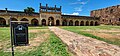 Juma masjid


In the fort are two ancient temples, dedicated to Madhava and Ranganatha. They are in ruins and the fort area is full of the debris of ages and many ancient structures in varying stages of decay. The large granary, with a vaulted roof, is now used as watchman's quarters. The Jamia Masjid has two adjacent minarets. A heritage festival is held every year in the fort area.[10]
The other structures in the fort, include another large granary (used for storing food and grains late back), a magazine, a graceful 'pigeon tower' with fretted windows and an extensive palace built by bricks with some plastered decorations and some wells. There is an old cannon lying in the fort. There is the 'Rayalacheruvu' with its perennial springs irrigating some lime and plantain gardens. It is said that this 'Cheruvu' was connected to a fountain in Jamia Masjid by pipes, traces of which can still be seen.[citation needed]
There were other gardens and springs. There is an undated inscription on a boulder, near the 'Nagajhari' outside the fort, recording the gift of two gardens at the place to the temple. There was a garden called 'Parebagh' with a waterfall at the foot of the hills, on the bank of the Penneru.
There are multiple camping areas outside the Fort and on the banks of the Penna (Pennar) river.
The other main attractions at the fort includes House of the Drum (drums were used to alert the army in case of invasion), Charminar, Jail (where in the prisoners were held captive) and Red Koneru (Also known as pond of Swords, The huge lake in front of the mosque, where the warriors used to dip their swords in this lake and the waters used to turn blood red after the war).[citation needed]
Access and transportation[edit | edit source]

.jpg)
The nearest railway stations are Muddanuru which is 26 km (railway code: MOO) and Jammalamadugu (JMDG) in Kadapa District. There are number of trains from Gooty Junction. Recently the town of Jammalamadugu which is closest to Gandikota fort [11] also got railway connectivity due to the completion of Nandyal–Yerraguntla section railway line. However frequency of trains on this line is very low.
There are buses available from Jammalamadugu Old Bus Stand (Gandhi Statue Junction) to Gandikota.
Inside the fort there is no means of transportation except to walk by foot. There is a good downhill trek through the canyon that leads to the riverbed. There is a dam upstream (Gandikota Dam) and a dam downstream (Mylavaram Dam).[citation needed]
There is a Haritha hotel run by Andhra Pradesh Tourism department which has lodging facilities. However the facilities are limited during the weekdays as the visitors during weekdays are low.[citation needed]
Tourism[edit | edit source]
Gandikota has been referred to as "the Grand Canyon of India."[12]
The Andhra Pradesh government announced an investment of three crore rupees towards tourism development in Gandikota.[12]
References[edit | edit source]
- ↑ "Lok Sabha Unstarred Question No. 5213" (PDF). Ministry of Tourism. 4 April 2022. Archived (PDF) from the original on 12 August 2022. Retrieved 22 April 2024.
- ↑ "Palaeoproterozoic sedimentation in the Cuddapah Basin south India and regional tectonics A review". 2012. Retrieved 11 February 2023.
- ↑ "Pictorial Atlas of Cuddapah Basin" (PDF). Geological Survey of India. 2020. Archived from the original (PDF) on 22 December 2023. Retrieved 11 February 2023.
- ↑ Sewell, Robert. "A Forgotten Empire (Vijayanagar): A contribution to the History of India". Archived from the original on 2 December 2005. Retrieved 3 March 2007.
- ↑ "K. A. Nilakanta sastry: Further Sources of Vijayanagar History". 1946.
- ↑ Stein, Burton (1989). Vijayanagara. Cambridge University Press. p. 92. ISBN 0-521-26693-9.
- ↑ Tidings of the king: a translation and ethnohistorical analysis of the Rayavachakamu by Phillip B. Wagoner. Honolulu: University of Hawaii Press. 1993. pp. 138–139. ISBN 0-8248-1495-9.
- ↑ "Copper plate inscription about Gandikonda Fort found".
- ↑ "Gandikota | District YSR (Kadapa)". Archived from the original on 3 April 2025. Retrieved 22 May 2025.
- ↑ "Gandikota Heritage festival from October 26". The Hindu. 19 September 2012. Retrieved 4 April 2014.
- ↑ "Trip to Gandikota".
- ↑ 12.0 12.1 "Andhra Pradesh is planning to upgrade tourism infrastructure at Gandikota village". The Times of India.
Further reading[edit | edit source]
- Article about this visiting Gandikota: Grand Canyon at Gandikota, Deccan Chronicle newspaper (Hyderabad edition), 6 April 2012, Wanderlust Page: 21
External links[edit | edit source]
- Gandikota — YSR District Official Website
- GandiKota Travel Guide to Plan Your Trip by Nature inFocus/
- Imperial Gazetteer of India: About Gandikota
- Water color paintings by Thomas Fraser and Sir Thomas Anburey-- in 1799 & 1802
- French Traveller Tavernier's experience about Gandikota Fort & about Nawab of Gandikota while he was in India
- Gandikota Fort Canyon - A Complete guide with Pictures!/
