



m Removed empty portal template using script |
improved section also |
||
| Line 1: | Line 1: | ||
{{Use dmy dates|date=June 2018}} | {{Use dmy dates|date=June 2018}} | ||
{{Use Indian English|date=June 2018}} | {{Use Indian English|date=June 2018}}{{Infobox settlement | ||
| name = Palot | |||
| native_name = | |||
{{Infobox settlement | | native_name_lang = | ||
| name | | settlement_type = [[Village]] | ||
| native_name | | image_skyline = Tejaji Temple Inside Photo.jpg | ||
| native_name_lang | | image_alt = | ||
| settlement_type | | image_caption = Veer Tejaji Temple | ||
| image_skyline | | pushpin_map = India Rajasthan#India | ||
| image_alt | | pushpin_label_position = right | ||
| image_caption | | pushpin_map_alt = | ||
| pushpin_map | | pushpin_map_caption = Location of Palot in [[Rajasthan]], India | ||
| pushpin_label_position | | coordinates = {{coord|27.24|N|74.26|E|display=inline,title}} | ||
| pushpin_map_alt | | subdivision_type = Country | ||
| pushpin_map_caption | | subdivision_name = {{flag|India}} | ||
| coordinates | | subdivision_type1 = [[States and territories of India|State]] | ||
| subdivision_type | | subdivision_name1 = [[Rajasthan]] | ||
| subdivision_name | | subdivision_type2 = [[List of districts of India|District]] | ||
| subdivision_type1 | | subdivision_name2 = [[Nagaur district|Nagaur]] | ||
| subdivision_name1 | | established_title = <!-- Established --> | ||
| subdivision_type2 | | established_date = | ||
| subdivision_name2 | | founder = | ||
| established_title | | named_for = Palot | ||
| established_date | | government_type = | ||
| founder | | governing_body = | ||
| named_for | | unit_pref = Metric | ||
| government_type | | area_footnotes = | ||
| governing_body | | area_rank = | ||
| unit_pref | | area_total_km2 = 18.1609 | ||
| area_footnotes | | elevation_footnotes = | ||
| area_rank | | elevation_m = 1072 | ||
| area_total_km2 | | population_total = 2,232 | ||
| elevation_footnotes | | population_as_of = 2019 | ||
| elevation_m | | population_rank = | ||
| population_total | | population_density_km2 = auto | ||
| population_as_of | | population_demonym = | ||
| population_rank | | population_footnotes = | ||
| population_density_km2 | | demographics_type1 = Languages | ||
| population_demonym | | demographics1_title1 = Official | ||
| population_footnotes | | demographics1_info1 = [[Hindi language|Hindi]] | ||
| demographics_type1 | | demographics1_title2 = Local | ||
| demographics1_title1 | | demographics1_info2 = [[Marwari language|Marwari]] | ||
| demographics1_info1 | | timezone1 = [[Indian Standard Time|IST]] | ||
| demographics1_title2 | | utc_offset1 = +5:30 | ||
| demographics1_info2 | | postal_code_type = [[Postal Index Number|PIN]] | ||
| timezone1 | | postal_code = 341305 | ||
| utc_offset1 | | registration_plate = RJ-37 | ||
| postal_code_type | | blank1_name_sec1 = | ||
| postal_code | | blank1_info_sec1 = | ||
| registration_plate | | blank2_name_sec2 = | ||
| blank1_name_sec1 | | blank2_info_sec2 = | ||
| blank1_info_sec1 | | website = {{URL|http://www.panchayatportals.gov.in/web/40422_palot-gram-panchayat#}} | ||
| blank2_name_sec2 | | footnotes = | ||
| blank2_info_sec2 | |||
| website | |||
| footnotes | |||
}} | }} | ||
'''Palot''' | '''Palot''' is a village in [[Didwana]] tehsil in [[Nagaur district]] of [[Rajasthan]].<ref>{{Cite web |title=Palot Village Population - Didwana - Nagaur, Rajasthan |url=https://www.census2011.co.in/data/village/82477-palot-rajasthan.html#google_vignette |access-date=2024-08-05 |website=www.census2011.co.in}}</ref> It is located 85km towards East from district headquarters [[Nagaur district]]. 13km from [[Didwana]] and 184km from the state capital [[Jaipur]]. Pin code is 341305 and postal head office is Koliya.<ref>{{Cite web|url=https://pincode.net.in/RAJASTHAN/NAGAUR/P/PALOT|title = Pin Code: PALOT, NAGAUR, RAJASTHAN, India, Pincode.net.in}}</ref> | ||
== Gallery == | |||
[[File:Tejaji Temple.jpg|thumb|Veer Tejaji Temple]] | |||
[[File:Tejaji Temple Inside Photo.jpg|thumb|Veer Tejaji Temple]] | |||
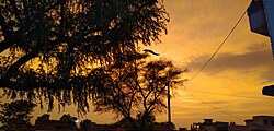
[[File:Sunset Photo.jpg|thumb|Sunset view]] | |||
[[File:Peacocks Picture.jpg|thumb|Peacocks]] | |||
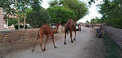
[[File:Camel Walking.jpg|thumb|Camels]] | |||
==References== | ==References== | ||
| Line 92: | Line 68: | ||
{{Nagaur district}} | {{Nagaur district}} | ||
[[Category:Villages in | [[Category:Villages in Didwana Kuchaman district]] | ||
[[Category:Villages in Rajasthan]] | |||
Latest revision as of 20:13, 19 February 2025
Palot | |
|---|---|
 Veer Tejaji Temple | |
  Palot Location of Palot in Rajasthan, India  Palot Palot (India) | |
| Coordinates: 27°14′N 74°16′E / 27.24°N 74.26°E | |
| Country |  India India |
| State | Rajasthan |
| District | Nagaur |
| Named for | Palot |
| Area | |
| • Total | 18.1609 km2 (7.0120 sq mi) |
| Elevation | 1,072 m (3,517 ft) |
| Population (2019) | |
| • Total | 2,232 |
| • Density | 120/km2 (320/sq mi) |
| Languages | |
| • Official | Hindi |
| • Local | Marwari |
| Time zone | UTC+5:30 (IST) |
| PIN | 341305 |
| Vehicle registration | RJ-37 |
| Website | www |
Palot is a village in Didwana tehsil in Nagaur district of Rajasthan.[1] It is located 85km towards East from district headquarters Nagaur district. 13km from Didwana and 184km from the state capital Jaipur. Pin code is 341305 and postal head office is Koliya.[2]
Gallery[edit | edit source]


References[edit | edit source]
- ↑ "Palot Village Population - Didwana - Nagaur, Rajasthan". www.census2011.co.in. Retrieved 5 August 2024.
- ↑ "Pin Code: PALOT, NAGAUR, RAJASTHAN, India, Pincode.net.in".