


imported>Rao Ravindra No edit summary |
Isaac22019 (talk | contribs) further update citations as per guidelines further |
||
| Line 1: | Line 1: | ||
{{Short description|Mountain pass in Arunachal Pradesh, India}} | |||
{{Use dmy dates|date=February 2020}} | {{Use dmy dates|date=February 2020}} | ||
{{Use Indian English|date=February 2020}} | {{Use Indian English|date=February 2020}} | ||
| Line 6: | Line 7: | ||
| photo = File:Tawang Gate.jpg | | photo = File:Tawang Gate.jpg | ||
| photo_width = 250px | | photo_width = 250px | ||
| photo_caption = Sela | | photo_caption = Sela Pass gate in April 2015 | ||
| map = India Arunachal Pradesh#India | | map = India Arunachal Pradesh#India | ||
| coordinates = {{coord|27.50480843|92.10469818|format=dms|display=inline,title}} | | coordinates = {{coord|27.50480843|92.10469818|format=dms|display=inline,title}} | ||
| Line 15: | Line 16: | ||
}} | }} | ||
The '''Sela Pass''' ([[list of tautological place names|more appropriately called]] ''Se La'', as La means Pass) is a high-altitude [[mountain pass]] located on the border between the [[Tawang District|Tawang]] and [[West Kameng]] districts in the [[India]]n [[States and territories of India|state]] of [[Arunachal Pradesh]]. It has an elevation of 4170 m (13,700 ft) and connects the Indian [[Tibetan Buddhist|Buddhist]] town of [[Tawang Town|Tawang]] to [[Dirang]] and [[Guwahati]]. The pass carries the [[National Highway 13 (India)|National Highway 13]] (previously NH 229), connecting [[Tawang]] with the rest of [[India]]. | The '''Sela Pass''' ({{bo|t=གཟེ་ལ། |w=|s=}}) ([[list of tautological place names|more appropriately called]] ''Se La'', as La means Pass in [[Lhasa Tibetan|Tibetan language]]) is a high-altitude [[mountain pass]] located on the border between the [[Tawang District|Tawang]] and [[West Kameng]] districts in the [[India]]n [[States and territories of India|state]] of [[Arunachal Pradesh]]. It has an elevation of 4170 m (13,700 ft) and connects the Indian [[Tibetan Buddhist|Buddhist]] town of [[Tawang Town|Tawang]] to [[Dirang]] and [[Guwahati]]. The pass carries the [[National Highway 13 (India)|National Highway 13]] (previously NH 229), connecting [[Tawang]] with the rest of [[India]]. The pass supports scarce amounts of vegetation and is usually snow-covered to some extent throughout the year. Sela Lake, near the summit of the pass, is one of approximately 101 lakes in the area that are sacred in [[Tibetan Buddhism]]. While Sela Pass does get heavy snowfall in winters, it is usually open throughout the year unless landslides or snow require the pass to be shut down temporarily. Sela pass is one of the highest motorable mountain passes in the world | ||
[[File:Se La Pass 100 (74).jpg|thumb|300px|Sela Pass in August, 2018]] | [[File:Se La Pass 100 (74).jpg|thumb|300px|Sela Pass in August, 2018]] | ||
| Line 22: | Line 23: | ||
[[File:Se La Pass 100 (35).jpg|thumb|300px|View from Sela Lake]] | [[File:Se La Pass 100 (35).jpg|thumb|300px|View from Sela Lake]] | ||
[[File:Sela Pass 100 (31).jpg|thumb|300px|A vehicle negotiating Sela Pass]] | [[File:Sela Pass 100 (31).jpg|thumb|300px|A vehicle negotiating Sela Pass]] | ||
==Etymology== | |||
[[File:Martyr Jaswant Singh Rawat.jpg|thumb|Jaswant Singh who received out from Sela and Nura|220x220px|alt=|left]] | |||
[[File:Jaswant Garh War Memorial.JPG|thumb|Jaswant Garh War Memorial, Jaswantgarh, Arunachal Pradesh|220x220px|alt=|left]] | |||
During the 1962 [[Sino-Indian War]], [[Maha Vir Chakra]] awardee [[Jaswant Singh Rawat]] held Chinese Army off at this mountain pass with the help of two local [[Monpa people|Monpa]] girls named ''Sela'' and ''Noora''. Later, Sela was killed and Noora captured. Rushing from position to position, Rawat held off the enemy for 72 hours until the Chinese captured a local supplier, who told them that they were facing only one fighter. The Chinese then stormed Rawat's position and Rawat was killed.<ref>{{Cite web|title=Indian Army's 'Immortal' soldier Jaswant Singh Rawat, on duty even after being martyred|url=https://indiannewsweekly.com/2021/10/21/indian-armys-immortal-soldier-jaswant-singh-rawat-on-duty-even-after-being-martyred/|date=2021-10-21|access-date=2022-05-21|language=en|archive-date=17 October 2022|archive-url=https://web.archive.org/web/20221017180555/https://indiannewsweekly.com/2021/10/21/indian-armys-immortal-soldier-jaswant-singh-rawat-on-duty-even-after-being-martyred/|url-status=dead}}</ref> the Indian army built [[Jaswant Singh Rawat#Jaswantgarh|Jaswant Garh war memorial]] for Jaswant Singh and the pass, tunnel & lake were named after Sela for her sacrifice. The tunnel is also named after her.<ref name=selajas1>[https://www.bhaskar.com/db-original/news/china-vs-india-sela-tunnel-project-narendra-modi-govt-infrastructure-development-130768317.html जसवंत-सेला शहीद न हों, इसलिए बनी सेला टनल:1962 जैसे नहीं घुस पाएगा चीन; सड़कों, पुलों और सुरंगों का सुरक्षा जाल तैयार], Bhaskar, accessed 14 June 2023.</ref> [[Nuranang Falls]], 2 km east of [[Jang Town|Jang]], are named after Nura. | |||
==Geography== | ==Geography== | ||
Sela Pass crosses a subrange of the [[Himalayas]] that separates [[Tawang District]] from the rest of India.<ref name="arunachalonline.in">{{cite web | url=http://www.arunachalonline.in/about/Tourism/Tawang/Sela-Pass.html | title=Sela Pass | publisher=arunachalonline.in | work=Pan India Internet Private Limited (PIIPL) | access-date=2013-04-19}}</ref> | Sela Pass crosses a subrange of the [[Himalayas]] that separates [[Tawang District]] from the rest of India.<ref name="arunachalonline.in">{{cite web | url=http://www.arunachalonline.in/about/Tourism/Tawang/Sela-Pass.html | title=Sela Pass | publisher=arunachalonline.in | work=Pan India Internet Private Limited (PIIPL) | access-date=2013-04-19}}</ref> The pass is 4170 m (13,700 ft) high<ref name="beontheroad.com">{{cite web | url=http://www.beontheroad.com/2011/01/high-altitude-sela-passbackbone-of.html | title=High Altitude Sela Pass–Backbone of Tawang District | publisher=beontheroad.com | work=Sankara Subramanian C (www.beontheroad.com) | date=21 January 2011 | access-date=2013-04-18}}</ref><ref name="travelomy.com">{{cite web | url=http://www.travelomy.com/sela-pass/ | title=Sela Passmountain pass | publisher=travelomy.com | access-date=2013-04-18 | archive-date=5 May 2013 | archive-url=https://web.archive.org/web/20130505000627/http://www.travelomy.com/sela-pass | url-status=dead }}</ref> and is situated at a distance of 78 km from [[Tawang town]] and 340 km from [[Guwahati]].<ref>{{cite web |url =http://www.travelomy.com/sela-pass/ |title =How To Reach Sela Pass |publisher =Travelomy |access-date =2011-06-19 |archive-date =5 May 2013 |archive-url =https://web.archive.org/web/20130505000627/http://www.travelomy.com/sela-pass |url-status =dead }}</ref> While the Border Roads Organization (BRO) of [[India]] works to keep the pass open throughout the year, it may shut down temporarily after landslides and during heavy snow. Summers at Sela Pass are not very cold, but temperature in winter can dip down to -10 degree Celsius.<ref>{{cite web |url =http://www.travelomy.com/sela-pass |title =Sela Pass |publisher =Travelomy |access-date =2011-06-19 |archive-date =25 March 2012 |archive-url =https://web.archive.org/web/20120325190722/http://www.travelomy.com/sela-pass/ |url-status =dead }}</ref> Sela lake is a large lake located on the north side of the pass at an elevation of {{convert|4160|m|ft}}.<ref name="tawang">{{cite web | url=http://tawang.nic.in/others.html | title=Other Important Attractions of Tawang District | work=National Informatics Centre, Tawang (Arunachal Pradesh) | access-date=2013-04-18}}</ref> This lake often freezes during the winter and is drained in Nuranang River, a tributary of the Tawang River. Limited vegetation grows around the lake, which is used as a grazing site for yaks during the summer.<ref name="travelomy.com" /> | ||
{{wide image|Se La Pass 100 (105).jpg|1000px|Panoramic View of Sela Pass}} | {{wide image|Se La Pass 100 (105).jpg|1000px|Panoramic View of Sela Pass}} | ||
==Tunnel== | ==Tunnel== | ||
'''[[Sela Tunnel]]''', | '''[[Sela Tunnel]]''', [[Government of India]] announced the funding for construction of all weather road transport tunnel in 2018-19 budget.<ref name=sela1>[https://economictimes.indiatimes.com/budget-2018-live-updates/liveblog/62733507.cms Sela pass tunnel], [[The Economic Times|Economic Times]], 1 Feb 2018.</ref> Construction started in January 2019.<ref>{{cite news | url=https://www.business-standard.com/article/pti-stories/work-for-construction-of-sela-tunnel-to-start-soon-dgbr-118112101081_1.html | title=Work for construction of Sela tunnel to start soon: DGBR | date=21 November 2018 | agency=Press Trust of India | newspaper=Business Standard | access-date=18 June 2020 }}</ref><ref name=":0">{{Cite web |date=2022-05-18 |title=Explained: The Sela Tunnel – importance and the strategic edge it promises |url=https://indianexpress.com/article/explained/sela-tunnel-project-arunachal-pradesh-importance-explained-7924404/ |access-date=2022-08-24 |website=The Indian Express |language=en}}</ref> The plan included two tunnels (980 metres and 1,555 metres long) and a link road (1,200 metres long).<ref name=":0" /> | ||
'''Sela Tunnel''' is a road tunnel at {{convert|3000|m|ft}} which ensures all-weather connectivity between [[Guwahati]] in [[Assam]] and [[Tawang]] in [[Arunachal Pradesh]]. This tunnel is the longest bi-lane tunnel in the world at 13,000 feet. Situated 400 metres below the Sela Pass, the Sela Tunnel offers a vital passage, especially during the winter season. The tunnel helps move troops, weapons, and machinery quickly along the Sino-India border. It is connected with NH13 by a new 12.4 km road and has reduced the distance between [[Dirang]] and [[Tawang]] by 10 km. It was inaugurated by [[PM Modi]] on 9 March 2024.<ref name="Business Standard 2018"> | |||
Sela | [https://www.business-standard.com/article/pti-stories/work-for-construction-of-sela-tunnel-to-start-soon-dgbr-118112101081_1.html Sela tunnel construction to start soon], Business Standard, 21 Nov 2018. | ||
</ref> Executed by the [[Border Road Organisation]] (BRO), the project features two tunnels and a link road. Tunnel 1 is a 980-metre-long single-tube tunnel, while Tunnel 2 is a 1,555-metre-long twin-tube tunnel, with one bi-lane tube for traffic and the other for emergency services. The link road between these tunnels spans 1,200 metres. The tunnel provides access to [[Tawang]] by an all-weather road in the western region of Arunachal Pradesh throughout the year.<ref>{{cite web|url=https://www.hindustantimes.com/india-news/delay-hits-sela-tunnel-project-in-arunachal-pradesh-101669833033264.html|title=Delay hits Sela tunnel project in Arunachal Pradesh}}</ref> | |||
The Indian railway has undertaken the final location survey of Strategically important railway project to bring Tawang on railway map through [[Tawang#Railway|Bhalukpong-Tawang railway]], which will also pass through this region. | |||
==Religion== | |||
Sela Pass is a sacred site in [[Tibetan Buddhism]]. Buddhists believe that there are about 101 sacred lakes in and around the pass.<ref name="arunachalonline.in" /><ref name="beontheroad.com" /> | |||
==Sino-Indian War== | |||
{{see also | Galwan River#Sino-Indian_border_dispute | l1=Battle of Galwan | Dhan Singh Thapa#Battle_of_Pangong | l2= Battle of Pangong | Rezang La | l3= Battle of Rezang La | Gurung Hill#1962 | l4 =Battle of Gurung Hill | Jaswant Singh Rawat#Nuranang| l5= Battle of Nuranang & Sela Pass }} | |||
During the [[Sino-Indian War]] in 1962, the Sela Pass was one of the locations that saw significant action. The Chinese PLA infiltrated into the south of the ridge through other routes and the Indian position was withdrawn. | |||
A [[sepoy]] of the Indian Army named [[Jaswant Singh Rawat]] remained at the pass fighting rearguard action, and is said to have held off the Chinese for 72 hours. He was awarded the [[Maha Vir Chakra]] posthumously for his courage and devotion to duty.<ref name="arunachalonline.in" /><ref name="travelomy.com" /> | |||
==Gallery== | ==Gallery== | ||
| Line 62: | Line 70: | ||
* [[Tawang Monastery]] | * [[Tawang Monastery]] | ||
* [[Tawang#Railway|Bhalukpong-Tawang railway]], under-construction | * [[Tawang#Railway|Bhalukpong-Tawang railway]], under-construction | ||
* [[2022 Yangtse clash]] | |||
==References== | ==References== | ||
Latest revision as of 01:21, 13 January 2026
| Sela Pass | |
|---|---|
| Se La | |
<mapframe>: The JSON content is not valid GeoJSON+simplestyle. The list below shows all attempts to interpret it according to the JSON Schema. Not all are errors.
Interactive map of Sela Pass | |
| Elevation | 4,170 metres (13,680 ft) |
| Location | |
| Location | Arunachal Pradesh, India |
| Range | Himalaya |
| Coordinates | 27°30′17″N 92°06′17″E / 27.50480843°N 92.10469818°E |
The Sela Pass (Tibetan: གཟེ་ལ།) (more appropriately called Se La, as La means Pass in Tibetan language) is a high-altitude mountain pass located on the border between the Tawang and West Kameng districts in the Indian state of Arunachal Pradesh. It has an elevation of 4170 m (13,700 ft) and connects the Indian Buddhist town of Tawang to Dirang and Guwahati. The pass carries the National Highway 13 (previously NH 229), connecting Tawang with the rest of India. The pass supports scarce amounts of vegetation and is usually snow-covered to some extent throughout the year. Sela Lake, near the summit of the pass, is one of approximately 101 lakes in the area that are sacred in Tibetan Buddhism. While Sela Pass does get heavy snowfall in winters, it is usually open throughout the year unless landslides or snow require the pass to be shut down temporarily. Sela pass is one of the highest motorable mountain passes in the world
.jpg)
.jpg)
.jpg)
.jpg)
.jpg)
Etymology[edit | edit source]


During the 1962 Sino-Indian War, Maha Vir Chakra awardee Jaswant Singh Rawat held Chinese Army off at this mountain pass with the help of two local Monpa girls named Sela and Noora. Later, Sela was killed and Noora captured. Rushing from position to position, Rawat held off the enemy for 72 hours until the Chinese captured a local supplier, who told them that they were facing only one fighter. The Chinese then stormed Rawat's position and Rawat was killed.[1] the Indian army built Jaswant Garh war memorial for Jaswant Singh and the pass, tunnel & lake were named after Sela for her sacrifice. The tunnel is also named after her.[2] Nuranang Falls, 2 km east of Jang, are named after Nura.
Geography[edit | edit source]
Sela Pass crosses a subrange of the Himalayas that separates Tawang District from the rest of India.[3] The pass is 4170 m (13,700 ft) high[4][5] and is situated at a distance of 78 km from Tawang town and 340 km from Guwahati.[6] While the Border Roads Organization (BRO) of India works to keep the pass open throughout the year, it may shut down temporarily after landslides and during heavy snow. Summers at Sela Pass are not very cold, but temperature in winter can dip down to -10 degree Celsius.[7] Sela lake is a large lake located on the north side of the pass at an elevation of 4,160 metres (13,650 ft).[8] This lake often freezes during the winter and is drained in Nuranang River, a tributary of the Tawang River. Limited vegetation grows around the lake, which is used as a grazing site for yaks during the summer.[5]
.jpg)
Tunnel[edit | edit source]
Sela Tunnel, Government of India announced the funding for construction of all weather road transport tunnel in 2018-19 budget.[9] Construction started in January 2019.[10][11] The plan included two tunnels (980 metres and 1,555 metres long) and a link road (1,200 metres long).[11]
Sela Tunnel is a road tunnel at 3,000 metres (9,800 ft) which ensures all-weather connectivity between Guwahati in Assam and Tawang in Arunachal Pradesh. This tunnel is the longest bi-lane tunnel in the world at 13,000 feet. Situated 400 metres below the Sela Pass, the Sela Tunnel offers a vital passage, especially during the winter season. The tunnel helps move troops, weapons, and machinery quickly along the Sino-India border. It is connected with NH13 by a new 12.4 km road and has reduced the distance between Dirang and Tawang by 10 km. It was inaugurated by PM Modi on 9 March 2024.[12] Executed by the Border Road Organisation (BRO), the project features two tunnels and a link road. Tunnel 1 is a 980-metre-long single-tube tunnel, while Tunnel 2 is a 1,555-metre-long twin-tube tunnel, with one bi-lane tube for traffic and the other for emergency services. The link road between these tunnels spans 1,200 metres. The tunnel provides access to Tawang by an all-weather road in the western region of Arunachal Pradesh throughout the year.[13]
The Indian railway has undertaken the final location survey of Strategically important railway project to bring Tawang on railway map through Bhalukpong-Tawang railway, which will also pass through this region.
Religion[edit | edit source]
Sela Pass is a sacred site in Tibetan Buddhism. Buddhists believe that there are about 101 sacred lakes in and around the pass.[3][4]
Sino-Indian War[edit | edit source]
During the Sino-Indian War in 1962, the Sela Pass was one of the locations that saw significant action. The Chinese PLA infiltrated into the south of the ridge through other routes and the Indian position was withdrawn. A sepoy of the Indian Army named Jaswant Singh Rawat remained at the pass fighting rearguard action, and is said to have held off the Chinese for 72 hours. He was awarded the Maha Vir Chakra posthumously for his courage and devotion to duty.[3][5]
Gallery[edit | edit source]
-
 Sela Pass Gate
 -
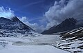 Clouds moving into the pass
 -
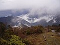 Sela Pass
 -
 Jainath Bridge, Sela Pass
 -
 View of Jaswant Garh
 -
 Sela Pass, Arunachal Pradesh, India
 -
 Sela Pass is prone heavy landslides
 -
 A village in the middle of Sela Pass


.jpg)


.jpg)
.jpg)
See also[edit | edit source]
- Tourism in North East India
- Tawang Town
- Tawang Monastery
- Bhalukpong-Tawang railway, under-construction
- 2022 Yangtse clash
References[edit | edit source]
- ↑ "Indian Army's 'Immortal' soldier Jaswant Singh Rawat, on duty even after being martyred". 21 October 2021. Archived from the original on 17 October 2022. Retrieved 21 May 2022.
- ↑ जसवंत-सेला शहीद न हों, इसलिए बनी सेला टनल:1962 जैसे नहीं घुस पाएगा चीन; सड़कों, पुलों और सुरंगों का सुरक्षा जाल तैयार, Bhaskar, accessed 14 June 2023.
- ↑ 3.0 3.1 3.2 "Sela Pass". Pan India Internet Private Limited (PIIPL). arunachalonline.in. Retrieved 19 April 2013.
- ↑ 4.0 4.1 "High Altitude Sela Pass–Backbone of Tawang District". Sankara Subramanian C (www.beontheroad.com). beontheroad.com. 21 January 2011. Retrieved 18 April 2013.
- ↑ 5.0 5.1 5.2 "Sela Passmountain pass". travelomy.com. Archived from the original on 5 May 2013. Retrieved 18 April 2013.
- ↑ "How To Reach Sela Pass". Travelomy. Archived from the original on 5 May 2013. Retrieved 19 June 2011.
- ↑ "Sela Pass". Travelomy. Archived from the original on 25 March 2012. Retrieved 19 June 2011.
- ↑ "Other Important Attractions of Tawang District". National Informatics Centre, Tawang (Arunachal Pradesh). Retrieved 18 April 2013.
- ↑ Sela pass tunnel, Economic Times, 1 Feb 2018.
- ↑ "Work for construction of Sela tunnel to start soon: DGBR". Business Standard. Press Trust of India. 21 November 2018. Retrieved 18 June 2020.
- ↑ 11.0 11.1 "Explained: The Sela Tunnel – importance and the strategic edge it promises". The Indian Express. 18 May 2022. Retrieved 24 August 2022.
- ↑ Sela tunnel construction to start soon, Business Standard, 21 Nov 2018.
- ↑ "Delay hits Sela tunnel project in Arunachal Pradesh".