



Kamal Guha (talk | contribs) Reoorganised |
Maxlogistic (talk | contribs) m Improved wording and formatting |
||
| Line 2: | Line 2: | ||
{{Infobox settlement | {{Infobox settlement | ||
| name = Narasapuram | | name = Narasapuram | ||
| other_name = Narasapur | |||
| other_name = | |||
| nickname = | | nickname = | ||
| settlement_type = | | settlement_type = Town | ||
| image_skyline = File:Kovela.jpg | | image_skyline = File:Kovela.jpg | ||
| image_alt = | | image_alt = | ||
| image_caption = Narasapuram Adikesava Embarmannar Swamy | | image_caption = Narasapuram Adikesava Embarmannar Swamy | ||
| pushpin_map = India Andhra Pradesh | | pushpin_map = India Andhra Pradesh#India | ||
| pushpin_label_position = right | | pushpin_label_position = right | ||
| pushpin_map_alt = | | pushpin_map_alt = | ||
| pushpin_map_caption = Location in Andhra Pradesh | | pushpin_map_caption = Location in Andhra Pradesh, India##Location in India | ||
| coordinates = {{coord|16.4361|N|81.7016|E|display=inline,title}} | | coordinates = {{coord|16.4361|N|81.7016|E|display=inline,title}} | ||
| subdivision_type = Country | | subdivision_type = Country | ||
| Line 30: | Line 28: | ||
| named_for = [[Narasimha]] | | named_for = [[Narasimha]] | ||
| government_footnotes = <ref name=civicbody>{{cite web|title=Municipalities, Municipal Corporations & UDAs |url=http://dtcp.ap.gov.in:9090/webdtcp/7-ULBs.pdf |website=Directorate of Town and Country Planning |publisher=Government of Andhra Pradesh |access-date=3 December 2015 |url-status=dead |archive-url=https://web.archive.org/web/20160305044311/http://dtcp.ap.gov.in:9090/webdtcp/7-ULBs.pdf |archive-date= 5 March 2016 }}</ref> | | government_footnotes = <ref name=civicbody>{{cite web|title=Municipalities, Municipal Corporations & UDAs |url=http://dtcp.ap.gov.in:9090/webdtcp/7-ULBs.pdf |website=Directorate of Town and Country Planning |publisher=Government of Andhra Pradesh |access-date=3 December 2015 |url-status=dead |archive-url=https://web.archive.org/web/20160305044311/http://dtcp.ap.gov.in:9090/webdtcp/7-ULBs.pdf |archive-date= 5 March 2016 }}</ref> | ||
| government_type = Municipal council | | government_type = [[Municipal council]] | ||
| governing_body = Narasapuram Municipality | | governing_body = Narasapuram Municipality | ||
| leader_title1 = Municipal Commissioner | | leader_title1 = [[Municipal Commissioner (India)|Municipal Commissioner]] | ||
| leader_name1 = | | leader_name1 = C. Srinivas | ||
| leader_title2 = [[Chairman|Municipal Chairperson]] | | leader_title2 = [[Chairman|Municipal Chairperson]] | ||
| leader_name2 = | | leader_name2 = | ||
| leader_title3 = [[Member of Legislative Assembly (India)|MLA]] | | leader_title3 = [[Member of Legislative Assembly (India)|MLA]] | ||
| leader_name3 = [[ | | leader_name3 = [[Bommidi Nayakar]] | ||
| leader_title4 = [[Member of Parliament|MP]] | | leader_title4 = [[Member of Parliament|MP(Loksabha)]] | ||
| leader_name4 = [[ | | leader_name4 = [[Bhupathiraju srinivasa varma]] | ||
| unit_pref = Metric | | unit_pref = Metric | ||
| area_footnotes = <ref name=census>{{cite web|title=District Census Handbook – West Godavari|url=http://www.censusindia.gov.in/2011census/dchb/2815_PART_B_DCHB_WEST%20GODAVARI.pdf|website=Census of India|access-date=22 January 2016|pages=22, 54}}</ref> | | area_footnotes = <ref name=census>{{cite web|title=District Census Handbook – West Godavari|url=http://www.censusindia.gov.in/2011census/dchb/2815_PART_B_DCHB_WEST%20GODAVARI.pdf|website=Census of India|access-date=22 January 2016|pages=22, 54}}</ref> | ||
| Line 52: | Line 50: | ||
| population_demonym = | | population_demonym = | ||
| population_footnotes = <ref name=population>{{cite web|title=Cities having population 1 lakh and above|url=http://www.censusindia.gov.in/pca/SearchDetails.aspx?Id=625722|publisher=The Registrar General & Census Commissioner, India|access-date=5 April 2015}}</ref> | | population_footnotes = <ref name=population>{{cite web|title=Cities having population 1 lakh and above|url=http://www.censusindia.gov.in/pca/SearchDetails.aspx?Id=625722|publisher=The Registrar General & Census Commissioner, India|access-date=5 April 2015}}</ref> | ||
| demographics_type1 = | | demographics_type1 = Languages | ||
| demographics1_title1 = Official | | demographics1_title1 = Official | ||
| demographics1_info1 = [[Telugu language|Telugu]] | | demographics1_info1 = [[Telugu language|Telugu]] | ||
| Line 62: | Line 60: | ||
| area_code = 08814 | | area_code = 08814 | ||
| registration_plate = AP-37 | | registration_plate = AP-37 | ||
| blank1_name_sec1 = Nearest | | blank1_name_sec1 = Nearest town | ||
| blank1_info_sec1 = [[Palakollu]] | | blank1_info_sec1 = [[Palakollu]] | ||
| website = | | website = | ||
| Line 69: | Line 67: | ||
}} | }} | ||
'''Narasapuram''' | '''Narasapuram''' is a town in [[West Godavari district]] of the Indian state of [[Andhra Pradesh]].<ref>{{cite web|title=Mandal wise villages |url=http://apland.ap.nic.in/cclaweb/Districts_Alphabetical/westgodavari.pdf |website=Revenue Department – AP Land |publisher=National Informatics Center |access-date=10 November 2014 |page=9 |url-status=dead |archive-url=https://web.archive.org/web/20150208134347/http://apland.ap.nic.in/cclaweb/Districts_Alphabetical/westgodavari.pdf |archive-date= 8 February 2015 }}</ref> It is a [[municipality]] and mandal headquarters of [[Narasapuram Mandal]] in [[Narasapuram revenue division]].<ref name=census /><ref name=map>{{cite web|title=Guntur District Mandals|url=http://censusindia.gov.in/2011census/maps/atlas/28part31.pdf|publisher=Census of India|access-date=19 January 2015|pages=460, 470}}</ref> The city is situated on the banks of the Vasista [[Godavari River]].<ref>{{cite news|last1=Nagaraja|first1=G|title=Narsapur civic body set to get a voice|url=http://www.thehindu.com/todays-paper/tp-national/tp-andhrapradesh/narsapur-civic-body-set-to-get-a-voice/article3983449.ece|access-date=2 March 2015|work=The Hindu|date=10 October 2012|location=Narsapur}}</ref><ref>{{cite book|author1=Edgar Thurston|title=The Madras Presidency with Mysore, Coorg and the Associated States|date=2011|publisher=Cambridge University Press|isbn=9781107600683|page=25|edition=reissue|url=https://books.google.com/books?id=O4VLY1KcltcC&q=narasapuram+major+towns+on+the+bank+of+the+Vasishta+Godavari+river.&pg=PA25|access-date=2 March 2015}}</ref> The lace industry is prevalent in the city and its surroundings.<ref>{{cite news|title=Handicraft exports jump 44 p.c. in November|url=http://www.thehindu.com/business/Economy/handicraft-exports-jump-44-pc-in-november/article71244.ece|access-date=8 May 2015|work=The Hindu|date=27 December 2009|location=New Delhi}}</ref><ref>{{cite web|url=http://gdwlace.com/lace/|title=Godavari Delta Women Lace Artisans Co-Operative Cottage Industrial Society Ltd., – Manufacturers and Exporters of Handmade Cotton Crochet Laces & Processed Cotton Made ups|work=gdwlace.com}}</ref> | ||
== Etymology == | == Etymology == | ||
Narsapur was also known as "Nrusimhapuri", named after the [[Lord Narasimha]].<ref>{{cite web|url=http://areaprofiler.gov.in/aboutUsIntgeratedPES.do?stateCode=28&lbCode=6063&languageId=1|title=Layout page|work=areaprofiler.gov.in}}</ref> Gradually it changed into Narasimhapuram and now to Narasapuram.{{ | |||
Narsapur was also known as "Nrusimhapuri", named after the [[Lord Narasimha]].<ref>{{cite web|url=http://areaprofiler.gov.in/aboutUsIntgeratedPES.do?stateCode=28&lbCode=6063&languageId=1|title=Layout page|work=areaprofiler.gov.in}}</ref> Gradually it changed into Narasimhapuram and now to Narasapuram.{{citation needed|date=April 2019}} It is also known as Abhinavabhutapuri. | |||
== History == | == History == | ||
The existence of Narsapur dates back to 1173 AD. [[Dutch people]] landed in Narsapur in 1626. Narsapur was used as a port by the Dutch and ships and boats were built here. It was noted for its ship building activity and some of the Europeans also were customers at this place; small boats are still built in Narsapur. In the 16th century, [[Portugal|Portuguese]] established their own factory which remained as a trading centre for a few years. In the 18th century, Narsapur became an important trading port. From this port, teak was exported to other regions. The ports at [[Kakinada]] and Narsapuram became famous for manufacturing ships. At present there is no port handling at Narsapur. | The existence of Narsapur dates back to 1173 AD. [[Dutch people]] landed in Narsapur in 1626. Narsapur was used as a port by the Dutch and ships and boats were built here. It was noted for its ship building activity and some of the Europeans also were customers at this place; small boats are still built in Narsapur. In the 16th century, [[Portugal|Portuguese]] established their own factory which remained as a trading centre for a few years. In the 18th century, Narsapur became an important trading port. From this port, teak was exported to other regions. The ports at [[Kakinada]] and Narsapuram became famous for manufacturing ships. At present there is no port handling at Narsapur. | ||
| Line 80: | Line 80: | ||
The trade of the town has steadily declined since the abolition of the company's factory in 1827. Before independence, British civilians had made imports and exports from Narsapur. | The trade of the town has steadily declined since the abolition of the company's factory in 1827. Before independence, British civilians had made imports and exports from Narsapur. | ||
==Geography== | ==Geography== | ||
| Line 93: | Line 85: | ||
Narsapur is located at {{coord|16.4361|N|81.7016|E}} and on the right bank of Vasista Godavari River at an altitude of {{Convert|0|m|abbr=on}}.<ref name=geo /> The [[River Godavari]] empties into [[Bay of Bengal]] near [[Antervedi|Antarvedi]], at 9.6 km from Narsapur.<ref name=map /> | Narsapur is located at {{coord|16.4361|N|81.7016|E}} and on the right bank of Vasista Godavari River at an altitude of {{Convert|0|m|abbr=on}}.<ref name=geo /> The [[River Godavari]] empties into [[Bay of Bengal]] near [[Antervedi|Antarvedi]], at 9.6 km from Narsapur.<ref name=map /> | ||
==Climate== | |||
{{Weather box | |||
| location = Narasapuram (1991–2020) | |||
| metric first = yes | |||
| single line = yes | |||
| width = auto | |||
| Jan record high C = 33.3 | |||
| Feb record high C = 37.2 | |||
| Mar record high C = 37.0 | |||
| Apr record high C = 39.3 | |||
| May record high C = 46.1 | |||
| Jun record high C = 44.6 | |||
| Jul record high C = 38.9 | |||
| Aug record high C = 37.6 | |||
| Sep record high C = 35.6 | |||
| Oct record high C = 36.2 | |||
| Nov record high C = 34.4 | |||
| Dec record high C = 33.4 | |||
|year record high C = 46.1 | |||
| Jan high C = 29.1 | |||
| Feb high C = 30.8 | |||
| Mar high C = 32.8 | |||
| Apr high C = 34.2 | |||
| May high C = 36.4 | |||
| Jun high C = 35.1 | |||
| Jul high C = 32.6 | |||
| Aug high C = 31.9 | |||
| Sep high C = 31.9 | |||
| Oct high C = 31.2 | |||
| Nov high C = 30.2 | |||
| Dec high C = 29.2 | |||
| year high C = 32.1 | |||
| Jan low C = 20.0 | |||
| Feb low C = 21.2 | |||
| Mar low C = 23.7 | |||
| Apr low C = 26.3 | |||
| May low C = 28.2 | |||
| Jun low C = 27.6 | |||
| Jul low C = 26.4 | |||
| Aug low C = 26.1 | |||
| Sep low C = 26.2 | |||
| Oct low C = 24.9 | |||
| Nov low C = 22.3 | |||
| Dec low C = 20.1 | |||
| year low C = 24.4 | |||
| Jan record low C = 13.5 | |||
| Feb record low C = 14.6 | |||
| Mar record low C = 18.9 | |||
| Apr record low C = 20.0 | |||
| May record low C = 21.2 | |||
| Jun record low C = 20.5 | |||
| Jul record low C = 21.6 | |||
| Aug record low C = 22.2 | |||
| Sep record low C = 21.5 | |||
| Oct record low C = 20.5 | |||
| Nov record low C = 15.6 | |||
| Dec record low C = 15.5 | |||
|year record low C = 13.5 | |||
| rain colour = green | |||
| Jan rain mm = 8.6 | |||
| Feb rain mm = 6.4 | |||
| Mar rain mm = 5.2 | |||
| Apr rain mm = 11.3 | |||
| May rain mm = 53.3 | |||
| Jun rain mm = 131.3 | |||
| Jul rain mm = 203.0 | |||
| Aug rain mm = 199.7 | |||
| Sep rain mm = 193.7 | |||
| Oct rain mm = 245.7 | |||
| Nov rain mm = 91.2 | |||
| Dec rain mm = 19.7 | |||
| year rain mm = 1169.0 | |||
| Jan rain days = 0.6 | |||
| Feb rain days = 0.4 | |||
| Mar rain days = 0.2 | |||
| Apr rain days = 1.2 | |||
| May rain days = 1.9 | |||
| Jun rain days = 6.7 | |||
| Jul rain days = 10.9 | |||
| Aug rain days = 11.2 | |||
| Sep rain days = 9.3 | |||
| Oct rain days = 10.7 | |||
| Nov rain days = 3.8 | |||
| Dec rain days = 0.8 | |||
|year rain days = 57.6 | |||
|time day = 17:30 [[Indian Standard Time|IST]] | |||
| Jan humidity = 66 | |||
| Feb humidity = 64 | |||
| Mar humidity = 67 | |||
| Apr humidity = 68 | |||
| May humidity = 65 | |||
| Jun humidity = 67 | |||
| Jul humidity = 72 | |||
| Aug humidity = 74 | |||
| Sep humidity = 77 | |||
| Oct humidity = 79 | |||
| Nov humidity = 73 | |||
| Dec humidity = 67 | |||
|year humidity = 70 | |||
|source 1 = [[India Meteorological Department]]<ref>{{cite web | |||
| url = https://imdpune.gov.in/library/public/Climatological%20Tables%201991-2020.pdf | |||
| title = Climatological Tables of Observatories in India 1991-2020 | |||
| publisher = [[India Meteorological Department]] | |||
| access-date = April 8, 2024 | |||
}}</ref>}} | |||
==Demographics== | ==Demographics== | ||
{{As of|2011}} [[Census of India|census]], the city had a population of 58,770. The total population is constituted of 28,796 males and 29,974 females – a sex ratio of 961 females per 1000 males, higher than the national average of 940 per 1000. 29,974 children are in the age group of 0–6 years, of which 2,665 are boys and 2,456 are girls. The average literacy rate stands at 86.24% with 46,266 literates, significantly higher than the district average of 73.00%.<ref name=population /><ref>{{cite web|title=Chapter–3 (Literates and Literacy rate) |url=http://www.censusindia.gov.in/2011census/PCA/PCA_Highlights/pca_highlights_file/India/Chapter-3.pdf|publisher=Registrar General and Census Commissioner of India|access-date=1 September 2014}}</ref> | {{As of|2011}} [[Census of India|census]], the city had a population of 58,770. The total population is constituted of 28,796 males and 29,974 females – a sex ratio of 961 females per 1000 males, higher than the national average of 940 per 1000. 29,974 children are in the age group of 0–6 years, of which 2,665 are boys and 2,456 are girls. The average literacy rate stands at 86.24% with 46,266 literates, significantly higher than the district average of 73.00%.<ref name=population /><ref>{{cite web|title=Chapter–3 (Literates and Literacy rate) |url=http://www.censusindia.gov.in/2011census/PCA/PCA_Highlights/pca_highlights_file/India/Chapter-3.pdf|publisher=Registrar General and Census Commissioner of India|access-date=1 September 2014}}</ref> | ||
== Governance == | == Governance == | ||
=== Civic administration === | === Civic administration === | ||
[[Narasapuram Municipality]] was constituted in 1956. Narsapur was made a 3rd Grade Municipality in 1956. It was upgraded to 2nd Grade Municipality in 1965 and again upgraded to 1st Grade Municipality in 2001. Narsapur Municipality consists of 31 wards and 48 slums in an area of 11.52 km<sup>2</sup>.<ref>{{Cite web|url=http://narasapur.cdma.ap.gov.in|title=About Narasapur Municipality {{!}} Narasapur Municipal Corporation|website=narasapur.cdma.ap.gov.in|language=en|access-date=27 June 2018}}</ref> | [[Narasapuram Municipality]] was constituted in 1956. Narsapur was made a 3rd Grade Municipality in 1956. It was upgraded to 2nd Grade Municipality in 1965 and again upgraded to 1st Grade Municipality in 2001. Narsapur Municipality consists of 31 wards and 48 slums in an area of 11.52 km<sup>2</sup>.<ref>{{Cite web|url=http://narasapur.cdma.ap.gov.in|title=About Narasapur Municipality {{!}} Narasapur Municipal Corporation|website=narasapur.cdma.ap.gov.in|language=en|access-date=27 June 2018}}</ref> | ||
=== Politics === | === Politics === | ||
Narasapuram is represented by [[Narasapuram (Assembly constituency)]] for [[Andhra Pradesh Legislative Assembly]]. Under Narasapuram [[mandal]], the town falls in [[Narasapuram (Lok Sabha constituency)]]. | |||
and the present [[Member of parliament|MP]] is | Narasapuram is represented by [[Narasapuram (Assembly constituency)]] for [[Andhra Pradesh Legislative Assembly]]. Under Narasapuram [[mandal]], the town falls in [[Narasapuram (Lok Sabha constituency)]]. Bommidi Narayana nayakar is the present [[Member of Legislative Assembly (India)|MLA]] of the constituency from [[Janasena Party]] | ||
and the present [[Member of parliament|MP]] is Srinivas Varma from [[BJP]]. | |||
== Economy == | == Economy == | ||
[[File:International Lace trade Centre.jpg|center|thumb]] | |||
[[File:Lace Park.jpg|center|thumb]] | |||
International Lace trade Centre.jpg| | |||
File:Lace Park.jpg| | |||
'''Industries''' | '''Industries''' | ||
[[File:Dawn @ Godavari.JPG|thumb|FishBoat]] | |||
Handmade crochet lace-work is one of the most common form of industry in the town.<ref>{{cite news|last1=Chari|first1=Pushpa|title=On a creative trip|url=http://www.thehindu.com/arts/crafts/on-a-creative-trip/article1038504.ece|access-date=3 December 2015|work=The Hindu|date=6 January 2011}}</ref> | Handmade crochet lace-work is one of the most common form of industry in the town.<ref>{{cite news|last1=Chari|first1=Pushpa|title=On a creative trip|url=http://www.thehindu.com/arts/crafts/on-a-creative-trip/article1038504.ece|access-date=3 December 2015|work=The Hindu|date=6 January 2011}}</ref> | ||
There are many industries in and around the town such as International Lace Trade Centre,<ref>{{Cite web|title = International lace trade centre to be set up at Narsapuram in AP|url = http://www.thehindubusinessline.com/economy/international-lace-trade-centre-to-be-set-up-at-narsapuram-in-ap/article3790514.ece|website = The Hindu Business Line|access-date = 11 October 2015}}</ref> Oil and Natural Gas Corporation of India,<ref>{{cite web|title=ONGC|url=http://www.godavarimahapushkaram2015.org/about-narasapuram/industriespsu/|publisher=godavarimahapushkaram2015|access-date=16 May 2015}}</ref> Central Industrial Security Force,<ref>{{cite web|title=CISF|url=http://www.cisf.gov.in/directory/south-sector/|publisher=Cntral Industrial Security Force|access-date=16 May 2015}}</ref> Central Marine Fisheries Research Institute,<ref>{{cite web|title=CMFRI|url=http://www.cmfri.org.in/uploads_en/media/cmfri-map.swf|publisher=Central Marine Fisheries Institute|access-date=16 May 2015}}</ref> PanGodavari (Handicrafts),<ref>{{cite web|title=Pangodavari|url=http://www.pangodavari.com/|publisher=pangodavari|access-date=16 May 2015}}</ref> Comprehensive Handicrafts Cluster Development Scheme, AWS (Automatic Weather Station) installed and commissioned by IMD.<ref>{{cite web|title=List of Automatic Weather Stations (AWS)|url=http://www.imdaws.com/125_AWS.PDF|website=[[India Meteorological Department]], AWS Lab|location=[[Pune]], India|access-date=16 May 2015|archive-url=https://web.archive.org/web/20160304070520/http://www.imdaws.com/125_AWS.PDF|archive-date=4 March 2016|url-status=dead}}</ref> | There are many industries in and around the town such as International Lace Trade Centre,<ref>{{Cite web|title = International lace trade centre to be set up at Narsapuram in AP|url = http://www.thehindubusinessline.com/economy/international-lace-trade-centre-to-be-set-up-at-narsapuram-in-ap/article3790514.ece|website = The Hindu Business Line| date=18 August 2012 |access-date = 11 October 2015}}</ref> Oil and Natural Gas Corporation of India,<ref>{{cite web|title=ONGC|url=http://www.godavarimahapushkaram2015.org/about-narasapuram/industriespsu/|publisher=godavarimahapushkaram2015|access-date=16 May 2015}}</ref> Central Industrial Security Force,<ref>{{cite web|title=CISF|url=http://www.cisf.gov.in/directory/south-sector/|publisher=Cntral Industrial Security Force|access-date=16 May 2015}}</ref> Central Marine Fisheries Research Institute,<ref>{{cite web|title=CMFRI|url=http://www.cmfri.org.in/uploads_en/media/cmfri-map.swf|publisher=Central Marine Fisheries Institute|access-date=16 May 2015}}</ref> PanGodavari (Handicrafts),<ref>{{cite web|title=Pangodavari|url=http://www.pangodavari.com/|publisher=pangodavari|access-date=16 May 2015}}</ref> Comprehensive Handicrafts Cluster Development Scheme, AWS (Automatic Weather Station) installed and commissioned by IMD.<ref>{{cite web|title=List of Automatic Weather Stations (AWS)|url=http://www.imdaws.com/125_AWS.PDF|website=[[India Meteorological Department]], AWS Lab|location=[[Pune]], India|access-date=16 May 2015|archive-url=https://web.archive.org/web/20160304070520/http://www.imdaws.com/125_AWS.PDF|archive-date=4 March 2016|url-status=dead}}</ref> | ||
'''Aquaculture''' | '''Aquaculture''' | ||
[[Fishery]] is one of the main occupations that generates good amounts of revenues for the fishermen. It involves cultivation of a variety of [[estuarine fish]] called ''Pulasa''.<ref>{{cite news|last1=Murali Sankar|first1=K.N|title=Pulasa fishermen wait for Pushkaram to end|url=http://www.thehindu.com/news/national/andhra-pradesh/pulasa-fishermen-wait-for-pushkaram-to-end/article7453925.ece|access-date=5 February 2016|work=The Hindu|date=23 July 2015}}</ref> | [[Fishery]] is one of the main occupations that generates good amounts of revenues for the fishermen. It involves cultivation of a variety of [[estuarine fish]] called ''Pulasa''.<ref>{{cite news|last1=Murali Sankar|first1=K.N|title=Pulasa fishermen wait for Pushkaram to end|url=http://www.thehindu.com/news/national/andhra-pradesh/pulasa-fishermen-wait-for-pushkaram-to-end/article7453925.ece|access-date=5 February 2016|work=The Hindu|date=23 July 2015}}</ref> | ||
== Culture == | == Culture == | ||
Godavari [[Pushkaram]] is | |||
Some of the religious | Godavari [[Pushkaram]] is held every twelve years in Narasapuram with a holy dip in the Vasista Godavari River.<ref>{{cite book|last1=Hyland|first1=Paul|title=Indian balm : travels amongst fakirs and firewarriors|date=1994|publisher=TPP|location=London|isbn=1845110854|page=52|url=https://books.google.com/books?id=Nebl_Xb4K_IC&q=narsapur+pushkaram&pg=PA52|access-date=24 April 2015}}</ref> This river is said to have been brought to earth by the Maharishi [[Vashishtha]], one of the seven great sages of the [[Hindu mythology]]. The place draws people from the world over throughout the year. [[Antarvedi]], the merging of the Bay of Bengal and Vasista River (which is a tributary of the River Godavari) is about 10 kms away. The place of confluence of the ocean and river is called the "Sapta Sagara Sangam Pradesam". It is also known as the ''Anna Chelli Gattu'' (meaning brother–sister embankment).<ref>{{cite web|url=http://aptdc.gov.in/blog/history-of-antarvedi/|title=AP Tourism Blog – Written words last}}</ref> | ||
Some of the religious sites in the town are Adikesava Emberumaanar Temple, a Vaishnavite temple 300 years old which was constructed by translator of the British East India Company, Prasannagresara Puppala Ramanappa Naidu.<ref>{{cite web|url=http://antaryami.net/darpanam/2013/04/22/sri-adikesava-perumal-brahmotsavams-narsapur/|archive-url=https://web.archive.org/web/20130513135520/http://antaryami.net/darpanam/2013/04/22/sri-adikesava-perumal-brahmotsavams-narsapur/|url-status=usurped|archive-date=13 May 2013|title=Sri Adikesava Perumal Brahmotsavams, Narsapur – Antaryami.net Sri Vaishnava Portal|work=indiamapped.com}}</ref> | |||
== Landmarks == | == Landmarks == | ||
[[File:Perupalem Beach.jpg|center|thumb|Perupalem Beach]] | |||
The Perupalem Beach is located at a distance of 20 km from the town.<ref>{{cite web|url=http://www.coastaltourism.in/perupalem-beach/|title=Perupalem Beach|author=Puja Tripathy|work=Coastal Tourism India}}</ref> Narasapuram has become a key landmark destination for foreigners due to monkey tourism.{{citation needed|date=February 2021}} | The Perupalem Beach is located at a distance of 20 km from the town.<ref>{{cite web|url=http://www.coastaltourism.in/perupalem-beach/|title=Perupalem Beach|author=Puja Tripathy|work=Coastal Tourism India}}</ref> Narasapuram has become a key landmark destination for foreigners due to monkey tourism.{{citation needed|date=February 2021}} | ||
==Education== | ==Education== | ||
[[File:Sri YN College.jpg|thumb|Sri YN College|none]] | |||
File:Sri YN College.jpg|Sri YN College | [[File:Swarnandra Engineering College.jpg|thumb|Swarnandra Engineering College|none]][[File:J_Beera.webp|frameless]] | ||
Swarnandra Engineering College.jpg|Swarnandra Engineering College | [[File:Flaiz Adventist College.jpg|none|thumb]] | ||
File:J_Beera.webp| | |||
File:Flaiz Adventist College.jpg| | |||
The primary and secondary school education is imparted by government, aided and private schools, under the ''School Education Department'' of the state.<ref>{{cite web|title=School Education Department |url=http://rmsaap.nic.in/Notification_TSG_2015.pdf |publisher=School Education Department, Government of Andhra Pradesh |access-date=7 November 2016 |url-status=dead |archive-url=https://web.archive.org/web/20151227185018/http://rmsaap.nic.in/Notification_TSG_2015.pdf |archive-date=27 December 2015 }}</ref><ref>{{cite web|title=The Department of School Education – Official AP State Government Portal {{!}} AP State Portal |url=http://www.ap.gov.in/department/organizations/school-education/ |website=www.ap.gov.in |access-date=7 November 2016 |url-status=dead |archive-url=https://web.archive.org/web/20161107155331/http://www.ap.gov.in/department/organizations/school-education/ |archive-date= 7 November 2016 }}</ref> The mediums of instruction followed by different schools are [[English language|English]] and [[Telugu language|Telugu]]. | The primary and secondary school education is imparted by government, aided and private schools, under the ''School Education Department'' of the state.<ref>{{cite web|title=School Education Department |url=http://rmsaap.nic.in/Notification_TSG_2015.pdf |publisher=School Education Department, Government of Andhra Pradesh |access-date=7 November 2016 |url-status=dead |archive-url=https://web.archive.org/web/20151227185018/http://rmsaap.nic.in/Notification_TSG_2015.pdf |archive-date=27 December 2015 }}</ref><ref>{{cite web|title=The Department of School Education – Official AP State Government Portal {{!}} AP State Portal |url=http://www.ap.gov.in/department/organizations/school-education/ |website=www.ap.gov.in |access-date=7 November 2016 |url-status=dead |archive-url=https://web.archive.org/web/20161107155331/http://www.ap.gov.in/department/organizations/school-education/ |archive-date= 7 November 2016 }}</ref> The mediums of instruction followed by different schools are [[English language|English]] and [[Telugu language|Telugu]]. | ||
Taylor High School is one of the major landmarks in Narsapuram showcasing the Dutch and the British buildings. The high school was founded by British Educationist and local Revenue Officer H. Taylor in 1852, and was later named after him.<ref>{{cite news|title=A major landmark fallen on bad days|url=http://www.thehindu.com/todays-paper/tp-national/tp-andhrapradesh/a-major-landmark-fallen-on-bad-days/article5965002.ece|access-date=24 April 2015|work=The Hindu|date=1 May 2014}}</ref> The 'manyam veerudu' (jungle hero) [[Alluri Sitarama Raju]] had his schooling in this institution before he led the [[Rampa Rebellion of 1922|Rampa rebellion]] against the British.<ref>{{cite news|title=Alluri Sita Rama Raju Biography|url=http://www.baynews.in/editorial/alluri-sita-rama-raju-biography|access-date=24 April 2015|work=Baynews}}</ref> [[Chilakamarti Lakshmi Narasimham]], a freedom fighter and a noted Telugu litterateur also attended the school.<ref>{{cite | Taylor High School is one of the major landmarks in Narsapuram showcasing the Dutch and the British buildings. The high school was founded by British Educationist and local Revenue Officer H. Taylor in 1852, and was later named after him.<ref>{{cite news|title=A major landmark fallen on bad days|url=http://www.thehindu.com/todays-paper/tp-national/tp-andhrapradesh/a-major-landmark-fallen-on-bad-days/article5965002.ece|access-date=24 April 2015|work=The Hindu|date=1 May 2014}}</ref> The 'manyam veerudu' (jungle hero) [[Alluri Sitarama Raju]] had his schooling in this institution before he led the [[Rampa Rebellion of 1922|Rampa rebellion]] against the British.<ref>{{cite news|title=Alluri Sita Rama Raju Biography|url=http://www.baynews.in/editorial/alluri-sita-rama-raju-biography|access-date=24 April 2015|work=Baynews}}</ref> [[Chilakamarti Lakshmi Narasimham]], a freedom fighter and a noted Telugu litterateur also attended the school.<ref>{{cite news|url=http://www.thehindu.com/todays-paper/tp-national/tp-andhrapradesh/a-major-landmark-fallen-on-bad-days/article5965002.ece|title=A major landmark fallen on bad days|author=Special Correspondent|work=The Hindu|date=30 April 2014 }}</ref> | ||
Swarnandhra College of Engineering and Technology, an affiliation to Jawaharlal Nehru Technological University of Kakinada,<ref>{{Cite web|title = Swarnandhra College of Engineering & Technology – Home|url = http://www.swarnandhra.ac.in/|website = www.swarnandhra.ac.in|access-date = 13 October 2015}}</ref> Sri Yerramilli Narayanamurthy college which was established in 1949, J Beera School of Education, BGBS Women's and music college, Flaiz Adventist Degree college and Some Corporate colleges are some of the other professional colleges.<ref>{{Cite web|title = About us {{!}} Shri YN College|url = http://www.sriyncollege.org/about-us/|website = www.sriyncollege.org|access-date = 13 October 2015}}</ref> | Swarnandhra College of Engineering and Technology, an affiliation to Jawaharlal Nehru Technological University of Kakinada,<ref>{{Cite web|title = Swarnandhra College of Engineering & Technology – Home|url = http://www.swarnandhra.ac.in/|website = www.swarnandhra.ac.in|access-date = 13 October 2015}}</ref> Sri Yerramilli Narayanamurthy college which was established in 1949, J Beera School of Education, BGBS Women's and music college, Flaiz Adventist Degree college and Some Corporate colleges are some of the other professional colleges.<ref>{{Cite web|title = About us {{!}} Shri YN College|url = http://www.sriyncollege.org/about-us/|website = www.sriyncollege.org|access-date = 13 October 2015}}</ref> | ||
| Line 144: | Line 243: | ||
===Roadways=== | ===Roadways=== | ||
The town has a total road length of {{Convert|79.67|km|mi|abbr=on}}.<ref>{{cite web|title=Details of Roads in each ULB of Andhra Pradesh|url=http://centralapp.cdma.ap.gov.in:8080/CDMAAPTaxesInfo/RoadDetails.jsp|website=Commissioner and Directorate of Municipal Administration|publisher=Municipal Administration and Urban Development Department – Government of Andhra Pradesh|access-date=28 March 2017|url-status=dead|archive-url=https://web.archive.org/web/20160801101300/http://centralapp.cdma.ap.gov.in:8080/CDMAAPTaxesInfo/RoadDetails.jsp|archive-date=1 August 2016}}</ref> The [[Andhra Pradesh State Road Transport Corporation]] operates bus services from Narasapuram bus station.<ref>{{cite web|title=Bus Stations in Districts |url=http://www.apsrtc.gov.in/Bus%20Stations.aspx |website=Andhra Pradesh State Road Transport Corporation |access-date=9 March 2016 |url-status=dead |archive-url=https://web.archive.org/web/20160322233330/http://apsrtc.gov.in/Bus%20Stations.aspx |archive-date=22 March 2016 }}</ref> [[National Highway 216 (India)|NH216]] connects [[National Highway 16 (India)|NH 16]] near [[Ongole]], a short route for [[Kolkata]] - [[Chennai]] route. | |||
[[Andhra Pradesh State Road Transport Corporation|APSRTC]] operates Bus servies from | [[Andhra Pradesh State Road Transport Corporation|APSRTC]] operates Bus servies from Narasapuram to [[Eluru]], [[Rajahmundry]], [[Vijayawada]], [[Visakhapatnam]], [[Nidadavolu]], [[Ramachandrapuram, East Godavari|Ramachandrapuram]], [[Mandapeta]], [[Palakollu]], [[Hyderabad]], [[kakinada]], [[Ravulapalem]], [[Machilipatnam|Machilipatanam]], and [[Kaikaluru]]. | ||
===Railways=== | ===Railways=== | ||
[[ | [[Narasapur railway station]] is a [[terminal station]] located on the [[Bhimavaram–Narasapur branch line]] of Bhimavaram -Nidadavolu loop line in [[South Coast Railway zone]]. | ||
It is classified as a ''B–category'' station in South Coast Railway zone.<ref>{{cite web |title=Divisional info |url=http://www.scr.indianrailways.gov.in/cris/uploads/files/1404647822154-Division%20profile.pdf |publisher=[[Indian Railways]]|access-date=18 July 2015}}</ref>[[Kotipalli]]-[[Narsapuram]] railway line is the important railway project to the town. | |||
===Waterways=== | ===Waterways=== | ||
Narasapur Port is proposed for developing it as a minor port, fishing harbor and ONGC Jetty.<ref>{{cite web|url=http://www.apports.in/in/content/view/47/66/|title=Department of Ports, Andhra Pradesh|work=apports.in}}</ref> | Narasapur Port is proposed for developing it as a minor port, fishing harbor and ONGC Jetty.<ref>{{cite web|url=http://www.apports.in/in/content/view/47/66/|title=Department of Ports, Andhra Pradesh|work=apports.in}}</ref> | ||
===Airways=== | ===Airways=== | ||
[[Rajahmundry Airport]] is the nearest airport | |||
[[Rajahmundry Airport]] is the nearest airport - 80 km away from the town. | |||
==Sports== | ==Sports== | ||
Narsapuram Football Club is part of FLOW (Football League Of West Godavari).<ref>{{Cite web|title = FLOW|url = http://www.flow.football/default.aspx|website = www.flow.football|access-date = 18 February 2016}}</ref> National level Kabaddi competitions are held every year on the eve of [[Sankranti]] festival at Kabadi Stadium, Narsapur. All India level Seniors Tennis Tournament is held in Narsapur officers club every year. | Narsapuram Football Club is part of FLOW (Football League Of West Godavari).<ref>{{Cite web|title = FLOW|url = http://www.flow.football/default.aspx|website = www.flow.football|access-date = 18 February 2016}}</ref> National level [[Kabaddi]] competitions are held every year on the eve of [[Sankranti]] festival at Kabadi Stadium, Narsapur. All India level Seniors Tennis Tournament is held in Narsapur officers club every year. | ||
== See also == | == See also == | ||
| Line 175: | Line 277: | ||
[[Category:Cities and towns in West Godavari district]] | [[Category:Cities and towns in West Godavari district]] | ||
[[Category:Mandal headquarters in West Godavari district]] | [[Category:Mandal headquarters in West Godavari district]] | ||
[[Category:Places situated on the banks of the Godavari river]] | |||
Latest revision as of 18:34, 14 January 2026
Narasapuram
Narasapur | |
|---|---|
Town | |
 Narasapuram Adikesava Embarmannar Swamy | |
  Narasapuram Location in Andhra Pradesh, India  Narasapuram Location in India | |
| Coordinates: 16°26′10″N 81°42′06″E / 16.4361°N 81.7016°E | |
| Country |  India India |
| State | Andhra Pradesh |
| District | West Godavari |
| Revenue division | Narasapuram |
| Mandal | Narasapuram |
| Named for | Narasimha |
| Government | |
| • Type | Municipal council |
| • Body | Narasapuram Municipality |
| • Municipal Commissioner | C. Srinivas |
| • MLA | Bommidi Nayakar |
| • MP(Loksabha) | Bhupathiraju srinivasa varma |
| Area | |
| • Total | 11.32 km2 (4.37 sq mi) |
| Elevation | 2 m (7 ft) |
| Population (2011)[4] | |
| • Total | 58,770 |
| • Density | 5,200/km2 (13,000/sq mi) |
| Languages | |
| • Official | Telugu |
| Time zone | UTC+5:30 (IST) |
| PIN | 534275 |
| Telephone code | 08814 |
| Vehicle registration | AP-37 |
| Nearest town | Palakollu |
Narasapuram is a town in West Godavari district of the Indian state of Andhra Pradesh.[5] It is a municipality and mandal headquarters of Narasapuram Mandal in Narasapuram revenue division.[2][6] The city is situated on the banks of the Vasista Godavari River.[7][8] The lace industry is prevalent in the city and its surroundings.[9][10]
Etymology[edit | edit source]
Narsapur was also known as "Nrusimhapuri", named after the Lord Narasimha.[11] Gradually it changed into Narasimhapuram and now to Narasapuram.[citation needed] It is also known as Abhinavabhutapuri.
History[edit | edit source]
The existence of Narsapur dates back to 1173 AD. Dutch people landed in Narsapur in 1626. Narsapur was used as a port by the Dutch and ships and boats were built here. It was noted for its ship building activity and some of the Europeans also were customers at this place; small boats are still built in Narsapur. In the 16th century, Portuguese established their own factory which remained as a trading centre for a few years. In the 18th century, Narsapur became an important trading port. From this port, teak was exported to other regions. The ports at Kakinada and Narsapuram became famous for manufacturing ships. At present there is no port handling at Narsapur.
Madhavayapalem (Madapollam) is celebrated as one of the earliest places where the English established a factory and was famous for its trade in cloth. According to Alexander Hamilton's A New Account of the East Indies (1727):
"Next to Matchulipatam (Machilipatnam) is Narsipore, where the English had a Factory for long Cloth, for the Use of their Factory of Matchulipatam, when they manufactured Chintz there. It also affords good Teak Timber for building, and has a fine deep River, but a dangerous Bar, which makes it little frequented."[12]
The trade of the town has steadily declined since the abolition of the company's factory in 1827. Before independence, British civilians had made imports and exports from Narsapur.
Geography[edit | edit source]

Narsapur is located at 16°26′10″N 81°42′06″E / 16.4361°N 81.7016°E and on the right bank of Vasista Godavari River at an altitude of 0 m (0 ft).[3] The River Godavari empties into Bay of Bengal near Antarvedi, at 9.6 km from Narsapur.[6]
Climate[edit | edit source]
| Climate data for Narasapuram (1991–2020) | |||||||||||||
|---|---|---|---|---|---|---|---|---|---|---|---|---|---|
| Month | Jan | Feb | Mar | Apr | May | Jun | Jul | Aug | Sep | Oct | Nov | Dec | Year |
| Record high °C (°F) | 33.3 (91.9) |
37.2 (99.0) |
37.0 (98.6) |
39.3 (102.7) |
46.1 (115.0) |
44.6 (112.3) |
38.9 (102.0) |
37.6 (99.7) |
35.6 (96.1) |
36.2 (97.2) |
34.4 (93.9) |
33.4 (92.1) |
46.1 (115.0) |
| Average high °C (°F) | 29.1 (84.4) |
30.8 (87.4) |
32.8 (91.0) |
34.2 (93.6) |
36.4 (97.5) |
35.1 (95.2) |
32.6 (90.7) |
31.9 (89.4) |
31.9 (89.4) |
31.2 (88.2) |
30.2 (86.4) |
29.2 (84.6) |
32.1 (89.8) |
| Average low °C (°F) | 20.0 (68.0) |
21.2 (70.2) |
23.7 (74.7) |
26.3 (79.3) |
28.2 (82.8) |
27.6 (81.7) |
26.4 (79.5) |
26.1 (79.0) |
26.2 (79.2) |
24.9 (76.8) |
22.3 (72.1) |
20.1 (68.2) |
24.4 (75.9) |
| Record low °C (°F) | 13.5 (56.3) |
14.6 (58.3) |
18.9 (66.0) |
20.0 (68.0) |
21.2 (70.2) |
20.5 (68.9) |
21.6 (70.9) |
22.2 (72.0) |
21.5 (70.7) |
20.5 (68.9) |
15.6 (60.1) |
15.5 (59.9) |
13.5 (56.3) |
| Average rainfall mm (inches) | 8.6 (0.34) |
6.4 (0.25) |
5.2 (0.20) |
11.3 (0.44) |
53.3 (2.10) |
131.3 (5.17) |
203.0 (7.99) |
199.7 (7.86) |
193.7 (7.63) |
245.7 (9.67) |
91.2 (3.59) |
19.7 (0.78) |
1,169 (46.02) |
| Average rainy days | 0.6 | 0.4 | 0.2 | 1.2 | 1.9 | 6.7 | 10.9 | 11.2 | 9.3 | 10.7 | 3.8 | 0.8 | 57.6 |
| Average relative humidity (%) (at 17:30 IST) | 66 | 64 | 67 | 68 | 65 | 67 | 72 | 74 | 77 | 79 | 73 | 67 | 70 |
| Source: India Meteorological Department[13] | |||||||||||||
Demographics[edit | edit source]
As of 2011[update] census, the city had a population of 58,770. The total population is constituted of 28,796 males and 29,974 females – a sex ratio of 961 females per 1000 males, higher than the national average of 940 per 1000. 29,974 children are in the age group of 0–6 years, of which 2,665 are boys and 2,456 are girls. The average literacy rate stands at 86.24% with 46,266 literates, significantly higher than the district average of 73.00%.[4][14]
Governance[edit | edit source]
Civic administration[edit | edit source]
Narasapuram Municipality was constituted in 1956. Narsapur was made a 3rd Grade Municipality in 1956. It was upgraded to 2nd Grade Municipality in 1965 and again upgraded to 1st Grade Municipality in 2001. Narsapur Municipality consists of 31 wards and 48 slums in an area of 11.52 km2.[15]
Politics[edit | edit source]
Narasapuram is represented by Narasapuram (Assembly constituency) for Andhra Pradesh Legislative Assembly. Under Narasapuram mandal, the town falls in Narasapuram (Lok Sabha constituency). Bommidi Narayana nayakar is the present MLA of the constituency from Janasena Party and the present MP is Srinivas Varma from BJP.
Economy[edit | edit source]


Industries

Handmade crochet lace-work is one of the most common form of industry in the town.[16]
There are many industries in and around the town such as International Lace Trade Centre,[17] Oil and Natural Gas Corporation of India,[18] Central Industrial Security Force,[19] Central Marine Fisheries Research Institute,[20] PanGodavari (Handicrafts),[21] Comprehensive Handicrafts Cluster Development Scheme, AWS (Automatic Weather Station) installed and commissioned by IMD.[22]
Aquaculture
Fishery is one of the main occupations that generates good amounts of revenues for the fishermen. It involves cultivation of a variety of estuarine fish called Pulasa.[23]
Culture[edit | edit source]
Godavari Pushkaram is held every twelve years in Narasapuram with a holy dip in the Vasista Godavari River.[24] This river is said to have been brought to earth by the Maharishi Vashishtha, one of the seven great sages of the Hindu mythology. The place draws people from the world over throughout the year. Antarvedi, the merging of the Bay of Bengal and Vasista River (which is a tributary of the River Godavari) is about 10 kms away. The place of confluence of the ocean and river is called the "Sapta Sagara Sangam Pradesam". It is also known as the Anna Chelli Gattu (meaning brother–sister embankment).[25]
Some of the religious sites in the town are Adikesava Emberumaanar Temple, a Vaishnavite temple 300 years old which was constructed by translator of the British East India Company, Prasannagresara Puppala Ramanappa Naidu.[26]
Landmarks[edit | edit source]

The Perupalem Beach is located at a distance of 20 km from the town.[27] Narasapuram has become a key landmark destination for foreigners due to monkey tourism.[citation needed]
Education[edit | edit source]


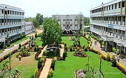
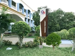
The primary and secondary school education is imparted by government, aided and private schools, under the School Education Department of the state.[28][29] The mediums of instruction followed by different schools are English and Telugu.
Taylor High School is one of the major landmarks in Narsapuram showcasing the Dutch and the British buildings. The high school was founded by British Educationist and local Revenue Officer H. Taylor in 1852, and was later named after him.[30] The 'manyam veerudu' (jungle hero) Alluri Sitarama Raju had his schooling in this institution before he led the Rampa rebellion against the British.[31] Chilakamarti Lakshmi Narasimham, a freedom fighter and a noted Telugu litterateur also attended the school.[32]
Swarnandhra College of Engineering and Technology, an affiliation to Jawaharlal Nehru Technological University of Kakinada,[33] Sri Yerramilli Narayanamurthy college which was established in 1949, J Beera School of Education, BGBS Women's and music college, Flaiz Adventist Degree college and Some Corporate colleges are some of the other professional colleges.[34]
Transport[edit | edit source]

Roadways[edit | edit source]
The town has a total road length of 79.67 km (49.50 mi).[35] The Andhra Pradesh State Road Transport Corporation operates bus services from Narasapuram bus station.[36] NH216 connects NH 16 near Ongole, a short route for Kolkata - Chennai route.
APSRTC operates Bus servies from Narasapuram to Eluru, Rajahmundry, Vijayawada, Visakhapatnam, Nidadavolu, Ramachandrapuram, Mandapeta, Palakollu, Hyderabad, kakinada, Ravulapalem, Machilipatanam, and Kaikaluru.
Railways[edit | edit source]
Narasapur railway station is a terminal station located on the Bhimavaram–Narasapur branch line of Bhimavaram -Nidadavolu loop line in South Coast Railway zone.
It is classified as a B–category station in South Coast Railway zone.[37]Kotipalli-Narsapuram railway line is the important railway project to the town.
Waterways[edit | edit source]
Narasapur Port is proposed for developing it as a minor port, fishing harbor and ONGC Jetty.[38]
Airways[edit | edit source]
Rajahmundry Airport is the nearest airport - 80 km away from the town.
Sports[edit | edit source]
Narsapuram Football Club is part of FLOW (Football League Of West Godavari).[39] National level Kabaddi competitions are held every year on the eve of Sankranti festival at Kabadi Stadium, Narsapur. All India level Seniors Tennis Tournament is held in Narsapur officers club every year.
See also[edit | edit source]
References[edit | edit source]
- ↑ "Municipalities, Municipal Corporations & UDAs" (PDF). Directorate of Town and Country Planning. Government of Andhra Pradesh. Archived from the original (PDF) on 5 March 2016. Retrieved 3 December 2015.
- ↑ 2.0 2.1 "District Census Handbook – West Godavari" (PDF). Census of India. pp. 22, 54. Retrieved 22 January 2016.
- ↑ 3.0 3.1 "Maps, Weather, and Airports for Narasapuram, India". fallingrain.com.
- ↑ 4.0 4.1 "Cities having population 1 lakh and above". The Registrar General & Census Commissioner, India. Retrieved 5 April 2015.
- ↑ "Mandal wise villages" (PDF). Revenue Department – AP Land. National Informatics Center. p. 9. Archived from the original (PDF) on 8 February 2015. Retrieved 10 November 2014.
- ↑ 6.0 6.1 "Guntur District Mandals" (PDF). Census of India. pp. 460, 470. Retrieved 19 January 2015.
- ↑ Nagaraja, G (10 October 2012). "Narsapur civic body set to get a voice". The Hindu. Narsapur. Retrieved 2 March 2015.
- ↑ Edgar Thurston (2011). The Madras Presidency with Mysore, Coorg and the Associated States (reissue ed.). Cambridge University Press. p. 25. ISBN 9781107600683. Retrieved 2 March 2015.
- ↑ "Handicraft exports jump 44 p.c. in November". The Hindu. New Delhi. 27 December 2009. Retrieved 8 May 2015.
- ↑ "Godavari Delta Women Lace Artisans Co-Operative Cottage Industrial Society Ltd., – Manufacturers and Exporters of Handmade Cotton Crochet Laces & Processed Cotton Made ups". gdwlace.com.
- ↑ "Layout page". areaprofiler.gov.in.
- ↑ Bowrey, Thomas (1895). Temple, Richard Carnac (ed.). A Geographical Account of Countries Round the Bay of Bengal, 1669 to 1679. Printed for the Hakluyt Society. p. 99.
- ↑ "Climatological Tables of Observatories in India 1991-2020" (PDF). India Meteorological Department. Retrieved 8 April 2024.
- ↑ "Chapter–3 (Literates and Literacy rate)" (PDF). Registrar General and Census Commissioner of India. Retrieved 1 September 2014.
- ↑ "About Narasapur Municipality | Narasapur Municipal Corporation". narasapur.cdma.ap.gov.in. Retrieved 27 June 2018.
- ↑ Chari, Pushpa (6 January 2011). "On a creative trip". The Hindu. Retrieved 3 December 2015.
- ↑ "International lace trade centre to be set up at Narsapuram in AP". The Hindu Business Line. 18 August 2012. Retrieved 11 October 2015.
- ↑ "ONGC". godavarimahapushkaram2015. Retrieved 16 May 2015.
- ↑ "CISF". Cntral Industrial Security Force. Retrieved 16 May 2015.
- ↑ "CMFRI". Central Marine Fisheries Institute. Retrieved 16 May 2015.
- ↑ "Pangodavari". pangodavari. Retrieved 16 May 2015.
- ↑ "List of Automatic Weather Stations (AWS)" (PDF). India Meteorological Department, AWS Lab. Pune, India. Archived from the original (PDF) on 4 March 2016. Retrieved 16 May 2015.
- ↑ Murali Sankar, K.N (23 July 2015). "Pulasa fishermen wait for Pushkaram to end". The Hindu. Retrieved 5 February 2016.
- ↑ Hyland, Paul (1994). Indian balm : travels amongst fakirs and firewarriors. London: TPP. p. 52. ISBN 1845110854. Retrieved 24 April 2015.
- ↑ "AP Tourism Blog – Written words last".
- ↑ "Sri Adikesava Perumal Brahmotsavams, Narsapur – Antaryami.net Sri Vaishnava Portal". indiamapped.com. Archived from the original on 13 May 2013.
- ↑ Puja Tripathy. "Perupalem Beach". Coastal Tourism India.
- ↑ "School Education Department" (PDF). School Education Department, Government of Andhra Pradesh. Archived from the original (PDF) on 27 December 2015. Retrieved 7 November 2016.
- ↑ "The Department of School Education – Official AP State Government Portal | AP State Portal". www.ap.gov.in. Archived from the original on 7 November 2016. Retrieved 7 November 2016.
- ↑ "A major landmark fallen on bad days". The Hindu. 1 May 2014. Retrieved 24 April 2015.
- ↑ "Alluri Sita Rama Raju Biography". Baynews. Retrieved 24 April 2015.
- ↑ Special Correspondent (30 April 2014). "A major landmark fallen on bad days". The Hindu.
{{cite news}}:|author=has generic name (help) - ↑ "Swarnandhra College of Engineering & Technology – Home". www.swarnandhra.ac.in. Retrieved 13 October 2015.
- ↑ "About us | Shri YN College". www.sriyncollege.org. Retrieved 13 October 2015.
- ↑ "Details of Roads in each ULB of Andhra Pradesh". Commissioner and Directorate of Municipal Administration. Municipal Administration and Urban Development Department – Government of Andhra Pradesh. Archived from the original on 1 August 2016. Retrieved 28 March 2017.
- ↑ "Bus Stations in Districts". Andhra Pradesh State Road Transport Corporation. Archived from the original on 22 March 2016. Retrieved 9 March 2016.
- ↑ "Divisional info" (PDF). Indian Railways. Retrieved 18 July 2015.
- ↑ "Department of Ports, Andhra Pradesh". apports.in.
- ↑ "FLOW". www.flow.football. Retrieved 18 February 2016.