

imported>Ira Leviton m Fixed a typo found with Wikipedia:Typo_Team/moss. |
No edit summary |
||
| Line 1: | Line 1: | ||
{{Use dmy dates|date=April 2018}} | {{Use dmy dates|date=April 2018}} | ||
{{Use Indian English|date=April 2018}} | {{Use Indian English|date=April 2018}} | ||
{{About|the town in Uttar Pradesh, India|Scottish band|RURA (band)}} | |||
<!-- See [[Wikipedia:WikiProject Indian cities]] for details -->{{Infobox settlement | <!-- See [[Wikipedia:WikiProject Indian cities]] for details -->{{Infobox settlement | ||
| name = Rura | | name = Rura | ||
| Line 56: | Line 57: | ||
}} | }} | ||
'''Rura''' is a [[Nagar Panchayat]] in [[Kanpur Dehat District]] in [[Uttar Pradesh]] [[States and territories of India|state]] of the [[India]]. The town is situated on the banks of Lower Ganga canal. The district headquarters is 15 km away at [[Kanpur Dehat district|Mati]]. | '''Rura''' is a [[Nagar Panchayat]] in [[Kanpur Dehat District]] in [[Uttar Pradesh]] [[States and territories of India|state]] of the [[India]]. The town is situated on the banks of Lower Ganga canal. The district headquarters is 15 km away at [[Kanpur Dehat district|Mati]]. | ||
The town is located at a distance of 49 km from famous industrial and educational hub of [[ | The town is located at a distance of 49 km from famous industrial and educational hub of [[Kanpur Nagar]]. | ||
== Education== | == Education== | ||
| Line 75: | Line 76: | ||
==Transport== | ==Transport== | ||
'''Rura <ref>http://www.jagran.com/uttar-pradesh/kanpur-city-13292589.html</ref> Railway Station''' is on the Delhi-Howrah rail route. It is a major station between Etawah and Kanpur central. It lies on the North Central railway zone. | '''Rura <ref>{{Cite web|url=http://www.jagran.com/uttar-pradesh/kanpur-city-13292589.html|title = कालपी-रूरा समेत कई स्टेशन 'आदर्श' श्रेणी में}}</ref> Railway Station''' is on the Delhi-Howrah rail route. It is a major station between Etawah and Kanpur central. It lies on the North Central railway zone. | ||
To the east, [[Roshan Mau]] Halt Station (8 km) is the nearest station. Going west, [[Ambiyapur]] (9 km) is the next station. | To the east, [[Roshan Mau]] Halt Station (8 km) is the nearest station. Going west, [[Ambiyapur]] (9 km) is the next station. | ||
Kanpur Central Railway Station is the nearest major railway station. | Kanpur Central Railway Station is the nearest major railway station. | ||
| Line 95: | Line 96: | ||
==Demographics== | ==Demographics== | ||
{{As of|2001}} India [[census]],<ref>{{cite web|url=http://www.censusindia.net/results/town.php?stad=A&state5=999|archiveurl=https://web.archive.org/web/20040616075334/http://www.censusindia.net/results/town.php?stad=A&state5=999|archivedate=2004-06-16|title= Census of India 2001: Data from the 2001 Census, including cities, villages and towns | {{As of|2001}} India [[census]],<ref>{{cite web|url=http://www.censusindia.net/results/town.php?stad=A&state5=999|archiveurl=https://web.archive.org/web/20040616075334/http://www.censusindia.net/results/town.php?stad=A&state5=999|archivedate=2004-06-16|title= Census of India 2001: Data from the 2001 Census, including cities, villages and towns (Provisional)|accessdate=2008-11-01|publisher= Census Commission of India}}</ref> Rura had a population of 35,206. Males constitute 53% of the population and females 47%. Rura has an average literacy rate of 70%, lower than the national average of 75%: male literacy is 75%, and female literacy is 65%. In Rura, 14% of the population is under 6 years of age. | ||
==Gallery== | ==Gallery== | ||
Revision as of 22:56, 4 November 2021
Rura | |
|---|---|
Town | |
  Rura Location in Uttar Pradesh, India | |
| Coordinates: 26°29′N 79°54′E / 26.48°N 79.9°E | |
| Country |  India India |
| State | Uttar Pradesh |
| District | Kanpur Dehat |
| Government | |
| • Chairman | Rama Devi |
| Elevation | 127 m (417 ft) |
| Population (2001) | |
| • Total | 15,206 |
| Languages | |
| • Official | Hindi |
| Time zone | UTC+5:30 (IST) |
| PIN | 209303 |
| Website | www |
Rura is a Nagar Panchayat in Kanpur Dehat District in Uttar Pradesh state of the India. The town is situated on the banks of Lower Ganga canal. The district headquarters is 15 km away at Mati. The town is located at a distance of 49 km from famous industrial and educational hub of Kanpur Nagar.
Education
- R P S Inter College
- C.D.Girls Inter College
- Pt.O.P.Sharma Degree College.
- Janka Devi Degree College
Places of interest
- Waneshwar Mahadev Temple[1]
- Parhul Devi Temple (Lamahra)[1]
- Durga Temple (city heart)
- Patha Mai Temple
- Bala ji Temple (Dhanirampur-Rura)
- Shiv Bajrang Dham Kishunpur
- Bajrang Temple Tanki Talab
Transport
Rura [2] Railway Station is on the Delhi-Howrah rail route. It is a major station between Etawah and Kanpur central. It lies on the North Central railway zone. To the east, Roshan Mau Halt Station (8 km) is the nearest station. Going west, Ambiyapur (9 km) is the next station. Kanpur Central Railway Station is the nearest major railway station. Rura Bus Stand : Rura bus stand is situated at Akbarpur Road and Derapur Road meet point. People can get bus for Akbarpur, Raniya, Fazalganj, Ramadevi and Galuwapur, Derapur Route. Bus is also available to Mangalpur via Derapur, Nonari & Dilval.
Another bus stand at canal bridge, From where people may get bus to Sheoli, Kalyanpur & Kanpur, and other route to Billhaur via Jhinjhak, Rasulabad and another to Bilhaur via Banipara, Minda ka Kunwa. Besides passenger trains following are main trains: Main Express Trains
- Gomti Express (super fast).
- Agra-Lucknow Intercity Express (super fast).
- Rourkela/Tata Nagar Jammu Tawi Muri Express .
- Unchahar Express .
- Sangam Express (up) .
- Toofan Express.
- Mahananda Express.
Geography
Rura is located at 26°29′N 79°54′E / 26.48°N 79.9°E.[3] It has an average elevation of 127 metres (416 feet).
Demographics
As of 2001[update] India census,[4] Rura had a population of 35,206. Males constitute 53% of the population and females 47%. Rura has an average literacy rate of 70%, lower than the national average of 75%: male literacy is 75%, and female literacy is 65%. In Rura, 14% of the population is under 6 years of age.
Gallery
-
 Parhul Devi Temple (west view)
 -
 Durga Temple of town Rura
 -
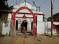 Waneshwar Mahadev Mandir
 -
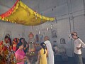 Waneshwar Mahadev Mandir (worshipping view)
 -
 20150111 163801 Temples in India
 -
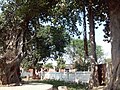 Banyan tree (Shiv Bjrag Dham, Kishunpur )
 -
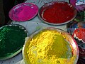 Holi -Holi
 -
 Railway Corridor
 -
 R P S Inter College Rura
 -
 C D Girls Inter College
 -
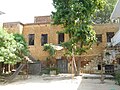 Ruins residence of Social Activist Babu Ram Prasad Shukla
.jpg)


.JPG)

%3D%3D.jpg)


References
- ↑ 1.0 1.1 http://kanpurdehat.nic.in/f_profile.html
- ↑ "कालपी-रूरा समेत कई स्टेशन 'आदर्श' श्रेणी में".
- ↑ Falling Rain Genomics, Inc - Rura
- ↑ "Census of India 2001: Data from the 2001 Census, including cities, villages and towns (Provisional)". Census Commission of India. Archived from the original on 16 June 2004. Retrieved 1 November 2008.