


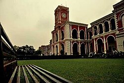

Created page with "thumb|A Hindu temple by the railway station '''Raipur''' is the capital city of the Indian state of Chhattisgarh.<ref name="Husain">{{cite book|a..." |
Fix error |
||
| Line 1: | Line 1: | ||
[[ | {{Infobox settlement | ||
| name = Raipur | |||
| native_name = | |||
| native_name_lang = | |||
| settlement_type = Village | |||
| pushpin_map = | |||
| pushpin_map_caption = | |||
| coordinates = | |||
| subdivision_type = Country | |||
| subdivision_name = [[India]] | |||
| subdivision_type1 = [[States and territories of India|State]] | |||
| subdivision_name1 = [[Maharashtra]] | |||
| subdivision_type2 = [[List of districts of India|District]] | |||
| subdivision_name2 = [[Nandurbar]] | |||
| subdivision_type3 = Tehsil | |||
| subdivision_name3 = [[Nawapur]] | |||
| government_type = [[Panchayati raj (India)|Panchayat raj]] | |||
| governing_body = [[Gram panchayat]] | |||
| unit_pref = Metric | |||
<!-- ALL fields with measurements have automatic unit conversion --> | |||
<!-- for references: use <ref>tags --> | |||
| elevation_m = | |||
| population_as_of = 2009 | |||
| population_blank1_title = Total Households | |||
| population_blank1 = 385 | |||
| population_blank2_title = Village code | |||
| population_blank2 = 525820 | |||
| population_footnotes = | |||
| population_total = 1618 | |||
| population_density_km2 = auto | |||
| population_note = | |||
| population_demonym = | |||
| demographics_type1 = Languages | |||
| demographics1_title1 = Official | |||
| demographics1_info1 = Marathi | |||
| demographics1_title2 = | |||
| demographics1_info2 = | |||
| timezone1 = [[Indian Standard Time|IST]] | |||
| utc_offset1 = +5:30 | |||
| postal_code_type = | |||
| postal_code = | |||
| area_total_ha = 70 | |||
| area_code_type = | |||
| area_code = | |||
| registration_plate = | |||
| iso_code = IN-MH | |||
| blank1_name_sec2 = | |||
| blank1_info_sec2 = | |||
| website = | |||
| footnotes = | |||
}} | |||
'''Raipur''' is a village in [[Nawapur]] in [[Nandurbar district]] of [[Maharashtra]] [[States and territories of India|State]], India. It is located {{convert|10|km}} from sub district headquarter and {{convert|70|km}} from district headquarter. The village is [[Administration (government)|administrated]] by [[Sarpanch]] an elected representative of the village as per [[Panchayati raj (India)]]. <ref name="census">{{cite web | url=https://censusindia.gov.in/2011census/dchb/DCHB_Village_Release_2700.xlsx | title=District Census Hand Book | work=indiapost.gov.in}}</ref> | |||
==References== | == Demography == | ||
As of 2009, The village has a total number of 385 houses and the population of 1618 of which 812 are males while 806 are females.According to the report [[published]] by [[Census India]] in 2011, out of the total population of the village 925 people are from [[Scheduled Castes and Scheduled Tribes|Schedule Caste]] and the village does not have any [[Scheduled Castes and Scheduled Tribes|Schedule Tribe]] population so far.<ref name="census" /> | |||
==See also== | |||
*[[List of villages in India]] | |||
== References == | |||
{{reflist}} | {{reflist}} | ||
[[Category: | [[Category:Villages in Nandurbar district]] | ||
{{geo-stub}} | |||

Revision as of 23:21, 5 March 2021
Raipur | |
|---|---|
Village | |
| Country | India |
| State | Maharashtra |
| District | Nandurbar |
| Tehsil | Nawapur |
| Government | |
| • Type | Panchayat raj |
| • Body | Gram panchayat |
| Area | |
| • Total | 70 ha (170 acres) |
| Population (2009) | |
| • Total | 1,618 |
| • Density | 2,300/km2 (6,000/sq mi) |
| • Total Households | 385 |
| • Village code | 525,820 |
| Languages | |
| • Official | Marathi |
| Time zone | UTC+5:30 (IST) |
| ISO 3166 code | IN-MH |
Raipur is a village in Nawapur in Nandurbar district of Maharashtra State, India. It is located 10 kilometres (6.2 mi) from sub district headquarter and 70 kilometres (43 mi) from district headquarter. The village is administrated by Sarpanch an elected representative of the village as per Panchayati raj (India). [1]
Demography
As of 2009, The village has a total number of 385 houses and the population of 1618 of which 812 are males while 806 are females.According to the report published by Census India in 2011, out of the total population of the village 925 people are from Schedule Caste and the village does not have any Schedule Tribe population so far.[1]
See also
References
- ↑ 1.0 1.1 "District Census Hand Book". indiapost.gov.in.
 | This article about a geographical location is a stub. You can help Bharatpedia by expanding it. |