
m robot: Update article (please report if you notice any mistake or error in this edit) |
Adityagoel (talk | contribs) fix structure for clarity and updated info |
||
| Line 1: | Line 1: | ||
{{Short description|British Indian political agency}} | |||
{{Use dmy dates|date=January 2020}} | {{Use dmy dates|date=January 2020}} | ||
{{EngvarB|date=January 2020}} | {{EngvarB|date=January 2020}} | ||
| Line 39: | Line 40: | ||
The native states came under British [[subsidiary alliance]]s after the [[Third Anglo-Maratha War]] of the early 19th century.<ref>''Historical Sketch of the Native States of India.'' 1875</ref> | The native states came under British [[subsidiary alliance]]s after the [[Third Anglo-Maratha War]] of the early 19th century.<ref>''Historical Sketch of the Native States of India.'' 1875</ref> | ||
The total surface was 4,971.75 square miles, comprising 3,412 villages, with a population of 479,055, yielding 2,072,026 | The total surface was 4,971.75 square miles, comprising 3,412 villages, with a population of 479,055, yielding 2,072,026 Rupees state revenue and paying 147,826 Rupees tribute (mostly to the Gaikwar [[Baroda State]]). | ||
In 1937 the princely states of the Rewa Kantha Agency were merged with [[Baroda State]] in order to form the [[Baroda and Gujarat States Agency]],<ref>[http://www.hubert-herald.nl/BhaGujarat1.htm History of the State of Gujarat]</ref> which in turn merged in 1944 with the [[Western India States Agency]] as [[Baroda, Western India and Gujarat States Agency]]. | In 1937 the princely states of the Rewa Kantha Agency were merged with [[Baroda State]] in order to form the [[Baroda and Gujarat States Agency]],<ref>[http://www.hubert-herald.nl/BhaGujarat1.htm History of the State of Gujarat]</ref> which in turn merged in 1944 with the [[Western India States Agency]] as [[Baroda, Western India and Gujarat States Agency]]. | ||
| Line 59: | Line 60: | ||
* [[Balasinor State|Balasinor]], Second Class, title Nawab, Hereditary salute of 9-guns | * [[Balasinor State|Balasinor]], Second Class, title Nawab, Hereditary salute of 9-guns | ||
* [[Sant State|Sant (Sunth)]] (Rampur), Second Class, title Maharana, Hereditary salute of 9-guns | * [[Sant State|Sant (Sunth)]] (Rampur), Second Class, title Maharana, Hereditary salute of 9-guns | ||
* [[Chhota Udaipur State|Chhota Udepur]], First Class, title Maharaja Maharawal, Hereditary Salute of 11 - guns | |||
* Chhota Udepur, First Class, title Maharaja Maharawal, Hereditary Salute of 11 - guns | |||
Non-salute states : | Non-salute states : | ||
| Line 77: | Line 75: | ||
* [[Mandva|Mandwa]], Third Class (personal) / Fourth Class | * [[Mandva|Mandwa]], Third Class (personal) / Fourth Class | ||
*[[Gad Boriad State|Gad Boriad]], Third Class (personal) / Fourth Class | *[[Gad Boriad State|Gad Boriad]], Third Class (personal) / Fourth Class | ||
* [[Shanor]], Fourth Class | * [[Shanor State|Shanor]], Fourth Class | ||
*[[Vajiria State|Vajiria]], Fourth Class | *[[Vajiria State|Vajiria]], Fourth Class | ||
*[[Vanala State|Vanmala]], Fourth Class (personal) / Fifth Class | *[[Vanala State|Vanmala]], Fourth Class (personal) / Fifth Class | ||
* [[Nangam]], Fifth Class | * [[Nangam State|Nangam]], Fifth Class | ||
* [[ | * [[Uchad State|Uchad]], | ||
* [[Agar, Gujarat|Agar]], | * [[Agar, Gujarat|Agar]], | ||
*[[Palasni State|Palasni]], | *[[Palasni State|Palasni]], | ||
* [[Khareda]], | |||
* [[Borkhad]], | |||
* [[Bhilodia]] : | * [[Bhilodia]] : | ||
**[[Bhilodia|Motisinghji]], | **[[Bhilodia|Motisinghji]], | ||
**[[Bhilodia|Chhatarsinghji]], | **[[Bhilodia|Chhatarsinghji]], | ||
* [[Vasan Virpur]], | * [[Vasan Virpur State|Vasan Virpur]], | ||
* [[Vora | * [[Vora State|Vora]], | ||
* [[Vasan Sewada]], | * [[Vasan Sewada State|Vasan Sewada]], | ||
* [[Virampura State|Virampura]] | |||
* [[Alwa Mehwa|Alwa]], | * [[Alwa Mehwa|Alwa]], | ||
* [[Chorangla]], | * [[Chorangla State]], | ||
* [[ | * [[Sindhiapura State|Sindhiapura]], | ||
* [[Bihora]], | * [[Bihora State]], | ||
* [[Vadia (Narmada)|Vadia]] (Virampura), | * [[Vadia (Narmada)|Vadia]] (Virampura), | ||
* [[Dudhpur]], | * [[Dudhpur]], | ||
* [[Rampura | * [[Rampura State|Rampura]], | ||
* [[Jiral Kamsoli]], | * [[Jiral Kamsoli]], | ||
* [[Chudesar]], | * [[Chudesar State]], | ||
* [[Pantalavdi]] : | * [[Pantalavdi]] : | ||
** [[Akbar Khan Mehwa|Akbar Khan]], | ** [[Akbar Khan Mehwa|Akbar Khan]], | ||
** [[Kesar Khan]], | ** [[Kesar Khan]], | ||
* [[ | * [[Rengan State|Rengan]], | ||
* [[Nalia]], | * [[Nalia State|Nalia]], | ||
* [[Nasvadi State|Nasvadi]] | |||
==== Pandu ==== | ==== Pandu ==== | ||
| Line 110: | Line 111: | ||
* [[Bhadarwa]], Third Class | * [[Bhadarwa]], Third Class | ||
* [[Umetha]], Third (personal) / Fourth Class | * [[Umetha State|Umetha]], Third (personal) / Fourth Class | ||
* [[Sihora]] | * [[Sihora State (Gujarat)|Sihora (Gujarat)]] Fourth Class | ||
* [[Pandu State|Pandu]], Fifth Class | * [[Pandu State|Pandu]], Fifth Class | ||
* [[Chhaliar]], | * [[Chhaliar State]], | ||
* [[Mevli]], | * [[Mevli State|Mevli]], | ||
* [[Kanoda]] , | * [[Kanoda State|Kanoda]], | ||
* [[Poicha]], | * [[Poicha State|Poicha]], | ||
* [[Dhari | * [[Dhari State|Dhari]], | ||
* [[Itwad]], | * [[Itwad State|Itwad]], | ||
* [[Gotardi]], | * [[Gotardi State|Gotardi]], | ||
* [[Litter Gothda]], | * [[Litter Gothda State]], | ||
* [[Amrapur | * [[Amrapur State (Rewa Kantha)|Amrapur]], | ||
* [[Vakhtapur (Rewa Kantha)|Vakhtapur]], | * [[Vakhtapur (Rewa Kantha)|Vakhtapur]], | ||
* [[Jesar]], | * [[Jesar State|Jesar]], | ||
* [[Moka | * [[Moka Paginu Muvadu State|Moka Paginu Muvadu]], | ||
* [[ | * [[Kasla Paginu Muvadu State|Kasla Paginu Muvadu]], | ||
* [[Rajpur State (Rewa Kantha)|Rajpur]], | * [[Rajpur State (Rewa Kantha)|Rajpur]], | ||
* [[Moti Varnol]], | * [[Moti Varnol]], | ||
* [[Jumkha]], | * [[Nahara State|Nahara]] | ||
* [[Jumkha State|Jumkha]], | |||
* [[Nani Varnol]], | * [[Nani Varnol]], | ||
* [[Varnolmal]], | * [[Varnolmal]], | ||
| Line 134: | Line 136: | ||
; the Dorka (e)states | ; the Dorka (e)states | ||
* [[ | * [[Dodka State|Dodka]], | ||
* [[Angadh]], | * [[Angadh]], | ||
* [[Rayka Mehwa|Rayka (Raika)]], | * [[Rayka Mehwa|Rayka (Raika)]], | ||
| Line 171: | Line 173: | ||
== Sources and external links == | == Sources and external links == | ||
* [https://dsal.uchicago.edu/reference/gazetteer/pager.html?objectid=DS405.1.I34_V21_296.gif Imperial Gazetteer, on DSAL - Rewa Kantha Agency] | * [https://dsal.uchicago.edu/reference/gazetteer/pager.html?objectid=DS405.1.I34_V21_296.gif Imperial Gazetteer, on DSAL - Rewa Kantha Agency] {{Webarchive|url=https://web.archive.org/web/20201128015056/https://dsal.uchicago.edu/reference/gazetteer/pager.html?objectid=DS405.1.I34_V21_296.gif |date=28 November 2020 }} | ||
{{Princely states of the Baroda and Gujarat States Agency}} | {{Princely states of the Baroda and Gujarat States Agency}} | ||
Latest revision as of 17:32, 8 December 2025
| Rewa Kantha Agency | |||||||
|---|---|---|---|---|---|---|---|
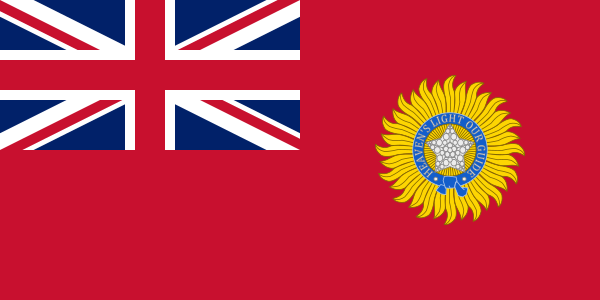
| Agency of British India | |||||||
| 1811–1937 | |||||||
 Rewa Kantha Agency within Gujarat | |||||||
| Area | |||||||
• 1901 | 12,877 km2 (4,972 sq mi) | ||||||
| Population | |||||||
• 1901 | 479065 | ||||||
| History | |||||||
| History | |||||||
• Established | 1811 | ||||||
• Formation of the Baroda and Gujarat States Agency | 1937 | ||||||
| |||||||


| Princely state |
|---|
| Individual residencies |
| Agencies |
| Lists |
Rewa Kantha was a political agency of British India, managing the relations (indirect rule) of the British government's Bombay Presidency with a collection of princely states. It stretched for about 150 miles between the plain of Gujarat and the hills of Malwa, from the Tapti River to the Mahi River crossing the Rewa (or Narmada) River, from which it takes its name.[1][2]
The political agent, who was also District collector of the prant (British District) of the Panchmahal, resided at Godhra.
History[edit | edit source]
The native states came under British subsidiary alliances after the Third Anglo-Maratha War of the early 19th century.[3]
The total surface was 4,971.75 square miles, comprising 3,412 villages, with a population of 479,055, yielding 2,072,026 Rupees state revenue and paying 147,826 Rupees tribute (mostly to the Gaikwar Baroda State).
In 1937 the princely states of the Rewa Kantha Agency were merged with Baroda State in order to form the Baroda and Gujarat States Agency,[4] which in turn merged in 1944 with the Western India States Agency as Baroda, Western India and Gujarat States Agency.
After the Independence of British India in 1947, split into India and Pakistan, the rulers of the states all agreed to accede to the Government of India and were integrated into Bombay State. Bombay state was split along linguistic lines in 1960, and Rewa Kantha became part of Gujarat, like Saurashtra State.
Princely States[edit | edit source]
The number of separate states was 61,[2] mostly minor or petty states except for five. Many of them were under British influence; the largest one was Rajpipla.[2][5]
The Agency also dealt with five first-class states named Chhota Udaipur State, Devgadh Bariya State, Santrampur, Lunawada State and Balasinor State. The total area of the states the agency related to was 12,877 km2 (4,972 sq mi). In 1901 their population was 479,065. Many of the inhabitants were Bhils and Kolis.[6]
Rewa Kantha division[edit | edit source]
(includes all the main states; in direct relations with the Political Agent at Godhra)
- Rajpipla (Nandod), First Class, title Maharaja, Hereditary salute of 13-guns
- Bari(y)a (Devgadh), Second Class, title Maharaol, Hereditary salute of 9-guns (11-guns personal)
- Lunavada, Second Class, title Maharana, Hereditary salute of 9-guns
- Balasinor, Second Class, title Nawab, Hereditary salute of 9-guns
- Sant (Sunth) (Rampur), Second Class, title Maharana, Hereditary salute of 9-guns
- Chhota Udepur, First Class, title Maharaja Maharawal, Hereditary Salute of 11 - guns
Non-salute states :
- Kadana, Third Class
- Sanjeli, Third Class
- Jambughoda (Narukot), Third Class
Mehwas[edit | edit source]
Only non-salute states: two geographical groups of minor or petty rural (e)states
Sankheda[edit | edit source]
(near Narmada River)
- Mandwa, Third Class (personal) / Fourth Class
- Gad Boriad, Third Class (personal) / Fourth Class
- Shanor, Fourth Class
- Vajiria, Fourth Class
- Vanmala, Fourth Class (personal) / Fifth Class
- Nangam, Fifth Class
- Uchad,
- Agar,
- Palasni,
- Khareda,
- Borkhad,
- Bhilodia :
- Vasan Virpur,
- Vora,
- Vasan Sewada,
- Virampura
- Alwa,
- Chorangla State,
- Sindhiapura,
- Bihora State,
- Vadia (Virampura),
- Dudhpur,
- Rampura,
- Jiral Kamsoli,
- Chudesar State,
- Pantalavdi :
- Rengan,
- Nalia,
- Nasvadi
Pandu[edit | edit source]
(near Mahi River; all paying tribute to the Gaekwar Baroda State):
- Bhadarwa, Third Class
- Umetha, Third (personal) / Fourth Class
- Sihora (Gujarat) Fourth Class
- Pandu, Fifth Class
- Chhaliar State,
- Mevli,
- Kanoda,
- Poicha,
- Dhari,
- Itwad,
- Gotardi,
- Litter Gothda State,
- Amrapur,
- Vakhtapur,
- Jesar,
- Moka Paginu Muvadu,
- Kasla Paginu Muvadu,
- Rajpur,
- Moti Varnol,
- Nahara
- Jumkha,
- Nani Varnol,
- Varnolmal,
- Angadh,
- the Dorka (e)states
Fiscal Stamps[edit | edit source]
In addition to those of Rewa Kantha Agency itself, revenue and/or court fee stamps were issued for the following native states :
- in the Rewa Kantha Division (all)
- Rajpipla
- Balasinor
- Baria
- Lunavada
- Sant
- Chhota Udaipur
- Jambughoda
- Kadana
- Sanjeli
- in the Sankheda Mehwas (only these)
- Gad Boriad
- Naswadi
- Shanor
- Vajiria
- in the Pandu Mehwas (only these)
- Bhadarva
- Pandu Mewas
- Umeta
- Bakrol (Boru)
See also[edit | edit source]
References[edit | edit source]
- ↑ "Gazetteer of the Bombay Presidency"
- ↑ 2.0 2.1 2.2 Chisholm, Hugh, ed. (1911). . Encyclopædia Britannica. Vol. 23 (11th ed.). Cambridge University Press. p. 225.
- ↑ Historical Sketch of the Native States of India. 1875
- ↑ History of the State of Gujarat
- ↑ Princely States within the Rewa Kantha Agency (1901)
- ↑ "The Rewakantha directory"
Sources and external links[edit | edit source]
- Imperial Gazetteer, on DSAL - Rewa Kantha Agency Archived 28 November 2020 at the Wayback Machine

