Anjad: Difference between revisions
imported>Gotam502 No edit summary |
No edit summary |
||
| (One intermediate revision by one other user not shown) | |||
| Line 7: | Line 7: | ||
| other_name = <!-- Please do not add any Indic script in this infobox, per WP:INDICSCRIPT policy. --> | | other_name = <!-- Please do not add any Indic script in this infobox, per WP:INDICSCRIPT policy. --> | ||
| nickname = | | nickname = | ||
| settlement_type = | | settlement_type = City | ||
| image_skyline = | | image_skyline = | ||
| image_alt = | | image_alt = | ||
| Line 52: | Line 52: | ||
| footnotes = | | footnotes = | ||
}} | }} | ||
'''Anjad''' is a | '''Anjad''' is a City and a [[Tehsil]] in [[Barwani district]] in the state of [[Madhya Pradesh]], [[India]]. | ||
==Geography== | ==Geography== | ||
| Line 59: | Line 59: | ||
==Demographics== | ==Demographics== | ||
{{As of|2001}} India [[census]],<ref>{{cite web|url=http://www.censusindia.net/results/town.php?stad=A&state5=999|archive-url=https://web.archive.org/web/20040616075334/http://www.censusindia.net/results/town.php?stad=A&state5=999|archive-date=2004-06-16|title= Census of India 2001: Data from the 2001 Census, including cities, villages and towns (Provisional)|access-date=2008-11-01|publisher= Census Commission of India}}</ref> Anjad had a population of 22,890. | {{As of|2001}} India [[census]],<ref>{{cite web|url=http://www.censusindia.net/results/town.php?stad=A&state5=999|archive-url=https://web.archive.org/web/20040616075334/http://www.censusindia.net/results/town.php?stad=A&state5=999|archive-date=2004-06-16|title= Census of India 2001: Data from the 2001 Census, including cities, villages and towns (Provisional)|access-date=2008-11-01|publisher= Census Commission of India}}</ref> Anjad had a population of 22,890. | ||
==References== | ==References== | ||
Latest revision as of 12:04, 28 December 2021
This article needs additional citations for verification. (June 2021) |
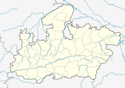
Anjad is a City and a Tehsil in Barwani district in the state of Madhya Pradesh, India.
Anjad | |
|---|---|
City | |
| Coordinates: 22°02′N 75°03′E / 22.03°N 75.05°ECoordinates: 22°02′N 75°03′E / 22.03°N 75.05°E | |
| Country | |
| State | Madhya Pradesh |
| District | Barwani |
| Population (2001) | |
| • Total | 22,890 |
| Languages | |
| • Official | Hindi |
| Time zone | UTC+5:30 (IST) |
| ISO 3166 code | IN-MP |
| Vehicle registration | MP 46 |
GeographyEdit
Anjad is located in the Narmada Valley, at 22°02′N 75°03′E / 22.03°N 75.05°E.[1] It has an average elevation of 151 metres (495 feet).
DemographicsEdit
As of 2001[update] India census,[2] Anjad had a population of 22,890.
ReferencesEdit
- ↑ "Maps, Weather, and Airports for Anjad, India". fallingrain.com.
- ↑ "Census of India 2001: Data from the 2001 Census, including cities, villages and towns (Provisional)". Census Commission of India. Archived from the original on 16 June 2004. Retrieved 1 November 2008.

