.svg)
Dhak Bahiri: Difference between revisions
>GoingBatty (→top: Expanded Template:Notability and general fixes) |
m (robot: Create/update articles. If there is a mistake please report on my talk page.) |
||
| Line 10: | Line 10: | ||
==Inside the cave== | ==Inside the cave== | ||
Water from the rock face drains into a cistern in the cave. There is room inside for 15 - 20 people to camp overnight. The local village maintains a supply of utensils and cookware on hand for use by | Water from the rock face drains into a cistern in the cave. There is room inside for 15 - 20 people to camp overnight. The local village maintains a supply of utensils and cookware on hand for use by campers.<ref>{{Cite web|url=http://www.kokansearch.com/forts/english/forts_in_raigad/dhak_bahiri/|title=Dhak-Bahiri fort wadhap | forts in raigad | kokan | trekking|website=www.kokansearch.com}}</ref> | ||
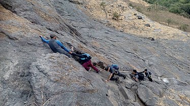
[[File:Dhakbahiri7.jpg|thumb|The final climb]] | [[File:Dhakbahiri7.jpg|thumb|The final climb]] | ||
Latest revision as of 06:53, 14 April 2022
This article has multiple issues. Please help improve it or discuss these issues on the talk page. (Learn how and when to remove these template messages)
|
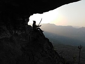
Dhak Bahiri is a cave in the Sahyadri hill range, situated near the village Jambhivli off village-Malavali in the Pune district of India. It was used by pilgrims and sages for the pilgrimage to the god Bahiri.[citation needed]
Location[edit]
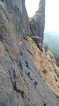
The nearest col to the cave sits at the end of a 1-hour hike along a trail leading out of Jambhivli. From there, the terrain rises into the Dhak and Kalakrai peak. Reaching the cave requires ascending the col and walking along the scarp, followed by a 30' vertical ascent.
Inside the cave[edit]
Water from the rock face drains into a cistern in the cave. There is room inside for 15 - 20 people to camp overnight. The local village maintains a supply of utensils and cookware on hand for use by campers.[1]

Gallery[edit]

Dhak fort
The cole between Dhak and kalakrai pinnacle
The vertical climb

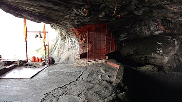
The Bahiri cave
Water cistern in the cave
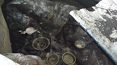
The utensils dipped in water

Dhak fort and the pinnacle
JAI SHIVRAI


References[edit]
- ↑ "Dhak-Bahiri fort wadhap | forts in raigad | kokan | trekking". www.kokansearch.com.
External links[edit]
Coordinates: 18°52′29.6″N 73°25′42″E / 18.874889°N 73.42833°E
This article about a location in Pune district is a stub. You can help Wikipedia by expanding it. |