Nikari: Difference between revisions
->Citation bot (Alter: pages. Formatted dashes. | Use this bot. Report bugs. | Suggested by Abductive | #UCB_webform 2026/2200) |
CleanupBot (talk | contribs) m (→top: clean up) |
||
| Line 51: | Line 51: | ||
| footnotes = | | footnotes = | ||
}} | }} | ||
'''Nikari''' is a village in [[Sandi, Uttar Pradesh|Sandi]] block of [[Hardoi district]], [[Uttar Pradesh]], [[India]].<ref name="Census 2011">{{cite web |title=Census of India 2011: Uttar Pradesh District Census Handbook - Hardoi, Part A (Village and Town Directory) |pages=231–55|url=https://censusindia.gov.in/2011census/dchb/DCHB_A/09/0924_PART_A_DCHB_HARDOI.pdf |website=Census 2011 India|access-date=5 June 2021}}</ref> It is located | '''Nikari''' is a village in [[Sandi, Uttar Pradesh|Sandi]] block of [[Hardoi district]], [[Uttar Pradesh]], [[India]].<ref name="Census 2011">{{cite web |title=Census of India 2011: Uttar Pradesh District Census Handbook - Hardoi, Part A (Village and Town Directory) |pages=231–55|url=https://censusindia.gov.in/2011census/dchb/DCHB_A/09/0924_PART_A_DCHB_HARDOI.pdf |website=Census 2011 India|access-date=5 June 2021}}</ref> It is located 8 km away from Sandi, which is the nearest city.<ref name="Census 1981">{{cite book |title=Census 1981 Uttar Pradesh: District Census Handbook Part XIII-A: Village & Town Directory, District Hardoi |date=1982 |pages=176–7 |url=http://lsi.gov.in:8081/jspui/bitstream/123456789/1229/1/27831_1981_HAR.pdf |access-date=5 June 2021}}</ref> The village has one [[primary school]],<ref name="Census 2011"/> and the main staple crops are wheat and rice.<ref name="Census 1981"/> As of 2011, the population of Nikari is 1,878, in 283 households.<ref name="Census 2011"/> | ||
The [[1961 Census of India|1961 census]] recorded Nikari as comprising 3 hamlets, with a total population of 607 (312 male and 295 female), in 110 households and 91 physical houses.<ref name="Census 1961">{{cite book |title=Census 1961: District Census Handbook, Uttar Pradesh (36 - Hardoi District) |date=1965 |location=Lucknow |pages=158, xciv-xcv of section "Bilgram Tahsil" |url=http://lsi.gov.in:8081/jspui/bitstream/123456789/987/1/22855_1961_HAR.pdf |access-date=5 June 2021}}</ref> The area of the village was given as 470 [[acre]]s.<ref name="Census 1961"/> | The [[1961 Census of India|1961 census]] recorded Nikari as comprising 3 hamlets, with a total population of 607 (312 male and 295 female), in 110 households and 91 physical houses.<ref name="Census 1961">{{cite book |title=Census 1961: District Census Handbook, Uttar Pradesh (36 - Hardoi District) |date=1965 |location=Lucknow |pages=158, xciv-xcv of section "Bilgram Tahsil" |url=http://lsi.gov.in:8081/jspui/bitstream/123456789/987/1/22855_1961_HAR.pdf |access-date=5 June 2021}}</ref> The area of the village was given as 470 [[acre]]s.<ref name="Census 1961"/> | ||
Latest revision as of 12:53, 11 December 2022
Nikari
Nikāri | |
|---|---|
Populated place | |
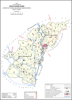
 Map showing Nikari (#860) in Sandi CD block | |
| Coordinates: 27°17′17″N 79°53′19″E / 27.288134°N 79.888502°ECoordinates: 27°17′17″N 79°53′19″E / 27.288134°N 79.888502°E[1] | |
| Country | |
| State | Uttar Pradesh |
| District | Hardoi |
| Area | |
| • Total | 1.857 km2 (0.717 sq mi) |
| Population (2011)[2] | |
| • Total | 1,878 |
| • Density | 1,000/km2 (2,600/sq mi) |
| Languages | |
| • Official | Hindi |
| Time zone | UTC+5:30 (IST) |
Nikari is a village in Sandi block of Hardoi district, Uttar Pradesh, India.[2] It is located 8 km away from Sandi, which is the nearest city.[3] The village has one primary school,[2] and the main staple crops are wheat and rice.[3] As of 2011, the population of Nikari is 1,878, in 283 households.[2]
The 1961 census recorded Nikari as comprising 3 hamlets, with a total population of 607 (312 male and 295 female), in 110 households and 91 physical houses.[4] The area of the village was given as 470 acres.[4]
The 1981 census recorded Nikari as having a population of 915, in 158 households, and covering an area of 185.75 hectares.[3]
References[edit]
- ↑ Search for "Nikari" here https://geonames.nga.mil/namesgaz/.
{{cite web}}: Missing or empty|title=(help) - ↑ 2.0 2.1 2.2 2.3 2.4 "Census of India 2011: Uttar Pradesh District Census Handbook - Hardoi, Part A (Village and Town Directory)" (PDF). Census 2011 India. pp. 231–55. Retrieved 5 June 2021.
- ↑ 3.0 3.1 3.2 Census 1981 Uttar Pradesh: District Census Handbook Part XIII-A: Village & Town Directory, District Hardoi (PDF). 1982. pp. 176–7. Retrieved 5 June 2021.
- ↑ 4.0 4.1 Census 1961: District Census Handbook, Uttar Pradesh (36 - Hardoi District) (PDF). Lucknow. 1965. pp. 158, xciv-xcv of section "Bilgram Tahsil". Retrieved 5 June 2021.
{{cite book}}: CS1 maint: location missing publisher (link)
