




ImportMaster (talk | contribs) robot: Creating new article from Special:WantedPages |
m robot: Update article (please report if you notice any mistake or error in this edit) |
||
| Line 1: | Line 1: | ||
{{ | {{short description|Marginal sea of the northern Indian Ocean between the Arabian Peninsula and India}} | ||
{{Infobox body of water | {{Infobox body of water | ||
| name = Arabian Sea | | name = Arabian Sea | ||
| native_name = | | native_name = | ||
| native_name_lang = | | native_name_lang = | ||
| image = Arabian Sea - n22e70.jpg | | image = Arabian Sea - n22e70.jpg | ||
| alt = center | | alt = center | ||
| caption = | | caption = | ||
| pushpin_map = | | pushpin_map = | ||
| pushpin_map_alt = | | pushpin_map_alt = | ||
| pushpin_map_caption = | | pushpin_map_caption = | ||
| image_bathymetry = Arabian Sea map.png | | image_bathymetry = Arabian Sea map.png | ||
| alt_bathymetry = | | alt_bathymetry = | ||
| caption_bathymetry = | | caption_bathymetry = | ||
| location = [[Horn of Africa]], [[Western Asia]] and [[South Asia]] | |||
| coordinates = {{coord|14|N|65|E|type:waterbody_scale:10000000|display=inline,title}} | | coordinates = {{coord|14|N|65|E|type:waterbody_scale:10000000|display=inline,title}} | ||
| type = [[Sea]] | | type = [[Sea]] | ||
| part_of = [[Indian Ocean]] | | part_of = [[Indian Ocean]] | ||
| inflow = | | inflow = | ||
| rivers = | | rivers = | ||
| outflow = | | outflow = | ||
| catchment = | | catchment = | ||
| basin_countries = | | basin_countries = [[India]]<br>[[Iran]]<br>[[Maldives]]<br>[[Oman]]<br>[[Pakistan]]<br>[[Somalia]]<br>[[Yemen]]<br>[[Seychelles]]<br>[[Sri Lanka]] | ||
| designation = | | agency = | ||
| length = | | designation = | ||
| length = | |||
| width = {{convert|2400|km|mi|abbr=on}} | | width = {{convert|2400|km|mi|abbr=on}} | ||
| area = {{convert|3862000|km2|sqmi|abbr=on}} (3,600,000 to 4,600,000 | | area = {{convert|3862000|km2|sqmi|abbr=on}} (3,600,000 to 4,600,000 km2 in various sources) | ||
| depth = | | depth = | ||
| max-depth = {{convert|4652|m|ft|abbr=on}} | | max-depth = {{convert|4652|m|ft|abbr=on}} | ||
| residence_time = | | volume = | ||
| salinity = | | residence_time = | ||
| shore = | | salinity = | ||
| elevation = | | shore = | ||
| frozen = | | elevation = | ||
| islands = [[Astola island]], [[ | | frozen = | ||
| sections = | | islands = [[Astola island]], [[Basavaraj Durga Island]], [[Lakshadweep]], [[Masirah Island]], [[Piram Island]], [[Pirotan]], [[Socotra]] | ||
| islands_category = | | sections = | ||
| trenches = | | islands_category = | ||
| benches = | | trenches = | ||
| cities = | | benches = | ||
| website = | | cities = | ||
| reference = | | website = | ||
| reference = | |||
}} | }} | ||
[[File:Locatie Arabische Zee.PNG|thumb| | [[File:Locatie Arabische Zee.PNG|thumb|right|Arabian Sea]] | ||
[[File:Arabian Sea | [[File:PeriplusAncientMap.jpg|thumb|17th century map depicting the locations of the ''[[Periplus of the Erythraean Sea]]''.]] | ||
[[File:Arabian Sea - October 2012.jpg|thumb|right|Arabian Sea as seen from space.]] | |||
The '''Arabian Sea''' is | The '''Arabian Sea''' ([[Arabic]]: اَلْبَحرْ ٱلْعَرَبِيُّ [[Romanization|romanized]]: Al-Bahr al-ˁArabī) is a region of the northern [[Indian Ocean]] bounded on the north by [[Pakistan]], [[Iran]] and the [[Gulf of Oman]], on the west by the [[Gulf of Aden]], [[Guardafui Channel]] and the [[Arabian Peninsula]], on the southeast by the [[Laccadive Sea]]<ref>Banse, Karl, and Charles R. McClain. "Winter blooms of phytoplankton in the Arabian Sea as observed by the Coastal Zone Color Scanner." Marine Ecology Progress Series (1986): 201-211.</ref> and the [[Maldives]], on the southwest by [[Somalia]],<ref>Pham, J. Peter. "Putting Somali piracy in context." Journal of Contemporary African Studies 28.3 (2010): 325-341.</ref> and on the east by [[India]]. Its total area is 3,862,000 km<sup>2</sup> (1,491,000 sq mi) and its maximum depth is 4,652 meters (15,262 ft). The Gulf of Aden in the west connects the Arabian Sea to the [[Red Sea]] through the strait of [[Bab-el-Mandeb]], and the [[Gulf of Oman]] is in the northwest, connecting it to the [[Persian Gulf]]. | ||
== | ==Name== | ||
The [[ | The sea is named after [[Arabia]], the historic name of the region to the west of the sea. The Arabian Sea's name in Arabic is {{lang|ar|بحر العرب|translit=Bahr al-Arab}}; in Persian it is دریای عرب; in Urdu it is بحیرہ عرب; in Hindi it is अरब सागर; in Gujarati it is અરબી સમુદ્ર; in Marathi it is अरबी समुद्र; in Malayalam it is അറബിക്കടൽ (Arabi Kadal) and in Somali it is Bada Carbeed. | ||
== | ==Geography== | ||
The | The Arabian Sea's surface area is about {{convert|3862000|km2|sqmi|-1|abbr=on}}.<ref name="Britannica">[https://www.britannica.com/EBchecked/topic/31653/Arabian-Sea Arabian Sea], Encyclopædia Britannica</ref> The maximum width of the sea is approximately {{convert|2400|km|mi|-1|abbr=on}}, and its maximum depth is {{convert|4652|m|ft|0}}. The biggest river flowing into the sea is the [[Indus River]]. | ||
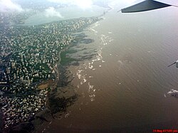
[[File:Bandra Sea Link aerial.jpg|thumb|right| The aerial view of the Arabian Sea above Bombay/Mumbai, India]] | |||
The Arabian Sea has two important branches — the Gulf of Aden in the southwest, connecting with the Red Sea through the strait of [[Bab-el-Mandeb]]; and the Gulf of Oman to the northwest, connecting with the Persian Gulf. There are also the gulfs of [[Gulf of Khambhat|Khambhat]] and [[Gulf of Kutch|Kutch]] on the [[Coastal South West India|Indian Coast]]. | |||
The Arabian Sea has been crossed by many important marine trade routes since the 3rd or 2nd millennium BCE. Major seaports include [[Kandla|Kandla Port]], [[Mundra Port]], [[Pipavav Port]], [[Dahej Port]], [[Hazira Port]], [[Mumbai Port Trust|Mumbai Port]], [[Jawaharlal Nehru Port|Nhava Sheva Port (Navi Mumbai)]], [[Mormugao|Mormugão Port (Goa)]], [[New Mangalore Port]] and [[Cochin Port|Kochi Port]] in India, the [[Port of Karachi]], [[Port Qasim]], and the [[Gwadar Port]] in Pakistan, [[Chabahar Port]] in Iran and the [[Port of Salalah]] in [[Salalah]], [[Oman]]. The largest islands in the Arabian Sea include [[Socotra]] ([[Yemen]]), [[Masirah Island]] (Oman), [[Lakshadweep]] (India) and [[Astola Island]] (Pakistan). | |||
The countries with coastlines on the Arabian Sea are Yemen, Oman, Pakistan, Iran, India and the [[Maldives]].<ref name="Britannica"/> | |||
== | ===Limits=== | ||
The [[International Hydrographic Organization]] defines the limits of the Arabian Sea as follows:<ref>{{cite web |url=https://iho.int/uploads/user/pubs/standards/s-23/S-23_Ed3_1953_EN.pdf |title=Limits of Oceans and Seas, 3rd edition |year=1953 |publisher=International Hydrographic Organization |access-date=28 December 2020|archive-url=https://web.archive.org/web/20171207191813/https://www.iho.int/iho_pubs/standard/S-23/S-23_Ed3_1953_EN.pdf |archive-date=7 December 2017 |pages=20–21}}</ref> | |||
*On the west: the eastern limit of the Gulf of Aden. | |||
*On the north: a line joining [[Ras al Hadd|Ràs al Hadd]], east point of the [[Arabian Peninsula]] (22°32'N) and [[Jiwani|Ràs Jiyùni]] (61°43'E) on the coast of Pakistan. | |||
*On the south: a line running from the southern extremity of [[Addu Atoll]] in the Maldives, to the eastern extremity of [[Ras Hafun|Ràs Hafun]] (the easternmost point of [[Africa]], 10°26'N). | |||
*On the east: the western limit of the Laccadive Sea a line running from [[Sadashivgad]] on the west coast of India ({{coord|14|48|N|74|07|E}}) to [[Cora Divh]] ({{coord|13|42|N|72|10|E}}) and thence down the west side of the [[Lakshadweep|Laccadive]] and Maldive archipelagos to the most southerly point of [[Addu Atoll]] in the Maldives. | |||
==Border and basin countries== | |||
Border and basin countries:<ref>{{Cite web|url=https://www.cia.gov/the-world-factbook/countries/iran/|title=Middle East :: Iran — The World Factbook - Central Intelligence Agency|website=www.cia.gov|date=11 February 2022}}</ref><ref>{{Cite web|url=http://www.wildlifeofpakistan.com/IntroductiontoPakistan/coastlineofPakistan.htm|title=Introduction to Pakistan: Section 5: Coastline|website=www.wildlifeofpakistan.com}}</ref> | |||
#{{IND}} - 2,500 km coastline | |||
#{{PAK}} - 1,050 km coastline | |||
#{{IRI}} | |||
#{{MDV}} | |||
#{{OMA}} | |||
#{{YEM}} | |||
#{{SOM}} | |||
==Alternative names== | |||
<ref>{{ | The Arabian Sea historically and geographically has been referred to with different names by [[Arabian]] and European geographers and travelers, including [[Erythraean Sea]], Indian Sea, [[Oman sea]],<ref name=Kamat>{{cite web|url=http://www.kamat.com/indica/geography/arabian_sea.htm|title=Kamat's Potpourri: The Arabian Sea|work=kamat.com}}</ref> Erythraean , Persian Sea in para No 34-35 of the Voyage<ref name=Periplus>{{cite web|url=http://depts.washington.edu/silkroad/texts/periplus/periplus.html|title=The Voyage around the Erythraean Sea|work=washington.edu}}</ref> In Indian folklore, it is referred to as Darya, Sindhu Sagar, and Arab Samudra.<ref>{{Cite web|url=http://www.kamat.com/indica/geography/arabian_sea.htm|title=Kamat's Potpourri: The Arabian Sea|website=www.kamat.com}}</ref><ref>{{Cite web|url=http://depts.washington.edu/silkroad/texts/periplus/periplus.html|title=The Voyage around the Erythraean Sea|website=depts.washington.edu}}</ref><ref name="auto">{{Cite web |url=http://www.scribd.com/doc/8583367/The-Periplus-of-the-Erythraean-Sea |title=Archived copy |access-date=2012-04-03 |archive-date=2013-12-02 |archive-url=https://web.archive.org/web/20131202223335/http://www.scribd.com/doc/8583367/The-Periplus-of-the-Erythraean-Sea |url-status=dead }}</ref> | ||
Arab geographers, sailors and nomads used to call this sea by different names, including the Akhzar (Green) Sea, Bahre Fars (Persian Sea), the Ocean Sea, the Hindu sea, the Makran Sea, the sea of Oman, among them the [[Zakariya al-Qazwini]], [[Al-Masudi]], [[Ibn Hawqal]] and ([[Hafiz-i Abru]]) They wrote: "The green sea and Indian sea and Persian sea are all one sea and in this sea there are strange creatures." in Iran and Turkey people call it Oman sea.<ref name=MFA>{{cite web|url=https://japan.mfa.gov.ir/en/newsview/536034|title=Ministry of MoFA Iran: Introducing a Book and Atlas|work=mfa.gov.ir}}</ref> | |||
In the [[Periplus of the Erythraean Sea]] , as well as in some ancient maps, Erythraean Sea refers to the whole area of the northwestern Indian Ocean, including the Arabian Sea.<ref>{{cite web| url = http://commons.wikimedia.org/wiki/File:1794_Anville_Map_of_the_Ancient_World_-_Geographicus_-_AncientWorld-anville-1794.jpg| title = 1794, Orbis Veteribus Notus by Jean Baptiste Bourguignon d'Anville| year = 1794}}</ref> | |||
<gallery mode="packed"> | <gallery mode="packed"> | ||
File:A horizontal Malabar Coast miniature, a reprint by Petrus Bertius, 1630.jpg|A horizontal Malabar Coast miniature, a reprint by Petrus Bertius, 1630 | File:A horizontal Malabar Coast miniature, a reprint by Petrus Bertius, 1630.jpg|A horizontal Malabar Coast miniature, a reprint by Petrus Bertius, 1630 | ||
File:Basra-ps64.JPG|Persian Sea. | File:Basra-ps64.JPG|Persian Sea. | ||
File:Map of persia.jpg| | File:Asia in the shape of the mythical winged horse Pegasus..jpg|Asia. Sinus Persicus and the Mare Persicum | ||
File:Soulier, E.; Andriveau-Goujon, J. Anciens Empires Jusqua Alexandre. 1838.jpg| | File:Map of persia.jpg|IRAN&MAKRAN | ||
File:1658 Jansson Map of the Indian Ocean (Erythrean Sea) in Antiquity - Geographicus - ErythraeanSea-jansson-1658.jpg|1658 Jansson Map of the Indian Ocean ( | File:Soulier, E.; Andriveau-Goujon, J. Anciens Empires Jusqua Alexandre. 1838.jpg|[[Erythraean Sea]] 1838. | ||
File:The western part of the Indian Ocean, by Vincenzo Maria Coronelli, 1693, from his system of global gores the south.jpg|The western part of the Indian Ocean | File:1658 Jansson Map of the Indian Ocean (Erythrean Sea) in Antiquity - Geographicus - ErythraeanSea-jansson-1658.jpg|1658 Jansson Map of the Indian Ocean ([[Erythraean Sea]]) | ||
File:The western part of the Indian Ocean, by Vincenzo Maria Coronelli, 1693, from his system of global gores the south.jpg|The western part of the Indian Ocean,1693. | |||
</gallery> | </gallery> | ||
=== | ==Trade routes== | ||
< | [[File:Periplous of the Erythraean Sea.svg|upright=1.8|thumb|Names, routes and locations of the ''Periplus of the Erythraean Sea''.]] | ||
<gallery> | The Arabian Sea has been an important [[Marine (ocean)|marine]] [[trade route]] since the era of the ''coastal sailing vessels'' from possibly as early as the 3rd millennium BCE, certainly the late 2nd millennium BCE through the later days known as the [[Age of Sail]]. By the time of [[Julius Caesar]], several well-established combined land-sea trade routes depended upon [[water transport]] through the sea around the rough inland [[terrain feature]]s to its north. | ||
These routes usually began in the [[Far East]] or down river from [[Madhya Pradesh]], India with [[transshipment]] via historic [[Bharuch]] (Bharakuccha), traversed past the inhospitable coast of modern-day Iran, then split around [[Hadhramaut]], Yemen into two streams north into the Gulf of Aden and thence into the [[Levant]], or south into [[Alexandria]] via Red Sea ports such as [[Axum]]. Each major route involved transhipping to [[camel train|pack animal caravan]], travel through desert country and risk of bandits and extortionate tolls by local potentates. | |||
This southern coastal route past the rough country in the [[South Arabia|southern Arabian Peninsula]] was significant, and the [[Egypt]]ian [[Pharaoh]]s built several shallow canals to service the trade, one more or less along the route of today's [[Suez Canal]], and another from the Red Sea to the [[Nile River]], both shallow works that were swallowed up by huge [[sand storm]]s in antiquity. Later the [[kingdom of Axum]] arose in [[Ethiopia]] to rule a mercantile empire rooted in the trade with Europe via Alexandria. | |||
<ref>{{cite web| url = https://japan.mfa.gov.ir/en/newsview/536033| title = Documents on the Persian Gulf's name the eternal heritage ancient time by Dr.Mohammad Ajam<!-- -->}}</ref> | |||
===Major ports=== | |||
[[Jawaharlal Nehru Port]] in [[Mumbai]] is the largest port in the Arabian Sea, and the largest container port in India. | |||
Major Indian ports in the Arabian Sea are [[Mundra Port]], [[Kandla Port]], [[Nava Sheva]], [[Kochi Port]], [[Mumbai Port]], and [[Mormugão]].<ref>{{cite web|url=http://shipping.gov.in/writereaddata/l892s/7yearsTRAFFIC-42175832.pdf|title=TRAFFIC HANDLED AT MAJOR PORTS (LAST 7 YEARS)|website=shipping.gov.in}}{{Dead link|date=October 2019 |bot=InternetArchiveBot |fix-attempted=yes }}</ref><ref>{{cite web|url=http://aapa.files.cms-plus.com/PDFs/WORLD%20PORT%20RANKINGS%202009.pdf|title=WORLD PORT RANKINGS|year=2009|website=aapa.files.cms-plus.com}}</ref> | |||
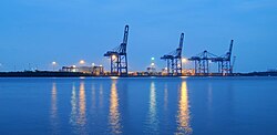
[[File:Container terminal.JPG|thumb|upright=1.2|The Kochi Port located on the south-west coast of India is the nearest Indian port to the international shipping routes, as well as one of the largest and busiest ports serving the Arabian Sea. Seen here is the [[International Container Transshipment Terminal, Kochi|International Container Transshipment Terminal]], the only such facility in India.]] | |||
The [[Port of Karachi]], Pakistan's largest and busiest seaport lies on the coast of the sea. It is located between the [[Karachi]] towns of [[Kiamari]] and [[Saddar]]. | |||
The [[Gwadar Port]] of Pakistan is a warm-water, deep-sea port situated at [[Gwadar]] in [[Balochistan]] at the apex of the Arabian Sea and at the entrance of the Persian Gulf, about 460 km west of Karachi and approximately 75 km (47 mi) east of Pakistan's border with Iran. The port is located on the eastern bay of a natural hammerhead-shaped peninsula jutting out into the Arabian Sea from the coastline. | |||
[[Port of Salalah]] in Salalah, Oman is also a major port in the area. The International Task Force often uses the port as a base. There is a significant number of warships of all nations coming in and out of the port, which makes it a very safe bubble. The port handled just under 3.5m [[Twenty-foot equivalent unit|teu]] in 2009.<ref>[http://www.portofsalalah.com/port_news_item.aspx?id=16655 Salalah’s versatility beats the slump] {{webarchive |url=https://web.archive.org/web/20121025024826/http://www.portofsalalah.com/port_news_item.aspx?id=16655 |date=October 25, 2012 }}, Port of Salalah</ref> | |||
==Islands== | |||
[[File:Socotra satview.jpg|thumb|Landsat view of Socotra, an island of Yemen.]] | |||
There are several islands in the Arabian Sea, with the most important ones being [[Lakshadweep Islands]] (India), [[Socotra]] (Yemen), [[Masirah]] (Oman) and [[Astola Island]] (Pakistan). | |||
The Lakshadweep Islands (formerly known as the Laccadive, Minicoy, and Aminidivi Islands) is a group of islands in the Laccadive Sea region of Arabian Sea, 200 to 440 km (120 to 270 mi) off the southwestern coast of India. The archipelago is a [[union territory]] and is governed by the [[Union Government of India]]. The islands form the smallest union territory of India with their total surface area being just {{convert|32|km2|abbr=on}}. The islands are the northernmost of the [[Chagos-Laccadive Ridge|Lakshadweep-Maldives-Chagos]] group of islands. | |||
Astola Island, also known as ''Jezira Haft Talar'' in [[Balochi language|Balochi]], or 'Island of the Seven Hills', is a small, uninhabited island in the northern tip of the Arabian Sea in Pakistan's territorial waters. | |||
Socotra, also spelled ''Soqotra'', is the largest island, being part of a small archipelago of four islands. It lies some {{convert|240|km|mi|abbr=on}} east of the [[Horn of Africa]] and {{convert|380|km|mi|abbr=on}} south of the Arabian Peninsula. | |||
Masirah is an island off the east coast of Oman. | |||
==Oxygen Minimum Zone== | |||
[[File:Winter Phytoplankon Arabian Sea.jpg|alt=Phytoplankton bloom over the Arabian Sea|thumb|Phytoplankton bloom over the Arabian Sea in winter (NASA)]] | |||
The Arabian Sea has one of the world's three largest oceanic [[oxygen minimum zone]]s (OMZ), or “dead zones,” along with the eastern tropical North Pacific and the eastern tropical South Pacific. OMZs have very low levels of [[oxygen]], sometimes undetectable by standard equipment.<ref>{{Cite journal|last1=Lüke|first1=Claudia|last2=Speth|first2=Daan R.|last3=Kox|first3=Martine A. R.|last4=Villanueva|first4=Laura|last5=Jetten|first5=Mike S. M.|date=2016-04-07|title=Metagenomic analysis of nitrogen and methane cycling in the Arabian Sea oxygen minimum zone|url=https://peerj.com/articles/1924|journal=PeerJ|language=en|volume=4|pages=e1924|doi=10.7717/peerj.1924|issn=2167-8359|pmc=4830246|pmid=27077014}}</ref> The Arabian Sea's OMZ has the lowest levels of oxygen in the world, especially in the Gulf of Oman.<ref>{{Cite journal|last1=Queste|first1=Bastien Y.|last2=Vic|first2=Clément|last3=Heywood|first3=Karen J.|last4=Piontkovski|first4=Sergey A.|date=2018|title=Physical Controls on Oxygen Distribution and Denitrification Potential in the North West Arabian Sea|journal=Geophysical Research Letters|language=en|volume=45|issue=9|pages=4143–4152|doi=10.1029/2017GL076666|bibcode=2018GeoRL..45.4143Q|issn=1944-8007|doi-access=free}}</ref> Causes of the OMZ may include untreated sewage as well as high temperatures on the Indian subcontinent, which increase winds blowing towards India, bringing up nutrients and reducing oxygen in the Arabian Sea's waters. In winter, phytoplankton suited to low-oxygen conditions turn the OMZ bright green.<ref>{{Cite news|last=Bhanoo|first=S.N.|title=A Green Blanket on the Arabian Sea|work=The New York Times}}</ref> | |||
== Environment and wildlife == | |||
The wildlife of the Arabian sea is diverse, and entirely unique because of the geographic distribution. | |||
<gallery mode="packed"> | |||
File:The western part of the Indian Ocean, by Vincenzo Maria Coronelli, 1693 from his system of global gores the Makran coast.jpg|The western part of the Indian Ocean, by Vincenzo Maria Coronelli, 1693 from his system of global gores the Makran coast | |||
File:Nakhl-Minoo.jpg|[[Arecaceae|Palm]] and [[sunset]] in [[Minoo Island]], Iran. | |||
File:The-Worlds-Most-Isolated-and-Distinct-Whale-Population-Humpback-Whales-of-the-Arabian-Sea-pone.0114162.s001.tif|Critically endangered | |||
File:Dugong.jpg|[[Dugong]] mother and her offspring in shallow waters. | File:Dugong.jpg|[[Dugong]] mother and her offspring in shallow waters. | ||
File:Makran sea .makoran coast in Iran.jpg|Makran coast | |||
File:Makoran sea .Makoran coast in Iran.jpg|Makran sea .Makoran coast in Iran | |||
File:Makran sea .makoran coast in Iran.jpg | File:Red Coast of Makoran sea Iran.jpg|Makran coast | ||
File:Makoran sea .Makoran coast in Iran.jpg | File:Arabian or Makoran sea .Makoran red coast in Iran.jpg|Iran | ||
File:Red Coast of Makoran sea Iran.jpg | |||
File:Arabian or Makoran sea .Makoran red coast in Iran.jpg | |||
</gallery> | </gallery> | ||
</ | |||
==Underwater tunnel== | |||
A rail tunnel under the sea is planned. It will link the UAE with the western coast of India. The tunnel will be supported by pontoons and will be nearly 2000 kilometres in length.<ref>{{Cite web|url=https://timesofindia.indiatimes.com/travel/destinations/a-2000-km-long-underwater-rail-will-connect-mumbai-to-the-uae-very-soon/amp_articleshow/66878629.cms|title = A 2,000-km-long underwater rail will connect Mumbai to the UAE very soon! | Times of India Travel|website = [[The Times of India]]}}</ref> | |||
<ref>{{Cite web|url=https://futurism.com/united-arab-emirates-underwater-bullet-train-india/amp|title=The UAE wants an underwater bullet train to India|date=5 December 2018}}</ref> | |||
==See also== | ==See also== | ||
* [[Indian Ocean]] | * [[Indian Ocean Rim Association]] | ||
* [[North Indian Ocean tropical cyclone]] | |||
* [[Piracy off the coast of Somalia]] | |||
==References== | ==References== | ||
{{Reflist}} | {{Reflist}} | ||
==Sources== | |||
{{EB1911 |wstitle=Arabian Sea}} | {{EB1911 |wstitle=Arabian Sea}} | ||
* | *Documents on the Persian Gulf's name [https://simple.wikipedia.org/wiki/Documents_on_the_Persian_Gulf%27s_name] | ||
*A book and Atlas [https://japan.mfa.gov.ir/en/newsview/536034] | |||
==External links== | ==External links== | ||
{{ | {{commons category-inline|Arabian Sea}} | ||
* | * [https://web.archive.org/web/20110523064712/http://wwf.panda.org/about_our_earth/ecoregions/arabian_sea.cfm Arabian Sea (World Wildlife Fund)] | ||
{{List of seas}} | |||
{{Waters of South Asia}} | |||
{{Countries bordering the Arabian Sea}} | |||
{{portalbar|Oceans}} | |||
{{ | {{Authority control}} | ||
[[Category:Arabian Sea| ]] | |||
[[Category:Arabian Peninsula]] | |||
[[Category:Marine ecoregions]] | |||
[[Category:India–Pakistan border]] | |||
[[Category:Oman–Yemen border]] | |||
[[Category:Bodies of water of Pakistan]] | |||
[[Category:Bodies of water of India]] | |||
[[Category:Bodies of water of Oman]] | |||
[[Category:Seas of Yemen]] | |||
[[Category:Seas of Iran]] | |||
[[Category:Bodies of water of Somalia]] | |||
[[Category:Bodies of water of Iran]] | |||
[[Category:Bodies of water of the Maldives]] | |||
[[Category:Seas of the Indian Ocean]] | [[Category:Seas of the Indian Ocean]] | ||
[[Category:Seas of Asia]] | |||
Latest revision as of 03:31, 5 June 2022
| Arabian Sea | |
|---|---|
 | |
 | |
| Location | Horn of Africa, Western Asia and South Asia |
| Coordinates | 14°N 65°E / 14°N 65°E |
| Type | Sea |
| Part of | Indian Ocean |
| Basin countries | India Iran Maldives Oman Pakistan Somalia Yemen Seychelles Sri Lanka |
| Max. width | 2,400 km (1,500 mi) |
| Surface area | 3,862,000 km2 (1,491,000 sq mi) (3,600,000 to 4,600,000 km2 in various sources) |
| Max. depth | 4,652 m (15,262 ft) |
| Islands | Astola island, Basavaraj Durga Island, Lakshadweep, Masirah Island, Piram Island, Pirotan, Socotra |


The Arabian Sea (Arabic: اَلْبَحرْ ٱلْعَرَبِيُّ romanized: Al-Bahr al-ˁArabī) is a region of the northern Indian Ocean bounded on the north by Pakistan, Iran and the Gulf of Oman, on the west by the Gulf of Aden, Guardafui Channel and the Arabian Peninsula, on the southeast by the Laccadive Sea[1] and the Maldives, on the southwest by Somalia,[2] and on the east by India. Its total area is 3,862,000 km2 (1,491,000 sq mi) and its maximum depth is 4,652 meters (15,262 ft). The Gulf of Aden in the west connects the Arabian Sea to the Red Sea through the strait of Bab-el-Mandeb, and the Gulf of Oman is in the northwest, connecting it to the Persian Gulf.
Name[edit | edit source]
The sea is named after Arabia, the historic name of the region to the west of the sea. The Arabian Sea's name in Arabic is [بحر العرب] Error: {{Lang}}: invalid parameter: |translit= (help); in Persian it is دریای عرب; in Urdu it is بحیرہ عرب; in Hindi it is अरब सागर; in Gujarati it is અરબી સમુદ્ર; in Marathi it is अरबी समुद्र; in Malayalam it is അറബിക്കടൽ (Arabi Kadal) and in Somali it is Bada Carbeed.
Geography[edit | edit source]
The Arabian Sea's surface area is about 3,862,000 km2 (1,491,130 sq mi).[3] The maximum width of the sea is approximately 2,400 km (1,490 mi), and its maximum depth is 4,652 metres (15,262 ft). The biggest river flowing into the sea is the Indus River.

The Arabian Sea has two important branches — the Gulf of Aden in the southwest, connecting with the Red Sea through the strait of Bab-el-Mandeb; and the Gulf of Oman to the northwest, connecting with the Persian Gulf. There are also the gulfs of Khambhat and Kutch on the Indian Coast. The Arabian Sea has been crossed by many important marine trade routes since the 3rd or 2nd millennium BCE. Major seaports include Kandla Port, Mundra Port, Pipavav Port, Dahej Port, Hazira Port, Mumbai Port, Nhava Sheva Port (Navi Mumbai), Mormugão Port (Goa), New Mangalore Port and Kochi Port in India, the Port of Karachi, Port Qasim, and the Gwadar Port in Pakistan, Chabahar Port in Iran and the Port of Salalah in Salalah, Oman. The largest islands in the Arabian Sea include Socotra (Yemen), Masirah Island (Oman), Lakshadweep (India) and Astola Island (Pakistan). The countries with coastlines on the Arabian Sea are Yemen, Oman, Pakistan, Iran, India and the Maldives.[3]
Limits[edit | edit source]
The International Hydrographic Organization defines the limits of the Arabian Sea as follows:[4]
- On the west: the eastern limit of the Gulf of Aden.
- On the north: a line joining Ràs al Hadd, east point of the Arabian Peninsula (22°32'N) and Ràs Jiyùni (61°43'E) on the coast of Pakistan.
- On the south: a line running from the southern extremity of Addu Atoll in the Maldives, to the eastern extremity of Ràs Hafun (the easternmost point of Africa, 10°26'N).
- On the east: the western limit of the Laccadive Sea a line running from Sadashivgad on the west coast of India (14°48′N 74°07′E / 14.800°N 74.117°E) to Cora Divh (13°42′N 72°10′E / 13.700°N 72.167°E) and thence down the west side of the Laccadive and Maldive archipelagos to the most southerly point of Addu Atoll in the Maldives.
Border and basin countries[edit | edit source]
Border and basin countries:[5][6]


Alternative names[edit | edit source]
The Arabian Sea historically and geographically has been referred to with different names by Arabian and European geographers and travelers, including Erythraean Sea, Indian Sea, Oman sea,[7] Erythraean , Persian Sea in para No 34-35 of the Voyage[8] In Indian folklore, it is referred to as Darya, Sindhu Sagar, and Arab Samudra.[9][10][11]
Arab geographers, sailors and nomads used to call this sea by different names, including the Akhzar (Green) Sea, Bahre Fars (Persian Sea), the Ocean Sea, the Hindu sea, the Makran Sea, the sea of Oman, among them the Zakariya al-Qazwini, Al-Masudi, Ibn Hawqal and (Hafiz-i Abru) They wrote: "The green sea and Indian sea and Persian sea are all one sea and in this sea there are strange creatures." in Iran and Turkey people call it Oman sea.[12] In the Periplus of the Erythraean Sea , as well as in some ancient maps, Erythraean Sea refers to the whole area of the northwestern Indian Ocean, including the Arabian Sea.[13]
-
 A horizontal Malabar Coast miniature, a reprint by Petrus Bertius, 1630
 -
 Persian Sea.
 -
 Asia. Sinus Persicus and the Mare Persicum
 -
 IRAN&MAKRAN
 -
 Erythraean Sea 1838.
 -
 1658 Jansson Map of the Indian Ocean (Erythraean Sea)
 -
 The western part of the Indian Ocean,1693.


_in_Antiquity_-_Geographicus_-_ErythraeanSea-jansson-1658.jpg)

Trade routes[edit | edit source]

The Arabian Sea has been an important marine trade route since the era of the coastal sailing vessels from possibly as early as the 3rd millennium BCE, certainly the late 2nd millennium BCE through the later days known as the Age of Sail. By the time of Julius Caesar, several well-established combined land-sea trade routes depended upon water transport through the sea around the rough inland terrain features to its north.
These routes usually began in the Far East or down river from Madhya Pradesh, India with transshipment via historic Bharuch (Bharakuccha), traversed past the inhospitable coast of modern-day Iran, then split around Hadhramaut, Yemen into two streams north into the Gulf of Aden and thence into the Levant, or south into Alexandria via Red Sea ports such as Axum. Each major route involved transhipping to pack animal caravan, travel through desert country and risk of bandits and extortionate tolls by local potentates.
This southern coastal route past the rough country in the southern Arabian Peninsula was significant, and the Egyptian Pharaohs built several shallow canals to service the trade, one more or less along the route of today's Suez Canal, and another from the Red Sea to the Nile River, both shallow works that were swallowed up by huge sand storms in antiquity. Later the kingdom of Axum arose in Ethiopia to rule a mercantile empire rooted in the trade with Europe via Alexandria. [14]
Major ports[edit | edit source]
Jawaharlal Nehru Port in Mumbai is the largest port in the Arabian Sea, and the largest container port in India. Major Indian ports in the Arabian Sea are Mundra Port, Kandla Port, Nava Sheva, Kochi Port, Mumbai Port, and Mormugão.[15][16]

The Port of Karachi, Pakistan's largest and busiest seaport lies on the coast of the sea. It is located between the Karachi towns of Kiamari and Saddar.
The Gwadar Port of Pakistan is a warm-water, deep-sea port situated at Gwadar in Balochistan at the apex of the Arabian Sea and at the entrance of the Persian Gulf, about 460 km west of Karachi and approximately 75 km (47 mi) east of Pakistan's border with Iran. The port is located on the eastern bay of a natural hammerhead-shaped peninsula jutting out into the Arabian Sea from the coastline.
Port of Salalah in Salalah, Oman is also a major port in the area. The International Task Force often uses the port as a base. There is a significant number of warships of all nations coming in and out of the port, which makes it a very safe bubble. The port handled just under 3.5m teu in 2009.[17]
Islands[edit | edit source]

There are several islands in the Arabian Sea, with the most important ones being Lakshadweep Islands (India), Socotra (Yemen), Masirah (Oman) and Astola Island (Pakistan).
The Lakshadweep Islands (formerly known as the Laccadive, Minicoy, and Aminidivi Islands) is a group of islands in the Laccadive Sea region of Arabian Sea, 200 to 440 km (120 to 270 mi) off the southwestern coast of India. The archipelago is a union territory and is governed by the Union Government of India. The islands form the smallest union territory of India with their total surface area being just 32 km2 (12 sq mi). The islands are the northernmost of the Lakshadweep-Maldives-Chagos group of islands.
Astola Island, also known as Jezira Haft Talar in Balochi, or 'Island of the Seven Hills', is a small, uninhabited island in the northern tip of the Arabian Sea in Pakistan's territorial waters.
Socotra, also spelled Soqotra, is the largest island, being part of a small archipelago of four islands. It lies some 240 km (150 mi) east of the Horn of Africa and 380 km (240 mi) south of the Arabian Peninsula.
Masirah is an island off the east coast of Oman.
Oxygen Minimum Zone[edit | edit source]

The Arabian Sea has one of the world's three largest oceanic oxygen minimum zones (OMZ), or “dead zones,” along with the eastern tropical North Pacific and the eastern tropical South Pacific. OMZs have very low levels of oxygen, sometimes undetectable by standard equipment.[18] The Arabian Sea's OMZ has the lowest levels of oxygen in the world, especially in the Gulf of Oman.[19] Causes of the OMZ may include untreated sewage as well as high temperatures on the Indian subcontinent, which increase winds blowing towards India, bringing up nutrients and reducing oxygen in the Arabian Sea's waters. In winter, phytoplankton suited to low-oxygen conditions turn the OMZ bright green.[20]
Environment and wildlife[edit | edit source]
The wildlife of the Arabian sea is diverse, and entirely unique because of the geographic distribution.
-
 The western part of the Indian Ocean, by Vincenzo Maria Coronelli, 1693 from his system of global gores the Makran coast
 -

-
Critically endangered
-
 Dugong mother and her offspring in shallow waters.
 -
Makran coast
-
Makran sea .Makoran coast in Iran
-
Makran coast
-
Iran


Underwater tunnel[edit | edit source]
A rail tunnel under the sea is planned. It will link the UAE with the western coast of India. The tunnel will be supported by pontoons and will be nearly 2000 kilometres in length.[21] [22]
See also[edit | edit source]
References[edit | edit source]
- ↑ Banse, Karl, and Charles R. McClain. "Winter blooms of phytoplankton in the Arabian Sea as observed by the Coastal Zone Color Scanner." Marine Ecology Progress Series (1986): 201-211.
- ↑ Pham, J. Peter. "Putting Somali piracy in context." Journal of Contemporary African Studies 28.3 (2010): 325-341.
- ↑ 3.0 3.1 Arabian Sea, Encyclopædia Britannica
- ↑ "Limits of Oceans and Seas, 3rd edition" (PDF). International Hydrographic Organization. 1953. pp. 20–21. Archived from the original (PDF) on 7 December 2017. Retrieved 28 December 2020.
- ↑ "Middle East :: Iran — The World Factbook - Central Intelligence Agency". www.cia.gov. 11 February 2022.
- ↑ "Introduction to Pakistan: Section 5: Coastline". www.wildlifeofpakistan.com.
- ↑ "Kamat's Potpourri: The Arabian Sea". kamat.com.
- ↑ "The Voyage around the Erythraean Sea". washington.edu.
- ↑ "Kamat's Potpourri: The Arabian Sea". www.kamat.com.
- ↑ "The Voyage around the Erythraean Sea". depts.washington.edu.
- ↑ "Archived copy". Archived from the original on 2013-12-02. Retrieved 2012-04-03.
{{cite web}}: CS1 maint: archived copy as title (link) - ↑ "Ministry of MoFA Iran: Introducing a Book and Atlas". mfa.gov.ir.
- ↑ "1794, Orbis Veteribus Notus by Jean Baptiste Bourguignon d'Anville". 1794.
- ↑ "Documents on the Persian Gulf's name the eternal heritage ancient time by Dr.Mohammad Ajam".
- ↑ "TRAFFIC HANDLED AT MAJOR PORTS (LAST 7 YEARS)" (PDF). shipping.gov.in.[permanent dead link]
- ↑ "WORLD PORT RANKINGS" (PDF). aapa.files.cms-plus.com. 2009.
- ↑ Salalah’s versatility beats the slump Archived October 25, 2012, at the Wayback Machine, Port of Salalah
- ↑ Lüke, Claudia; Speth, Daan R.; Kox, Martine A. R.; Villanueva, Laura; Jetten, Mike S. M. (2016-04-07). "Metagenomic analysis of nitrogen and methane cycling in the Arabian Sea oxygen minimum zone". PeerJ. 4: e1924. doi:10.7717/peerj.1924. ISSN 2167-8359. PMC 4830246. PMID 27077014.
{{cite journal}}: CS1 maint: article number as page number (link) - ↑ Queste, Bastien Y.; Vic, Clément; Heywood, Karen J.; Piontkovski, Sergey A. (2018). "Physical Controls on Oxygen Distribution and Denitrification Potential in the North West Arabian Sea". Geophysical Research Letters. 45 (9): 4143–4152. Bibcode:2018GeoRL..45.4143Q. doi:10.1029/2017GL076666. ISSN 1944-8007.
- ↑ Bhanoo, S.N. "A Green Blanket on the Arabian Sea". The New York Times.
- ↑ "A 2,000-km-long underwater rail will connect Mumbai to the UAE very soon! | Times of India Travel". The Times of India.
- ↑ "The UAE wants an underwater bullet train to India". 5 December 2018.

Sources[edit | edit source]
 This article incorporates text from a publication now in the public domain: Chisholm, Hugh, ed. (1911). "Arabian Sea". Encyclopædia Britannica (11th ed.). Cambridge University Press.
External links[edit | edit source]
- Pages using the JsonConfig extension
- Lang and lang-xx template errors
- Arabian Sea
- Arabian Peninsula
- Marine ecoregions
- India–Pakistan border
- Oman–Yemen border
- Bodies of water of Pakistan
- Bodies of water of India
- Bodies of water of Oman
- Seas of Yemen
- Seas of Iran
- Bodies of water of Somalia
- Bodies of water of Iran
- Bodies of water of the Maldives
- Seas of the Indian Ocean
- Seas of Asia