

>SchreiberBike Change a "0" to an "o" - also some copy editing |
->Filedelinkerbot Bot: Removing c:File:Indira Gandhi Wildlife Sanctuary and National Park.JPG , deleted by Jameslwoodward (per Commons:Commons:Deletion requests/File:Indira Gandhi Wildlife Sanctuary and National Park.JPG). |
||
| Line 1: | Line 1: | ||
{{Use dmy dates|date=July 2019}} | {{Use dmy dates|date=July 2019}} | ||
{{Use Indian English|date=July 2019}} | {{Use Indian English|date=July 2019}} | ||
{{Infobox road | {{Infobox road | ||
|country=IND | | country = IND | ||
|type = SH | | type = SH | ||
|route = 17 | | state = Kerala | ||
| | | route = 17 | ||
|maint = Kerala Public Works Department | | alternate_name = Northern outlet road | ||
|length_km = | | map = {{maplink|frame=yes|plain=yes|frame-align=center|frame-width=290|frame-height=300|type=line|zoom=10|from=State Highway 17 (Kerala).map}}| map_custom = yes | ||
| | | map_notes = SH 17 highlighted in red | ||
|direction_a = | | spur_type = | ||
|terminus_a | | spur_of = | ||
|junction | | maint = [[Kerala Public Works Department]] | ||
|direction_b = | | length_km = 59.1 | ||
|terminus_b | | length_notes = <!--[[Corridor_Name1]]: {{convert|00|km|mi|abbr=on}} (Place1 – Place2)<br />[[Corridor_Name2]]: 00 km (Place1 – Place2) --> | ||
| established = | |||
| allocation = | |||
| direction_a = South | |||
| terminus_a = {{jct|state=Kerala|NH|85|country=IND}} in [[Munnar]] <!-- Road begins here. Include Route No. if road starts from another Major route--> | |||
| junction = <!--Use {{plainlist|}}. Only include Primary highways (single & double digit numbered routes) and Inter-state highways. Maximum 10 entries--> | |||
| direction_b = North | |||
| terminus_b = [[List of major district roads in Tamil Nadu|MDR 509]] at [[Tamil Nadu|TN]] border in [[Chinnar Wildlife Sanctuary|Chinnar]] <!-- Road ends here. Include Route No. if road ends on another major route--> | |||
| districts = [[Idukki]] | |||
| previous_type = SH | |||
| previous_route = 16 <!-- previous route in road numbering system (SH 4 - SH 5 - SH 6) --> | |||
| next_type = SH | |||
| next_route = 18 <!-- next route in highway numbering system ((SH 4 - SH 5 - SH 6) --> | |||
}} | }} | ||
[[Kerala]] '''State Highway 17''', also called the '''''Northern outlet road''''' and '''''[[Munnar]] - [[Udumalaippettai|Udumalpet]] road''''', is notable for passing between the [[Anaimalai Hills]] and the [[Palani Hills]], through or near three important [[protected areas]] and providing opportunities for viewing [[Wildlife of Tamil Nadu|wildlife]] in unspoiled [[South Deccan Plateau dry deciduous forests|forest]]s.<br /> | [[Kerala]] '''State Highway 17''', also called the '''''Northern outlet road''''' and '''''[[Munnar]] - [[Udumalaippettai|Udumalpet]] road''''', is notable for passing between the [[Anaimalai Hills]] and the [[Palani Hills]], through or near three important [[protected areas]] and providing opportunities for viewing [[Wildlife of Tamil Nadu|wildlife]] in unspoiled [[South Deccan Plateau dry deciduous forests|forest]]s.<br /> | ||
The total road length is about <!--?59.1km-->{{convert| | The total road length is about <!--?59.1km-->{{convert|59.1|km|mi|abbr=on}}.<ref>{{Cite web|url=http://www.keralapwd.gov.in/getPage.php?page=maps&pageId=248|title=PWD Public Site|website=www.keralapwd.gov.in|access-date=2017-08-22}}</ref> | ||
==Route== | ==Route== | ||
| Line 29: | Line 42: | ||
Image:Munnar hillstation kerala.jpg|Departing Munnar | Image:Munnar hillstation kerala.jpg|Departing Munnar | ||
Image:Eravikulam National Park.jpg|Eravikulam National Park | Image:Eravikulam National Park.jpg|Eravikulam National Park | ||
Image: | Image:Anamudi.jpg|Anamudi Peak | ||
Image:Chinnar Watchtower.jpg| Chinnar Watchtower seen from Manjampatti Watchtower | Image:Chinnar Watchtower.jpg| Chinnar Watchtower seen from Manjampatti Watchtower | ||
Image:Chinnarwatchtower.jpg|Chinnar Watchtower | Image:Chinnarwatchtower.jpg|Chinnar Watchtower | ||
Image:Chinnar river at checkpost.jpg|Chinnar river from SH 17 border bridge | Image:Chinnar river at checkpost.jpg|Chinnar river from SH 17 border bridge | ||
Image:Amaravathi Dam.jpg|Amaravathi Dam | Image:Amaravathi Dam.jpg|Amaravathi Dam | ||
Image:Amaravathi Reservoir & Dam.jpg|Amaravathi Reservoir | Image:Amaravathi Reservoir & Dam.jpg|Amaravathi Reservoir | ||
Latest revision as of 00:22, 6 November 2021
 | |
|---|---|
| Northern outlet road | |
| Route information | |
| Maintained by Kerala Public Works Department | |
| Length | 59.1 km (36.7 mi) |
| Major junctions | |
| South end |  NH 85 in Munnar NH 85 in Munnar |
| North end | MDR 509 at TN border in Chinnar |
| Location | |
| Country | India |
| State | Kerala |
| Districts | Idukki |
| Highway system | |
| State Highways in Kerala | |
| Lua error in package.lua at line 80: module 'Module:Road data/browsetable' not found. | |
Kerala State Highway 17, also called the Northern outlet road and Munnar - Udumalpet road, is notable for passing between the Anaimalai Hills and the Palani Hills, through or near three important protected areas and providing opportunities for viewing wildlife in unspoiled forests.
The total road length is about 59.1 km (36.7 mi).[1]
Route[edit | edit source]

SH 17 starts north from NH 49 (Aluva - Munnar Highway) at Munnar, running about 2 km alongside the Kannimala River, then to Rajamudi village - Anakkalpetty road and on to Eravikulam village. It passes near Eravikulam National Park and Anamudi, The tallest Indian peak south of the Himalayas and into Marayoor town, (km 42). It then passes through the centre of Chinnar Wildlife Sanctuary, past Chinnar Watchtower and continues to Chinnar Check post, (km 59). It crosses the state boundary on a highway bridge over the Chinnar River at 10°21′09″N 77°13′04″E / 10.35241°N 77.21775°E.

It enters Indira Gandhi Wildlife Sanctuary and National Park at Tamil Nadu check post and continues past Manjampatti Watchtower along the bottom of Manjampatti Valley. It passes through the park around Amaravathi Reservoir and Amaravathi Dam to exit the park at the Forest Department checkpost (km 71) near Amaravathinagar and the Sainik School, Amaravathinagar. It goes down onto the plains through Manupatti (km 75), Kurichkotti, through a large area of wind turbines, Pallapalyam, extensive agricultural fields, Bodipatti, across Southern Railway - Salem Division tracks in Kanakkampalayam, and on to NH 209 at Udumalpet (km 85) in Tamil Nadu, South India.
Gallery[edit | edit source]
-
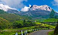 Departing Munnar
 -
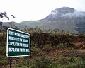 Eravikulam National Park
 -
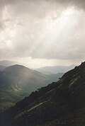 Anamudi Peak
 -
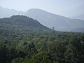 Chinnar Watchtower seen from Manjampatti Watchtower
 -
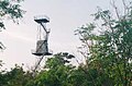 Chinnar Watchtower
 -
 Chinnar river from SH 17 border bridge
 -
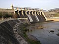 Amaravathi Dam
 -
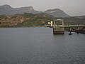 Amaravathi Reservoir
 -
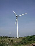 Wind turbines outside Udumalpet


Notes[edit | edit source]
- ↑ "PWD Public Site". www.keralapwd.gov.in. Retrieved 22 August 2017.
External links[edit | edit source]
 | This Indian road or road transport-related article is a stub. You can help Bharatpedia by expanding it. |