Dera Gopipur
Thank you for being part of the Bharatpedia family! 0% transparency: ₹0 raised out of ₹100,000 (0 supporter) |
It has been suggested that this article be merged with Dera Gopipur. (Discuss) Proposed since December 2020. |
Dehra Gopipur | |
|---|---|
city | |
| Coordinates: 31°54′N 76°13′E / 31.90°N 76.22°ECoordinates: 31°54′N 76°13′E / 31.90°N 76.22°E | |
| Administrative Country | Dehra Gopipur
|
| State | Himachal Pradesh |
| District | Kangra |
| Government | |
| • Body | Municipal Council |
| Area | |
| • Total | 5 km2 (2 sq mi) |
| Elevation | 503 m (1,650 ft) |
| Population (2011) | |
| • Total | 4,816 |
| • Density | 960/km2 (2,500/sq mi) |
| Languages | |
| • Official | Hindi |
| Time zone | UTC+5:30 (IST) |
| PIN | 177101 |
| Telephone code | 01970 |
| Vehicle registration | HP-36 |
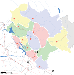
Dehra Gopipur is a town, a Municipal Council, and a Tehsil in Kangra district in the state of Himachal Pradesh, India.
Geography[edit]
Dehra Gopipur is located at 31°54′N 76°13′E / 31.90°N 76.22°E.[1] It has an average elevation of 503 metres (1,650 feet). River Beas also flows past Dera. Pong reservoir (Maharana Pratap reservoir) is also a nearby major structure.
Demographics[edit]
As of 2001[update] India census,[2] Dehra Gopipur had a population of 4336. Males constitute 52% of the population and females 48%. Dehra Gopipur has an average literacy rate of 79%, higher than the national average of 59.5%: male literacy is 82% and, female literacy is 76%. In Dehra Gopipur, 11% of the population is under 6 years of age.
Places of interest[edit]
Bagulamukhi temple, devoted to the goddess Bagulamukhi. President of India Sh. Pranav Mukherjee has also paid his obedience in this temple.
Pragpur, a small hamlet in the Dera Gopipur, has been listed as the only World Heritage village in India. It is known for its history as well as for an executive clan of 'Sood' (some write it as 'Sud') community. Three other hamlets, named Garli, Nagrota Bagwan and Chamba Pattan lie in close vicinity to Paragpur.
Other nearby towns include Rancer Island in Nagrota Surian, Jawalamukhi (a famous temple and one of the most visited religious shrines of Hindus); Hamirpur (the commercial hub of Himachal Pradesh); Kangra (known for its forts, temples and rich cultural heritage); and Nadaun (a place still remembered for having a Sikh's Gurdwara which was built to commemorate Guru Gobind Singh's victory in the Battle of Nadaun. Kaleshwar Temple: At a distance of around 15 km, this place has got great religious importance as pandavas stayed here during exile. Baisakhi fair is held on every 13 April. Pong river basin is a bird sanctuary included in Ramsar Wetlands list. Millions of Siberian birds visit it every year. Boating and water-sports is available in Dera and Chambapattan, Kaleshwar. Dera has great potential for water sports and tourism,[citation needed] but various governments had failed to develop it.[citation needed]
References[edit]
- ↑ Falling Rain Genomics, Inc - Dera Gopipur[permanent dead link]
- ↑ "Census of India 2001: Data from the 2001 Census, including cities, villages and towns (Provisional)". Census Commission of India. Archived from the original on 16 June 2004. Retrieved 1 November 2008.
External links[edit]
- Heritage Zone Garli Pragpur Kangra Pongdam
- The Indian National Trust For Art and Cultural Heritage was set up to Protect and Conserve India's vast Natural and Cultural Heritage

