.svg)
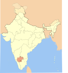
File:Western-ganga-empire-map.svg

Size of this PNG preview of this SVG file: 220 × 234 pixels. Other resolutions: 226 × 240 pixels | 353 × 375 pixels | 1,651 × 1,753 pixels.
Original file (SVG file, nominally 1,651 × 1,753 pixels, file size: 430 KB)
File history
Click on a date/time to view the file as it appeared at that time.
| Date/Time | Thumbnail | Dimensions | User | Comment | |
|---|---|---|---|---|---|
| current | 06:10, 28 May 2007 | | 1,651 × 1,753 (430 KB) | wikimediacommons>Mlpkr | I used Image:India-locator-map-blank.svg as base and edited myself using inkspace and created it by looking at the following sources. * Malini Adiga (2006), The Making of Southern Karnataka: Society, Polity and Culture in the early medieval period, |
File usage
The following 3 pages use this file: