
File:View of Diamond Exchange Center from Azrieli Center.jpg

Size of this preview: 220 × 109 pixels. Other resolutions: 320 × 159 pixels | 4,110 × 2,039 pixels.
Original file (4,110 × 2,039 pixels, file size: 5.23 MB, MIME type: image/jpeg)
Summary
| DescriptionView of Diamond Exchange Center from Azrieli Center.jpg |
English: Photos taken from the top of Azrieli Center Circular Tower, once the tallest building in Israel, at 53 stories. Azrieli Sarona, when finished, will be the tallest building at 73 stories. An even taller building, Rockefeller Center, has been commissioned and will be 80 stories tall.
In the views, you can see Azrieli Sarona under construction, Shalom Tower, from 1965-1999 the tallest building in Israel at 36 stories, as well as Port of Tel Aviv with Sde Dov Airport. The Electra (Elco) Tower, also pictured, houses Google Israel and is currently the 3rd tallest building. See: en.wikipedia.org/wiki/List_of_tallest_buildings_in_Tel_Aviv; officesnapshots.com/2013/01/31/google-tel-aviv-office-des... See: Thanks for publishing my photo @GeektimeCoIL in בדקנו: כמה יעלה לכם להריץ סטארטאפ בערים השונות בארץ? | גיקטיים – Ted Eytan, MD |
||||||||||||||
| Date | |||||||||||||||
| Source | https://www.flickr.com/photos/taedc/28130606302/ | ||||||||||||||
| Author |
creator QS:P170,Q116943179 |
||||||||||||||


| Camera location |  | View this and other nearby images on: OpenStreetMap |  32.074437; 34.791880 32.074437; 34.791880 |
|---|

Licensing


This file is licensed under the Creative Commons Attribution-Share Alike 2.0 Generic license.
- You are free:
- to share – to copy, distribute and transmit the work
- to remix – to adapt the work
- Under the following conditions:
- attribution – You must give appropriate credit, provide a link to the license, and indicate if changes were made. You may do so in any reasonable manner, but not in any way that suggests the licensor endorses you or your use.
- share alike – If you remix, transform, or build upon the material, you must distribute your contributions under the same or compatible license as the original.

|
This image was originally posted to Flickr by tedeytan at https://flickr.com/photos/22526649@N03/28130606302. It was reviewed on 27 June 2020 by FlickreviewR 2 and was confirmed to be licensed under the terms of the cc-by-sa-2.0. |
27 June 2020
Captions
Add a one-line explanation of what this file represents
File history
Click on a date/time to view the file as it appeared at that time.
| Date/Time | Thumbnail | Dimensions | User | Comment | |
|---|---|---|---|---|---|
| current | 17:05, 27 June 2020 | 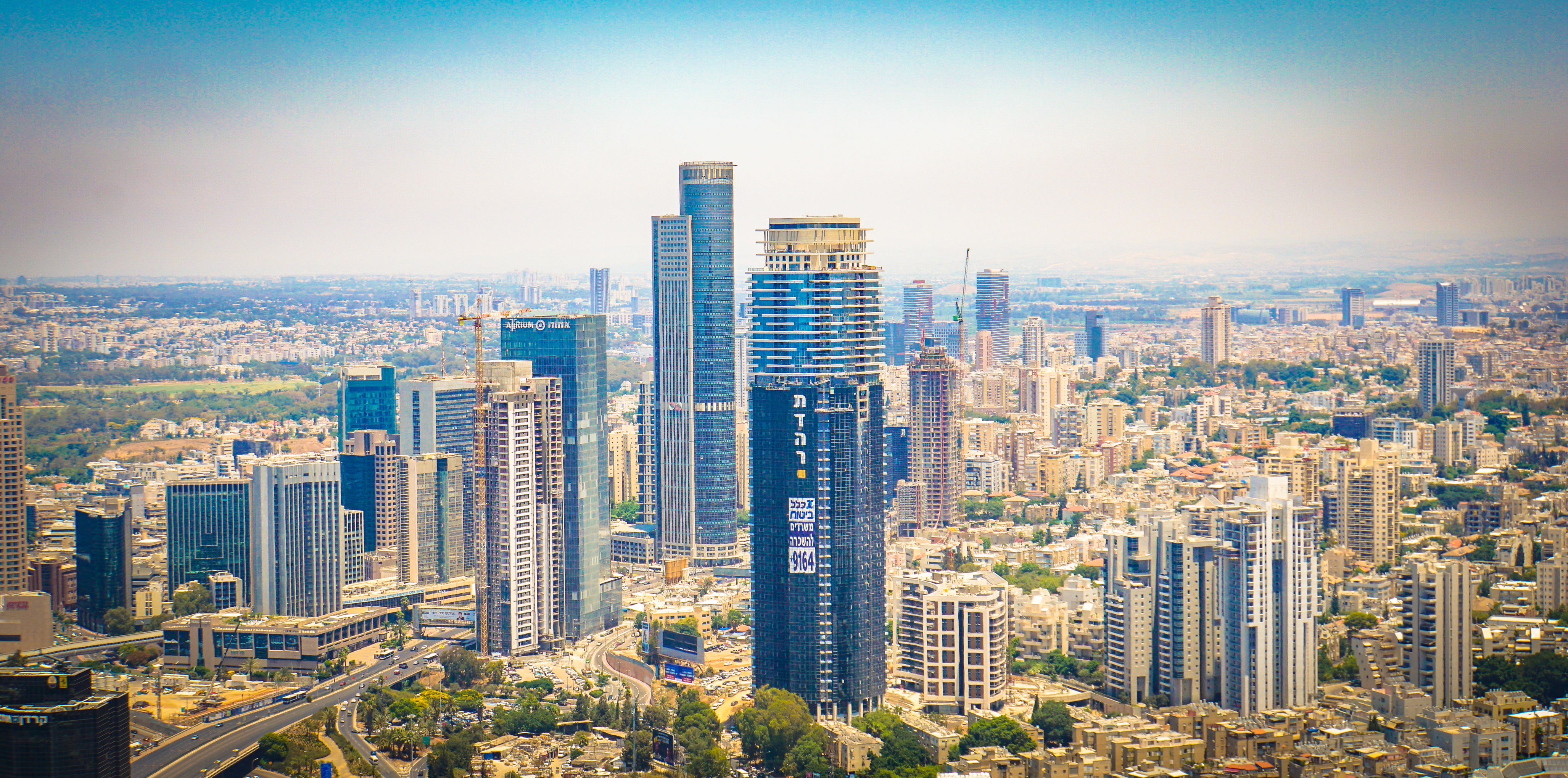 | 4,110 × 2,039 (5.23 MB) | smartcommons>Danloud | Uploaded a work by Ted Eytan from https://www.flickr.com/photos/taedc/28130606302/ with UploadWizard |
File usage
There are no pages that use this file.
