.svg)
File:Txu-oclc-10552568-nh48-6.jpg
Size of this preview: 220 × 168 pixels. Other resolutions: 315 × 240 pixels | 491 × 375 pixels | 5,000 × 3,817 pixels.
Original file (5,000 × 3,817 pixels, file size: 5.7 MB, MIME type: image/jpeg)
Summary
| Description |
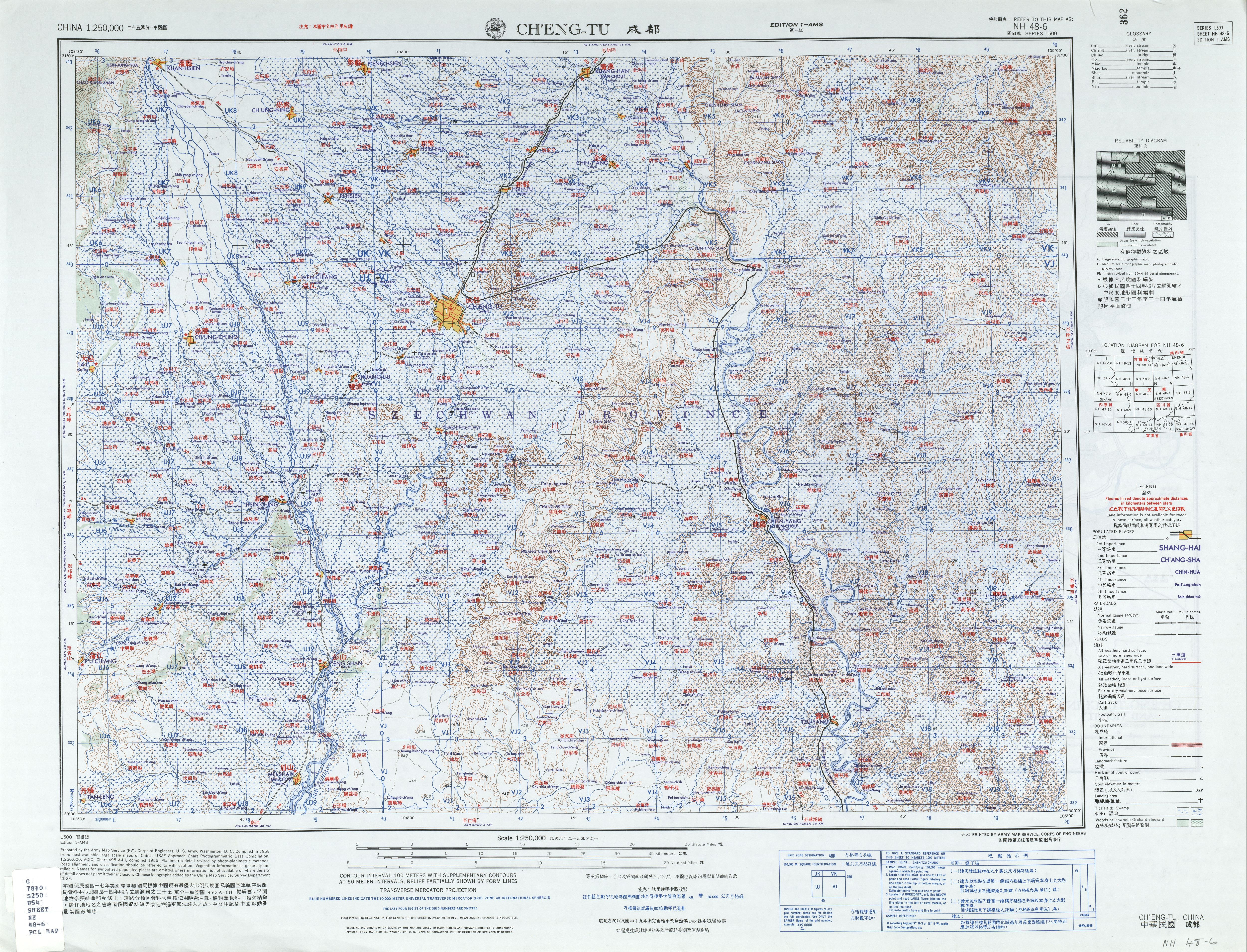
English: Chengdu (Chʻeng-tu), Sichuan, China and surrounding region AMS Topographic Maps |
| Date |
Compiled: 1958 Printed: August 1963 |
| Source | Courtesy of the University of Texas Libraries, The University of Texas at Austin. (NH 48-6) |
| Author | Army Map Service, Corps of Engineers |
Licensing
This image or file is a work of a U.S. Army Corps of Engineers soldier or employee, taken or made as part of that person's official duties. As a work of the U.S. federal government, the image is in the public domain.
|
File history
Click on a date/time to view the file as it appeared at that time.
| Date/Time | Thumbnail | Dimensions | User | Comment | |
|---|---|---|---|---|---|
| current | 10:25, 13 September 2019 | | 5,000 × 3,817 (5.7 MB) | wikimediacommons>Geographyinitiative | User created page with UploadWizard |
File usage
The following page uses this file: