.svg)
File:Tranquebar map.jpg
Size of this preview: 220 × 244 pixels. Other resolutions: 216 × 240 pixels | 338 × 375 pixels | 4,472 × 4,960 pixels.
Original file (4,472 × 4,960 pixels, file size: 21.14 MB, MIME type: image/jpeg)
Summary
| Description |
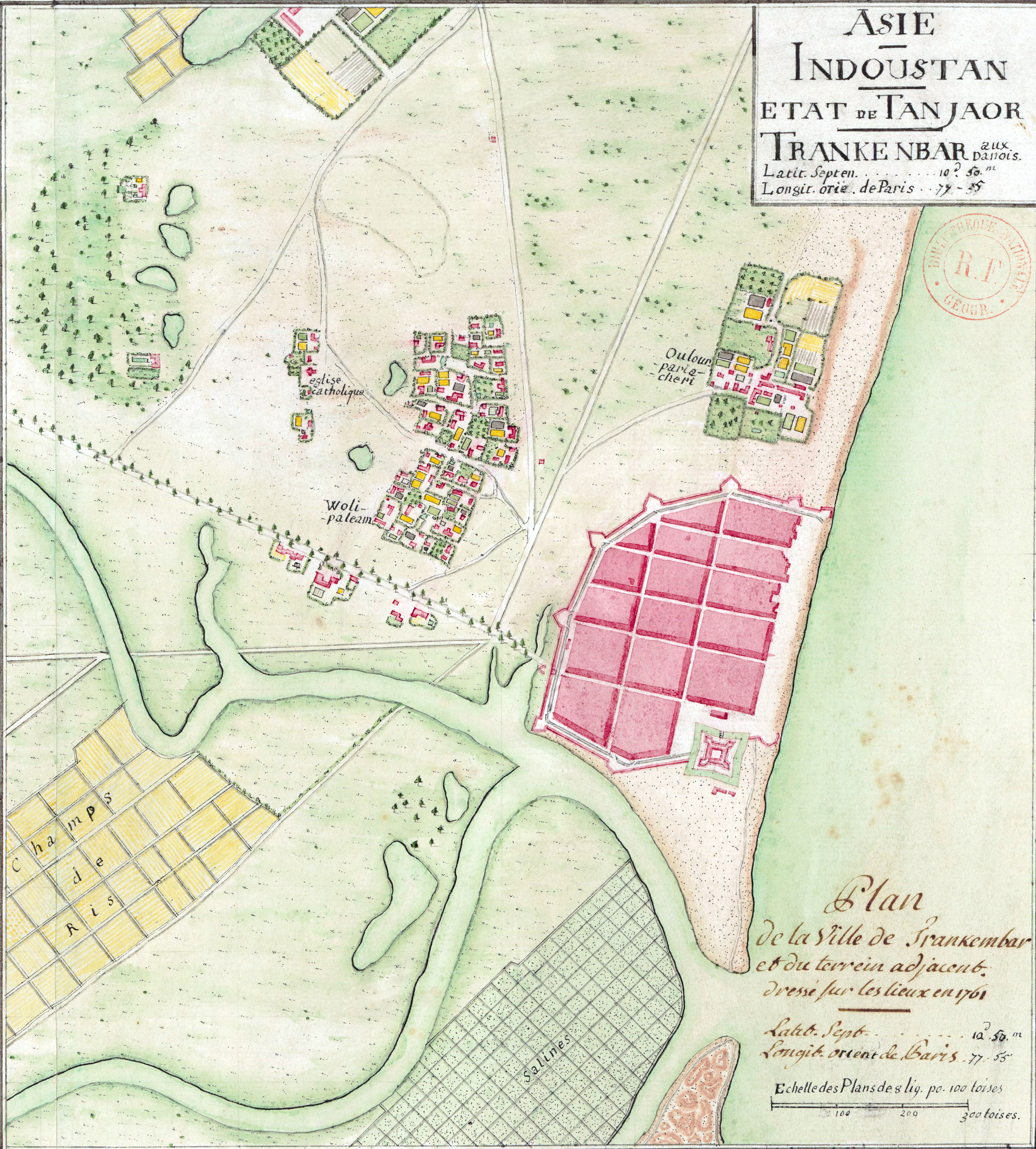
Asie. Indoustan. Etat de Tanjaor. Trankenbar aux Danois. Plan de la ville de Trankenbar et du terrain adjacent, dressé sur les lieux en 1761 (par le capitaine du génie Leveux) |
|||||||||
| Date | ||||||||||
| Source | Bibliothèque nationale de France, GED-3370 | |||||||||
| Creator |
Unknown author |
|||||||||
| Permission (Reusing this file) |
|
|||||||||
| Geotemporal data | ||||||||||
| Bounding box |
|
|||||||||
| Georeferencing | ||||||||||


File history
Click on a date/time to view the file as it appeared at that time.
| Date/Time | Thumbnail | Dimensions | User | Comment | |
|---|---|---|---|---|---|
| current | 17:38, 14 May 2020 | | 4,472 × 4,960 (21.14 MB) | wikimediacommons>Shyamal | {{Map |Description=Asie. Indoustan. Etat de Tanjaor. Trankenbar aux Danois. Plan de la ville de Trankenbar et du terrain adjacent, dressé sur les lieux en 1761 (par le capitaine du génie Leveux) |Source=[https://gallica.bnf.fr/ark:/12148/btv1b84421731 Bibliothèque nationale de France, GED-3370 ] |Date=1761 |Author=Unknown |Permission={{PD-US}} |other_versions= }} Category:Tharangambadi |
File usage
The following page uses this file: