.svg)
File:Spice Islands (Zanzibar highlighted).svg

Size of this PNG preview of this SVG file: 220 × 271 pixels. Other resolutions: 195 × 240 pixels | 304 × 375 pixels | 512 × 631 pixels.
Original file (SVG file, nominally 512 × 631 pixels, file size: 6.08 MB)
.svg)
Summary
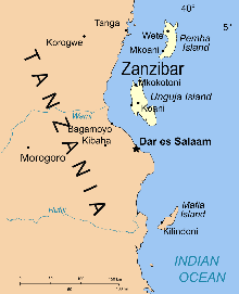
| Description | Part of the map of Tanzania, showing the Spice Islands, and highlighting Zanzibar. |
| Date | |
| Source | Vectors self-made in Inkscape. Source was cropped from 2003 Political map of Tanzania at Perry-Castañeda Library Map Collection — Tanzania. The maps are attributed to the US Central Intelligence Agency. |
| Author | Mysid |
| Other versions |
Derivative works of this file: Image:Spice Islands (Tanzania).svgin French : Image:Spice_Islands_Tanzania-fr.svg in French : Image:Spice_Islands-Zanzibar_highlighted-fr.svg in Arabic: Image:Spice Islands (Zanzibar highlighted)-ar.svg |
| SVG development |
_el.svg)
_sv.svg)
.svg)
-ar.svg)
Licensing
| I, the copyright holder of this work, release this work into the public domain. This applies worldwide. In some countries this may not be legally possible; if so: I grant anyone the right to use this work for any purpose, without any conditions, unless such conditions are required by law. |
File history
Click on a date/time to view the file as it appeared at that time.
| Date/Time | Thumbnail | Dimensions | User | Comment | |
|---|---|---|---|---|---|
| current | 07:46, 9 October 2021 | | 512 × 631 (6.08 MB) | wikimediacommons>Nwbeeson | Zanzibar Island renamed to Unguja Island to match article caption |
File usage
The following page uses this file:
.svg)