
File:Ratnagiri Hill Fort Penukonda Anantapuram Main Entrance.jpg

Size of this preview: 220 × 165 pixels. Other resolutions: 320 × 240 pixels | 4,032 × 3,024 pixels.
Original file (4,032 × 3,024 pixels, file size: 4.98 MB, MIME type: image/jpeg)
Summary
| DescriptionRatnagiri Hill Fort Penukonda Anantapuram Main Entrance.jpg |
English: This is the Ratnagiri hill fort's main entrance, a massive brick wall with an arched gateway. This wall was built during Hyder Ali or Tipu Sultan's rule. It is said that Ratnagiri fort was an important fort in Pandyas and Cholas kingdoms. It was also part of Vijayanagara kingdom, hence the presence of the temples. After the fall of Vijayanagara, the fort might have been under Nayakas. At some point in history the fort fell to Hyder or Tipu's forces. That's when the fort was renovated probably with the help of French engineers. The fort's perimeter is approximately 4.5 kms spanning over plains and two hillocks.
|
||
| Date | |||
| Source | Own work | ||
| Author | Maxmad007 |


| Camera location |   | View this and other nearby images on: OpenStreetMap |  13.816356; 77.128278 13.816356; 77.128278 |
|---|

Licensing
I, the copyright holder of this work, hereby publish it under the following license:


This file is licensed under the Creative Commons Attribution-Share Alike 4.0 International license.
- You are free:
- to share – to copy, distribute and transmit the work
- to remix – to adapt the work
- Under the following conditions:
- attribution – You must give appropriate credit, provide a link to the license, and indicate if changes were made. You may do so in any reasonable manner, but not in any way that suggests the licensor endorses you or your use.
- share alike – If you remix, transform, or build upon the material, you must distribute your contributions under the same or compatible license as the original.

|
This image was uploaded as part of Wiki Loves Monuments 2020.
|
 |
Captions
Add a one-line explanation of what this file represents
File history
Click on a date/time to view the file as it appeared at that time.
| Date/Time | Thumbnail | Dimensions | User | Comment | |
|---|---|---|---|---|---|
| current | 21:41, 4 September 2020 | 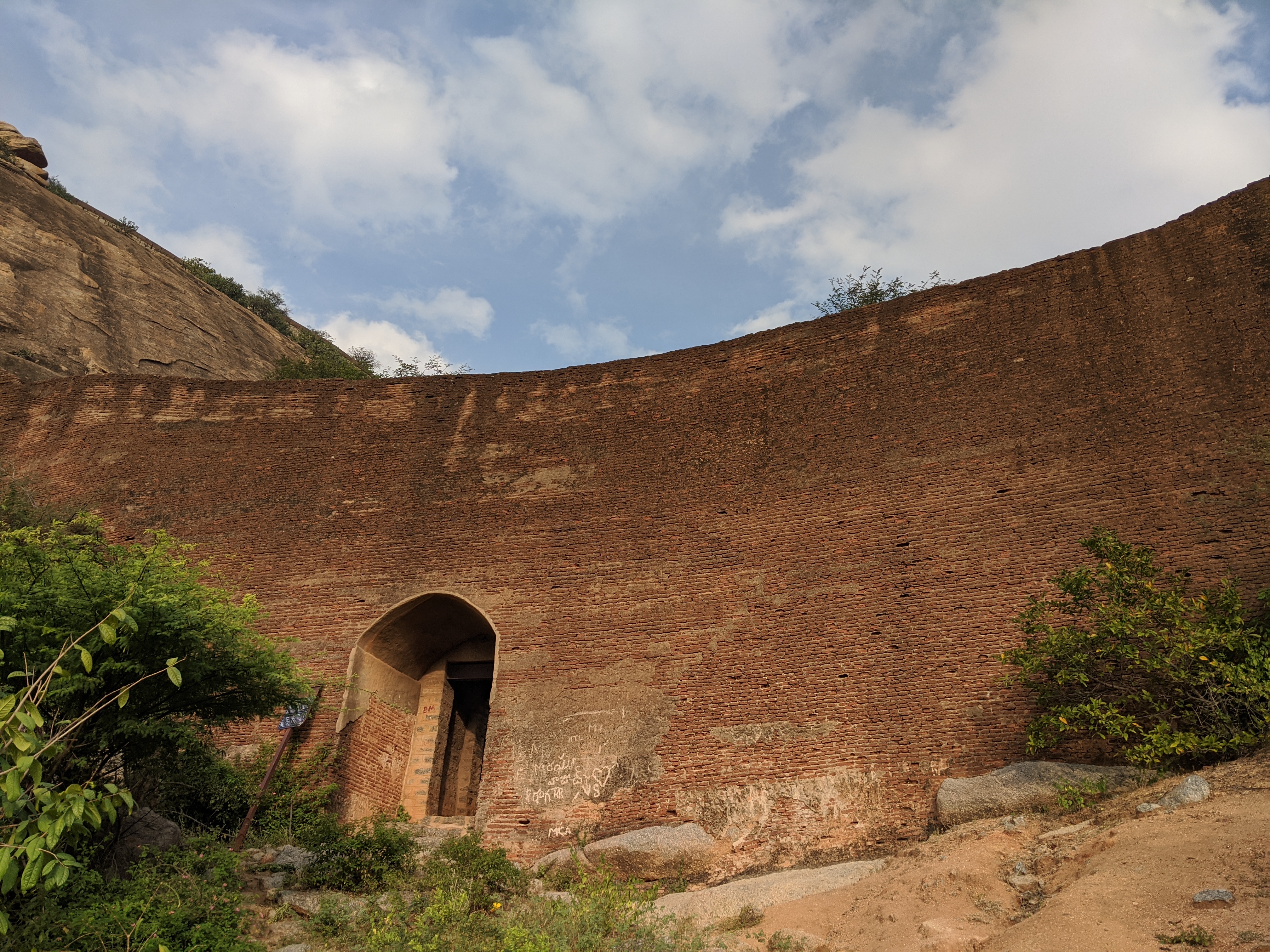 | 4,032 × 3,024 (4.98 MB) | smartcommons>Maxmad007 | Uploaded own work with UploadWizard |
File usage
The following page uses this file:
