
File:Ph regions and provinces.svg

Size of this PNG preview of this SVG file: 220 × 320 pixels. Other resolution: 165 × 240 pixels.
Original file (SVG file, nominally 4,200 × 6,105 pixels, file size: 3.03 MB)
Summary
| DescriptionPh regions and provinces.svg |
English: Map of the Philippines showing the location of all the regions and provinces.
Notes: The map does not depict cities that are independent of any province. It also does not depict the status of Sabah, the Spratly Islands, and Scarborough Shoal as disputed Philippine territories. |
| Date | |
| Source | Own work, based on seav's Ph regions and provinces.png and Felipe Aira's File:PhlMapCit.svg |
| Author | HueMan1 |
| Other versions |
|


Licensing
HueMan1, the copyright holder of this work, hereby publishes it under the following license:

|
Permission is granted to copy, distribute and/or modify this document under the terms of the GNU Free Documentation License, Version 1.2 or any later version published by the Free Software Foundation; with no Invariant Sections, no Front-Cover Texts, and no Back-Cover Texts. A copy of the license is included in the section entitled GNU Free Documentation License.http://www.gnu.org/copyleft/fdl.htmlGFDLGNU Free Documentation Licensetruetrue |
Captions
Add a one-line explanation of what this file represents
File history
Click on a date/time to view the file as it appeared at that time.
| Date/Time | Thumbnail | Dimensions | User | Comment | |
|---|---|---|---|---|---|
| current | 13:17, 23 October 2024 | 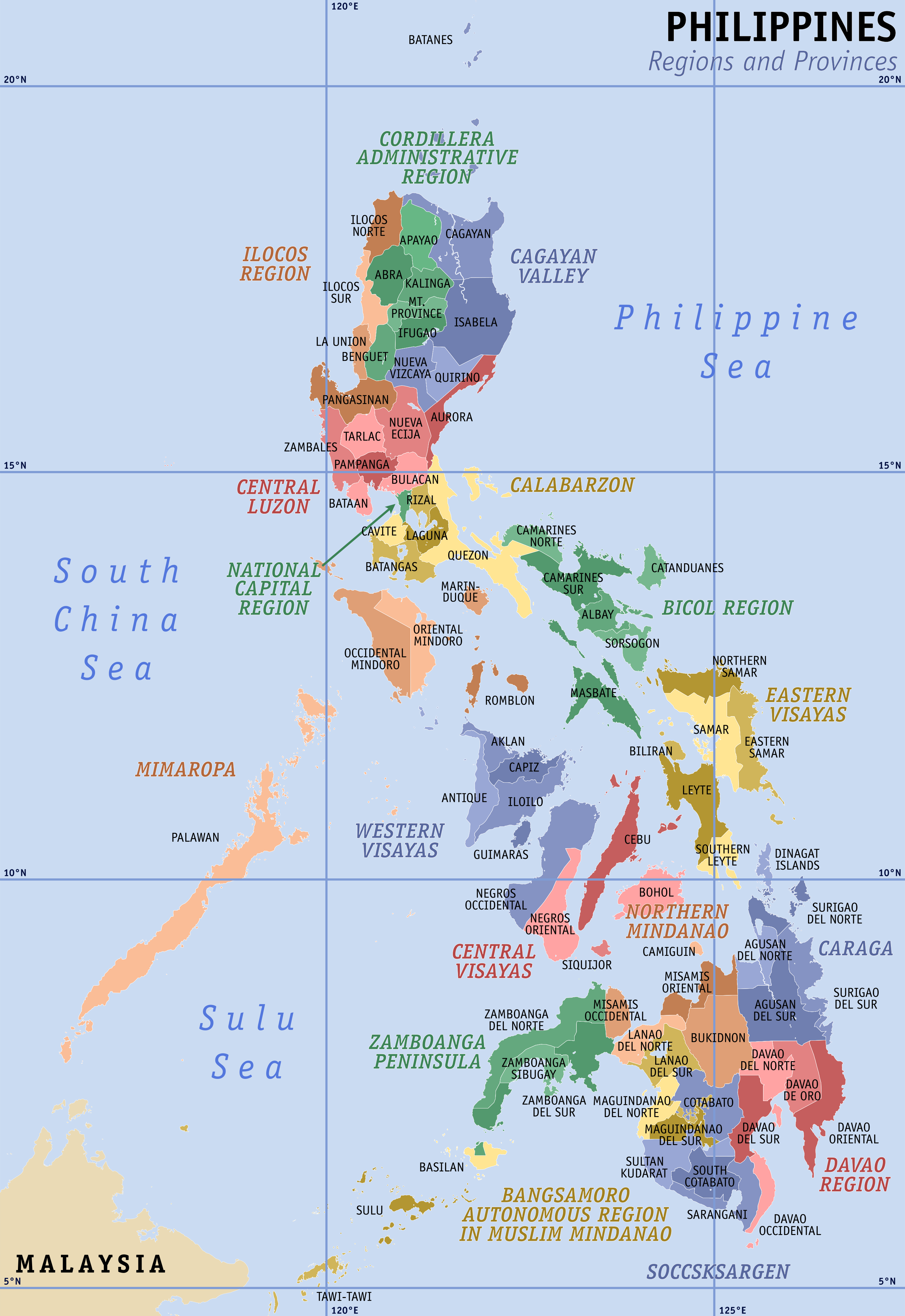 | 4,200 × 6,105 (3.03 MB) | (username removed) |
File usage
The following page uses this file:
