


File:Paddy field Viet Nam.jpg

Size of this preview: 220 × 147 pixels. Other resolutions: 320 × 213 pixels | 2,048 × 1,365 pixels.
Original file (2,048 × 1,365 pixels, file size: 3.35 MB, MIME type: image/jpeg)

Summary
| DescriptionPaddy field Viet Nam.jpg |
English: Northern rice field in Vietnam
Tiếng Việt: Cánh đồng lúa miền Bắc Việt Nam |
| Date | |
| Source | https://www.flickr.com/photos/145283084@N04/41171552095/ |
| Author | Lee Nguyen |
| Camera location |  | View this and other nearby images on: OpenStreetMap |  22.833685; 106.139484 22.833685; 106.139484 |
|---|

Licensing

|
This image, originally posted to Flickr, was reviewed on 22 April 2024 by the administrator or reviewer Leoboudv, who confirmed that it was available on Flickr under the stated license on that date. | 
|
| Public domainPublic domainfalsefalse |

|
This work has been released into the public domain by the author on Flickr, where the author has declared it as a "Public Domain Work" and tagged it with the Creative Commons Public Domain Mark.
|

|
The Public Domain Mark (PDM) is not a copyright license, but a symbol used to indicate that a work is in the public domain. When it is applied by the author or the copyright holder, community consensus has decided such works as being public domain in the US and countries where it is legally possible to release own work to the public domain. In the countries where this is not possible, the copyright status of the work remains undetermined.
| ||
If a file is tagged with Public Domain Mark by someone other than the author or the copyright holder, a more specific copyright tag such as one found at Commons:Copyright tags/General public domain must be applied. If this is your own work, please use {{Cc-zero}} instead.
Public domain Public domain false false |
Captions
Northern rice field in Ha Quang, Cao Bang, Vietnam
Ruộng lúa bậc thang ở Hà Quảng, Cao Bằng, Việt Nam
Risfält i Ha Quang, Cao Bang, norra Vietnam
File history
Click on a date/time to view the file as it appeared at that time.
| Date/Time | Thumbnail | Dimensions | User | Comment | |
|---|---|---|---|---|---|
| current | 15:38, 8 March 2021 | 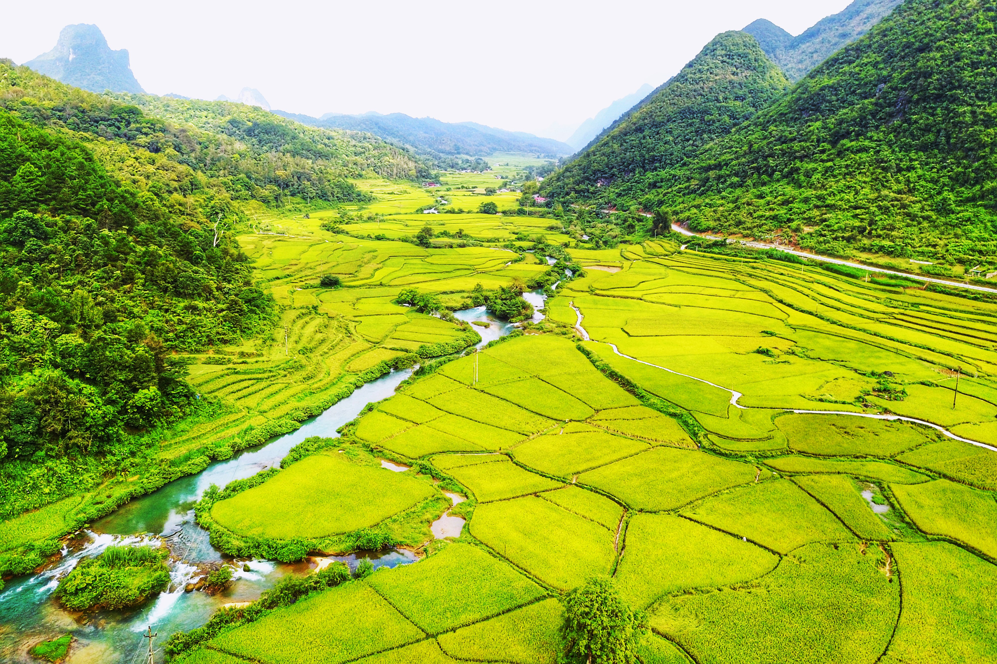 | 2,048 × 1,365 (3.35 MB) | (username removed) |
File usage
There are no pages that use this file.
