
File:Ocean currents 1943 (borderless).png
.png)
Size of this preview: 220 × 111 pixels. Other resolutions: 320 × 162 pixels | 2,577 × 1,306 pixels.
Original file (2,577 × 1,306 pixels, file size: 2.75 MB, MIME type: image/png)

|
This file has been superseded by Ocean currents 1943 (borderless)3.png. It is recommended to use the other file. Please note that deleting superseded images requires consensus.
|
3.png)
|

|
This meteorology image could be re-created using vector graphics as a SVG file. This has several advantages; see Commons:Media for cleanup for more information. If a SVG form of this image is available, please upload it and afterwards replace this template with
{{vector version available|new image name}}.It is recommended to name the SVG file “Ocean currents 1943 (borderless).svg”—then the template Vector version available (or Vva) does not need the new image name parameter. |
Summary
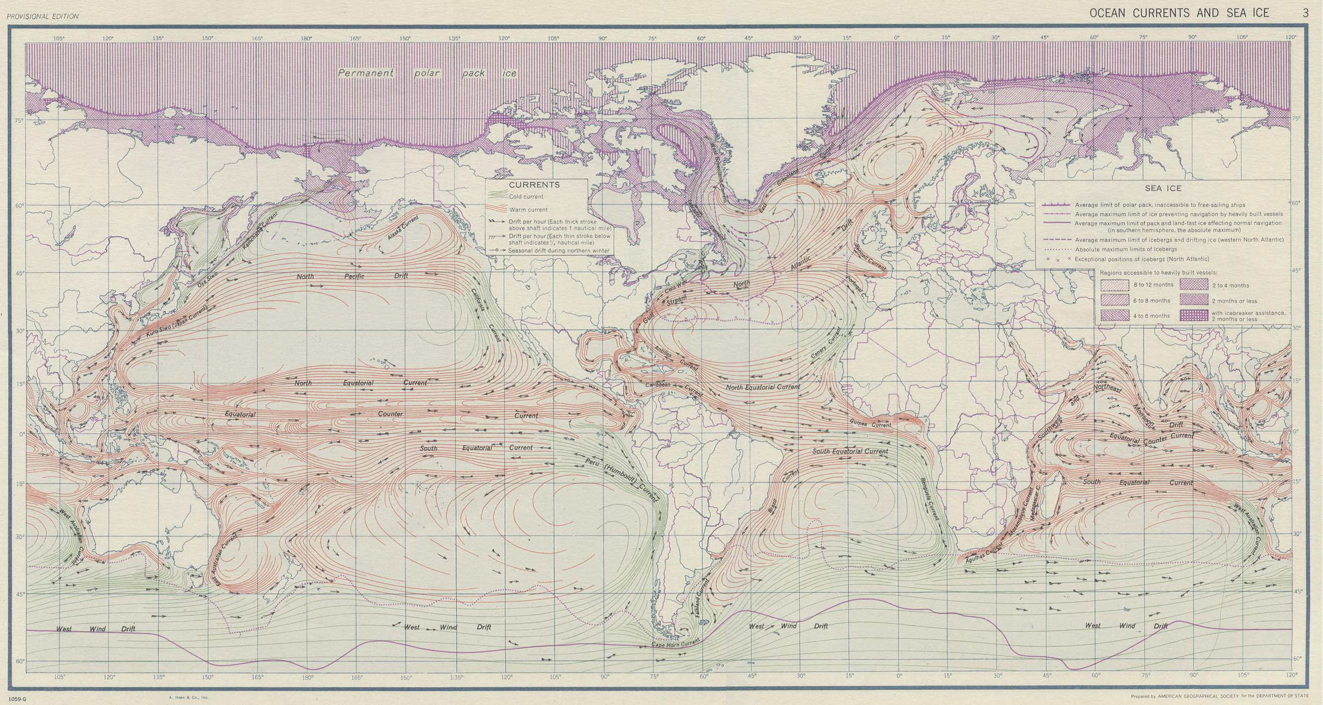
| DescriptionOcean currents 1943 (borderless).png | Ocean Currents and Sea Ice from Atlas of World Maps, United States Army Service Forces, Army Specialized Training Division. Army Service Forces Manual M-101 (1943). It could be drawn by the Miller cylindrical projection announced in 1942. | ||||
| Date | |||||
| Source | http://www.lib.utexas.edu/maps/world_maps/ocean_currents_1943.jpg | ||||
| Author | Original by US army, successively modified by Jack · talk · (removed borders and rivers) | ||||
| Permission (Reusing this file) |
|
||||
| Other versions |
Derivative works of this file: Ocean currents 1943 for colorblind users.png |


.png&action=edit§ion=new)

.png)

Captions
Add a one-line explanation of what this file represents
File history
Click on a date/time to view the file as it appeared at that time.
| Date/Time | Thumbnail | Dimensions | User | Comment | |
|---|---|---|---|---|---|
| current | 23:57, 7 April 2008 |  | 2,577 × 1,306 (2.75 MB) | smartcommons>Jrockley | fix finland |
File usage
There are no pages that use this file.
.png)