


File:Moon landing map.jpg
Size of this preview: 220 × 214 pixels. Other resolutions: 247 × 240 pixels | 1,100 × 1,070 pixels.
Original file (1,100 × 1,070 pixels, file size: 288 KB, MIME type: image/jpeg)

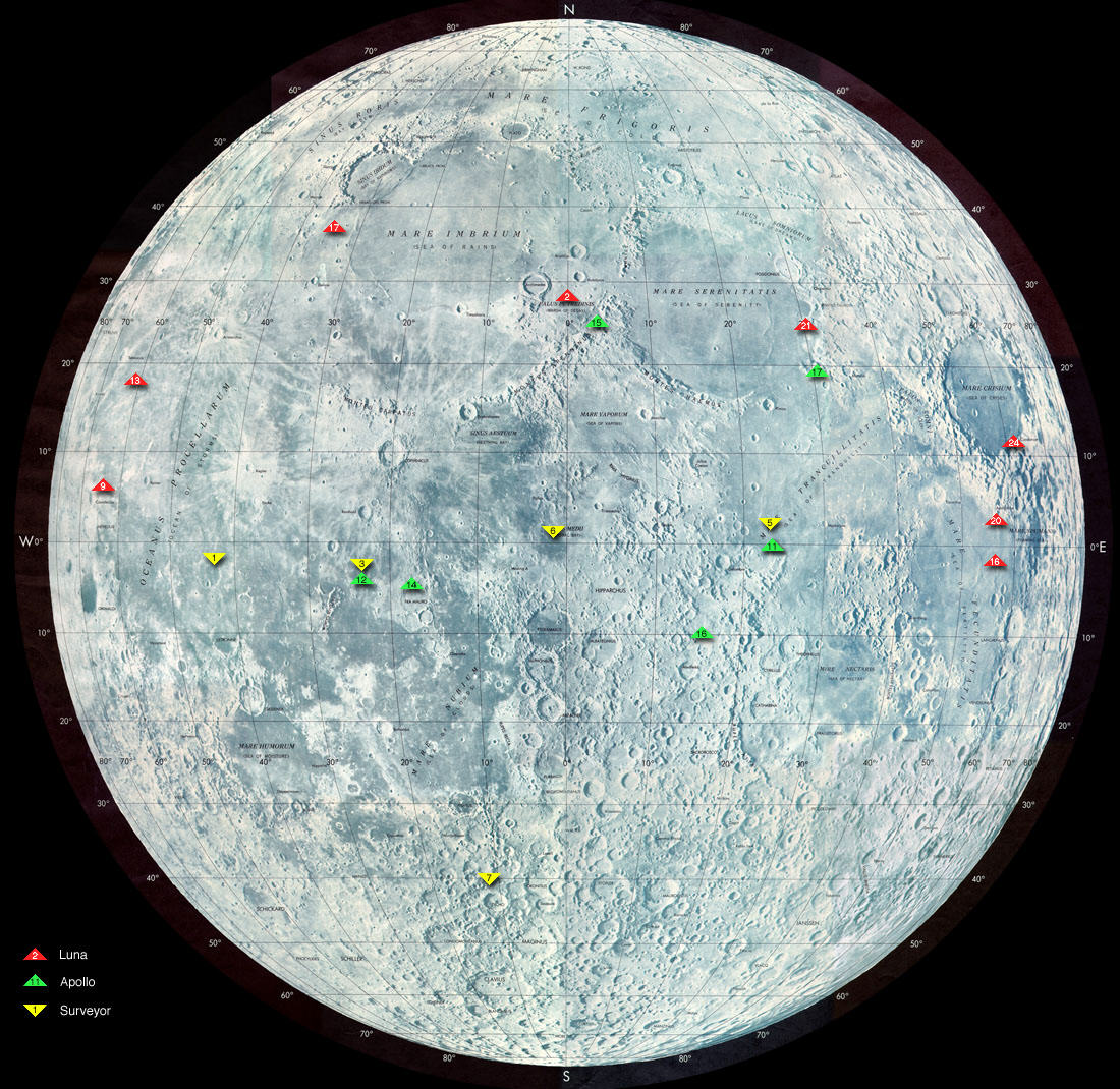
Map shows landing sites of Surveyor, Apollo and Luna missions
source: http://nssdc.gsfc.nasa.gov/planetary/lunar/moon_landing_map.jpg

| Annotations InfoField | This image is annotated: View the annotations at Commons |

| Public domainPublic domainfalsefalse |

|
This file is in the public domain in the United States because it was solely created by NASA. NASA copyright policy states that "NASA material is not protected by copyright unless noted". (See Template:PD-USGov, NASA copyright policy page or JPL Image Use Policy.) |  |
 |
Warnings:
|

derivative works
Derivative works of this file: Moon landing map surveyor.svg

Captions
Add a one-line explanation of what this file represents
Σημεία προσσελήνωσης των προγραμμάτων Luna, Surveyor και Apollo.
File history
Click on a date/time to view the file as it appeared at that time.
| Date/Time | Thumbnail | Dimensions | User | Comment | |
|---|---|---|---|---|---|
| current | 18:47, 10 December 2004 |  | 1,100 × 1,070 (288 KB) | (username removed) |
File usage
The following page uses this file:
