.svg)
File:Modelare 3D pentru Bazinul Hidrografic al Paraului Latorita.gif
Size of this preview: 220 × 157 pixels. Other resolution: 300 × 214 pixels.
Original file (300 × 214 pixels, file size: 7.21 MB, MIME type: image/gif, looped, 180 frames, 11 s)
Summary
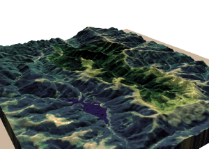
| Description |
Română: Modelare 3D pentru Bazinul Hidrografic al Râului Latorița. Elevație 130%. Magyar: a Latorca folyó vízgyűjtő területének 3D ábrázolása |
| Date | |
| Source | Topographic data SRTM from NASA and World Imagery - NASA World Wind & 3Dem & Inkscape |
| Author | Asybaris01 |
| Other versions |
 |
Clickable map of the (ro:Defileul Oltului)/(en:Defile Olt) drainage basin

Licensing
| This image is in the public domain because it is a screenshot from NASA’s globe software World Wind using a public domain layer, such as Blue Marble, MODIS, Landsat, SRTM, USGS or GLOBE.
|
 |
File history
Click on a date/time to view the file as it appeared at that time.
| Date/Time | Thumbnail | Dimensions | User | Comment | |
|---|---|---|---|---|---|
| current | 13:05, 21 October 2011 | | 300 × 214 (7.21 MB) | wikimediacommons>Asybaris01 | {{Information |Description ={{ro|1=Modelare 3D pentru Bazinul Hidrografic al Paraului Latorita.gif}} |Source =Topographic data SRTM from NASA and World Imagery - NASA World Wind & 3Dem & Inkscape |Author =Asybaris01 |
File usage
The following page uses this file: