.svg)
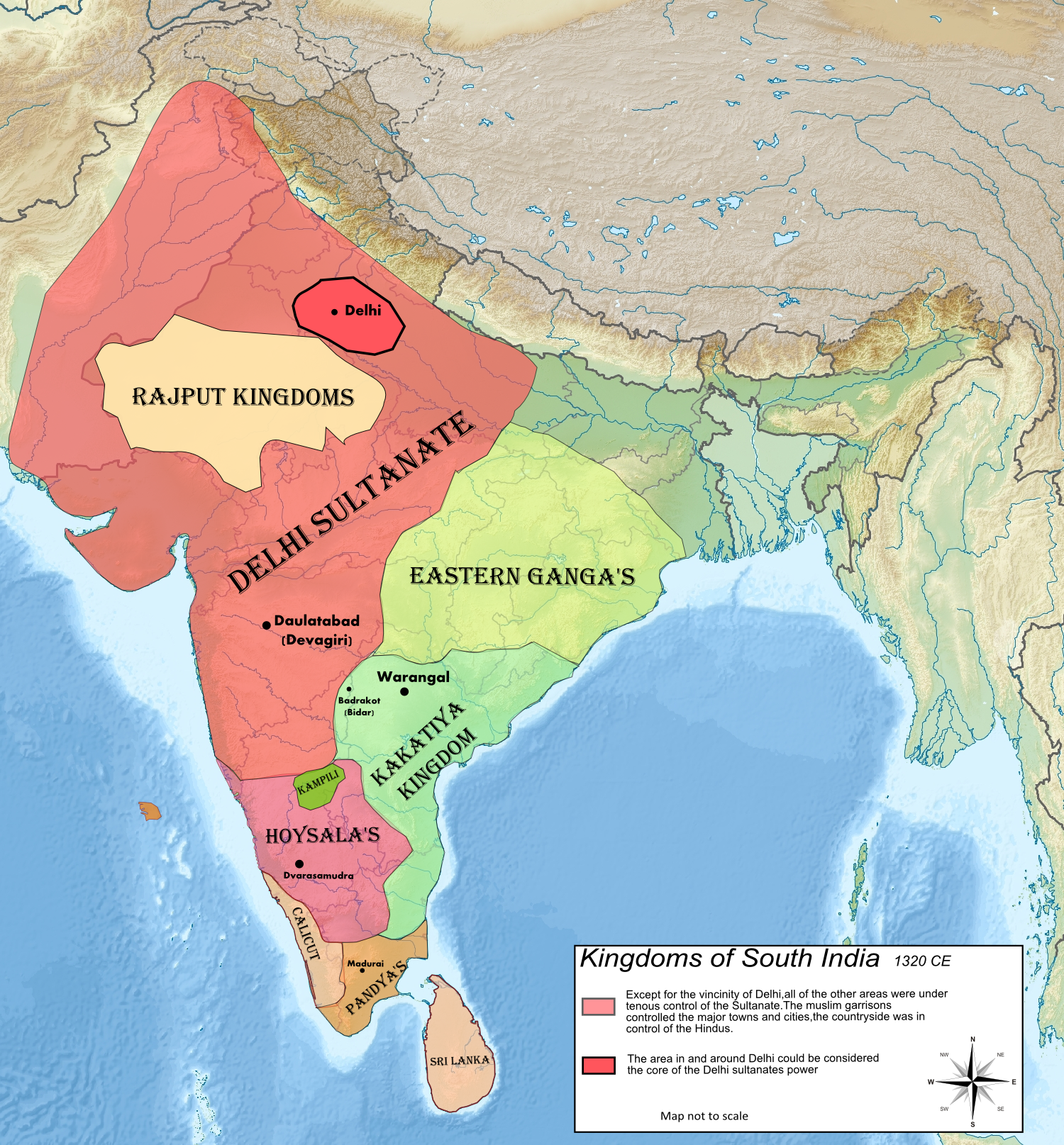
File:Map of Kampili kingdom.png
Size of this preview: 220 × 237 pixels. Other resolutions: 223 × 240 pixels | 348 × 375 pixels | 1,500 × 1,615 pixels.
Original file (1,500 × 1,615 pixels, file size: 3.72 MB, MIME type: image/png)
Summary
| Description | |
| Date | |
| Source | Own work |
| Author | Tulika and Satvik |
Licensing
I, the copyright holder of this work, hereby publish it under the following license:
This file is licensed under the Creative Commons Attribution-Share Alike 4.0 International license.
- You are free:
- to share – to copy, distribute and transmit the work
- to remix – to adapt the work
- Under the following conditions:
- attribution – You must give appropriate credit, provide a link to the license, and indicate if changes were made. You may do so in any reasonable manner, but not in any way that suggests the licensor endorses you or your use.
- share alike – If you remix, transform, or build upon the material, you must distribute your contributions under the same or compatible license as the original.
File history
Click on a date/time to view the file as it appeared at that time.
| Date/Time | Thumbnail | Dimensions | User | Comment | |
|---|---|---|---|---|---|
| current | 15:18, 23 March 2022 | | 1,500 × 1,615 (3.72 MB) | wikimediacommons>Okayokin | Reverted to version as of 08:33, 19 December 2020 (UTC) |
File usage
The following 13 pages use this file: