.svg)
File:Map Kumaon 1851.jpg

Size of this preview: 220 × 166 pixels. Other resolutions: 318 × 240 pixels | 496 × 375 pixels | 1,831 × 1,384 pixels.
Original file (1,831 × 1,384 pixels, file size: 1.61 MB, MIME type: image/jpeg)
| Description |
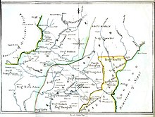
Map of the Kumaon region in 1851 |
|||||||||
| Date | ||||||||||
| Source | Official reports on the province of Kumaon : with a medical report on the Mahamurree in Gurhwal, in 1849-50 | |||||||||
| Creator |
J H Batten |
|||||||||
| Permission (Reusing this file) |
|
|||||||||
| Geotemporal data | ||||||||||
| Bounding box |
|
|||||||||
| Georeferencing | ||||||||||
File history
Click on a date/time to view the file as it appeared at that time.
| Date/Time | Thumbnail | Dimensions | User | Comment | |
|---|---|---|---|---|---|
| current | 15:44, 8 June 2017 | | 1,831 × 1,384 (1.61 MB) | wikimediacommons>Shyamal | {{Information |Description=Map of the Kumaon region in 1851 |Source=[https://archive.org/stream/officialreportso00batt#page/n5/mode/2up Official reports on the province of Kumaon : with a medical report on the Mahamurree in Gurhwal, in 1849-50 ] |Date=... |
File usage
The following page uses this file: