.svg)
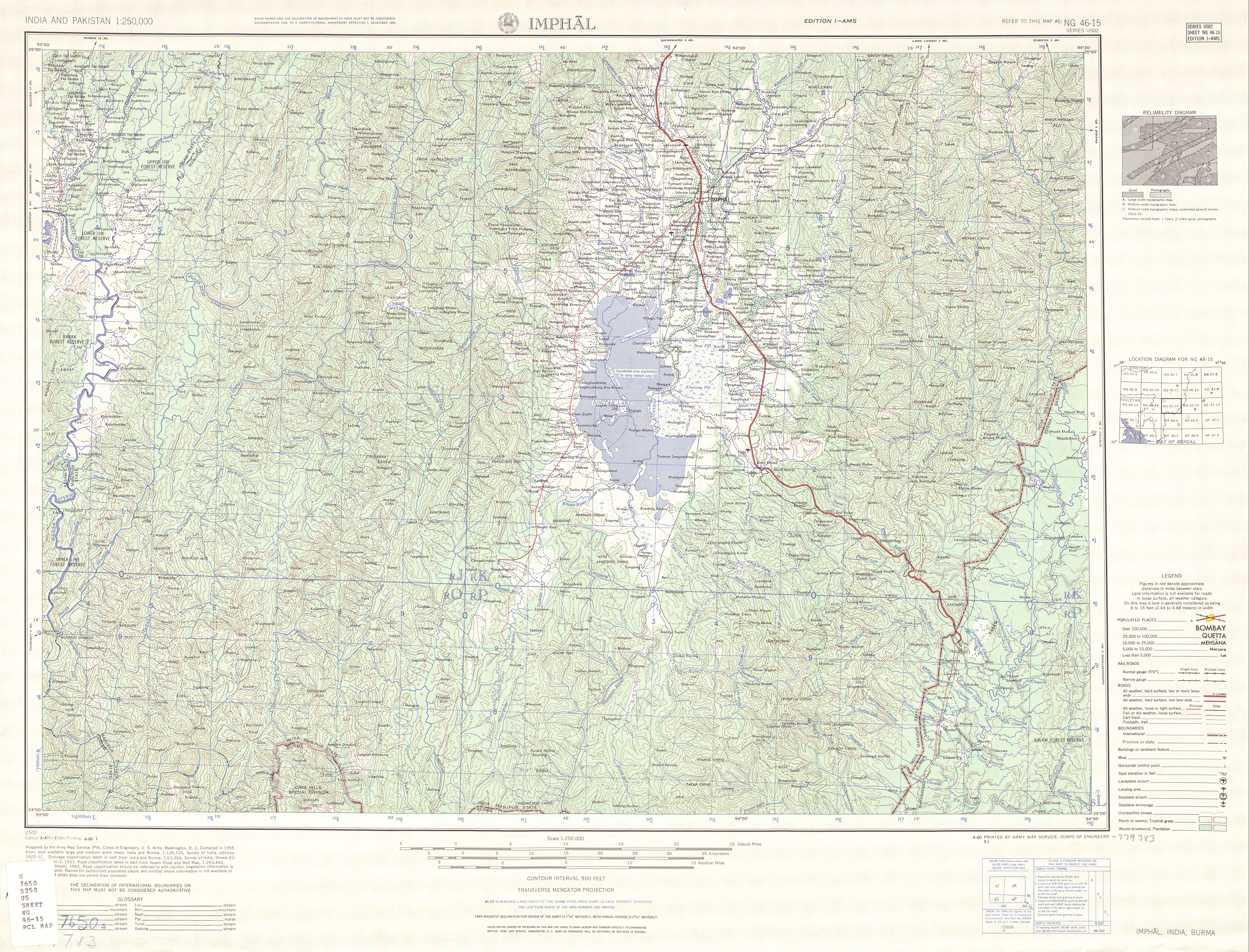
File:Map India and Pakistan 1-250,000 Tile NG 46-15 Imphal.jpg
Size of this preview: 220 × 168 pixels. Other resolutions: 315 × 240 pixels | 492 × 375 pixels | 5,000 × 3,810 pixels.
Original file (5,000 × 3,810 pixels, file size: 6.21 MB, MIME type: image/jpeg)
| Description |
English: NG 46-15 Imphal. Tile of the Map India and Pakistan 1:250,000. Series U502, U.S. Army Map Service, 1955 |
||||||
| Date | |||||||
| Source | https://www.lib.utexas.edu/maps/ams/india/ [1] | ||||||
| Creator |
English: U.S. Army Map Service |
||||||
| Permission (Reusing this file) |
|
||||||
| Georeferencing | If inappropriate please set warp_status = skip to hide. | ||||||
| Other versions |
|
||||||


![[1]](http://www.lib.utexas.edu/maps/ams/india/txu-oclc-6614190-ng46-15.jpg)
File history
Click on a date/time to view the file as it appeared at that time.
| Date/Time | Thumbnail | Dimensions | User | Comment | |
|---|---|---|---|---|---|
| current | 01:01, 12 September 2012 | | 5,000 × 3,810 (6.21 MB) | wikimediacommons>Slick-o-bot | {{Information |Description={{en|1=NG 46-15 Imphal. Tile of the Map India and Pakistan 1:250,000. Series U502, U.S. Army Map Service, 1955}} |Source=https://www.lib.utexas.edu/maps/ams/india/ [http://www.lib.utexas.edu/maps/ams/india/txu-oclc-6614190-ng... |
File usage
The following page uses this file: