.svg)
File:Malabar 1854.jpg
Original file (5,259 × 6,171 pixels, file size: 18.28 MB, MIME type: image/jpeg)
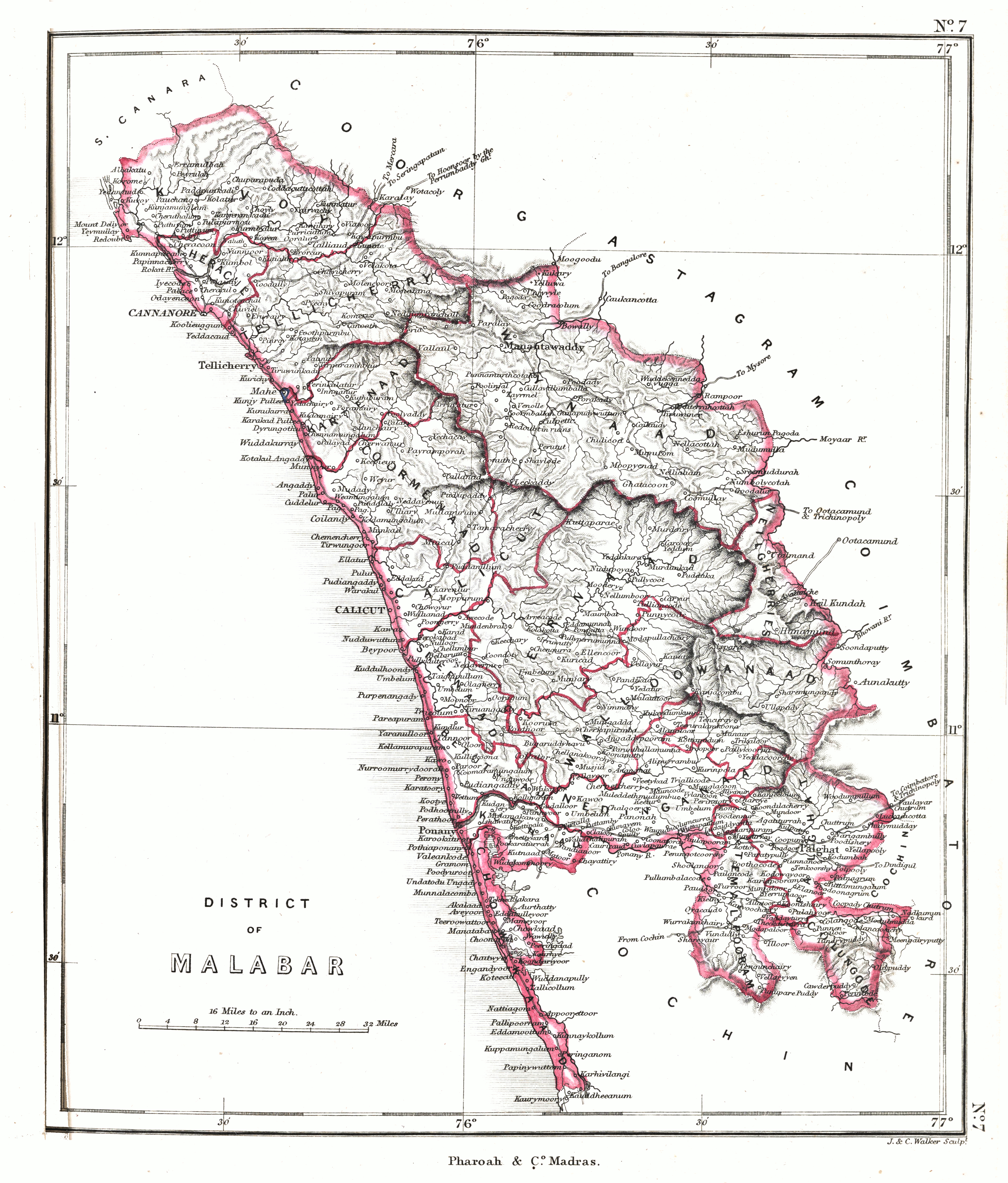
Summary
| Description |
Malabar region ca. 1854 |
|||||||||
| Date | ||||||||||
| Source | An atlas of the southern part of India : including plans of all the principal towns and cantonments, reduced from the Grand trigonometrical survey of India showing also the Tenasserim Province | |||||||||
| Creator |
J. & C. Walker; Pharoah and Co. Madras |
|||||||||
| Permission (Reusing this file) |
|
|||||||||
| Geotemporal data | ||||||||||
| Bounding box |
|
|||||||||
| Georeferencing | ||||||||||
File history
Click on a date/time to view the file as it appeared at that time.
| Date/Time | Thumbnail | Dimensions | User | Comment | |
|---|---|---|---|---|---|
| current | 11:36, 29 January 2020 | | 5,259 × 6,171 (18.28 MB) | wikimediacommons>Shyamal | {{Map |Description=Malabar region ca. 1854 |Source=[https://searchworks.stanford.edu/view/12089476 An atlas of the southern part of India : including plans of all the principal towns and cantonments, reduced from the Grand trigonometrical survey of India showing also the Tenasserim Province] |Date=1854 |Author=J. & C. Walker; Pharoah and Co. Madras |Permission={{pd-old-70}} |other_versions= }} Category:Maps of Kerala Category:Maps of South India |
File usage
The following 14 pages use this file: