


File:Major River Systems within the Mississippi River Basin.svg

Size of this PNG preview of this SVG file: 220 × 155 pixels. Other resolution: 320 × 225 pixels.
Original file (SVG file, nominally 945 × 664 pixels, file size: 473 KB)

Summary
| DescriptionMajor River Systems within the Mississippi River Basin.svg |
English: Map of the major river systems within the Mississippi River Basin. |
| Date | |
| Source | http://www.epa.gov/msbasin/subbasins/ |
| Author | Environmental Protection Agency |
Licensing
| Public domainPublic domainfalsefalse |
 |
This image (or other media) is a work of an Environmental Protection Agency employee, taken or made as part of that person's official duties. As works of the U.S. federal government, all EPA images are in the public domain.
|
 |
Captions
Add a one-line explanation of what this file represents
File history
Click on a date/time to view the file as it appeared at that time.
| Date/Time | Thumbnail | Dimensions | User | Comment | |
|---|---|---|---|---|---|
| current | 08:34, 24 July 2023 | 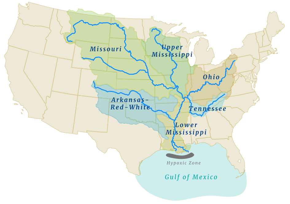 | 945 × 664 (473 KB) | smartcommons>Aaron1a12 | Uploaded a work by Environmental Protection Agency from http://www.epa.gov/msbasin/subbasins/ with UploadWizard |
File usage
The following page uses this file:
