.svg)
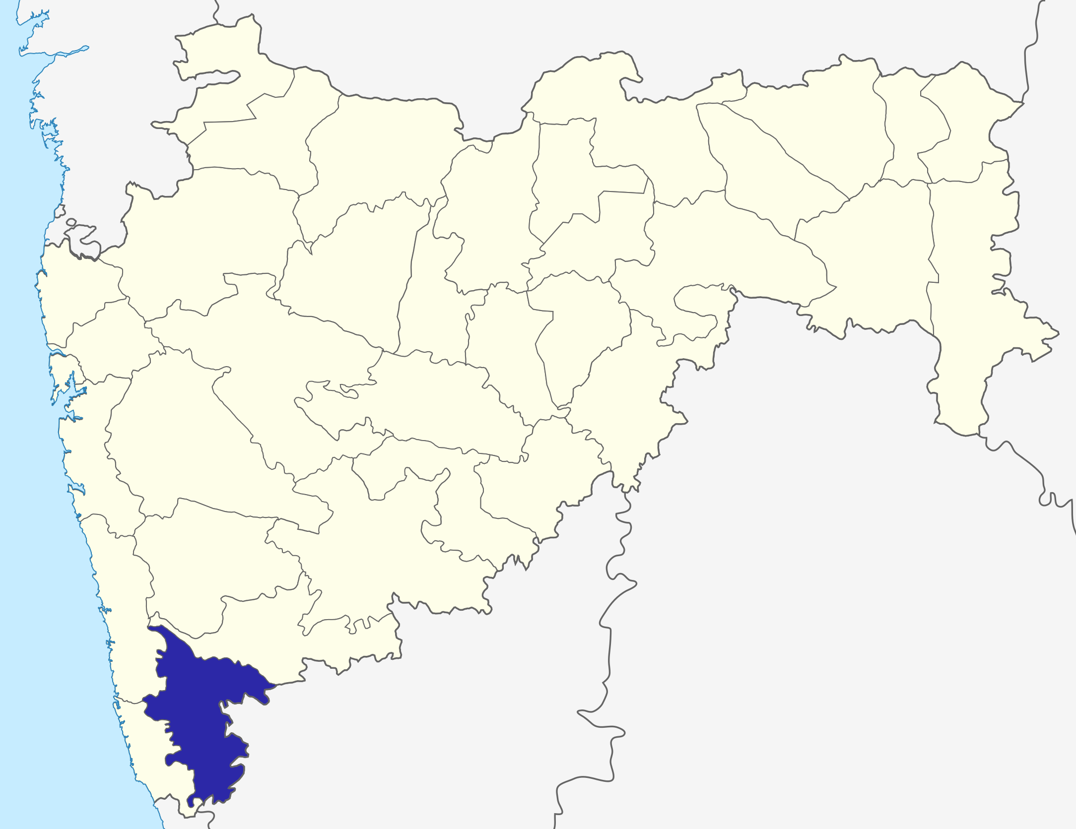
File:MaharashtraKolhapur.png
Size of this preview: 220 × 170 pixels. Other resolutions: 312 × 240 pixels | 487 × 375 pixels | 2,168 × 1,671 pixels.
Original file (2,168 × 1,671 pixels, file size: 426 KB, MIME type: image/png)
| Description | Kolhapur District map in Maharashtra |
| Date | (UTC) |
| Source | |
| Author |
|
| This is a retouched picture, which means that it has been digitally altered from its original version. The original can be viewed here: Maharashtra locator map.svg:
|
I, the copyright holder of this work, hereby publish it under the following license:
This file is licensed under the Creative Commons Attribution-Share Alike 3.0 Unported license.
- You are free:
- to share – to copy, distribute and transmit the work
- to remix – to adapt the work
- Under the following conditions:
- attribution – You must give appropriate credit, provide a link to the license, and indicate if changes were made. You may do so in any reasonable manner, but not in any way that suggests the licensor endorses you or your use.
- share alike – If you remix, transform, or build upon the material, you must distribute your contributions under the same or compatible license as the original.
Original upload log
This image is a derivative work of the following images:
- File:Maharashtra_locator_map.svg licensed with Cc-by-sa-3.0
- 2008-12-21T12:11:22Z PlaneMad 2789x2232 (365545 Bytes) {{Information |Description= |Source= |Date= |Author= |Permission= |other_versions= }}
- 2008-12-21T12:08:04Z PlaneMad 2789x2232 (365091 Bytes) {{Information |Description={{en|1=map}} |Source=Own work by uploader |Author=[[User:PlaneMad|PlaneMad]] |Date= |Permission= |other_versions= }}
Uploaded with derivativeFX
File history
Click on a date/time to view the file as it appeared at that time.
| Date/Time | Thumbnail | Dimensions | User | Comment | |
|---|---|---|---|---|---|
| current | 12:03, 6 October 2015 | | 2,168 × 1,671 (426 KB) | wikimediacommons>Abhijitsathe | State map updated to reflect new Palghar district |
File usage
The following 62 pages use this file:
- Ajara (India)
- Amba Ghat
- Battle of Kolhapur
- Bhavani Mandap
- Chandgad
- Chandgad (Vidhan Sabha constituency)
- Chitri Dam
- D. Y. Patil College of Engineering and Technology
- Gadhinglaj
- Gadhinglaj Taluka
- Halkarni
- Harali
- Hatkanangale
- Hatkanangale (Vidhan Sabha constituency)
- Hatkanangle (Lok Sabha constituency)
- Ichalkaranji
- Ichalkaranji (Vidhan Sabha constituency)
- Jaysingpur
- Jyotiba Temple
- Kadgaon
- Kagal
- Kagal (Vidhan Sabha constituency)
- Kalyanpur, Maharashtra
- Karvir (Vidhan Sabha constituency)
- Khasbag Wrestling Stadium
- Kolhapur
- Kolhapur (Lok Sabha constituency)
- Kolhapur Airport
- Kolhapur North (Vidhan Sabha constituency)
- Kolhapur South Assembly constituency
- Kolhapur State
- Kolhapur district
- Kolhapuri chappal
- Kudnur Dam
- Kumbhoj
- Mahalakshmi Temple, Kolhapur
- Maharashtra Film Company
- Mugruwadi
- Murgud
- Nesari
- New Palace, Kolhapur
- Panchganga River
- Panhala Fort
- Private High School Kolhapur
- R.C.S.M. Govt Medical College and CPR Hospital, Kolhapur
- Rajarampuri
- Rajarshi Shahu Stadium
- Rankala Lake
- Shahu of Kolhapur
- Shahuwadi (Vidhan Sabha constituency)
- Shalini Palace
- Shirol
- Shirol (Vidhan Sabha constituency)
- Shirol Taluka
- Shivaji University
- Shri Chhatrapati Shivaji Stadium
- Siddhagiri Gramjivan Museum (Kaneri Math)
- State Highway 134 (Maharashtra)
- Tillari (Forebay) Dam
- Uttur, Kolhapur
- Veg kolhapuri
- Template:Kolhapur district topics