.svg)
File:Lad Khan temple, Aihole, Karnataka.jpg
Size of this preview: 220 × 137 pixels. Other resolutions: 320 × 199 pixels | 500 × 312 pixels | 1,024 × 638 pixels.
Original file (1,024 × 638 pixels, file size: 385 KB, MIME type: image/jpeg)
Summary
| Camera location | | View this and other nearby images on: OpenStreetMap |
|---|
| Description |
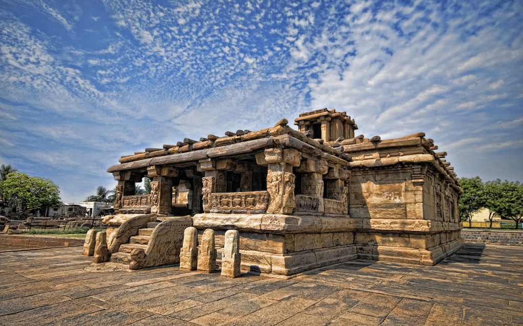
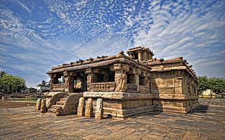
English: A temple of Galaganatha group (1)
Lad Khan temple: Consists of a shrine with two mantapas in front of it. The shrine bears a Shiva lingam. The mukha mantapa in front of the sanctum has a set of 12 carved pillars. The sabhamantapa in front of the mukha mantapa has pillars arranged in such a manner as to form two concentric squares. There are also stone grids on the wall carrying floral designs. The temple is built in a Panchayat hall style, indicating a very early experiment in temple construction. The windows are filled with lattice style which is a north Indian style. The temple was built in late 7th or early 8th century.
|
||
| Date | |||
| Source | Own work | ||
| Author | Mukul Banerjee |
Licensing
I, the copyright holder of this work, hereby publish it under the following license:
This file is licensed under the Creative Commons Attribution-Share Alike 3.0 Unported license.
- You are free:
- to share – to copy, distribute and transmit the work
- to remix – to adapt the work
- Under the following conditions:
- attribution – You must give appropriate credit, provide a link to the license, and indicate if changes were made. You may do so in any reasonable manner, but not in any way that suggests the licensor endorses you or your use.
- share alike – If you remix, transform, or build upon the material, you must distribute your contributions under the same or compatible license as the original.

|
This image was uploaded as part of Wiki Loves Monuments 2012.
|
 |
File history
Click on a date/time to view the file as it appeared at that time.
| Date/Time | Thumbnail | Dimensions | User | Comment | |
|---|---|---|---|---|---|
| current | 20:47, 4 September 2012 | | 1,024 × 638 (385 KB) | wikimediacommons>Mukulb | User created page with UploadWizard |
File usage
The following page uses this file: